Monday, December 28, 2020

A 17-Day Rafting Trip with the Grand Canyon Monitoring and Research Center

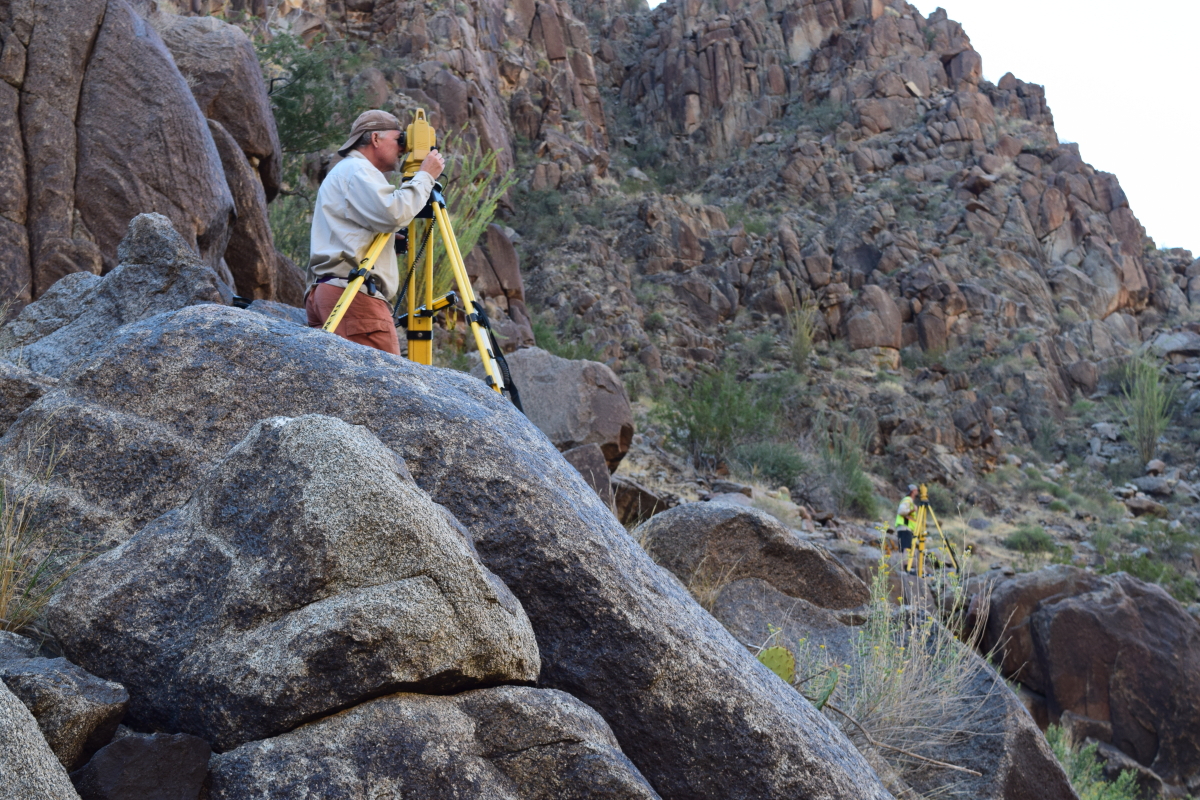
In October of this year, I completed a 17-day rafting trip on the Colorado River in Grand Canyon. We experienced perfect weather on this trip; the few times there was a breeze it was always blowing in the downstream direction. I worked as a volunteer as part of a vegetation survey, linked to a larger and longer survey concerning sand bars and beaches along the Colorado River in Grand Canyon. Scrambling through the dense riverside vegetation was very tough work and I found the going quite tough. Fortunately, I was working alongside Dr. Ryan Crow of the US Geological Survey who was much more agile through the brush than I. We both served as volunteers on this trip in order to travel together and field check our upcoming "Geologic Guide to the Colorado River in Grand Canyon" (working title). The field work was a great success!

Matt Kaplinski and Joe Hazel are lead investigators on this long-term monitoring project and are former classmates of mine from the 1980s at Northern Arizona University. They note that, "The work we do and the data we collect are important and get used by the Dept. of Interior and the stakeholders of the Adaptive Management Program in Grand Canyon." A very interesting and interactive time-series of the sandbar data can be viewed here

This is mostly a photo essay of our trip and I provide only short captions where desired. Enjoy the trip!
 
Matt Kaplinski rows our boat through the Inner Gorge. Dr. Ryan Crow sits on the tube (right). Photo by Geoff Gourley.

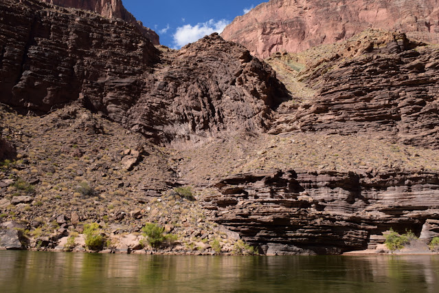
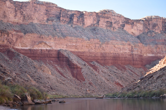
Dissected talus aprons in the Hermit Formation.

Which way does the river go? The answer will be in the geologic guide but the answer is, left. A barbed tributary (a stream that enters the master trunk against its downstream direction) called Soap Creek comes in on the right.

Reptile trackway on an upright boulder on RL (River Left) at RM (River Mile) 15.0.

Sheer Redwall Limestone cliff near RM 27.0
 
Stanton Cave on RR at RM 32.0. This is a geologic gem of a cave! Fossils of Harrington's mountain goat, teratorn (large carnivorous birds), river otter, horse, and camelid have been recovered from it. Over 80 split twig figurines were found as well. 

Chemical weathering on a Redwall boulder in camp at Nautiloid Canyon.

Part of the sandbar survey with Namdor's (Rodman spelled backwards).

Obvious contact of the newly described and blocky Frenchman Mountain Dolostone (above) underlain by the more thinly bedded Muav Limestone (below). Photo on RL near RM 36.8. 
  
Boat in repose at Buck Farm Canyon.

Gunner stands opposite the Namdors to take location readings of the sandbars.

Dr. Ryan Crow points out the rocks.

View downstream to Nankoweap Mesa, where landslide deposits rest on top.
 
Colorful Bright Angel Shale.

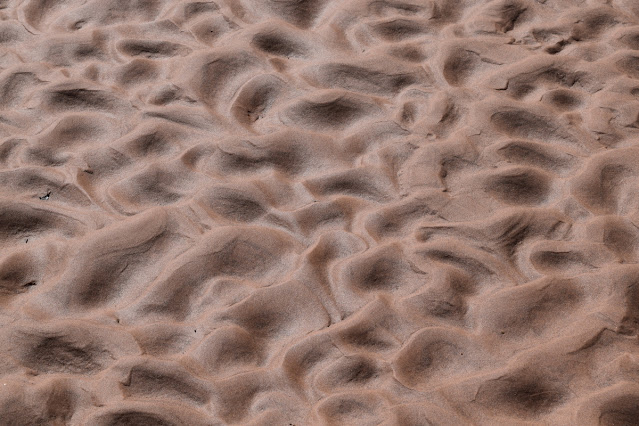
Ripple marks in the wet sand.

Smooth sailing in Marble Canyon.

Grey's Castle on RL at RM 55.5 is composed mostly of Muav Limestone.
 
Travertine buttress adjacent to the Bright Angel Shale below Kwagunt Rapid. Then travertine is dated between about 100,000 and 400,000 year old.

It was actually hot some days.

Exposed ripple marks along the Colorado River at Carbon Creek.

The wind has sheared the ripples into sastrugi-like forms.

Looking upstream at sunset from the beach at Basalt Canyon.

Looking downstream at sunset from the beach at Basalt Canyon.

The Colorado River meanders below Comanche Point.

Two fresh rockfalls can be seen beneath the Palisades of the Desert.

The dike at Hance Rapid runs through the red Hakatai Shale.

From Zoroaster beach looking up to the Great Unconformity, where the Tapeats Sandstone is thinning across (left to right) a crystalline rock highland.

There were 8 boats in our entourage.

A tamarisk tree grows out of a bedrock knob in the river near Salt Creek.

Pegmatite within the Zoroaster Granite at Schist Camp.

Vishnu Schist foliation near Emerald Rapid.

Contrails turning to cirrus clouds on October 9, 2020.

The Monument fold at RM 116.3.

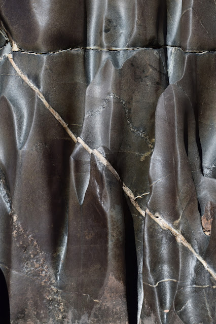
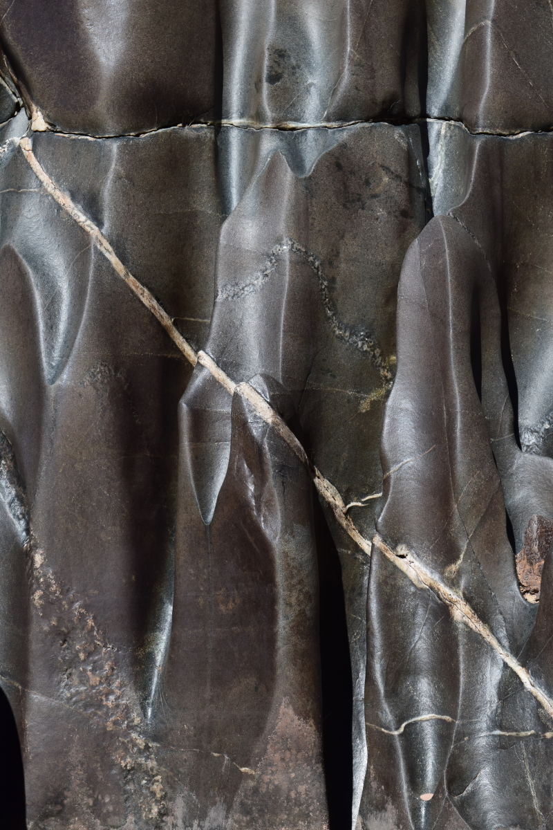
Fluting carved by the river within the Elves Chasm Gneiss, the oldest rock unit in the canyon at 1,840 Ma.

Two rusty brown dolostone beds within the Bright Angel Shale in Conquistador Aisle. These beds make excellent stratigraphic markers in the canyon when it grades westward into the "limestone wilderness."

Curious extensional features in the Middle Granite Gorge.

One of my favorite features in the canyon is the onlap of the Tapeats Sandstone (brown cliff, lower left) onto the uplifted, tilted and eroded edge of the Shinumo Sandstone (same colored cliff disappearing behind the right hand shadows). Note the different bedding angles between the two rock units.

I sat and watched this dragonfly  for 30 minutes as it hunted in the mouth of Matkatamiba Canyon.

A small paleovalley in the Redwall is filled with the Surprise Canyon Formation at Fern Glen Canyon.

The ever-perplexing Red Slide at RM 175.3 is likely formed from a series of rock falls from cliff failures above. Some sections of the debris are rich in red Supai boulders, others in gray Redwall boulders. Coarser material is often on top of finer material. 

Vulcan's Anvil at RM 178.3 is a volcanic vent within the river! The long Black Ledge lava flow (86 miles long) may have issued from this vent. The plug is dated at 530,000 + 30,000 years.

At RM 212.6, black granodiorite forms a small bedrock gorge along the river.

An upstream view of scoured potholes in Tapeats bedrock and limestone boulders at RM 212.9.

Joe Hazel "guns" a beach upstream from Diamond Creek. This was the 45th and last beach surveyed on this trip.

On October 6, 2020, I marked my 45th anniversary as a member of the Grand Canyon community. On October 6, 1975, I started down the Bright Angel Trail as a volunteer with the National Park Service. What a life the canyon has given me! 

For the first time ever, I was the oldest person on the trip. That awareness came to me about halfway through the trip. What an article of note!

Photo by Geoff Gourley.

Sunday, December 13, 2020

From 43 years Ago - Recalling an Epic Adventure in Mexico on the Feast Day of Our Lady of Guadalupe

December 12 is one of the most important religious holidays in all of Mexico. On that day people are on the move from rural villages to their parish church (sometimes many hours away on very poor roads),  to visit family members, or to take part in colorful celebrations. (Here is one article about the importance of Our Lady of Guadalupe to the Mexican people). My first experience with this feast day came in 1977 when I was on my fourth significant lifetime adventure - traveling by bus and hitchhiking for three months through Mexico, Belize, and Guatemala. I will never forget what I saw and experienced on that night in rural, tropical Mexico. It is a memory that comes to life each December 12 from 43 years ago. 

16th century image of Our Lady of Guadalupe

We were about four weeks into our adventure. I had just finished my second season as a backcountry ranger at Grand Canyon National Park. Those two years changed the course of my life but they did not take me away from my desire to throw off the chains of predictability and hit the road. I had previously made three, six-week long hitchhiking adventures in the USA and Canada during the summers of 1973 and 1974, and the winter of 1976. After my expected seasonal layoff at Grand Canyon, I drove with my girlfriend, Cindy Kane, to Austin Texas where we met her old boyfriend Peter Sprouse. Peter was a professional caver who with his fellow spelunkers, was going down to eastern Mexico to map the Cueva de Infiernillo, at that time thought to be the second longest cave in the Western Hemisphere. A paper describing the cave system can be accessed here. Back then, how was I to know that the cave system was formed in Cretaceous limestone?

After this amazing 10-day backcountry camping adventure, we made our way south and completed a seven-mile hike to another cave, the Sótano de Las Golondrinas, where at sunset thousands of white-collared swifts dive headlong into the bell-shaped cavern that is over 1200 feet deep. We visited Mexico City and then took a bus to Oaxaca city, where we caught passage on a second-class bus to Puerto Escondido, a beachside resort where we slept in hammocks under a palapa. This is where the Guadalupe story begins.

The road to Oaxaca
Puerto Escondido was a tried and true stop along the Gringo Trail in the mid-70s. After our early December arrival, we looked out onto the south-facing Pacific Ocean with temperatures in the low 90s. Columnar cactus graced the nearby hillsides and I reflected on what the weather must've been on this very day in mountains of northern Arizona. I could not believe my good fortune to be laying out on a beach, hotter than I wanted to be, but enjoying a superb road trip. We paid the equivalent of one dollar a night (about 22 old Mexican pesos) to string our hammocks at a place called Suzana's. When I asked the proprietress, "Donde está el baño?" she lifted her chin towards the garden and said, "ayi" - out there. She muttered under her breath, "el puerco" as I went outside. I was confused but what the hell - it was Mexico and I was often confused. Sure enough, within five minutes of me completing my business, there was not a trace to be seen as the pig snorted and rolled happily in the dust. What I had left behind including the paper was gone. I didn't eat any bacon for about a month. 

After a few days being beach-bums, Cindy and I decided to move towards the state of Chiapas and the ruins of Palenque. So we packed our hammocks into our backpacks and went to the bus station in Pachutla late on the afternoon on December 12. As we entered the bus station, what a scene was spread out before us! Hundreds of tiny Mexicans were crowding toward the three-window ticket office. Cindy, a long-haired blonde about 5' 7" really stood out amongst the sea of black hair. She and I towered over these mixed-race Mestizo's, who held more Indian blood than Spanish. Everyone was crowding cheek to jowl towards the caged ticket agents - there was not even a slight semblance of a line. We asked a few people next to us why there were so many people here and they replied. "La Fiesta. La Fiesta de Nuestra Señora de Guadalupe." Whoa! We had no idea.

It became obvious to us that we were going to have to be as proactive about getting to those ticket windows as our little neighbors were. There was no other way. We were told that if we didn't get a bus ticket that night, there would no more buses until the following morning. I was still a bit uncomfortable traveling in a country that I didn't know the language well, nor the customs. So it was rather easy for me to use our height advantage to struggle our way to the ticket window. It was like a scene out of a movie, hundreds of people attempting to make it to the window, with very little movement at any one time. After about 45 minutes, we got to the window where I obtained what seemed like the last two seats on a second class bus, traveling through the night for nine hours on the bumpy road to Oaxaca. I felt exhausted from the ticket ordeal, but had no idea that most of the adventure still lay ahead of us. In a situation such as this, I thought there was no guarantee that we would even get on the bus, ticket or not. Nevertheless, we did get a seat on a bus at about 8 PM. (Bus travel in Mexico back then was nothing like it is today, where reservations can be made online on busses that are roomy with Wi-Fi -it was quite primitive then).

It was pitch-black dark outside in the warm tropical air and I looked forward to being in the mountains overnight where it would be much cooler. I also entertained visions of sleeping on the bus all the way to Oaxaca. Once seated on the bus, I began to relax. The trip started out easy enough as we climbed into the Sierra Madre de Sur. The road was extremely rough in those days and that was part of the reason why it would take nine hours to do the approximate 150 miles. What I didn't count on was that our backseat was not completely bolted to the floor of the bus. The gentle rocking of the seat was barely noticeable as we left the station. But as we began to climb and the road was beset with more rocks, it became obvious that sleep was going to be very difficult. 

After a few hours, difficult sleeping turned to impossible as with every bump in the road, the seat rocked forward and backward such that my head slammed onto the back window of the bus with each jolting rock.  If that wasn't enough, the back door of the bus did not close firmly and was only being held partially closed by a wire. About an inch of open air creeped in behind the seat the whole night. Along the coast, this might have been welcomed relief from the stuffiness of the crowded bus and the tropical heat. Here, it merely meant that cold air from the mountainous setting was let in. To add insult to injury, the opening also let in prodigious amounts of dust, which at first in the nighttime darkness was not obvious but soon became thick as smoke inside the bus. Between the bumpiness of the road, the rocking seat, and the choking dust, I was unable to get comfortable, let alone sleep. The bus was like most of the buses in Latin America, a Blue Bird. It was therefore made for elementary school children and so there was very little legroom to begin with.

What a night! There was no sleep. The ordeal at the ticket office would've been memorable enough, but the bus ride only added to the adventure. I was in a very foul mood when the bus finally pulled in to the second class bus station at sunrise in downtown Oaxaca. I looked at my clothing, caked in white powdery dust. I wondered what my lungs might look like too. I went to the young conductor who was on the bus and showed him how the seat was not bolted properly to the floor, hoping that he might somehow make it all go away. Shrugging his shoulders all he could muster was "lo siento," I'm sorry. Cindy was none too happy as well, as it had been my idea to "sleep" on the bus rather than stay in a cheap hotel to save precious funds (we did the whole three months on $350 each). Her bad mood might have been more likely due to my handling of the situation. She seemed more willing to let the night be chalked up to just another Mexican adventure. 

To think that I had fought off hundreds of other Mexicans in a crowded second-class bus station, only to obtain a seat on an overcrowded bus (a rickety old school bus at that), with an ill-fitted bench seat and a door that did not close, on a bumpy dirt road with clouds of dust and bitter cold for nine hours, was about as much as I could take.

As the city awoke in the station yard in Oaxaca, I marched off brusquely and bleary-eyed toward the baño. As I entered the restroom I saw it was filled with many tiny little men standing at the urinals. But I had other business there and as I scanned the space to locate the toilets, I saw none. Focusing more clearly, I could see across from the urinals where the toilets should have been. Instead I saw only their foundations where they apparently had been broken off with a sledge hammer rather than repaired. I could not believe my eyes. Even if had I just walked into this baño after a drunken round of cold Modelo's, this would have been a shock. But after the previous night's adventure, it was all part of an evolving story. Only the sharp, upturned edges of the toilet foundations were protruding above the hole where the toilets should have been, their normally white porcelain edges draped in piles of human waste. My need for a morning constitution quickly escaped me. As I exited the east-facing door with the brilliant sunshine in my eyes that I came to see the entire situation in a more pleasant light. It was there and then that I regained my composure and laughed at the incredible sequence of events that brought me to this place at this time. Something clicked inside of me in this indignant end to an unforgettable night.

Some readers may wonder why I recall this story. I will be the first to admit that the final act in this play is not a pleasant memory. However, throughout the entire night there was not one Mexican who treated me badly, nor I suppose would think my attitude towards it inappropriate. In fact, it was quite the opposite. Most of them looked at me with sympathy and understanding, knowing that I came from a culture that saw life's little inconveniences as major traumas to be avoided at all costs. To them, this was just the other side in the coin of life. Throughout that three month-long journey, I became schooled many times in the different ways to frame what happens to you along the road of adventure. It took a number of incidents similar to this for it to break through - that how I reacted to what was placed in front of me mattered much more than what the encounter gave to me. 

And so this is why every December 12, I recall with a smile the importance of the feast of Our Lady of Guadalupe, the matron saint of Mexico. As Carl Franz told us, "Wherever you go, there you are"!

Monday, October 19, 2020

Join Me On a Grand Canyon River Trip - Virtually - November 5, 2020

The Covid pandemic has really slowed things down in my world, as I know it has in all readers of Earthly-Musings. Faithful readers have certainly noticed a sharp drop-off in posts from me as I first, recovered from bilateral knee surgery in late 2019; then in March, the travel industry was put in complete shutdown by the worldwide pandemic. My river trip with the Museum of Northern Arizona in May, 2020 was the first cancellation to my schedule (however, it was run later on August 1 with great safety and success). Then, the same month my Smithsonian Journeys trip to Machu Picchu and the Galapagos Islands was canceled. Another Grand Canyon geology-themed river trip scheduled for late August was canceled next. I lost another two trips that were scheduled this month - a 10-day excursion with Smithsonian to Grand Canyon, Bryce and Zion; then, an Around the World By Private Jet adventure with TCS Travel (that is a tough one to miss). Patagonia and Easter Island with Yavapai College was scheduled for November and December this year but is now rescheduled for 2021 (fingers crossed). And lastly, my 30th trip to Antarctica, scheduled for January, 2021 with Smithsonian Journeys, will have to wait one more year. These are First World problems I know. People are suffering a lot more from this than losing work and our hearts go out to those who have lost loved ones. Stay safe!

Nevertheless, I have been busy with Zoom lectures for various non-profits including Smithsonian Journeys, Geofest/Earth Science Week, and others. I want to bring to your attention an upcoming lecture for a good cause! Museums have been especially hard hit by the lack of visitation due to the spread of the virus. For that reason, I will be holding a fundraiser for the Museum of Northern Arizona on Thursday, November 5 at 6 PM (Mountain Standard Time). Join me as we take a virtual river trip along the Colorado River in Grand Canyon. I will be highlighting some of the many attractions that can be found on this amazing trip, using some of my best images from trips taken in the last 15 years. Hopefully, next year we can all run the river for real. But in the meantime, come run the river with me - virtually!

Thank you and see you "on the river" November 5!


Virtual Grand Canyon River Trip
Thursday Nov. 5, at 6 pm Mountain Standard Time (8 PM Eastern; 7 PM Central; and 5 PM Pacific)

Ticketed online event, $12 for members/ $15 nonmembers

Take a Grand Canyon river trip with renowned geologist and long-time river runner Wayne Ranney, all without leaving home! Ranney will share images of the geology, archaeology sites, and waterfalls on the Colorado River. This is a fundraiser to support the Museum of Northern Arizona.


Thursday, August 20, 2020

Update on A Newly Exposed Trackway Along the Bright Angel Trail in Grand Canyon

Artists rendition of how the new trackway was created (Figure 8 in the paper). Art by Emily Waldman.

I have posted a second addendum to my original post from December 11, 2016. A new paper describes this trackway in detail! See the addendum here.

CNN also picked up the story here.

Monday, August 17, 2020

Jellyfish Sprite Captured by Camera in Texas

 McDonald Observatory

On rare summer nights, ethereal forms leap into the skies above distant thunderstorms. Alien invaders? Not quite: it's a jellyfish sprite, an extremely brief and rarely captured event associated with incredibly powerful lightning strikes. This event lasted less than 1/30th of a second and occurred above a powerful storm about 100 miles away as seen from McDonald Observatory on July 2nd, 2020. 


Image Credit: Stephen Hummel

Tuesday, July 28, 2020

Images from Curiosity on Mars


The Mars rover, Curiosity, has been roaming the Gale Crater for 8 years - it was only supposed to be operating for 2 years. This ten minute video is amazing! They have taken thousands of images and spliced them together to make it look like a video. Outstanding !

Watch here.


I understand that if folks are not in tune with desert landscapes that the video may appear bleak. However, looking at an alien planet ironically brings life to the images. Geologically, we see the similarities between our home planet and the Red Planet - sand dunes, limestone, tilted strata, sandstone, and skylines. Try not to let the barren nature of this "other world" taint your appreciation of the wonders of the solar system of which we are finally beginning to understand more deeply.


Self portrait of the Curiosity rover. I support interplanetary exploration!

Friday, July 03, 2020

Remembering Hugh and Ruth Downs - Fellow Travelers to Earth's North Pole, 1998

From left to right, Hugh Downs, Ruth Downs, Herbergers, and Buzz Aldrin.

You may have heard that Hugh Downs, longtime TV personality at NBC and ABC, passed away on July 1, 2020. His obituary was published by the New York Times on July 2. I was fortunate to travel with Hugh Downs, his wife Ruth, and their friend and colleague Buzz Aldrin to the North Pole in July, 1998. He was filming a segment of the ABC program "20/20." Mr. Downs had previously filmed a 20/20 segment at the Amundsen-Scott South Pole Station in Antarctica and wanted to round out his "far-ends-of-the-earth" résumé by filming a segment at the opposite end of the earth.

In a previous blog posting celebrating the Centennial of statehood in Arizona, I included a picture taken with the Downs' and Buzz Aldrin at the North Pole. The link to that posting can be found here. We were traveling by nuclear-powered ice breaker on the Sovietsky Soyuz through Arctic ice on a 14-day expedition. I was working onboard as a geologic lecturer for TCS World Travel on the trip. 

Ruth (Shaheen) Downs passed away in 2017 and her obituary can be read here. She was a very gracious person on our voyage and Hugh credited her with much of his success. Ruth was quite successful in her own right and I want to remember her passing as well, since she likely escaped much of the limelight when she passed in 2017. They were together for 75 years!

On our voyage, I found Hugh Downs to be an excellent listener, curious, and gracious to all of the passengers on the trip. The well-known Herberger family of Phoenix were also along and our group formed a sort of Arizona contingent on the trip.

I tried to find a link to the 20/20 segment that was filmed at the North Pole, with no luck. If any readers have such luck - send me the link and I will include it here.

Tuesday, June 30, 2020

Meanders, Oxbows, and Time


My colleague, Brad Dimock, sent along a link recently that I know you will find interesting. It involves a cartoon graphic that shows the way mature rivers meander and evolve through time. You will see meanders turn into oxbow lakes that are cut-off from the main stem, then fill with sediment. You will see point bars grow as meander loops arch outwards. You could look a this for a half hour and not see enough. The site was constructed by Robert Hodgin. Watch it here. Thanks Brad!

Here are photos I took of the upper Amazon River near Iquitos Peru in September, 2009. You can easily see the meanders and oxbow lakes. Imagine that these are migrating and moving just like in the graphic above, but on a much slower pace. 


Saturday, June 20, 2020

Why no blogs...?

Palisades of the Desert from the Colorado River, September 17, 2013
I think everyone will agree it has been a difficult few months. While I weathered the pandemic and its consequent isolation fairly well in March, April, and May, I seemed to falter a bit in June. I miss traveling. I miss lecturing. I miss being on the river looking at the Grand Canyon. I know it is difficult for many of us right now. But we have to keep in mind that we, as a species, aren't calling the shots right now. That can be difficult for some - to admit that we are helpless against nature. But why should we be against nature. No matter how difficult it is for the both of us here, we are doing what we can to limit the spread of the virus. We do it for us. And we do it for others. It has been especially hard on my wife not seeing the children or grandchildren. But we want to be good citizens.

There are really two reasons why I have not been blogging since the end of May. The first is that there is nothing to say. I haven't been anywhere, haven't done anything. So why force it. I can take a break - I hope you will stick with me until we come out on the other side. The second reason is that I have been working on a project. I am a co-author on an upcoming geologic river guide for the Grand Canyon. Since the end of April, I have been plugging away at the keys of my computer, transferring my river observations into readable text. A sample spread is included below. There will be a geologic map on one half of each spread and a mile-by-mile description on the other half. My co-author is Dr. Ryan Crow at the USGS here in Flagstaff and the book will be published by them. I am excited to be working with Ryan - he has researched the lava fields found in western Grand Canyon and brings great expertise to the project.

I am hoping the guide will be ready for the 2021 river season. For that to happen, I will have to take significant time away from blogging and dedicate that time to finishing the guidebook. I will try to post something now and then from previous trips, and I may even dip into my vast collection of photographic slides from days long before this blog existed. There are some good ones. But right now I need to focus on the book and maintain some sanity during the necessary isolation.

Just letting you all know there may be less blogging through the summer. My enthusiasm for travel, geology, landscapes, and exploration remains high. Thanks for your understanding.


Saturday, May 16, 2020

Cratering - Marking the 40th Anniversary of the Mt. St. Helens Eruption

Photomural image by Richard Gordon Bowen, May 18, 1980. Courtesy of the Bowen Family.
May 18, 1980. If most people remember this date at all, they will recall it was the sunny morning that Mt. St. Helen's in southwest Washington's Cascade Mountains let loose with a powerful blast that tragically killed 57 people. The 40th anniversary of that eruption is this Monday, May 18. I found out about the blast upon ending a river trip in the Grand Canyon. But first...

... The Portland Art Museum is sponsoring an exhibit to commemorate this historic geologic event. I learned of the exhibit, now viewable virtually and online, through my friend Dixie Watkins and his wife Elaine. They sent me a link that will take you on this virtual tour, which is outstanding! This is the preamble to the exhibit and tour:

"The Portland Art Museum proudly presents this tribute to Mount St. Helens on the fortieth anniversary of the eruptions of 1980. Spanning the period from 1845 to the present, this exhibition is the first survey of works of art inspired by the mountain. Although 175 years is barely a blip in geologic time, the art bears witness to an extraordinary era in the long, cyclical life of the volcano. The beauty of Mount St. Helens has ranged from bucolic to savage. Before the eruptions, painters delighted in depicting its pleasing conical shape rising high above the verdant landscape. The 1980 eruptions challenged artists to capture the thrilling and terrifying displays of nature’s sublime power. When the smoke cleared, the new apocalyptic face of Mount St. Helens compelled the depiction of its haunting majesty. Since then, the rapid return of life to the mountain has captured the attention of photographers as well as scientists from many fields. Although the volcano seems to have reclaimed its serenity, some artists have begun to look to the future. Mount St. Helens will erupt again. We are pleased to welcome you to this celebration of a great wonder on our horizon."

*** You can view the virtual exhibit at this link: https://portlandartmuseum.org/volcano-online/.***
Paul Kane, 1810–1871) Mount St. Helens, 1849–1856. Oil on canvas. Royal Ontario Museum, Toronto
I remember the day 40 years ago. I was rowing for the very first time a raft down the Grand Canyon. It was a US Geological Survey research trip with veteran geologist Don Elston leading the way. Don was studying remnant paleo-magnetism recorded in some of Grand Canyon's rocks and he conducted river trips to access the sites. Before this trip began, he was short one boatman - and in the final moments before the trip began.

Don had open heart surgery just six months before this trip, which was to be his first since his operation. He was excited and perhaps just a bit anxious about the trip. His wife Shirley and nephew Charlie were on the trip as well.
Gary Mercado, a fellow geology student with me at Northern Arizona University, had previously rowed boats for Don in these studies. But just before the trip began, Gary received word that he got a job with the USGS in Denver. We had both just recently graduated with geology degrees the week before the trip began but now Gary needed to decline his previous commitment to row this trip. Luckily for me, he asked if I was interested in being his replacement. I jumped at the opportunity, not giving it a whole lot of forethought. In those days, I said yes to anything that sounded good, oftentimes not thinking it through (like the one and only time I jumped out of an airplane in 1976).
Gary put me in touch with Don Elston and before I knew it I was rowing a boat down the Grand Canyon!

Up to this point I had only been a passenger on the river in Grand Canyon and that was just half of a trip from Phantom Ranch on down. Like everyone else back then, you learned by doing - just get in the row seat and go. Do what I do. So after the trip started and we would scout a rapid, people would ask me what that particular rapid in Marble Canyon looked like. Not wanting to appear inexperienced, I quickly came up with the honest, but incomplete answer, that, "I've never seen this rapid at this level of water." It seemed to work. (Although to this day I'm sure many of those intelligent folks figured out that I was the new guy. I was so scared from the get go and I made too many mistakes. But I was thrilled for the opportunity to row a boat and there were so many big name geologists that were along on the trip. I remember one - Max Crittenden, one of the first geologists to ever describe metamorphic core complexes. There were others whose names I have now forgotten.

Many interesting events happened on this trip. This was the year that Glen Canyon Dam filled the Powell reservoir for the first time so there was 30,000 cfs coming down the river. It was HUGE! I was rowing a very large 22' snout boat with 12-foot oars. As skinny as I was in those days, and with no prior rowing experience, I couldn't really control the boat. One day, camp was to be made at the Clear Creek beach but I missed the pull in. Don wanted to walk up to the horizontal waterfall and look at some rocks there. It was late in the day we were to camp there. But because I missed the pull-in, we had to continue down to Phantom Ranch.

There was no way to camp there for river parties but we did take time walk up to the Ranch so Don could make a phone call. While we were there, I encountered my old Park Service boss, who was giving an orientation tour of the Ranch to the brand new Superintendent of the Park, Dick Marks. I was not on good terms with my old boss and as the formalities were exchanged between the various members of our group, I eyed my ex-boss warily, as he did me.

We left Phantom but it was too late to go vary far, so we had to find a camp fast. We stopped just a few hundred meters downstream on a cobble beach just across from the River Trail. It was illegal for river parties to camp there in those days but we really had no other choice. It was getting dark and Horn Creek Rapid loomed ahead just two miles. While we setting up camp, wouldn't you know it, the two rangers we saw at Phantom Ranch were hiking up to Indian Garden on the River Trail and stopped across the way to look at our camp. They knew who we were. When the trip was over, Don received a citation in the mail from Grand Canyon National Park for illegal camping. For years afterwards, Don always joked that the citation was labeled "Department of the Interior vs. Department of the Interior".

A few days later, I got into an eddy I could not row out of. It was just above Tapeats Creek. Round and round we went for at least 20 minutes and I became thoroughly exhausted. Finally, one of the younger geologists in my boat stepped in next to me and we each took one oar and finally made it out. Man that was big water!

Albert Bierstadt (American, born Germany, 1830–1902). Mount St. Helens, Columbia River, Oregon, 1889. 
Oil on canvas. Collection of L.D. "Brink" Brinkman, LDB Corp, Kerrville, TX

On May 18, 1980, the day that Mt. St. Helen's blew its top, we were blissfully unaware of it and getting ready for our run of Lava Falls Rapid, the biggest, meanest rapid in the whole canyon. To say I was scared to run this monster for the first time would not convey in a proper way how I felt. I was terrified. And apparently, Don had a history with this rapid that caused his wife Shirley to begin to fret as much as me. While we scouted the rapid, it was determined that Shirley would ride with me on the biggest boat, and Don's nephew,Charlie would ride in the smaller boat with him. Remember, this was just six months after Don's open heart surgery.

Finally, I got in my boat. I was hyperventilating as I pulled away from shore and entered the tongue of the rapid. I guess I was lucky to have such a large craft but one still needs to bee spot-ion for the entry through the tongue. And myriad swirling currents play havoc on smaller boats in there. I remember very little about the specific run I made. Someone on shore took a movie picture of it and I have a copy of that somewhere. But it must have been a good run because I don't remember it! At the foot of the rapid I had a hard time stopping but eventually pulled over on the left bank below Prospect Spring. We couldn't see the rapid from there but waited for the other boats in our party to come down.

As we bobbed in the eddy below the spring, time seemed to drag on forever. Where were they? Before long, Shirley started to worry that no one was coming down. "Where is Don," she repeated. I tried to comfort her as best as I could. But I started to worry as well. Shirley hadn't wanted Don to row this trip so soon after his surgery and wanted to be on the trip with him. She worried audibly that something bad had happened. I tried to calm her down.

Meanwhile, up north, Mt. St. Helens was roaring with its gigantic blast. We would not find out until the trip was over what happened, although we were all talking about it on the trip, as it had been rumbling for months. All geologists back then were excited about what might happen with the volcano.

Finally, we saw something coming down the river. It was an ice chest bobbing in the water. Uh-oh. Something else came along just after that - a life jacket! Oh no, that's not good. Shirley started to cry. I immediately pulled out into the current of the river to be of assistance anyway I could. Just by chance at that time Don came by my boat bobbing in the water. Charlie was very close to him trying to reach him in case he needed help. I pulled them both into my boat as we began to go through Son of Lava Rapid. Someone in another boat wrangled his boat ashore. He had misplaced his position in the tongue of the rapid, the swirling currents grabbed his keel and he ran right over the ledge hole! No man's land!

Forever afterwards, Shirley Elston thought of me as the one who saved her husbands' life. For the rest of our friendship, spanning many decades, I could do no wrong. She and Don took that day at Lava Falls all the way to their graves and I was honored to be invited to Don's memorial. I remain forever grateful to them both in giving me the chance to be a boatman in Grand Canyon.

Look at the online exhibit and remember Mt. St. Helens 40 years on!

Frank Gohlke (American, born 1942). Aerial view: Landslide—debris flow area—looking east toward Spirit Lake, 
5 miles north of Mount St. Helens, 1982; printed 2005. Gelatin silver print. Courtesy of Artist and Gallery Luisotti

Thursday, May 07, 2020

More Cratering in Northern Arizona - Rattlesnake Maar

Photo by Dawn Kish - From the top of the Rattlesnake scoria cone; the reddish arc behind the figure is Rattlesnake maar
An unusual and little-known landform on the eastern side of the San Francisco Volcanic Field is the Rattlesnake maar near Winona Arizona. As the Covid-19 pandemic set in, some friends, my wife and I decided to visit nearby volcanic craters — to get exercise, breathe fresh air, and hone our geologic skills. (Admittedly, I was the only geologist on these excursions and none of the others wished to hone anything of the kind. Yet they at least admitted to wanting to know more)! When I was a graduate student at Northern Arizona University in the 1980s, I took a class called Volcanology and the lab consisted of visiting a different volcano every week! It was the best lab class I ever had. Rattlesnake maar was one of the features we studied.

View of the west side of the maar where the truck is parked. We are on the rim of the maar at this location and simply walked up the gentle slope on the two-track road around to its crest. The snow-capped San Francisco stratovolcano lies in the distance to the west, with other cinder cones in between. Cinder is a term in common usage but geologists also use terms such as lapilli and scoria. All are any pea-sized ejecta that forms when droplets of molten lava are thrown into the air and cool and harden. Scoria contains more vesicles, being the basaltic equivalent of pumice. Thus, the cones can properly be referred to as cinder cones, lapilli cones, or scoria cones.

On top of the Rattlesnake maar looking west. Note the dip of the tuff to the north (right) that was thrown out when the maar erupted (see my detailed description of maar eruptions below).

Looking south to the scoria cone that formed after the tuff cone. The evidence for this is that the southern part of the tuff ring is buried beneath the scoria cone. This was a great hike. For the geologist, I include the next section on maar volcanoes.

Maar's are broad, low-relief volcanic craters found not uncommonly on Earth's surface. Check out this Wikipedia site for some examples of maar's found around the world. They form when hot magma rises into the upper crust and interacts with water. On continents this usually is groundwater but can also be lakes or rivers. When the magma encounters the water a phreatomagmatic eruption occurs. These are violent steam ejections that emplace tuff around the vent. Krakatoa in Indonesia, which erupted in 1883, is an example of an especially large and explosive phreatomagmatic eruption.


Geologists are also interested in the subsurface structure of maar's. The diagram above is used courtesy of Dr. Steve Semken at Arizona State University. It shows a typical carrot-shaped diatreme that underlies a maar volcano. One of the most famous exposed diatremes is Shiprock on the Navajo Nation in New Mexico.


Dr. Semken created this cross-section that places two different, but nearby surface features one on top of the other. They share a common ancestry but one (Shiprock) is the more deeply eroded feature. In other words, before Shiprock was so deeply eroded, it was covered by something akin to the Narbona Pass crater.

Dr. Semken, along with colleague Larry Crumpler of the New Mexico Museum of Natural History, also created this photo collage of the two features. On the bottom is an aerial photo of Shiprock with its presumed diatreme margins added. These project upwards into a second aerial photo of the Narbona Pass crater. I think this image really relates two different parts of maar formation.

This is an excerpt of the USGS geologic map - MF-1960. I have colored some of the pertinent features using the Macintosh Keynote program. The tuff ring of Rattlesnake maar is colored dark purple. Note how it is not present on the south. The Rattlesnake scoria cone is colored lighter purple and overlaps the presumed southern portion of Rattlesnake maar. The brown color denotes the lava flows that issued from the scoria cone and that flowed down the regional slope. Another scoria cone and associated lava flow (not colored), Merrill Crater, can be seen to the east of the Rattlesnake cone.

The map is called "Geologic map of the east part of the San Francisco Volcanic Field, north-central Arizona." You can access the USGS map here:  MF-1960

More cones to come! Thanks as always for reading.