Thursday, July 31, 2014

The Rockville Rockfall of Dec., 2013, the 5th Annual Bryce Canyon Geology Festival, and the Geology of the Cottonwood Canyon Road

The folks at Bryce Canyon really know how to celebrate the geology at their park! On July 25 and 26 of this year they held their 5th annual Geology Festival. I have participated as a speaker and/or hike/bus tour leader at four of the five festivals and can assure that just keeps getting bigger and better. This year, I first traveled to Zion National Park to give a lecture and then returned home on the ever-satisfying Cottonwood Canyon Road within Grand Staircase-Escalante National Monument.


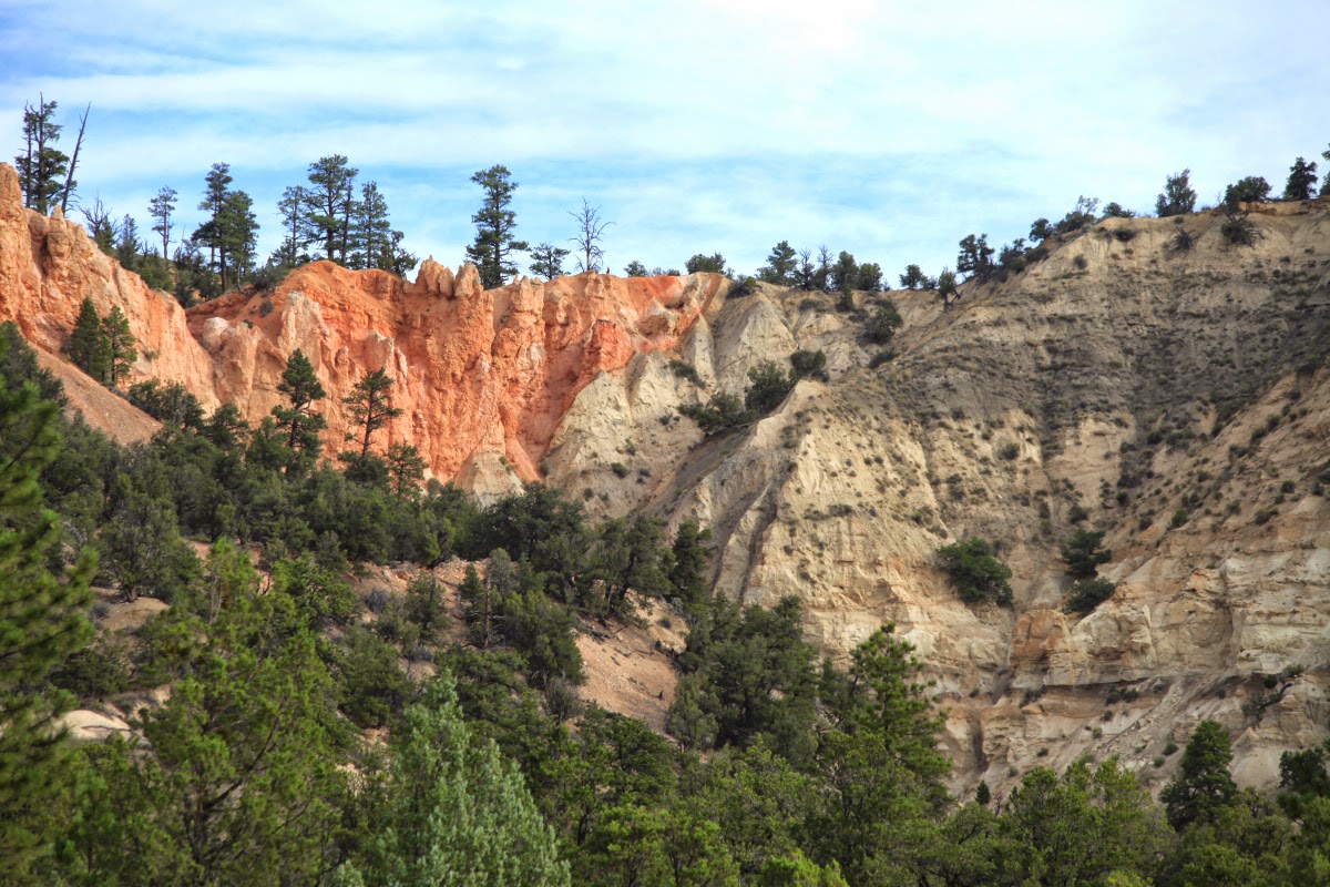
At Zion National Park I gave a lecture to the members of the Zion Natural History Association titled, "New Insights Into the Evolution of the Virgin and Colorado Rivers." This was a brand new lecture for me and I had the usual jitters about how it was all going to go. But the 75 people in attendance were much appreciative of the talk and the animations I constructed in the Apple Keynote application. This was the view I had driving into Zion from near Colorado City, Arizona on the Smithsonian Butte Road. Rocks are Triassic and Jurassic in age in the distance.


I wanted very much to see the site of the December 12, 2013 rockfall in Rockville that killed two people. You can read a Utah Geological Survey article about it here. The Salt Lake Tribune also ran an article here.


I went to take some pictures of the site. I was told that the house rubble was cleared away about three weeks prior to my arrival. You can see the size of the boulders in the foreground and the source area on the cliff at top. This is the Shinarump Conglomerate Member of the Chinle Formation. The slope is the red Moenkopi Formation, also covered with blocks of Shinarump.


More rubble from another different angle. These are very large boulders composed of well-cemented conglomerate.

Copyright St. George News,  photographer, Dan Mabbutt
I met a fellow at the lecture who lives in the area and who took pictures on the day it happened. What a tragedy to befall the two victims. Thanks to Dan Mabbutt for sending me these photographs.


This years theme at the Bryce Canyon Geology Festival was, "It Came From the Cretaceous Sea." I attended great talks about the fossils that can be found in the Tropic Shale (outside the park of course).


The front of the Visitor Center is filled with covered tents from various nearby agencies who also wish to celebrate their geology. Here kids color paper that will be pressed into a button.


Nearby Capitol Reef National Park also sent a crew over to extol the wonders found there.


A visitor contemplates a cast of a saber-tooth cat skull from the Pleistocene Epoch.


We heard a lot about the five species of Plesiosaurs that have been found in the nearby Tropic Shale. These were swimming reptiles that preyed on ammonites and other Cretaceous sea creatures.


Grand Staircase-Escalante National Monument has become a treasure trove of dinosaur finds recently. This includes the famous Tyrannosaurs, the teeth of which can be seen here at this display. After the Festival was over, I decided to drive home through the Monument, located just east of Bryce Canyon.


On State Highway 12 the Paunsaugunt fault is clearly seen to the north of the highway. Here (looking north) the pink Claron Formation (Eocene), so well exposed at Bryce Canyon, is faulted down against the gray Kaiparowits Formation (Cretaceous). The throw on this normal fault is about 2,000 feet.


The geo-treasures continue south on the unpaved Cottonwood Canyon Road. In this view, the folded Carmel Formation (Jurassic) is truncated and covered by Plio-Pleistocene river gravel. When the Carmel Formation was bent, it was quite young and not completely consolidated.


In this area near Kodachrome Basin State Park, the sandstone pipes are really well exposed. Note how the beds all dip into the center of the exposure, with a vertical pipe in the center. During the Jurassic, material was mobilized from below and shot upwards to disrupt the bedding. As the material was removed from below, the overlying layers sank downwards toward the center of the pipe. Recent erosion has cut the pipe in half for all to see.


This escarpment forms the backdrop to Kodachrome Basin State Park. The brown and highly eroded Entrada Sandstone forms the base of the escarpment, with the Henrieville Sandstone and Dakota Formation capping the top. This area was known as Thistle Flat until an expedition from the National Geographic Society visited it in 1948 and suggested the name change.


This is perhaps the most colorful part of the road. It is called "Candyland" or "The Squeeze," take your pick. Here the Carmel and Entrada formations are turned upright along the East Kaibab monocline (view to the south). They are both easily weathered to give the texture to the scene.


View to the north in Candyland or "The Squeeze." The rocks are highly deformed and it all happened while these in view were still very deep in the subsurface. Subsequent erosion left these shapes on the ground.


View to the south of the Cockscomb, the largest feature seen along the Cottonwood Canyon Road. These rocks are also upturned on the monocline and dip to the east (left). The road is constructed on the tilted Tropic Shale (gray) and this feature is known as a strike valley. The hard surface that forms the Cockscomb is composed of the Dakota Formation. It is a continuous (but tilted) unit in the subsurface. It has been cut by small streams that flow from left to right across the view.


The Paria River near the Cottonwood Canyon Road.


Near the southern end of the Cottonwood Canyon Road. Take this scenic road if you have a few hours to spare on your way to Bryce Canyon.

The Bryce Canyon Geology Festival is always held over the last weekend in July. Plan to be there in 2016.

Wednesday, July 16, 2014

1st Order Effects of Climate Change Becoming Evident in Miami Beach

In November 2013, a full moon and high tides led to flooding in parts of the city, including here at Alton Road and 10th Street. Photograph: Corbis
For those of us in the earth sciences it is kind of mind-boggling to believe that some people still think that climate change is a hoax foisted on us only by liberals or communists. There is a billion-year record of climate change that exists in the rock record and it clearly shows that Earth's climate is subject to change. And there is a multi-thousand year record of climate change preserved in Antarctic and Greenland ice sheets. Anyone paying attention can see that the climate changes through time. And these changes occur on multiple scales from millennia to decades.

But apparently, there is lots of money to be made sucking petroleum out of the ground and burning it so that the modern world can hum along and a few worrisome details like warming of the planet simply  must not get in the way.

This interesting article first appearing in The Guardian newspaper highlights what may be some of the first evidence for 1st order effects of climate change - dramatic sea level rise. Take a look and see what is happening in Miami Beach, Florida.

Low-lying houses in Miami Beach are especially vulnerable. Photograph: Joe Raedle/Getty Images


Wednesday, July 09, 2014

Dedication of Grand Canyon's Eighth National Historic Landmark - The 1956 Grand Canyon TWA-United Airlines Aviation Accident Site


On July 8, 2014, Grand Canyon National Park Superintendent Dave Uberuaga formally dedicated the 1956 Grand Canyon TWA-United Airlines Aviation Accident Site. Wikipedia has a great synopsis of the crash here. At an event that was covered by the NBC affiliate in Phoenix and the Associated Press, about 200 people attended the ceremony. Below is an image of the printed program that was distributed at the event. You will notice that the names of all 128 persons who perished in this tragic collision are listed on the left hand side.


When I first began working at the Grand Canyon in the mid-1970's, one of the first impressions I got was when I was perusing the Park's collection of slide photographs. The first set of slides I encountered were the ones associated with the recovery of the wreckage and the bodies a few days later. I instantly felt a connection to this event. Now I am even more connected to it.

The Park Service requested that someone from the Grand Canyon Historical Society give remarks at this event. I serve as the President of the Society and was glad to give remarks, which are included at the end of this posting.

Here are some of the pictures I took at this historic occasion.

Milton Tso provided the opening music on a gorgeous summer day at Desert View

Ron Lee is the District Director for Congresswoman Ann Kirkpatrick

Clint Chandler represented the office of Senator Jeff Flake

Glen Miller is the Acting Western Regional Administrator for the Federal Aviation Administration

Mike Nelson, who has just written a book called "We Are Going In." His uncle was one of the victims on the United plane and he told an outstanding story from the book.

Superintendent Dave Uberuaga in front of the plaque that will be mounted on a rock at Desert View. A miniature of this exact plaque will be given to the family members.

Researcher Ben Carver of Northern Arizona University (left) who has studied the crash and NPS ranger Ian Hough who spearheaded to the nomination process which took about 8 years to complete and finalize.

Standing with Superintendent Uberuaga

Behind the plaque is the general location of the crash site

Louis Hudgin (left) was a small boy when the crash happened and his family owned Grand Canyon Airlines at the time. It was his father and uncle who flew over the canyon late in the evening of June 30, 1956 and located the crash site.

Ray Cook (left) also lost his father in the crash and was 10 years old at the time. He sits here with Mike Nelson.

Comments given by Wayne Ranney, 
President of the Grand Canyon Historical Society at the Dedication 
July 8, 2014

Good morning everyone and welcome to Grand Canyon National Park. My name is Wayne Ranney and I am the President of the Grand Canyon Historical Society – established in 1984 by a group of dedicated Grand Canyon residents who wished to preserve the rich and colorful human history of the Grand Canyon. In the 30-year existence of our Society we have endeavored to keep the memory of the many human successes and failures, that have occurred at this iconic landscape, in focus for future generations. Ours is not a Society that merely preserves old photographs or dusty texts, but one that puts history in clear view so that people today can learn from the past. I guess that is why the National Park Service so graciously and thoughtfully asked our organization to be a part of this dedication. I am honored to represent the Society here today and we are honored that the National Park Service has chosen to include us at this important dedication. We have never forgotten the scope and scale of this horrific accident in the skies over Grand Canyon. 


A little over one week ago on June 30, we commemorated the 58th anniversary of the mid-air collision of two airliners over Grand Canyon – TWA Flight 2 and United Airlines Flight 718. Memorial wreaths were laid at both mass gravesites in Flagstaff and Grand Canyon. About fifty family members came, some for the first time since the accident. Sons and daughters of the victims, grandchildren and great-grand children were here to remember. In most respects it was a happy event but in every sense it was a moving and heart-rending occasion. I was amazed that after 58 years that anyone involved with the crash would bother to come at all. But such is the depth to which this tragedy cut into the lives of thousands of people.

One of the themes that we continually heard last week was how the crash severely and negatively impacted the lives of so many family members, such as spouses and children, who were left behind in the wake of a disaster, which rippled outward much farther than the 128 people who lost their lives that fateful day. In the innocent and naïve decade of the 1950’s the people living with the loss of loved ones were expected to be strong, stand tall, and perhaps pretend that it never really happened and would just go away. Perhaps that was an equal part of the tragedy – that many of these people had few places to turn to, to express their grief or feel the depth of their loss.

In the years following the crash the National Park Service reacted to the event in much the same way. I saw this first hand when I became a ranger at Grand Canyon only 20 years after the accident. Like a lot of family members who were profoundly wounded, the National Park Service employees and residents of Grand Canyon Village couldn’t believe it happened here and wished it would just go away. Two after-crash clean up projects were undertaken to repair the landscape below us but little was done to repair the broken hearts or shattered lives left across a country of 169 million people in 1956.

And then remarkably, eight and a half years ago in late 2005, a chance luncheon in Flagstaff between my wife, Helen Ranney of the Grand Canyon Association and historian Richard Quartaroli of Northern Arizona University, started a conversation that everyone felt was appropriate and timely – to hold a commemoration event in Grand Canyon Village on the 50th anniversary of the mid-air collision, June 30th, 2006. I think the National Park Service was as surprised as the rest of us to see every seat in the Shrine of the Ages Auditorium taken by people from everywhere who just wanted to honor the people who were lost, recall and remember the tragedy, and touch a piece of history. At that commemoration, we were all touched when two family members showed up, Ray Cook who lost his father on the United Airlines flight and ­­­Sally Gauthier who lost her father on TWA (please stand).

That event hosted by the Grand Canyon Association eight years ago changed everything related to this accident at Grand Canyon National Park. It began a process whereby the accident could be viewed in the context of the present without the shadows or the pain of the past. The National Park Service completely reversed course on its long silence and began to understand the accident not merely as a scar upon the landscape but also as a scar upon the hearts of loved ones who needed remembrance, acknowledgment, and closure. Bravo to the National Park Service today for acknowledging that this event is an important piece of Grand Canyon and United States history! I want to thank everyone with the National Park Service, the Grand Canyon Historical Society, the Grand Canyon Association, both airlines, and the Federal Aviation Administration who made this designation possible. But especially let us thank Rangers Ian Hough and Jan Balsom who spearheaded the drive to make this happen. Without their personal understanding of the crash and their professional commitment to see something done, we would not be here today. 

Three minutes – that was the elapsed time between take off for both of the planes. How many times people must have thought if they had only been delayed just a few more seconds somewhere on their path toward the Painted Desert VOR line that stretched 200 miles between Bryce Canyon to the north and Winslow to the south. Just a few more seconds would have prevented this crash. But the truth is, if this accident didn't happen here at 10:31 AM on June 30, 1956, it would have happened somewhere else not long afterward. With the benefit of 58 years of reflection we can now see that as a people we were giddy with our technological ability to fly cross-country and that our enthusiasm for flight far outpaced the need to better regulate the sky for air traffic. In some unthinkable way, this accident needed to happen so that the skies above us could become better organized for the safety, speed, and modern lifestyle we take for granted today. Regulations, especially federal ones, often get a bad rap these days but let this tragedy be a reminder to us all what the results can be when there is too little of it.

On behalf of the nearly 300 members of the Grand Canyon Historical Society, we welcome you to Grand Canyon National Park today and we honor the family members here who have lived without a sense of closure for these 58 years. We hope that all of you will take this opportunity to meet these family members who are here with us (show of hands please), talk with National Park Service representatives (in uniform) and with Grand Canyon Historical Society members (show of hands please) about the National Historic Landmark designation of the accident site. We remember those lost and we thank everyone for being here today."

Wednesday, July 02, 2014

Interactive Natural Hazards Map of Arizona

This interactive map is really fun. It is produced by the Arizona Geological Survey, the Arizona Division of Emergency Management, Arizona Emergency Information Network, and FEMA. It shows the locations of various natural hazards within the state such as active faults, earthquake epicenters, flood risks, fire hazards, and earth fissure locations. Here is the link for the map.

When you click on the link, it will bring up an ordinary map that, like other online maps, allows you to zoom in or out. The zoom button is located in the upper left of the map (not shown). Then in the upper right (also not shown) are tabs to bring up the various hazards.

Here is the map for earthquake epicenters. On this map you can also add or subtract earthquakes by magnitude. So if you only want to see the big ones, you can "turn off" the smaller quakes.

Here is the fire hazard map for Arizona. Zooming in on this is real interesting to see where the trouble areas might be around the Mogollon Rim and Flagstaff.

Here is the flood hazard map for the state. But if you zoom in real close.....

....you can see how detailed the maps are. This one centers on the Phoenix area in central Arizona. Note that even normally dry washes are shown.