Thursday, December 27, 2012

Article Published in Arizona Geology Magazine on the Controversy of the Age of the Grand Canyon

Jonathan DuHamel, who writes a geology blog at TucsonCitizen.com, just posted a link to my new article that was published by the Arizona Geological Survey regarding the controversy on the age of the Grand Canyon. The AZGS published the article in their 2012 Fall/Winter issue of Arizona Geology Magazine. You can access the article at this link. You can also access DuHamel's discussion of the topic here at his blog site. And the lead article in this issue of Arizona Geology Magazine, "Post-Tectonic Landscape Evolution in Southeastern Arizona"looks quite interesting as well. Read it here.

Also, if you live in Flagstaff, Arizona, please be sure to drop by the Museum of Northern Arizona on January 9 at 7 PM when I will lead a "Science Cafe" discussion on the "Age of the Grand Canyon". The Science Cafe begins with a short 20 minute overview of the topic, then audience members raise questions and discuss the issue. Please drop by if you live in Flagstaff. It is sure to be a lively and interesting evening.

Photo by Wayne Ranney©  Taken from Dutton Point on Powell Plateau, July 1, 2007

Monday, December 17, 2012

Sharing Geology with 4th Graders at Mabel Padgett School

The tragic events of last Friday in Newtown, Connecticut hold special meaning to me. Just three days prior, I visited an elementary school in Litchfield Park, Arizona to lecture about geology, erosion, and the rock cycle. I was a bit miffed when the secretary at the front desk asked me for my drivers license, so that she could copy it before admitting to the grounds. Now I know why.

The 4th graders in Mrs. Mahoney's class were quite knowledgeable about geology already. I was astounded really. Three other 4th grade classes were also admitted to my talk. Here are a few pictures of the day.

My invitation to the class came from none other than my grandson, Jacob Lynch. I have known Jacob since he was two years old and remember well the first time we took him to the Grand Canyon. We blindfolded him and led him carefully up to the edge. Then we pulled the blindfold off so that he could see the canyon spectacularly in one grand sweep for the first time. He has been an ace geologist and paleontologist ever since.

Here I am with Mrs. Mahoney answering questions in the class. All of these students have been studying the rock cycle, erosion and rocks the whole semester and they were well prepared to meet a real geologist.

I brought some rock samples for the students to inspect. They looked at and held granite, many kinds of schist (even one speciment with garnets in it!), sandstone, and limestone fossils.

It was so much fun to do this and Jacob was really jazzed to share his own personal geologist with the rest of his class.

Wednesday, December 12, 2012

Age of the Grand Canyon Still in the News


 I have been on the air recently of NPR affiliate KNAU here in Flagstaff, to provide some context to the controversy regarding the age of the Grand Canyon. The first in-studio interview was with reporter Gillian Ferris-Kohl and you can listen to it here.

Today a piece aired from the Fronteras desk and reporter Laurel Morales. We walked along Grand Canyon's Trail of Time last week and discussed the recent controversy. You can listen to the report here.  


Sunday, December 02, 2012

The Latest Big Controversy on the Age of the Grand Canyon

Take a look at this group of people

Participants at the  "Workshop on the Origin of the Colorado River", USGS, Flagstaff, May, 2010
It represents the entire cohort of experts on planet Earth who know something about the science of the origin of the Grand Canyon. There's about 60 of them, meaning there are not a whole lot of people in the world who regularly concern themselves with the age of the Grand Canyon.

So it was a big deal when the national media reported on the publication of a paper in the journal Science by researchers Rebecca Flowers and Kenneth Farley on November 29. The article reported on evidence they obtained documenting an ancient Grand Canyon of about 70 Ma (million years). The date is more than ten times the age that most of those in the photograph ascribe to the canyon, thus perhaps explaining why the press went hog-wild over a subject that normally lives in the shaded recesses of small tributary canyon. Who would have known that this story would fire up the creative juices of a nation still recovering from the long, drawn out presidential election.

Front page stories appeared in the New York Times, Washington Post, the Los Angeles Times, Huffington Post, the Seattle Times, and Latino Post. The story went viral in just about every small town newspaper in America and who knows how many globally. (My hometown newspaper, the Arizona Daily Sun, ran the mistaken headline, "Jurassic Canyon", obviously trying to play off the Jurassic Park name but missing the time period (Cretaceous) by about 80 million years). Broadcast media even chimed in, with NPR's "All Things Considered" running a 7-minute segment on the radio and PBS doing similar justice on the television Nightly Newshour. You can listen and watch these reports here and here.

Zoroaster Temple along the Colorado River in Grand Canyon
To put it mildly, most scientists who work in this field are not used to the all the attention. So why the hoopla? Perhaps it's because research journals like Science are not immune to the publicity-seeking payoffs that any media outlet strives for in our information blitzkrieg culture. That's not to say that there is no merit in the research (or the arguments against it). It's not to say that Science is no longer a well respected journal - it very much is. It's just ironic that the only time the collective national ear is cocked in the direction of Grand Canyon geology is when two respected groups of researchers duke it out in a 'who's right/who's wrong' sockdolager.

As someone who is knowledgeable about Grand Canyon geology (yes, I am in the picture above but be forewarned that I rarely take sides in such matters, preferring to think that anyone who has come up with an original idea about the canyon's origin is likely to be at least partially right), my own in-box was slammed over the weekend. This in part may be due to the fact that my book was fortuitously released in a new 2nd edition in late September of this year. Talk about a publicity windfall! Yes, this line of research is contained in the new edition and those in Arizona who have attended my book tour are already aware of its controversial findings.

Cover of the 2nd edition
What is the controversy you might ask? First off, it's not an entirely new idea. Flowers and Farley have been working with another Cal Tech researcher, Brian Wernicke, since at least 2008, when Flowers completed a post-doc under Wernicke at Cal Tech. Wernicke adopted the idea from another "old canyon" geologist, Don Elston, who endured violent opposition to his ideas on the antiquity of the canyon during the late 20th century. There have always been researchers who have found evidence of one kind or another for an "old canyon" since the days of John Wesley Powell. In fact, the idea for a "young canyon" only emerged in 1934 when Eliot Blackwelder published his seminal work, "Origin of the Colorado River" in the GSA Bulletin.

The new theory involves two very complex and complicated laboratory techniques that can reveal when the canyons rocks were brought close to the surface. Using tiny apatite crystals collected from the basement rocks in the canyon (Vishnu Schist or  Zoroaster Granite), the information yielded two different stories, one for the history of the western Grand Canyon and the other for the eastern canyon, where most tourists see the gorge. The results said that western Grand Canyon (downstream from Lava Falls) was cut to within a few hundred meters (about 1,000 feet) of its present depth by 70 Ma! The second story reported that the eastern area was the site of a canyon of similar proportions to the modern canyon by 55 Ma, and cut in Mesozoic rocks now completely eroded away. Incredibly, the western canyon was cut by a river that flowed exactly opposite to the modern Colorado River and the researchers call this the California River. (Get it? - the modern Colorado River goes from Colorado to California, while the ancient California River went from California to Colorado).

A view of western Grand Canyon, which may have been cut as early as 70 million years ago
Suffice it to say that those who argue for a young canyon (which is one no older than 6 million years), find the new results tantamount to heresy. Researcher Karl Karlstrom of the University of New Mexico had a four-page rebuttal ready by press time and was quoted as calling the results "ludicrous". And while there may be some legitimate concerns he raises about the use of the technique, I wonder if this kind of response is, in the long run, really beneficial to our science or the public being exposed to it. I believe this is Grand Canyon's moment in the sun, a time to cherish and nurture the opportunity to be heard on the national stage. Perhaps we geologists shouldn't take sides so quickly or denounce our colleagues in such a way. I know, some say this is how science works but don't we decide how to respond to ideas contrary to our own? Shouldn't we instead take the larger view on the good fortune to be nationally recognized and view the new research results as another possibility for canyon formation that at least deserves to be heard and considered? The Grand Canyon has always had its adherents for an "old canyon". They are a minority for sure but the fact that this idea will not die is evidence enough that something must be there. That is my opinion on the "controversy".

When the Cal Tech group began their study they assumed that the apatite samples would reveal that Grand Canyon's rocks were buried in unequal amounts of overlying rock - unequal because the canyon today has 5,000 feet of relief and the lower samples should have been buried under more material than those collected from near the top. Most geologists suspect a very subdued surface over the canyon about 70 Ma. The illustration below (from my current lecture) shows red dots where the apatite samples were collected in eastern Grand Canyon. The unequal length of the blue arrows depicts the amount of overlying material they expected to find.


After running the laboratory technique the samples produced surprising results to the researchers. They showed that no matter from what depth the samples were collected, they all appeared to have been buried under equal amounts of overlying rock. When the tops of the blue arrows are connected here, they reveal a canyon-like topography in eastern Grand Canyon about 70 Ma.


Below is a diagram that shows their interpretation of the data - a gorge of similar proportions was cut into the Mesozoic rocks that are now stripped back to the modern Echo and Vermilion Cliffs.


In my reading of the Science paper (not light I might add) I observed that the laboratory technique is not as evolved as one might hope for. Some assumptions are made that could result in different outcomes. Still, the technique has potential to help geologists better understand the erosional history of the area and even Karlstrom admits such a possibility. But he also wonders how a canyon could have been carved so early in time and then just sit there relatively unmodified for tens of millions of years. (Don Elston suspected that after being carved, the early canyon was partially filled with sediment and then exhumed only in the last 6 million years).

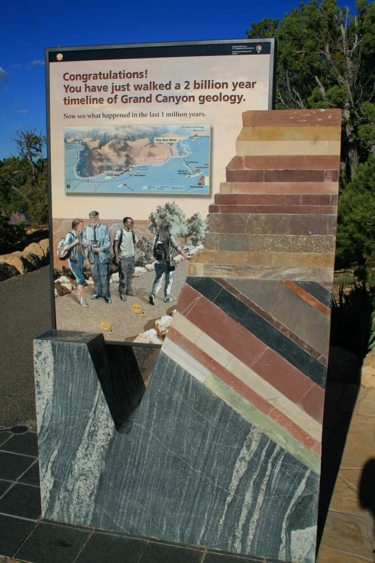
It's true that the Park will not soon change the widely regarded and useful date regarding the age of the Grand Canyon. What we see today from the canyon's edge is a gorge that has been greatly deepened and shaped in only the last few million years. The evolutionary history of the Colorado River shows that its exact course through the canyon to the Gulf of California was accomplished in only the last 6 million years. But as I make abundantly clear in "Carving Grand Canyon", most geologists too often conflate the age of the river with an absolute age for the canyon. For while the Colorado River is definitely no more than 6 million years old, the age of its ancestors or some early incarnation of the canyon need not be so strictly confined.

If we are to make sense of "When did the Grand Canyon form?", we should first ask ourselves, "What defines the Grand Canyon?". Karl Karlstrom and others say that the Grand Canyon must be a feature formed entirely by the modern Colorado River. I'm not so sure. Some aspects of the canyon, with respect to its depth or extent, could pre-date the modern river, having been formed by prior ancestors. Perhaps the question of "When did the Grand Canyon form?" can only be answered by another question: "What constitutes the beginning of the Grand Canyon?"

We are lucky that the world is paying us a visit at this time. Let us attempt to keep the debate civil, respectful, and without harsh words to our fellow geologists. We all seek the truth and each incremental step brings us closer to it. This is part of the process of getting to know a world-class landform that continues to inspire and enchant us all.

Title page to "Carving Grand Canyon" Photograph by George H.H. Huey

Wednesday, November 21, 2012

A Trip to the Mogollon Rim and Payson to Give A Lecture

On November 19 I gave a lecture in Payson, Arizona on "Carving Grand Canyon". I serve as an Arizona Road Scholar where I get to drive around the state and give geology lectures to various volunteer groups and clubs. This is a great program of the Arizona Humanities Council. It was a wonderful event and even the drive there was fascinating. Take a drive with me on Coconino County Road 3 (aka Lake Mary Road) and State Highway 87 through one of the most beautiful and interesting forested drives in all the Southwest.

The trip begins in downtown Flagstaff, which is quickly becoming a place full of public art. Here is one on the side of the Will McNabb Jewelry store showing a Northern Arizona University scene (right) and Homecoming Parade (left).

About 30 miles south of Flagstaff is the largest natural lake in the state, Mormon Lake. This basin was formed when the Lake Mary fault blocked surface drainage to the north. The foreground shows the upthrown block with the lake situated on top of the downthrown block. One professional colleague of mine has suggested that this type of setting could eventually develop into a larger and deeper valley, much like the Verde Valley located on the opposite side of Mormon Mountain (on the horizon). Time will tell. The recent Southwestern drought has drawn down the level of Mormon Lake considerably.

Mormon Mountain is a dacite dome volcano that has given an age date of 3.1 million years. It's slopes are carpeted in a thick stand of Ponderosa pine trees, revealing that the eruptions are long dead here.

Farther along the road, there is a nice view to the north of San Francisco Mountain, affectionately known as The Peaks locally. This strato-volcano collapsed its top about 400,000 years ago (although there is another idea that it blew its top Mt. St. Helen's style) giving the crest its jagged outline. Mt. Kendrick sits to the west of the Peaks and is a 2 million year dome volcano. To read a detailed account of the geology of the San Francisco Peaks, see Written in Stone, the blog of my colleague Jack Share.

After driving dozens of miles through stately Ponderosa pines, State Highway 87 emerges at the lip of the Mogollon Rim, an escarpment that is thought by many to be the second most significant landform in Arizona (after the Grand Canyon). This is a view to the west toward the lower Verde River valley. Squaw Peak is the dome feature in the upper right and is likely a basaltic shield volcano that is broken in half by the Verde fault, located in front of the peak. The Bradshaw Mountains near Prescott can be seen on the skyline and are composed mostly of Precambrian basement rocks.

The Coconino Sandstone is exposed in a road cut along the north side of the highway. As is typical of this eolian sandstone, the cross-bedding evident dips to the south and east, documenting the dominant wind direction during the Permian Period some 275 million years ago. The Coconino attains its thickest section here along the Mogollon Rim and it thins northward beyond the Grand Canyon.

A view back toward the Rim from farther down the highway. The capping rock is a basalt lava flow, likely erupted between 10 nd 15 million years ago. The red beds belong to the Schnebly HIll Formation, most famous from exposures around Sedona. This deposit is changing from am eolian deposit near Sedona to a more marginal shoreline deposit here. It finally becomes a gray marine limestone near Ft. Apache to the southeast.


Here is a classic view of the Mogollon Rim just north of Payson and east of Highway 87. The lack of vegetation on the scarp is due to the Dude fire that scorched the trees in 1990. The rocks visible in the Mogollon Rim are Upper Paleozoic in age (about 285 to 270 million years old) and dip slightly to the north (left). This dip was imprinted in the rocks during the Laramide Orogeny when the Mogollon Highlands were raised in central Arizona (located far to the south or right in this photograph). As these Highlands were destroyed by Basin and Range faulting beginning about 17 million years ago, the Rim country became differentially elevated and the Rim emerged!


Approaching Payson, I look back to the north and see the lower Paleozoic section exposed at the base of the Rim. Seen in the cliff is the Tapeats Sandstone, most famous from exposures in the bottom of the Grand Canyon. The slope beneath the cliff is cut into the basement rocks.


The Great Unconformity is exposed in a road cut farther south. The bedded Tapeats Sandstone lies atop the basement rocks, here named the Payson Granite. More than 1,200 million years of earth history are missing at this contact.

Close-up of the Great Unconformity


The Tapeats Sandstone is a coarse-grained deposit interpreted to have been deposited along the shore of a Cambrian beach (525 million years ago). If you would like to see some of the trace fossils found in the Tapeats Sandstone from near the Payson area, see this blog here for descriptions and photographs.


My lecture was given to the Library Friends of Payson, a support group for the public library in town. They have an active group that meets monthly and use the Humanities Speakers Bureau for much of their meeting content.

There were 28 members present for the lecture and I think it was a rousing success. They learned many of the new ideas on how the Grand Canyon may have formed. Our country's public libraries are the backbone of our civilization and I was taken by a quote that appeared in the group's monthly newsletter. It was by Carl Sagan, the esteemed astronomer:

"I think the health of our civilization, the depth of our awareness about the underpinnings of our culture, and our concern for the future, can all be tested by how well we support our libraries." 

This is part of the reason why I enjoy giving these lectures about the geology of our state so much. These people are "salt of the earth" kind of folks, yet they rarely have an opportunity to learn about our science. When they are exposed to it, they not only enjoy it but can understand it and relate to it. We had a great time sharing with each other on this glorious fall day in Payson.

Saturday, November 10, 2012

Article in the Williams/Grand Canyon News

Clara Beard, a reporter for the Williams/Grand Canyon News, recently interviewed me about the 2nd edition of "Carving Grand Canyon." You can read the interview here.


Monday, November 05, 2012

What Is A Geologist?

A Geologist Outstanding In His Field
I don't know about you, but we have been receiving a lot of political phone calls these days. I've stopped answering the phones because of the number of robo-calls we receive.

I thought it might be fun to take a light hearted look at "What is a Geologist?" This was obviously written by someone with a sense of humor and an understanding of these unique people. You can read the description here. There is a short warning in the opening window but you will find it as full of parody and satire as the main body of the piece. Thanks to whomever wrote this! There is much truth in it.

Thursday, November 01, 2012

A Movie of Hurricane Sandy from Florida to New York


Technology from NASA and NOAA provides a view of the dynamic nature of Hurricane Sandy as it moved from the Bahama's to New York state. The images were spliced together  over a six-day period from October 25th to 31st. This movie shows how hurricanes swirl and move through our atmosphere. If you have 5 minutes to watch the events of these past six days, please take the time to watch. See the video here.

Wednesday, October 31, 2012

700 Months

How big is the number 700? Not very big in today's world (and certainly not for a geologist). But 700 months. How long do you think 700 months is?

Well I can tell you because on Nov. 1, I will turn 700 months old! It sounds like such a short time doesn't it? "Really? Only 700 months?" Yep, it's true.

So the first day of November I will turn 58.25 years old or

700 months;
3,045 weeks;
21,308 days;
511,400 hours;
About 30,683,500 minutes;
or 1,840,997,000 seconds.


If you'd like to know how old you are, check out this web site: http://www.paulsadowski.com/Birthday.asp. It's fun and a happy place to be.

Disclaimer! This photograph of me was taken in my 682nd month at one of my favorite places - the inner gorge of the Grand Canyon!

Saturday, October 27, 2012

10,000th Copy of "Ancient Landscapes" Sold At GCNP


Late on the afternoon of September 22 (or thereabouts), someone at Grand Canyon National Park bought the 10,000 copy of the book, "Ancient Landscapes of the Colorado Plateau". I don't know who that lucky person was, or where they live. But if there was any way that i could know, I would inscribe a most appropriate notation on the inside title page.

"ALCP" made its debut on bookshelves in October, 2008 to robust reviews. The book's "back story" however, is quite interesting. For years prior to its publication, I had been admiring Ron Blakey's paleogeographic maps and using them in the geology classes I taught at Yavapai and Coconino Community Colleges. Being a former student of Ron's at Northern Arizona University, I became filled with his infectious enthusiasm for rock strata and the ancient landscapes they reveal. I occasionally heard from Ron (and others) that he was about to publish a book containing the maps and always made it a point to ask him about it when I saw him at a professional meeting. All too often, he would relate his most recent publishing "detour". (He had three prior publishers lined up at different times and on one occasion was close to a deal with Oxford University Press). The only person more disappointed than Ron in hearing the news was myself, as I knew that his maps provided an excellent avenue for people to learn about geology and earth history.

Then in 2005, while attending the Annual Meeting of the Geological Society of America (GSA) in Salt Lake City, I saw Ron in the exhibit area of the convention floor. I had not seen him for a few years but once again asked him how the book project was coming along. He gave what was becoming an all too familiar look of disappointment and shuffled his feet and shook his head with disgust. Obviously, there had been another setback. I was disappointed once again to get the news. But then an idea came to mind! I was at the meeting to attend the professional talks and to promote and sign my new book, "Carving Grand Canyon". The book had been recently published by the Grand Canyon Association (the non-profit partner for Grand Canyon National Park) and I was aware that they were willing to consider other geology titles for future books. Within about 15 minutes of talking to Ron about a possible collaboration, the idea for "ALCP" came to light that moment in Salt Lake City.

It took three years to write new text and to design the book (beautifully executed by Ron Short). But by the time GSA held its Annual Meeting in October, 2008 in Houston, Texas, Ron Blakey and I were doing our own book signing on the convention floor.

Book signing at the GSA Annual Meeting in Houston, Texas in October, 2008

"Ancient Landscapes of the Colorado Plateau" is selling as well or even better now as it was on the day it was published. Both Ron and I are appreciative of the support that the Grand Canyon Association gives us and remain gratified that so many professionals and lay persons alike are benefiting from the story it tells. It is an amazing work and I receive correspondence from readers all the time telling me how it has helped them "get over the hump" in learning geologic concepts. ALCP rocks!

Wednesday, October 24, 2012

Yellowstone Article Posted On US Route 89 Web Site

One of the joys of being a geologic interpreter is that you often get a chance to explain some earthly phenomena for a general audience. It may be a public lecture, a chance to ride along on a river trip, or to write an article. I welcome these opportunities to enlighten the general public about the magic and joys of geologic thinking.

The Grand Canyon of the Yellowstone River is carved in volcanic rocks erupted about 640,000 years ago
I was recently contacted by Jim and Barbara Cowlin, who have a passion for US Highway 89, also known as the Park to Park Highway since it connects seven different National Parks (as well as many more National Monuments) between the Mexican and Canadian borders. Jim is a professional photographer and this site is one you should bookmark if you love this art form or Western scenery. They both have traveled the highway from one end to the other and know it well. They offer tips on things to see, side excursions, and places to visit.

They asked me to write a short post on volcanism near Yellowstone. I was fortunate to spend much time there about ten years ago, becoming familiar with many of the geologic features there. You can read my posting on Yellowstone volcanism here.  The introductory article for the US Highway 89 web site can be read here. I have also written geologic summaries of the three geographic provinces that US Highway 89 traverses. The Basin and Range article can be read here. The Colorado Plateau article is found at this link. And the article describing the geology of the Rocky Mountain Province is here. The Cowlin's are to be commended for celebrating the beauty and heritage of this incredible western highway.

Happy traveling!

Friday, October 12, 2012

"Game Changing" Images From The Mars Rover Curiosity

I thought for sure that the national airwaves would be buzzing endlessly about the discovery of river-worn pebbles by the Mars rover Curiosity on September 27. The announcement was made to the usual temporary fanfare and faded away predictably in unceremonious fashion. I guess that is the price we pay to live in this info-charged, "what-have-you-done-for-me-lately" world. If our attention spans get any shorter there will be nothing in the solar system that amazes us.

Well not for this old rock-hound, who remains duly impressed a full two weeks after the announcement was publicized. This truly is the smoking gun for the former presence of running water on Mars. Previous studies have shown that minute amounts of water still reside near the Martian poles and perhaps beneath the Martian surface elsewhere. But this is verifiable and visible evidence that rivers once ran on Mars! (A River Ran On It).

In this posting, I include images released by NASA with their own captions beautifully describing each one (I modified the captions slightly to reduce redundancy). The full story as posted on the NASA web site can be read and accessed here. Wow! This is really impressive. Stay tuned to NASA and this blog for more fantastic discoveries from Mars.

Where Water Flowed Downslope

This image shows the topography, with shading added, around the area where the rover Curiosity landed on Aug. 5 PDT (Aug. 6 EDT). Higher elevations are colored in red, with cooler colors indicating transitions downslope to lower elevations. The black oval indicates the targeted landing area for the rover known as the "landing ellipse," and the cross shows where the rover actually landed.

An alluvial fan, or fan-shaped deposit where debris spreads out downslope, has been highlighted in lighter colors for better viewing. On Earth, alluvial fans often are formed by water flowing downslope. New observations from Curiosity of rounded pebbles embedded with rocky outcrops provide concrete evidence that water did flow in this region on Mars, creating the alluvial fan. Water carrying the pebbly material is thought to have streamed downslope extending the alluvial fan, at least occasionally, to where the rover now sits studying its ancient history.

Remnants of Ancient Streambed on Mars

NASA's Curiosity rover found evidence for an ancient, flowing stream on Mars at a few sites, including the rock outcrop pictured here, which the science team has named "Hottah" after Hottah Lake in Canada’s Northwest Territories. It may look like a broken sidewalk, but this geological feature on Mars is actually exposed bedrock made up of smaller fragments cemented together, or what geologists call a sedimentary conglomerate. Scientists theorize that the bedrock was disrupted in the past, giving it the titled angle, most likely via impacts from meteorites.

The key evidence for the ancient stream comes from the size and rounded shape of the gravel in and around the bedrock. Hottah has pieces of gravel embedded in it, called clasts, up to a couple inches (few centimeters) in size and located within a matrix of sand-sized material. Some of the clasts are round in shape, leading the science team to conclude they were transported by a vigorous flow of water. The grains are too large to have been moved by wind. This image mosaic was taken by Curiosity's 100-millimeter Mastcam telephoto lens on its 39th Martian day, or sol, of the mission (Sept. 14, 2012 PDT/Sept. 15 GMT).


Close-up view of Hottah

A close-up view of Hottah reveals more details in the outcrop. Broken surfaces of the outcrop have rounded, gravel clasts, such as the one circled in white, which is about 1.2 inches (3 centimeters) across. Erosion of the outcrop results in gravel clasts that protrude from the outcrop and ultimately fall onto the ground, creating the gravel pile at left.


Monday, October 08, 2012

Flash Flood Videos from the 2012 Grand Canyon Monsoon

The monsoon season of 2012 will go down as one of the most active in recent memory. It seems that here in Flagstaff we were constantly under rain showers from July 4th to September 12th. There were many fantastic floods that also occurred in the Grand Canyon and I include some phenomenal links to videos of these events in this posting. Before that however, you may want to refer back to some pictures I posted of two debris piles that were deposited catastrophically at the mouths of Red Canyon and National Canyon. These were taken on my 10-Day Geology Rafting trip from September 12 to 21. You can refer to that posting and view the pictures here.

Some video was captured of the big National Canyon flood, which occurred on July 14, 2012. It is courtesy of Joe Clark, a boatman for Western River Expeditions. That video can be viewed here. And there is a second video here that shows how the floodwater entered the Colorado as a foamy mess. These are amazing images. I have heard estimates that National Canyon had a peak flow of about 15,000 cubic feet per second, making it almost as large as the Colorado River on that day.

 Another flood occurred very close to National Canyon but on the other side of the river at Fern Glen Canyon on August 20th, 2012. A river trip apparently had stopped to hike at Fern Glen but on the way up into the canyon, the extreme runoff filled the canyon bottom. That video can be watched here. I have heard no estimates of the discharge on this flood but it is quite a bit smaller that what came down National. Anyone who would have been caught in the narrows in Fern Glen Canyon however, would not have cared one bit if this flood was somewhat smaller - the amount of runoff is impressive and deadly.

 Finally, there is this footage from some monsoon waterfalls that developed quite rapidly in a downpour that occurred in Marble Canyon in July, specifically at Redwall Cavern. A party of rafters had stopped in the large cavern when the skies let loose and they watched the rain fall in sheets which produced significant waterfalls of brown water into the river. Watch the footage here. Be sure to watch it through to the end - the rain gets stronger and the amount of water pouring into the river gets extreme. (You can also look at waterfall footage from Redwall Cavern from 2008 here).

Flash floods are common in landscapes that contain widespread bare rock exposures with few soils. They are the mechanism by which the canyons are created and facilitate the deep dissection that makes the Colorado Plateau and Grand Canyon so wonderful. With the advent of cheap but high quality electronics, more of these events are now visible to us. Watching the majesty and power of these events stirs the soul.

Addendum - 12/12/12: I became aware of this footage of the Red Canyon flood at Hance Rapid today! Here it is.

Tuesday, October 02, 2012

How The Earth Was Made

See a clip of my part in the History Channel's production, "How The Earth Was Made" here at this link.

Arizona Daily Sun Article on the New Edition of Carving Grand Canyon

To read an article on the new edition of my book "Carving Grand Canyon" in the local Flagstaff newspaper, see the link here.

Tuesday, September 25, 2012

Images From My 2012 10-Day Geology Rafting Trip

Wow! I just concluded another great 10-day geology rafting trip in Grand Canyon. The trips just keep getting better and better. I'm off on another Grand Canyon adventure soon, this time on a Rim to Rim hike with the Grand Canyon Field Institute. But I thought I would at least post some of the pictures from the rafting trip. Highlights include seeing some brand new deposits from the intense runoff events that occurred during the summer monsoon. Look at these below!

I didn't take any pictures on the trip until river mile 76 at Hance Rapid, where a large debris flow entered the Colorado River in August.

The rock in the middle of the picture used to sit out in the channel of the river. But the new debris flow constructed a rocky pathway so that it is now part of the left bank.

New debris near the river's edge.

Looking upstream in Red Canyon where the debris flow originated.

While standing on the new debris fan, we got an excellent view of the Hance Rapid dike cutting across beds of the Hakatai Shale, a Precambrian red bed deposit of the Grand Canyon Supergroup.This is likely the unit that failed in the monsoon rain causing a cliff of overlying Shinumo Quartzite to collapse.

The vast majority of the boulders are Shinumo Quartzite suggesting that the debris was let loose close to the river and not within Paleozoic rocks up higher in the canyon walls.

Cruising through the Upper Granite Gorge above Phantom Ranch.

We talked a lot about metamorphic foliation, displayed vividly here.

Pt. Sublime on the North Rim of the canyon. Helen and I visited this viewpoint just three weeks previous to the river trip and I include a view from the point below, that looks back to this point on the river.

Looking back at the river from Pt. Sublime on August 12, 2012

A bighorn ram wanted to check us out at one lunch stop near Elves Chasm.

Evening on the river....

A time to reflect on the days sights....

A typical river camp. I did not set up a tent even once.

Barbara getting close to the Great Unconformity in Blacktail Canyon at river mile 121.

This years flooding left a large pool of clear water at the base of the chockstone cliff

A view downstream near Stone Creek of the angular unconformity that exists between the Tapeats Sandstone and the Grand Canyon Supergroup rocks. Can you see it?

If not, here is a close-up with all of the layers labeled. The yellow line represents the angular unconformity where more than half a billion years of earth history is missing in the rocks.

Near Tapeats Creek, there are huge landslide deposits that have filled former channels of the Colorado River. Can you spot the one here?

If not, here is the same photo with all of the labels.

Sunrise on the 6th morning below Deer Creek.

A quiet camp scene.

A huge fan of debris came down National Canyon at river mile 166 in July. The new material extends all the way to the rivers edge.

Wow! This view is of the upstream portion of the fan.

Here is a view of the downstream portion of the fan. The entire beach was inundated with rocky debris and rumors of 15,000 cfs coming down National Canyon are floating around.

No place to be in a flood.

The Grand Canyon

Alan and Carol

Cynthia and Tim

A volcanic dike cuts through the Bright Angel Shale just upstream from Lava Falls at river mile 179

Lava Falls as it looked on the morning of September 19 at just over 8,000 cfs.

Ready for the run of the Falls. Brandon did a great job getting us through.

I've never stopped at river mile 214 where the Bundy jars are located. The Bundy's are a local ranching family up on the Shivwits Plateau.

The jars are in an overhang of Tapeats Sandstone in front of numerous mescal pits. Here the group surrounds one of the pits.

Ripple marks in the sandtone

The summer rains really watered the desert in western Grand Canyon and I have rarely seen it so lush.

Green, green, green!

A lava remnant stands tall along a desert trail.

Mojave Desert vegetation in the western Grand Canyon.

Boatmen call this place "alien eggs."

Joe examines one close up. They appeared to be limestone blocks that were rounded and polished, then stained red by iron oxide.

This lava remnant is part of the Black Ledge flow that extends 84 miles down the channel of the Colorado River.

From the mouth of Three Springs Canyon at river mile 215.

Ocotillo

Looking downstream along the Colorado River at Three Springs Canyon.

Aliona or rounded pinwheel carpeting the desert floor.

Our final attraction stop was at Travertine Canyon at river mile 229.

The grotto is spectacular.

Final shot of our group.

Brandon and Tom, our crew for the trip.