In 1977-78, I undertook a fantastic three month journey of discovery to Mexico, Belize and Guatemala. There was no schedule per se, just a finite amount of money ($350 if I recall) and some vague stories of Mayan ruins, tropical jungles, and beaches. After a whirlwind of a year in 2016 with five Grand Canyon river trips, a Private Jet trip to South America, and three Smithsonian Journeys trips, I was ready for a little get-away. So the day after Christmas, Helen and I attempted to visit many of the places from that epic 1970's trip. This posting covers the Yucatan portion of the trip. Two post to follow will cover Belize and Guatemala. Not much geology in this posting but there will be in Guatemala.

Our first stop was Cancun but only to arrive at the airport. We hopped on a ferry and went directly to Isla Mujeres. I had missed this destination in my 1977 trip and wanted to see what it was all about. I'm afraid I was 39 years too late. Here Helen stands in front of the sign facing the Caribbean Sea.
This is the northern and windward side where the waves crash into the island.
It was a nice place but definitely has been discovered.
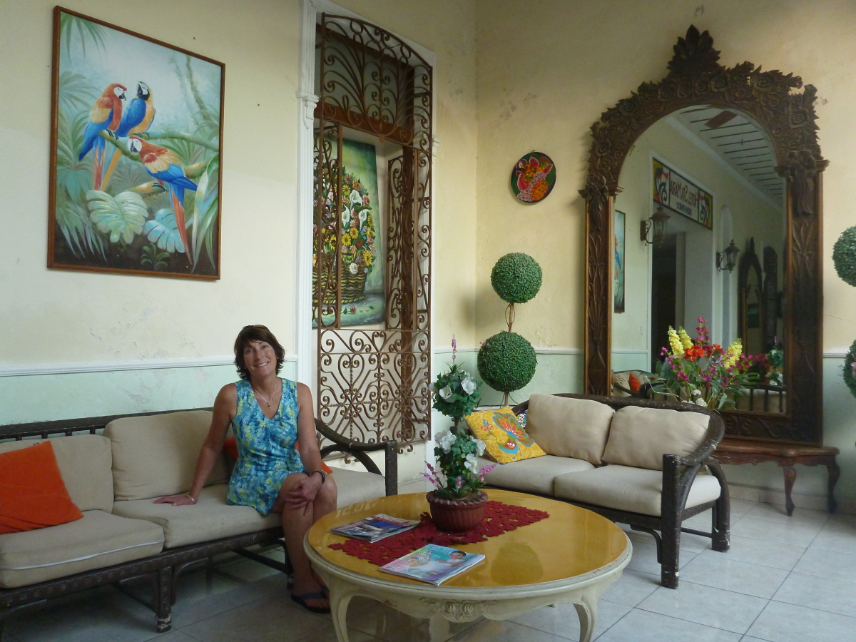
Next stop was the colonial city of Merida, capital of the state of Yucatan. Mexico is a great bargain with the exchange rate right now and nice hotels like this were had for about $50 per night for two people.
Many of the colonial buildings are undergoing renovation. We saw a few modern buildings among the older ones - what a shame. But there is enough to see here to delight the traveler.
This was Helen's first visit to a Central American market and it was a good one! So many colorful items for sale and the vendor aisles are very lively.
These are habanero peppers which we saw everywhere for sale and added to many dishes here.
This is the southern start to the Paseo de Montejo, an elegant tree-lined boulevard that was developed during the henequen boom years in the late 19th century. Many of the former mansions have been turned into museums, offices, restaurants and nightclubs.
This is one of the old homes that is now a museum to the henequen boom in Merida.
We visited the Mayan Museum on the north end of town. It was far enough away that we didn't want to walk. So we took a public bus and got lost in the suburbs. We did however, find our way back to the Museum.
These chairs were developed in Merida and were meant to keep young lovers far enough apart to preclude hanky-panky while they could still gaze into each others eyes. These two are found in the main square near the church.
Next stop was the Mayan site of Chichen-Itza. This is a view of the Observatory from the doorway at the Hotel Mayaland outside the archaeological reserve.
We took a guided tour early the next morning as we stayed at the Hotel Villas Archaeologicas, just outside the entrance to the site. We were inside the reserve hours before the hordes arrived from Merida and Cancun.
This is the largest ball court in all of Meso-America. I was proud to tell my guide that we live near the northern-most ball court known, located at Wupatki National Monument just outside Flagstaff. Having never traveled much, he seemed to not be impressed.
Carvings of skulls on a wall in Chichen-Itza.
To say that things have changed in these 39 years is an understatement in the extreme. In 1977, the highway ran through the site and was located just to the right of El Castillo in this view. At that time, the admission price was 5 pesos or 25 American cents. (I did not remember it but I Googled, "Admission price, Chichen-Itza ruins, 1977" and
found this 1977 travel article in the Chicago Tribune mentioning it - you've got to admit it is an amazing future we live in these days!). We paid 232 pesos per person this time (much devalued since 1977) or $11.60. Back then, we could climb El Castillo but is now off-limits since January 8, 2006 when a woman fell to her death while descending the pyramid.
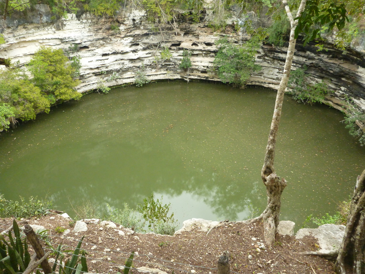
This is the sinkhole or Sacred Cenote (Chen Ku) located to the north of the ruin. The Maya would throw sacrifices, even human ones, into the cenote to appeased the god Chaac.
In the center of the photo is the famous Chaac Mool of Chichen-Itza. In 1977, one could climb the steps and gaze at the site where human hearts were placed as soon as they were taken out of a victims chest. I remember staring at the Chaac Mool then and pondering its importance. I think I even sat on it then. A great description of the Chaac Mool can be read
here.
In the south portion of the archaeological site are some wonderfully preserved glyphs.
This is called the Nunnery and much stucco is preserved on its façade.
Later in the morning, the sun came out to illuminate El Castillo.
It is a marvelous piece of architecture and is the second pyramid at this location. The other one is inside El Castillo! Stucco with colored paint would have made this a most impressive building during its occupation around 600 AD.
One of the many serpents with its tongue sticking out. We loved out time here but would highly recommend visiting in the early morning before the rush of people make it unbearable - 8,000 people on some days.
We spent New Years Eve in the colonial city of Valladolid. In 1977, our bus just passed by the church here and it left such an impression on me that I made a mental note to come back. It wasn't exactly how I had remembered it but here we can see a cresent moon and the planet Venus on the far right.
Street scene in Valladolid.
We got around on various kinds of First Class buses in the Yucatan. The three hour ride from Cancun to Merida was about $20 and included a bottle of chilled water. They has gender specific bathrooms and fully reclining seats.
Our last stop in the Yucatan Peninsula was the Mayan site of
Tulum, located right on the coast of the Caribbean.
This is one of the interpretive signs found inside the site. They were very well rendered and this shows the site as it would have looked during its period of occupation. There were Maya living here when the Spanish sighted it in 1519 arriving from Cuba, thirsty for gold.
The architecture at Tulum displays this angled look.
This is the tallest building at the site and is called El Castillo (The Castle).
An impressive view can be had here looking out to the Caribbean.
An iguana lounges on a wall in the winter sun.
A final look at Tulum in late afternoon light. This is another site much changed since my last visit.