On a trip like this, I usually take hundreds and hundreds of photos and going through them afterwards are both rewarding and time-consuming. Most often I choose only photos that are well composed and exposed to include in a blog posting. However, other times I want to express a particular thought or emotion from the trip. In this posting, there is a combination of the two. And I sometimes question why I lug around 8 pounds of camera gear repeatedly to the same place. To which a ready answer does come to mind - it is never the same! Time of day, time of year, time of life. It's always different.
I just love boiling mud pots! Maybe it is the boy in me wanting to get dirty. Here at
Namafjall, the Icelandic rift creates near surface geothermal heat that boils groundwater, which in turn chemically weathers the silica rock below. The result is silica and clay mud mixed with boiling water.
The gurgling and plop of the mud creates an another world feeling in the observer. Plus the smell of the Earth's interior! Our local guide warned us of the rotten egg smell, to which I added, some overcooked hard-boiled eggs have the same smell of the interior of the earth - breathe deep and enjoy its exotic nature! Okay, I go overboard sometimes. But no need to hate it off the bat without first giving it a chance to thrill the soul.
You have to take a lot of pictures to get the four boils going up at once.
A steam vent adds a sense of motion to the scene.
Up close the steam is hot to the touch. Ones skin could not take more than two seconds exposed to its heat and speed. It hisses loudly as the steam escapes.
Note the yellow sulphur deposits that precipitate near the vent.
Next stop was
Dimmuborgir near the shores of Lake Myvatn. Dimmu (dark) borgir (cities of castles) literally means the dark castles. It is a fantastic area that never ceases to amaze. But the geologic story is the true champion here. About 2,300 years ago (i.e. not that long ago but before people lived in Iceland) a lava flow came to rest on top of a shallow basin that held marsh, water forming a large lava lake about 30-40 feet deep. The top of the lava pool cooled forming a rocky crust. But on the inside, red hot lava was still heating the marshy ground below until steam began to shoot upwards through the hot lava. The vertical steam vents caused nearby portions of the lava lake to cool more quickly. Without warning, the lava drained away, collapsing the roof and leaving the steam vents standing like dark castles. An amazing place and story to go with it.

I had never noticed it before this trip but we saw a vertical steam vent in the middle of one of the "castles." It is just below the rounded pinnacle on the right and trends downward into the top of the trees.
Numerous windows are carved into the castles as well.
Leaving Lake Myvatn, we passed Godafoss, another impressive Icelandic waterfall.
The parking area has been recently upgraded here from a muddy pit to a nicely paved lot with wide, meandering trails to the falls. As this is right on the Ring Road and lies between Akureyri and Lake Myvatn, Godafoss sees a lot of visitors. Note the small lava tube across the way.
Zooming into the wall near the lava tube across the way (I have a 300 mm lens), I spied a very interesting set of textures. You will note two different textures are present - an upper regular set of vertically oriented columns, and a lower irregular oriented set of columns. The upper textures form what is called the colonnade and the lower part is called the entablature. The colonnade textures form in the absence of water while the entablature textures form when water seeps into and interacts with the cooling lava. But I never before noticed where a colonnade rests on top of the entablature. What could this be?

An even closer view reveals a possible explanation. Note the way the entablature fractures seem to emanate from a single central vertical fracture. I presume that when this lava flow came to rest here, it did so on top of wet ground. As the lava heated the water below, it formed steam which rose upwards. The steam channel started the cooling process in the lava - the fractures always form perpendicular to the cooling surface. It looks like the steam eventually was all "used up," allowing a colonnade to form on top. I'm telling you, stay here long enough and many insights begin to reveal themselves. It is a natural laboratory for earth processes! Although the above description is pure speculation on my part, I have been learning more such features in my travels here.
On the road in the afternoon sun near Akureyri along the east side of Eyjafjörđur (Island Fjord). This is one of my favorite drives in Iceland as the sun always seems to be not far away.
Leaving Akureryi and driving up into the mountains.
In Iceland in the summer, one sees many of these plastic wrapped bales of hay for winter silage. The bales are wrapped in different colors.
This is the Öxandalur Valley, birthplace of the famous Icelandic poet Jonas Hallgrimsson. Actually "dalur" means valley in Icelandic (dalur equals "dale" in English) so it is redundant. Note the sharp mountain peak in the background.
This is
Hraundrangi. It is an iconic mountain in Iceland but is usually in cloud. This was the best view I ever had of it. A quick glance might suggest that the peak formed as a cirque from glacial times. However, a wider view shows evidence for a catastrophic landslide here since the end of the Ice Age and what we are seeing the photo here is the headwall of the landslide.
Here is the rubble field to the south of Hraundrangi. Wow! What a difference the sun can make.
Although not native to Iceland, these daisy's were a welcome sight!
We spent the night in place not known for tourists - Sauđárkrókur. It is located along the Skagafjordur. This view is to the north toward the Arctic Circle.
The black sand beach at Sauđárkrókur.
Another location where we saw the debris field of a gigantic, post-glacial landslide. On the 8th of July this year, a very large landslide occurred in Iceland. Check out the AGU web site
here for some incredible photos. These are still a very real thing in Iceland. I found a seven minute video that shows drone footage of this slide
here. There may be a short ad to watch in Icelandic but you'll see the command in the lower right to skip after a few seconds. Wow!
What a day! August 11, 2018.
I had never before seen
Eíriksjökull - it always so gray and cloudy in this part of Iceland. But look at this view.
Next was a visit to Grábrók, found right along the Ring Road. After making the short climb to top of Grábrók (on a constructed trail), we could see one of the other two nearby volcanoes, Grábrókarfell.
Birch twigs were recovered from inside the flows here in the early 2000s and they revealed a radiocarbon age of about 1,800 years ago - still about 670 years too early for people to have witnessed these erupting.
This is where a lava flow emanated to the surface from inside the cinder cone. Note the extent of the flow in the right distance - evident from the lighter-colored moss covering it. The trail to the top takes advantage of this lava flow, switchbacking up its spine.
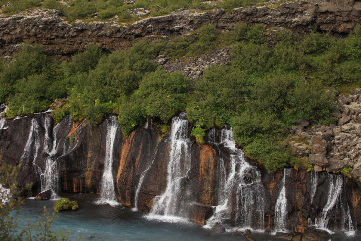
Another amazing stop along the way is Hraunfossar (literally, Lava Falls). Hundreds of springs flow to the surface here into the Hvítá River, made blue from glacial flour (ice-pulverized rock).
Note how the springs all come from the same horizon. About 2,000 years ago a very porous aa lava flow covered an older, more dense flow below. The pre space in the upper flow acts as a conduit for Hvítá River water from farther upstream, where the river flows up against the young lava flow. The upper flow becomes saturated with water, creating the falls. The falls erupt here because the upper flow is nearing its distal end and the water is forced out.
Iceland is a land of tunnels! Tunnels under basalt ridges, mountain, fjords. Yes fjords. This tunnel, the
Hvalfjörđur Tunnel, is almost 4 miles long and is about 540 feet below sea at its deepest point. The minimum amount of rock covering is 130 feet.
I had never before noticed so many landslides in Iceland. Perhaps it was the clear weather (likely). Or perhaps it tis my growing awareness of their ubiquity upon earth's landscapes (definitely). This may or may not be a landslide scar - it is very close to the sea and so may be a place where waves once washed against and eroded the cliff. Isostatic rebound has now caused the beach terrace to rise about 30 feet above the old seabed.
Guđaberg on the Snæfellsnes Peninsula is a favorite stop of mine.
Recent cinder cone formation left this impressive cone and flow to the east of it.
Note how the waterfalls just seem to appear our of nowhere in this view. The lighter-colored slopes are from mosses growing on quite recent lava flows. Like at Hraunfossar above, this flows were porous and act like sponges for water. When they encounter more dense flows below, the water is forced out suddenly. One can imagine how ancestral peoples would be baffled by such "magic." It doesn't take much more to understand the roots of some of our ancestral beliefs.
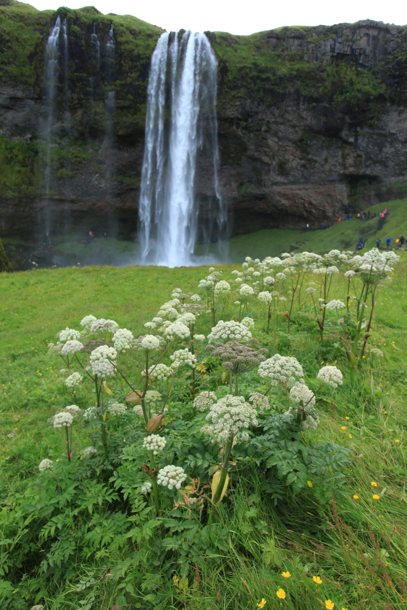
Iceland is a land of waterfalls, basalt lava, sea cliffs, and nature. I highly recommend a visit - just do not expect great weather at any time of year. For the geologist, it is a 'must see' place.
The old church at Buđir. Thank you as always for reading!