Iceland never disappoints - neither the geologist or lover of nature. Here, innumerable basalt lava flows are stacked one above the other, all battered by the cold North Atlantic wind. And this is summer! Rain and clouds are your constant companions, making this an unlikely but no less exotic island that is also a country. Every time I come here, I feel just a bit more Icelandic.


We've seen few puffins along the way.
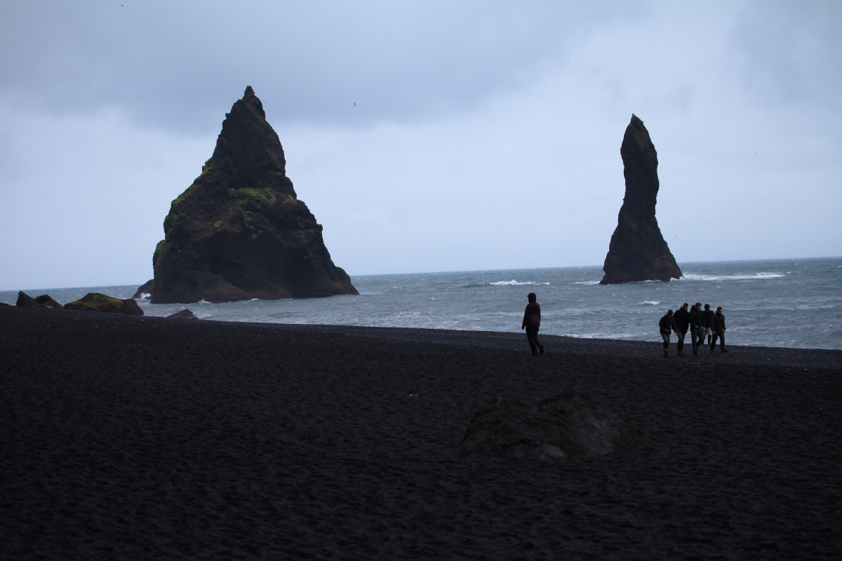
 The beach at Reynisdrangar is almost always dark and gray - this is near the wettest spot on a very wet island. The view to the west is towards Dryòlaey.
 There are the eroded remnants of the conduit to a volcano. The heavy North Atlantic surf has gradually worn the volcano away, leaving the conduit rocks standing tall.
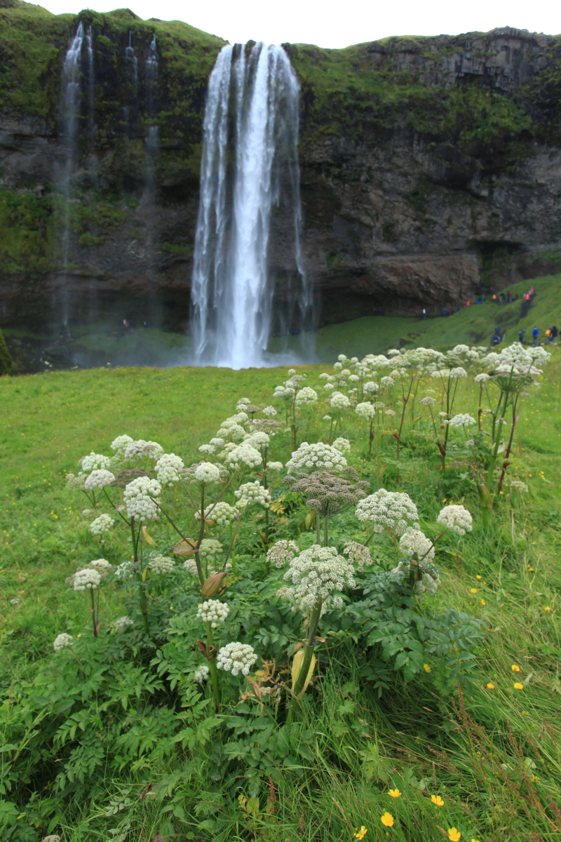
 Skogafoss waterfall along the south coast.
 And then we got a surprise. From the day we first arrived, there was a warning about a possible jökulhlaup from the Vatnajökull glacier. These are glacial outburst floods that occur when hot material beneath the glacier begins to melt its underside, creating a pool of water that can suddenly be released out from the glacier snout. For our first few days, we heard that the Ring Road that encircles the island might have to close if the flood became large enough. In due course, the warning was relaxed. We were all set to make a bathroom stop in Vik, when our local guide got a call that they might close the Ring Road because of unusual behavior regarding the flood. We rushed forward 30 miles to miss the closure but to no avail - the closure was in effect.
 And this is why - the flood had not taken the usual path down the Skafta River channel, but rather was being piped through a very porous lava flow that was laid down during the 1783 Laki eruption. The sub-lava flow of water was then shooting up from within the lava flow, flooding the Ring Road! Photo courtesy of a Reykjavik newspaper.
 Our bus was diverted onto a dirt road (along with everyone else) south past the lava flow.
 Here is the Skafta River with the surficial portion of the jökulhlaup - you could smell the mud and the sulphur.
 Sign at nearby Vatnajökull National Park announcing the road closure.
 A former bridge after a jökulhlaup in the 1990s. It is now a roadside attraction.
 These are the "Dwarf Cliffs" basalt columns called Dverghamrar.. They can be found along the southeast Ring Road.
 The columns present their top side where the six-sided columns can be seen. See a list of the 10 most interesting basalt columns in Iceland here.
 This shot shows a well-proportioned colonnade below, topped with a many-faceted entablature. The whole mass is within a single lava flow but the entablature was cooled in the presence of water. Joints form perpendicular to the cooling surface. Thus, in the colonnade, cooling was from the top and bottom. The joints in the entablature formed haphazardly when water from above seeped into the lava flow.
 This is Icelands tallest mountain, Öræfajökull, at 2109.6 meters or 6,821 feet. It was listed at 2119 meters until a remeasure in 2007 set its current height.
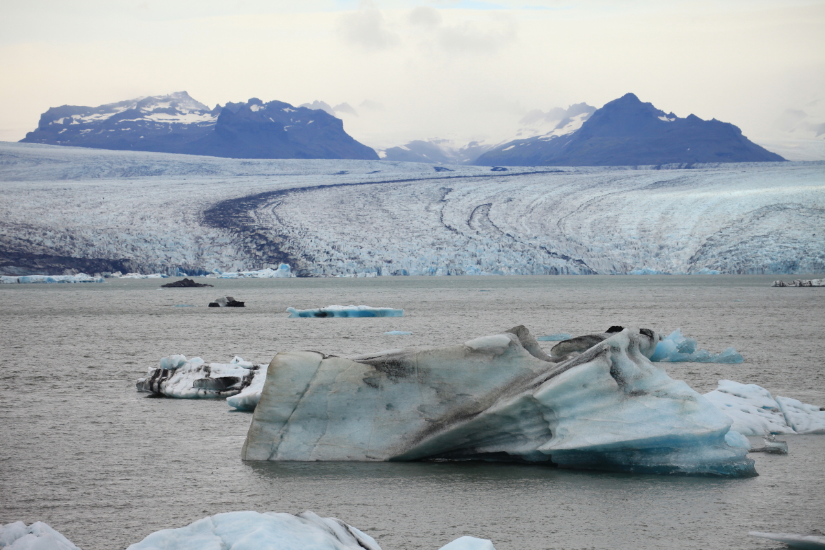
 A tongue of the Vatnajökull glacier spills out of the mountains. Note the medial moraine on its right side where two valley glaciers came together.
 A second glacial tongue from the mountains.
 Icebergs in the glacial lagoon.
 This is probably how most people think of Iceland - at least those who have not yet been.
 Icelands east coast.
 It was dark, grey and rainy on our east coast traverse.
 East coast lavas and dikes. It's too bad the weather was grey and cloudy while we were over here. What emerged from beneath the clouds looked interesting.


Wonderful blog! It helped me remember the things you told us when we were there. thank you!!!!
ReplyDelete