Our party of three turned north on the Ring Road, Highway 1 in Iceland. Today we transitioned from the west side Iceland to north Iceland. Along the way we found a few things to see and do.
Just about 20 miles north of Borganes are three scoria cones (wonder cones) called Grábruk. We c.imbed one of them to get a good view of another.The low hills in the distance are the remnants of a gigantic landslide that came down around 7000 years ago in the area of Vesturdalur. The debris traveled downslope about five miles, coming to rest across the river. The lake was formed in the process.
And Icelandic horses are often a part of these farm scenes. To learn more about the character of this unique breed, check out this link.
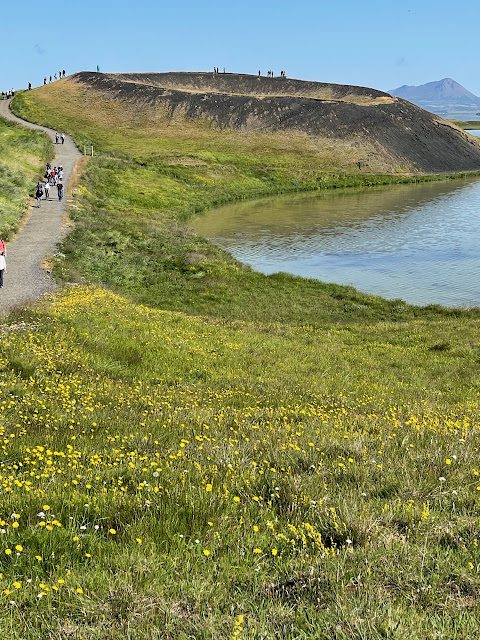
After our first night in Icelands second city, Akureyri, we made a long excursion east and north with a first stop at the pseudo-craters along Lake Myvatn. Pseudo-craters form when molten lava flows over wet or marshy ground, creating a layer of steam. The steam ultimately explodes through the lava flow to create a crater. Therefore, these features can also be called rootless cones, since they do not have a deep vent with far traveled magma.
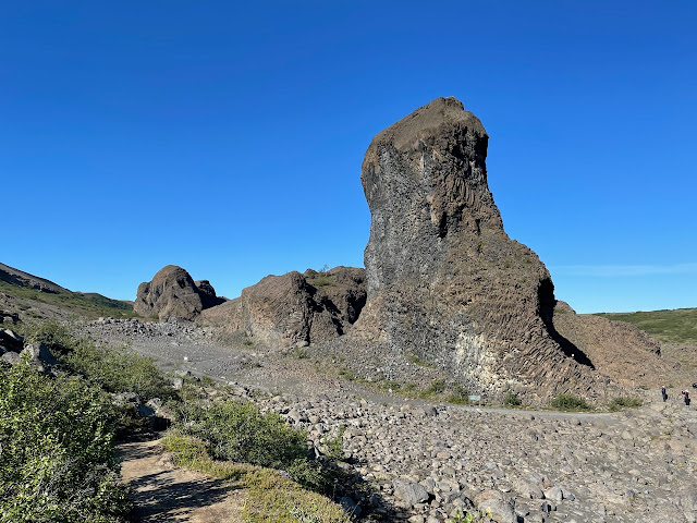
Nearby is another strange phenomena, the craggy towers of hardened lava at Dimmuborgir. About 2300 years ago, a large lava lake existed in this area. While still hot and molten, steam vents rose through the liquid lava, hardening these vents. Suddenly, the lava lake drained through a breach in its walls, leaving the hardened steam pipes standing tall.
While walking on the trail through the strange forms, we passed this outcrop showing where the catastrophic draining of the lava lake was visible. The vertical striations document the lowering of the lava lake.
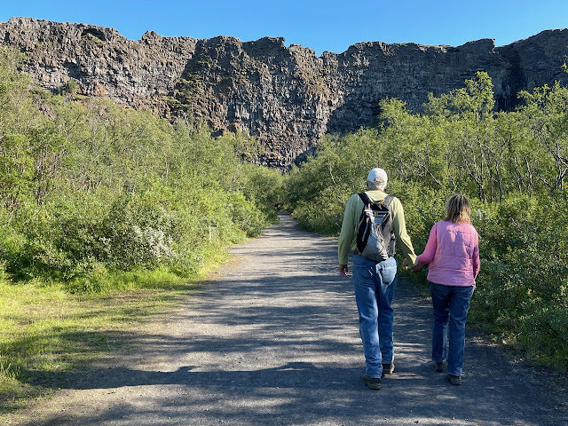
I had never before been to this location - the exit avenue for the lava lake. It might be a bit hard to see here but a linear valley spills downslope toward Lake Myvatn, visible in the far distance.
A part of the rift is visible from Highway 1 - the mountain has been split asunder. This is a view to the north with rocks on the left moving away from the center as part of the North American plate and rocks on the right moving with the Eurasia plate.
Viti Lake sits in a small crater in the Krafla volcanic belt. This lake was only formed in the Myvatn Fires of 1724-1729.
Moving east out of the immediate rift zone, we came to a very large waterfall called Dettifoss. The mist created this rainbow on our blue-bird day!
The water in Dettifoss comes from the Vatnajokull glacier upstream. Therefore the water is muddy and the mist smells like mud. The falls are over 160 feet high.
The parking area for Dettifoss is about one kilometer away. Why would the parking area be located so far from the falls? The answer is that the area has experienced huge glacial outburst floods that have created a channeled scabland. Here is one of the channels from a flood that must have been enormous.
Another view of the channeled scabland. These have happened here three times in the recent past, about 9000, 5000, and 2000 years ago. These are similar landscapes to what is seen in North Americas at the channeled scablands in eastern Washington state from the Missoula floods.
About 20 miles downstream from Dettifoss, we visited Hljodaklettar where evidence of the outburst floods is also visible. Note the canyon carved by these massive floods. This is a view in the upstream direction (south).
The floods carved through a shallow vent system, exposing the plugs in what used to be a scoria cone.
And finally, downstream at about sea level is Asbyrgi. Here the floods split around this island of stacked lava flows.
A box canyon has no stream within it today, yet it is scoured by the intermittent floods that roar out from beneath the glacier 80 miles upstream.
Late evening sunlight on Icelands north coast. Thanks for reading!


Wow! Those basaltic columns are so cool! Great photos as usual Wayne 👏💙
ReplyDelete