Thanks to readers who have written to me about their anticipation of the photos from this trip. I think many people are wanting to get out onto the landscape again after what seems like a long nights sleep. I am fortunate to have two friends who wanted me to show them some sights in Iceland. This post is from Days 2 and 3 of our trip around the Golden Circle route east of Reykjavik, and then out onto the westward-jutting Snaefellsnes Peninsula.
Day 2 - The Golden Circle
About 40 miles east of Reykjavik is Thingvellir Lake (above). The lake is only about 10,000 years old having formed after the end of the last widespread glaciation in Iceland. During the Ice Age, all of Iceland as well as much of its submerged submarine plateau was ice covered. The ice sheet obliterated much of the topography in Iceland but once the ice was gone many new landforms began to appear.
One such landform is this graben where Thingvellir Lake is found. This is a view of the Western side of the graben. Note how the "crack" has down-dropped and tilted the eastern (right-hand) block in this view. The Oxará River is flowing toward the photographer in the bottom of the graben into the lake behind the photographer.
The trail leads down into the crack. But this is not just any old graben - this formed on the Mid-Atlantic Rift, the gigantic crack where the Old World and New World continents broke apart in the sundering of Pangaea. Yep, this is where the Mid-Atlantic Rift is above sea level!
This is a view to the south along the graben's western margin. Locals tell visitors that the block on the west (right in this view) is a part of the North American plate and the block on the east (center and left) is part of the Eurasian plate. The width of the rift however is about 5 miles and so the simpler explanation is partly right. There is a five mile wide gap between the two major plates and the graben floor represents this gap.
The Oxará River tumbles down over the rift fault.
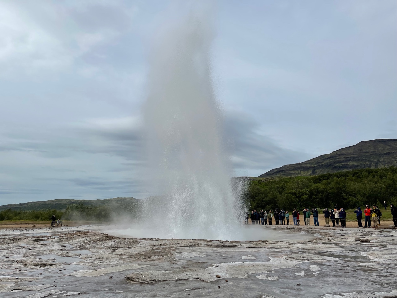
Next stop is Geysir (not incorrect spelling - Geysir is a place in Iceland that all of the worlds geysers take their name from. We just loved hearing the Brits telling us how much they loved this Geezer.
Geysir was quite active until an earthquake in the early 20th century changed it plumbing and it hardly ever erupts now. The photo above this is of a geyser called Strokkur and it erupts once every 5 or 6 minutes! It's easy to watch it over and over again. Imagine if the earthquake had happened a mere few hundreds of years before it did - then all of the world's geysers might be called strokkurs.
Gullfoss (Golden Falls) on the Oifusá River cascades over two resistant ledges of basalt lava. The middle platform is across weakly cemented gravels.
The upper half of the falls.
Natural basalt columns form parking barricades in the parking lot.
We attempted something I had never done before - we kept going on the road past Gullfoss! We got very close to the Langjokkul Glacier.
Many of the landforms in Iceland were created as sub-glacial volcanoes, meaning. that eruptions continued no matter what existed above them - such as a giant ice sheet. Some of their forms are amazing to see.
Day 3 - Snaefellsnes Peninsula
I had never in all of my trips to Iceland seen the very top of the Snaefelsnes volcano but on this glorious July 28 day it was visible. It exists as the ultimate landform on a westward-jutting peninsula into the North Atlantic.
Not all of the volcanic rocks are basaltic in Iceland. Here is a rhyolite dome that formed sub-glacially. It is mantled with scree.
The church at Budir was built in 1834.
Jules Vern's "Journey to the Center of the Earth" (1864) was set a this volcano. This is where the intrepid explorers in this work of fiction entered the earth.
Typically Snaefellsnes scene. Farm, mountains, waterfall. Repeat. Farm, mountains, waterfall.
Opening to the slot canyon.
We drove on a dirt road onto the shoulder of the volcano.
This is another subglacial volcanic center, albeit a small one.
Tranquil day on the North Atlantic. View to the south.
Erosional windows in the basalt.
The harbor at Arnarstapi.
The church at Arnarstapi. Wish I had time to flesh out more photos and descriptions!


Love it! Thank you!
ReplyDeleteFabulous photos - thanks! I especially appreciate those of the Thingvellir region, but all are wonderful. Looks like some good weather also. Happy travels!
ReplyDelete