Thursday, April 30, 2020

Moon Crater, San Francisco Volcanic Field, Northern Arizona

The next destination in the series, "We Are Cratering in Northern Arizona" is Moon Crater. This volcanic center is labeled as Crater 170 on Harold Colton's 1936 map in "The Basaltic Cinder Cones and Lava Flows of the San Francisco Mountain Volcanic Field" (republished in 1967), and as Vent 3031 on the USGS "Geologic Map of the East Part of the San Francisco Volcanic Field, North-Central Arizona." You can access the USGS map here:  MF-1960.


*** Note to any would-be visitor to Moon Crater: The eastern half of the cone is on private land and only the western half is open to the public as part of the Coconino National Forest. The red and green lines on the map above only denote a walking route used by the local landowners. 

 Panoramic view of the interior of Moon Crater looking east.

Annotated panoramic view of the photo above. The yellow line depicts the rim of Moon Crater. A secondary cone erupted within this larger feature and is outlined in red.

Five cinder cones are depicted in this excerpt from the USGS map MF - 1960. Moon Crater is the circular feature at bottom center. Qbb represents basaltic rocks that have normal polarity (meaning younger than 780,000 years) and are latest Pleistocene in age. The are rocks that form the cone inside the larger crater (red outline in the photo above). Qbbt represents basaltic tuff of the same age, forming the rim of Moon Crater. Qbsbp is Sunset Crater tephra that landed in the bowl of Moon Crater. It is assumed that the same deposit is already stripped from the rim of the crater.

View to the northeast from the rim of Moon Crater. Merriam Crater is the cone seen in the distant background. It may be the source for the lava flow that created Grand Falls (or the flow may have come from The Sproul, the small, dark, cloud-covered cone in front of Merriam's right shoulder.

A likely fulgurite where lightning struck a rock on top of Moon Crater and melted the heated portion.

View to the southeast of a series of beautiful cones and craters.

View to the northwest. The flat-topped mesa in the far distance is Gray Mountain.

The lone cone in the distance is Roden Crater, where artist James Turrell is shaping the entire cone into a work of art. Look at the web site here and be sure to let each page run the film (three pages).

The rocks on top of Moon Crater have been around long enough to have ventifact surfaces. These are surfaces shaped by particles that blow in the wind and abrade the rock surface.

Late afternoon light on the rim of Moon Crater.

A closer view of the north rim of the crater (foreground and skyline) and the slightly younger interior cone (right).

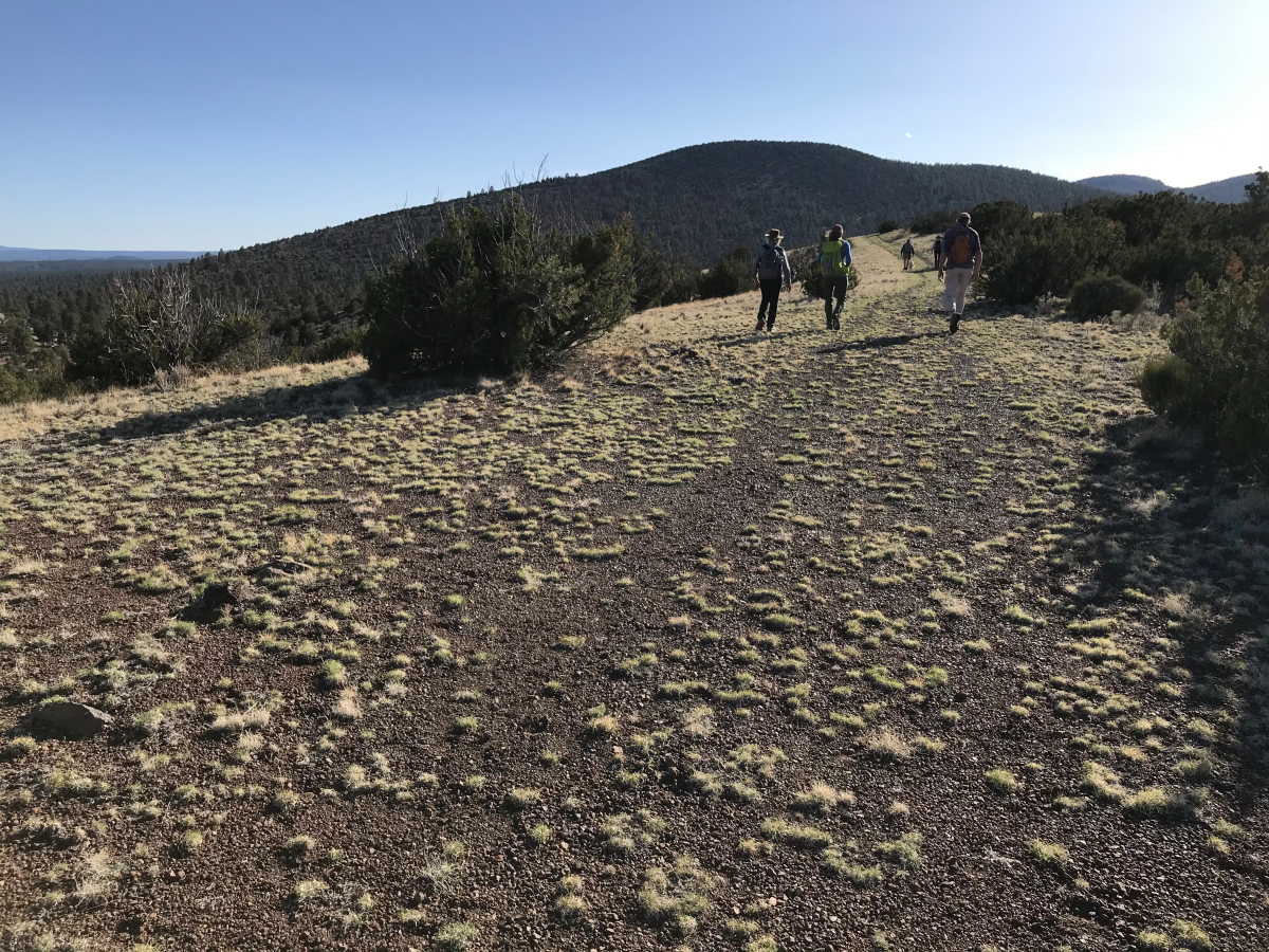
Descending down to the vehicles. Note the ponderosa pine trees in the valley below. This elevation marks the boundary between the ponderosa and Pinyon-Juniper eco-zones. Next on the tour is the Turkey Hills.

Sunday, April 26, 2020

We Are Cratering In Northern Arizona!

Winter photo of SP Crater, the 4th youngest cone and crater in the San Francisco Volcanic Field. It has recently been re-re-dated at about 60,000 to 70,000 years old. (Photo January 1, 2011)

You might think this blog title refers to a plea for mental health during the global pandemic. But while the heading is pandemic related, it actually involves a more in-depth exploration of various volcanic craters and cones located around my home nestled within the San Francisco Volcanic field. With all of my river trips and international excursions postponed or outright cancelled, we are positioning in place under wide-open skies of northern Arizona. And the Coconino National Forest is currently still open for exploration off trail. A group of friends and I are exploring!
Sunset Crater (Crater 41) is the youngest volcano in the San Francisco Volcanic Field and a recent redetermination of its eruptive date is constrained between 1085 and 1090 CE. You can read the paper that describes this new date here. The original date of 1064 BCE can be found in this reference.

Crater 36 - April 25, 2020
Dr. Harold S. Colton, the founder of the Museum of Northern Arizona catalogued most of the more than 600 volcanic cones and craters within the field. He gave number to many cones that had no otherl names. Crater 36 is a rather indistinct cone in a field of many cones. But it provided a beautiful hike nonetheless on a clear, April day.
The approach to the crater has views of rather mature ponderosa pines. The north flank of the San Francisco Mountain composite cone can be seen in the distance.

This is a panoramic view to the northwest from the top of Crater 36. From left to right you can see the San Francisco Mountain composite cone and dozens of rather young scoria cones. US Highway 89 is the linear gap in the trees.

The coarse cookware pot remains from the occupation of the Sinagua cultural group, which inhabited the area between 700 and 1200 CE. To understand how these people may have been affected by the Sunset Crater eruption of 1985 CE, see this paper.

A view from the west rim of Crater 36 toward the east and to O'Leary Peak, a dacite dome volcano (Crater 23 of Colton) with a K-Ar age of between 240,000-221,000 years.

Panoramic view of the interior crater.

There was early logging inside this crater and the stumps remain in this dry climate. In fact, modern-day ecologists can easily map the tree density in this forest from the time before logging began in the 1880s. This mature ponderosa was cut using a two-man cross-cut saw, as can bee seen by the bi-level cut on top of the stump. The limb debris from this felled tree lies in the background. The tree was cut likely about 120 years ago.

Medicine Valley in the middle distance. This was a wonderful hike! Next up - Moon Crater.

Monday, April 13, 2020

Announcing the Wayne and Helen Ranney Geoscience Educator Scholarship at Northern Arizona University

I have had the pleasure of traveling with many readers of this blog on geologic adventures across the globe, from Arizona to Zimbabwe, from Antarctica to Zion, or from the bottom of the Grand Canyon to the mountains of Patagonia, South America. I thank all of you for your support and interest in my work during these past 45 years! In this post I have exciting news about a scholarship that my wife and I are funding to further more geology careers in this type of work.

Sunrise on the 12 Ma laccolith at Torres del Paine National Park, Patagonia, Chile

As my work has blossomed and grown, many geologists and/or guides have asked to me how they might follow in my footsteps or perhaps even emulate my career. Unfortunately, I have to tell them that this is not as easily achieved as one would hope for. It requires being away from home a lot and it is not always easy to "break in" to the field. Thus, it is not conducive to a traditional family or career life. When I started out, there were no role models for this type of career adventure and in fact, I had no idea it was going to be a career! I just constantly said "Yes" to any jobs that came my way gradually cobbling together an international traveling gig that includes writing, guiding, and lecturing. Luckily, I did not have a family or kids to support that would encumber my choices.

Teaching geology to participants on a geology-themed 
river trip on the Colorado River in Grand Canyon, 2017

Still however, if I were granted one wish to somehow advance this type of career for others, it would be to help future Earth scientists learn about such career opportunities in sharing the joys of geologic thought with non-scientists. Modern life begs for ways to make deeper connections with this wildly beautiful and exotic planet. And while I've learned that geology is just another word for scenery, it is also another way to express sustainability, since taking the long view only helps to encourage a more proper use (and reuse) of natural resources. Not a day goes by that I do not wish that more geologists took an active role in speaking up about geology to a much wider audience. 

The Antarctic Peninsula where I have made 27 trips as a geologic lecturer

It is only appropriate then to mention a few of my fellow geologists who consistently contribute  their time and effort to advance a wider public understanding of geology. If you have not yet subscribed to the Facebook page of the Arizona Geological Survey please do so. The site is guided by  Michael Conway of the AzGS. Also, Dr. Karl Karlstrom and Dr. Laura Crossey of the University off New Mexico conceived and developed the Trail of Time at Grand Canyon National Park. Many thousands of visitors to the Park become enthralled by this linear representation of time, that sequentially tells the story of Grand Canyon's geologic history while strolling along a scenic Rim trail at the edge of the canyon. A shout-out also goes to Dr. Steve Semken at Arizona State University who has developed online virtual field trips for all to enjoy. Check out one of Dr. Semken's interactive virtual field trips here. Finally, Muhammed Qasim Mahmood administers the Learning Geology Facebook page that has outreach to literally thousands of geology enthusiasts around the world. All of these individuals and others provide continuing inspiration to me to further the outreach of geology.

Dr. Steve Semken on the Trail of Time, 
Grand Canyon National Park

A SHORT HISTORY OF MY CAREER AND DETAILS ABOUT THE SCHOLARSHIP
My two geology degrees from Northern Arizona University (B.S., 1980; M.S., 1988) launched my rather unconventional career in informal geoscience education, defined as geologic instruction at any level of learning occurring outside of a formal classroom setting. After leaving NAU in 1988, I worked as a river and trail guide in Grand Canyon (which is how I supported myself in graduate school), which ultimately led to other far-reaching work assignments around the globe. These were completed with Lindlblad Expeditions and Smithsonian Journeys. I’ve now traveled to, and lectured in almost 90 countries, all focused on the geology of those distant and quite scenic places.

Flying over the Zambezi River and Victoria Falls, the international boundary
between Zimbabwe (bottom) and Zaire (above)

As my career has gradually evolved into more writing and less traveling, my wife Helen and I desired to help current NAU geology undergrads to consider a similar career choice. We both recognize the inherent value of young geologists being exposed to as many diverse geologic features as possible, as well as the huge need in our discipline to develop knowledgeable and effective science communicators. We cherish and honor the wealth of modern geologic data, but lament that much of it is known by so few of our fellow citizens. We believe that geologic thought is empowering and transformative and want to encourage future geo-scientists to develop the tools that will allow them to effectively share their passion of geology with others.


With Helen at Grand Canyon's South Rim, 2019

This is why we created the Wayne and Helen Ranney Geoscience Educator Scholarship at NAU. We have personally committed a gift of $25,000 that will be fully funded by the year 2022. Interest from the fund will be used to support an upper level geology undergrad at NAU who will pursue some level of geoscience educator career path. Imagine the benefit to a geology student who will be able to partake in a Colorado River raft trip in Grand Canyon, or will serve as a Geologist in Residence at Grand Canyon National Park. Such are some of the possibilities that we envision for this award.

We have already funded the first two years of this five year giving commitment. And a very generous four-figure donation from one of my past alumni has allowed the principle to grow even more!  

If you would be interested in helping future geo-scientists prepare for public outreach in geology, please contribute to this fund directly at the link above.

The flow path is easy and will be obvious from there. Helen and I greatly appreciate any support you can give to this fund! Remember, your gift will live in perpetuity with only the interest used to support future Earth Scientists who engage in public outreach of geology to our society! Thank you!

The Grand Canyon of the Colorado River

Saturday, April 11, 2020

Grand Canyon Geology on Facebook Live - April 9, 2020

Some of you may have been able to tune in to a Facebook Live session I was part of on Thursday April 9, 2020. If you were not able to join us Live, here are some links to view the Q&A!


Watch on YouTube here or on Facebook here.

We had viewers and questions from as far away as Turkey, Indonesia, Pakistan, Egypt and Morocco. Folks also viewed from Prescott, Tucson, the Pacific Northwest, Georgia, New York and Grand Canyon (just to name a few).

As of April 11, this video has had 7,600+ views!

Wednesday, April 08, 2020

Facebook Live Session on Grand Canyon Geology!

Do you like the Grand Canyon? Do you have an interest in geology and Earth history? Or perhaps you are just looking for something to do during a global pandemic? If so, you may want to tune in to a Facebook Live session I will be presenting on Thursday, April 9.


The session will be conducted at 9 AM Arizona time (which is also 9 AM Pacific Daylight Time); 10 AM Mountain time; 11 AM Central time; and 12 Noon Eastern Time. (Coincidentally, it gives me great joy to list the Mountain and Pacific times first!). 

You can learn more about this event here: https://www.facebook.com/geologylearn/.


Please note: If you cannot attend the live session, it will be recorded and available for viewing at a later time!

The session will be hosted by the blog site, Learning Geology created and administered by Muhammed Qasim Mahmood, an Earth scientist living in  Lahore, Punjab Province, Pakistan. Learning Geology is a science website and a community of Earth scientists [that] share geology lessons and host Live Virtual Field Tours.

As you begin to tune into the session, you can invite others to attend and please do so! I will begin by giving a short introduction to Grand Canyon's rocks and its development. Viewers will then be able to submit written questions right on the site. This live session will last no more than 45 minutes to one hour in length. And if I am unable to answer your questions while Live, I can answer them in written form right on the site. The questions and answers will also be viewable at a later time.

The times again are:

9 AM - Arizona and Pacific Daylight Time
10 AM - Mountain Daylight Time
11 AM - Central Daylight Time
12 noon - Eastern Daylight Time
6 PM - Central European Daylight Time
9 PM - Pakistan Standard Time
2 AM - Australia Eastern Standard Time
4 AM - New Zealand Standard Time
6 AM - Hawaii Standard Time

Join us for what is certainly going to be a fascinating discussion of the geology of Earth's most magnificent gorge!

Although Grand Canyon National Park is closed during the pandemic, we will be discussing its fascinating geology on Facebook Live! Thursday, April 9 at 9 AM Arizona and Pacific time. 

Tuesday, March 24, 2020

The Tinajas Altas Mountains and Cabeza Prieta National Wildlife Refuge

“I have always loved the desert. One sits down on a desert sand dune, sees nothing, hears nothing. Yet through the silence something throbs and gleams…”   

Antoine de Saint-Exupéry, French writer, poet, aristocrat, journalist, and pioneering aviator

And so it goes. Where there is nothing, often there is everything. I think that is why I love the desert. Although I am not strictly a religious person, I revel in the fact that many of humanity's greatest and largest religions originated in desert environments. One feels close to God, perhaps, because one can see farther in the desert. I wonder if many people ever think of the environment where their belief system developed? Does it matter? Why do people in North and South America hold on to traditions originating from the Middle East? I think about these things while traveling along the smooth, hard roads in the desert. I also think about geology - time travel at its finest. Brace yourself - there is a wonderful geologic story about this place below!

I've had a long-time desire to see and visit the historic Tinajas Altas (meaning High Waterholes in Spanish), located in extreme southwest Arizona, along a historic route known as El Camino del Diablo (The Devil's Highway). People have been coming to these hidden pools along the Camino as long as there have been people here - nearly 13,000 years! And before the self-isolation of the current times began, myself and some friends planned a nice four day trip to this hidden oasis.

The Tinajas Altas Mountains are located within a one million acre+ military reservation known as the Barry M. Goldwater Range. Every person on our trip was required to fill out an online permit to enter the range for recreational purposes. It is located between Tucson and Yuma along the Mexican border in southwest Arizona and was created immediately after the Pearl Harbor bombings to train fighter pilots for that war effort. We made a base-camp for three nights in one place and explored a few areas from there. The Cabeza Prieta National Wildlife refuge abuts the bombing range on the east.

Signs like this were evident everywhere to discourage off-road exploration. This trip is not for the faint of heart as jets come seemingly out of nowhere, buzzing the desert floor on training missions.

DAY 1 - El Camino del Diablo Este

Sign announcing the northern boundary of the range.

My only surprise is that there are not more bullet holes in this sign.

After about 24 miles of dirt travel, a sign announces the location of the once hard-to-find waterholes.

A view of our base-camp looking toward the east on our first day. In the background are the Cabeza Prieta Mountains. Love those cirrus clouds framing them!

DAY 2 - Visiting the Tinajas Altas

On our first morning we went 1/2 mile south to the water holes. This large granite boulder contain an opening that could easily fit five to six individuals during a hot summer day or spring rain storm. Something like this would obviously serve prehistoric populations well! The rocks belong to the Gunnery Range batholith, a moderate-size intrusion from the Late Cretaceous period (batholiths by definition are larger than 100  square miles.

The Tinajas Altas Mountains belong to the Basin and Range Province, where blocks of the Earth's crust pulled apart and rotated beginning about 17 to 20 Ma (Mega-annum or millions of years ago). The event created long, uplifted ranges, separated by parallel and adjacent down-dropped basins. This occurred from southern Oregon into northern Mexico and out east to west Texas. Both the ranges and the basins appear linear on the landscape (see the trend of the Tinajas Altas and Mohawk Mountains on the map at the top).

The Tinajas Altas are composed of granite that was intruded as magma into the crust about 70 Ma. At that time, the Farallon oceanic plate was being subducted beneath the western edge of North America. This crumpled the crust well enough, but it also caused an influx of volcanism, as melting commenced at depth on the down-going oceanic plate. The melting formed granite, which you see in the photo above. In the last 70 million years, the overlying rocks that contained the magma have eroded way.

This is what southwest North America looked like about 70 Ma. (Note the modern state and county lines overlain on this ancient geography for reference from the book, "Ancient Landscapes of the Colorado Plateau", by Ron Blakey and Wayne Ranney). The red dot denotes the location of the Tinajas Altas Mountains. This is where the Gunnery Range Batholith was intruded into a large mountain range known to geologists as the Mogollon Highlands. The Pacific Ocean is located in the extreme southwest corner of the map. There were short, steep rivers running southwest out of the Mogollon Highlands to the Pacific. And very long, low-gradient rivers running northwest all the way into the Mississippi River system at this time. Think about that!

To further explain, I have overlain a map of the Amazon drainage in modern-day South America over that of modern-day North America. South America is a perfect modern analog for how the landscape and drainage pattern looked in the Late Cretaceous period in North America. In South America above, the Andes Mountains are the source of the Amazon with flow across the entire continent to the Atlantic. In Cretaceous North America, rivers rose in the Mogollon Highlands and flowed across the future Colorado Plateau and Rocky Mountains region into the Gulf of Mexico. What a joy it was to visit the roots of the ancient Mogollon Highlands in the Tinajas Altas Mountains!

Then, after the passage of 70,987,000 years, people arrived leaving their mark on the landscape near the thirst-quenching pools of fresh water. These are grinding pits called metates where people processed wild seeds near the tinajas.

The first and bottom-most of nine pools.

A few others in our group scrambled up to see pools two and three. I was unable to do that recovering from knee surgery.

Who knew Chuckwalla's love the taste of brittlebush flowers!

DAY 3 -To the Cabeza Prieta and Christmas Pass


Not your usual sign when undertaking recreational pursuits.

God only knows what this mannequin is supposed to represent or do. There was a live flare in its holster so perhaps if someone is in dire trouble they would approach anything that looked human and use the flare.

Evidence that walkers have been through here.

We saw many of these beautiful Desert lily's blooming (Hesperocallis undulata). They are also called Ajo lily's because of the bulbs garlicky flavor.

This is the feature that gives the Cabeza Prieta Mountains their name, Cabeza Prieta Peak (elevation 2485 ft.). Cabeza Prieta means Black of Dark Head in Spanish. A remnant black lava flow caps the light-colored Gunnery Range Batholith. When the Basin and Range Province was formed, andesitic magma welled up through the weakest parts of the extending crust to erupt these lava flows. Radiometric dates have been obtained from these lavas. The flow on the peak is dated on Potassium/Argon, whole rock at 16.12 Ma and a dike is dated on hornblende minerals at 17.81 Ma. These dates are clearly within the timeframe of Basin and Range extension.

Finally, we arrived at Tule Well, a well-known source of water that was hand dug in the 1850s. The giant dump truck is coming back for another load of sand to be used in the construction of the new border wall.

The dirt track was quite busy with construction traffic. Out of the 11 folks in our group, 10 of them thought the construction of a new wall was a waste of money.

Scorpion weed (Phacelia crenulata) is part of the Waterleaf family of plants with over 100 different species in Arizona.

Thanks to reader Barbara Yarbrough who correctly identified this as Miniature Woollystar (Eriastrum diffusum).


A Desert sunflower (Geraea caneacens) grows in front of the door of the adobe cabin built in 1989 at Tule Well.

A field of Desert Sunflowers in bloom. I would say that we hit the peak of flowering in this low desert spring bloom.

I couldn't tell if this was Teddy Bear cholla (Cylindropuntia bigelovii) or one of the other Cylindropuntia's. But I'm going with Teddy Bear cholla.

DAY 4 - El Camino del Diablo Oeste


Originally, we had hoped to enter the area from the east through Organ Pipe Cactus National Monument and work our way west. However, the intense rains that this area experienced just before our arrival made that a difficult route to travel. So we stuck to to the western side of the Goldwater Range where the granite soils were drier and more manageable. Therefore, we exited the area on the western branch of El Camino del Diablo. This route follows the western base of the Tinajas Altas Mountains. The flame-tipped ocotillo (Fouquieria splendens) was in full bloom!

Close-up of the flame tips.

Beautiful desert drive!

Saying good-bye for now to the Tinajas Altas Mountains. Rich geology, colorful plants, clear skies, and wonderful friends. We did however come back to a much different world.