You might think that this question would be hard to answer. But thanks to the folks at the United States Geological Survey (USGS), we have an answer. And it's a relatively small amount compared to the total volume of rock that our planet contains. (Thanks to Lee Allison at the Arizona Geological Survey for bringing this interesting link to my attention).
See the full USGS link here.
Some highlights from this site is that it explains the various forms
that water takes on our planet - water vapor,
oceans, rivers, lakes, and groundwater. The graphic below shows the
Earth relative to the volume of all of it's water (large
bubble). The diameter of this water sphere is about 860 miles and has a
volume of about 332.5 million cubic miles. That's a lot of water but as
you can see the vast majority of the earth's volume is rock. Note the small bubble of water to the right of the larger sphere. That medium size bubble represents all of the liquid freshwater on earth and represents a volume of 2.5 million cubic miles, with a diameter of about 170 miles.
Amazingly, 99% of this freshwater is groundwater! Finally, you can see a
tiny bubble dot just north of Florida and this represent the total volume of earth's lake and river water. This volume is just over
22,000 cubic miles with a diameter of 35 miles. That's a lot of water but still quite small compared to just about anything else depicted here.
A graphic at the bottom of the USGS link shows that all of the river water in the world totals a volume of only 509 cubic miles. In my book, "Carving Grand Canyon", I mention that the amount of rock removed from the canyon equals about 1,000 cubic miles, meaning that all the river water in the world would only fill the canyon a little more than half of that volume. Of course, the canyon is much wider at the top than at the bottom, so the majority of the canyon's depth would be filled. But still, the Grand Canyon is a very big place.
Amazing information is now at our disposal! Thanks to studies like these.
Adventure and foreign travel, philosophical and scientific musings, geology and landscapes, photography and earthly explorations.
Monday, June 04, 2012
Thursday, May 31, 2012
2nd Warmest Day Ever Recorded In Greenland
On Tuesday this week, May 29, 2012, the 2nd warmest temperature ever measured on the island of Greenland was recorded. The thermometer hit 76.6 degrees F at Narsarsuaq, located on the southern coast. The warmest day ever recorded on the island occurred 0n June 22, 1957 and was a scorching 77.9 degrees F, only 1.3 degrees F warmer than this 2nd highest temperature. Tuesday's recording smashed the previous warmest May temperature by 4.3 degrees F! That was 72.3 degrees F and was set on May 31, 1991.
Map showing the total number of melt days in Greenland in 2011, compared with the average number of melt days for the years 1979-2010. Note that many areas of Greenland experienced more than 20 extra melt days in 2011.
Tuesday, May 29, 2012
The Transit of Venus - June 5, 2012
With the excitement of the annular solar eclipse now receding into the past, we are getting ready for the transit of Venus on June 5, an event that only happens twice every 120 years. I first heard of these events while traveling down in Patagonia since many historic voyages were made in the 18th and 19th centuries to observe the rare event. My good friend Jack S. made me aware of this NASA site that explains a transit of Venus: http://www.youtube.com/watch?v=-nXv9YvkNyA.
Watch here in the coming week for my pictures and descriptions from northern Arizona.
PS - If you missed my posting on my personal blog of Dr. Tyler Norgren's posters of celestial events, please click here to view them. They are spectacular.
![]() |
| Global map showing that the transit of Venus in North America begins at 3 PM and is visible until sunset |
Watch here in the coming week for my pictures and descriptions from northern Arizona.
PS - If you missed my posting on my personal blog of Dr. Tyler Norgren's posters of celestial events, please click here to view them. They are spectacular.
Monday, May 21, 2012
Rare Annular Eclipse Seen from the Grand Canyon!
This past weekend was Member's Gathering for the Grand Canyon Association and 142 members from around the country showed up to show their support for our favorite national park non-profit. I gave two lectures to 70 members and took another 25 members on a guided walk along the Trail of Time.
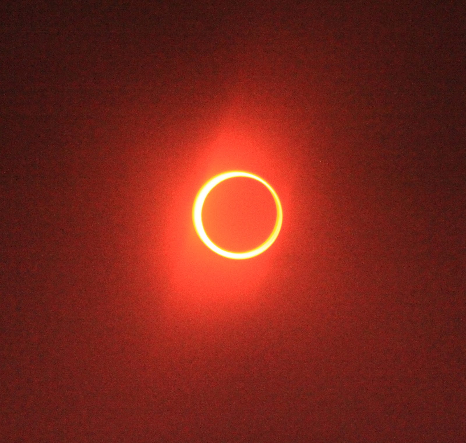
But Earth's biggest star, the Sun, was the headliner this weekend. It was eclipsed by the the moon, far enough away from the earth this week to create an annular or ring eclipse. I've been aware of this eclipse for at least two years and jokingly advised people that the center line of the eclipse (where the eclipse lasts the longest) would pass directly through the Jack-in-the-Box restaurant in Page, Arizona. See the map below and note that the entire southern half of the Colorado Plateau got to experience this event.
When Member's Gathering was over, Helen and I went to a viewpoint on the rim of Grand Canyon that did not have any paved road or trail to it. Only one other person was there with us. I took some photo's during the late afternoon, using a solar filter on my camera lens. You'll see the pictures of the eclipse at the end of this posting, the first photo's are of us and the canyon taken from our perch.
Here's Helen sitting on the Rim at the spot we selected to view the eclipse
Those who know the Grand Canyon landscape will see that we decided to view the eclipse from the East Rim portion of the canyon. This is a view towards the "Big Bend" of the Colorado River beneath Desert View.
We had a great view of Hance Rapid from our perch and the roar of the rapid was easily heard by us as the eclipse proceeded. Interestingly, Helen and I were supposed to be on a private river trip during the eclipse and might possibly have been near here on this date. A shaft of sunlight was still beaming down on the white sand dune near the rapid as the eclipse went full. Then, it disappeared soon thereafter.
Helen using an eclipse viewer
What a scene for such a celestial event
We noticed that the light became duller and slightly metallic as full occlusion came about. We both wondered if we would have noticed anything strange about the light had we not known about the eclipse. We agreed that we would have noticed the light becoming dimmer (and the air becoming cooler) but when we glanced in the direction of the sun at the height of the eclipse, the sun looked as bright an full as ever! Truly unbelievable considering that 88 to 94% of the disk was covered.
Here is a look at the walls of the canyon during full occlusion at about 6: 35 PM
Our rocky perch looking west with the moon still covering about half of the sun's disk
A bench mark nearby showed that the elevation was 7284 ft. above sea level. No date was on the marker.
Recent fires in Arizona gave an eerily orange glow to the canyon just before sunset
The final light falls on the walls of the Palisades of the Desert near Desert View
The eclipse began at 5:28. This is what it looked like at 5:46 PM. (Note that all times given are very close but approximate, and based solely on the timer in my camera on this date).
6:00 PM
6:05 PM
6:28 PM - just 6 minutes away from the beginning of the annular phase
6:30:19 PM
6:32:22 PM
6:33:22 PM
And here it is 6:34 PM
6:34:32 PM
6:34:36 PM
6:35:19 PM
6:35:22 PM
6:37 PM
6:46 PM
7:13 PM.
Sunset on this date at Grand Canyon was 7:32 and a fraction of the eclipse was still happening as the sun set. Here is the final picture taken at 7:29:36 as the sun was setting behind Havasupai Pt. (to the right). You can still see in the upper left the last part of the eclipse. What a spectacle we experienced.
The happy couple enjoying a celestial phenomenon in our favorite landscape! Below is a graph showing the timing of the eclipse through northern Arizona.
But Earth's biggest star, the Sun, was the headliner this weekend. It was eclipsed by the the moon, far enough away from the earth this week to create an annular or ring eclipse. I've been aware of this eclipse for at least two years and jokingly advised people that the center line of the eclipse (where the eclipse lasts the longest) would pass directly through the Jack-in-the-Box restaurant in Page, Arizona. See the map below and note that the entire southern half of the Colorado Plateau got to experience this event.
When Member's Gathering was over, Helen and I went to a viewpoint on the rim of Grand Canyon that did not have any paved road or trail to it. Only one other person was there with us. I took some photo's during the late afternoon, using a solar filter on my camera lens. You'll see the pictures of the eclipse at the end of this posting, the first photo's are of us and the canyon taken from our perch.
Here's Helen sitting on the Rim at the spot we selected to view the eclipse
Those who know the Grand Canyon landscape will see that we decided to view the eclipse from the East Rim portion of the canyon. This is a view towards the "Big Bend" of the Colorado River beneath Desert View.
We had a great view of Hance Rapid from our perch and the roar of the rapid was easily heard by us as the eclipse proceeded. Interestingly, Helen and I were supposed to be on a private river trip during the eclipse and might possibly have been near here on this date. A shaft of sunlight was still beaming down on the white sand dune near the rapid as the eclipse went full. Then, it disappeared soon thereafter.
Helen using an eclipse viewer
What a scene for such a celestial event
We noticed that the light became duller and slightly metallic as full occlusion came about. We both wondered if we would have noticed anything strange about the light had we not known about the eclipse. We agreed that we would have noticed the light becoming dimmer (and the air becoming cooler) but when we glanced in the direction of the sun at the height of the eclipse, the sun looked as bright an full as ever! Truly unbelievable considering that 88 to 94% of the disk was covered.
Here is a look at the walls of the canyon during full occlusion at about 6: 35 PM
Our rocky perch looking west with the moon still covering about half of the sun's disk
A bench mark nearby showed that the elevation was 7284 ft. above sea level. No date was on the marker.
Recent fires in Arizona gave an eerily orange glow to the canyon just before sunset
The final light falls on the walls of the Palisades of the Desert near Desert View
The eclipse began at 5:28. This is what it looked like at 5:46 PM. (Note that all times given are very close but approximate, and based solely on the timer in my camera on this date).
6:00 PM
6:05 PM
6:28 PM - just 6 minutes away from the beginning of the annular phase
6:30:19 PM
6:32:22 PM
6:33:22 PM
And here it is 6:34 PM
6:34:32 PM
6:34:36 PM
6:35:19 PM
6:35:22 PM
6:37 PM
6:46 PM
7:13 PM.
Sunset on this date at Grand Canyon was 7:32 and a fraction of the eclipse was still happening as the sun set. Here is the final picture taken at 7:29:36 as the sun was setting behind Havasupai Pt. (to the right). You can still see in the upper left the last part of the eclipse. What a spectacle we experienced.
The happy couple enjoying a celestial phenomenon in our favorite landscape! Below is a graph showing the timing of the eclipse through northern Arizona.
Tuesday, May 15, 2012
New Three Day Geology Class at Grand Canyon!
How often have you been out and about in the great Southwest and wished you could understand geology just a little bit better? The deep time thing is too monstrous to get your head around or the names of the many formations are confusing right? Well, now there is an opportunity for you to go to the next step with geology.
This coming August 3 to 5, I will be offering a three-day intensive course on how to better grasp geology. The topics covered will be the enormity of deep time, the rock record at Grand Canyon, and the various theories in which the canyon was formed. The class is called "Geology on the Edge" and will be offered through the Grand Canyon Field Institute. It will take place at Grand Canyon's South Rim.
Here are the details and I hope to see you at the canyon in August! http://www.grandcanyonassociation.org/page/GCFI/PROD/NHIST/GOE
A short hike down the Bright Angel Trail will take us to this outcrop of the Bright Angel Fault.
We will discuss and learn about all of the canyon's rock formations, including the enigmatic Grand Canyon Supergroup, shown here as the the tilted block of rocks above the right hand side of the river.
There are many theories on how the Colorado River carved the Grand Canyon and certainly boulders like these did much of the cutting. You will never again be a beginning geologist after this class!
There are only a few spots remaining for this years class. Come join us and get over the "hump" with geology at the Grand Canyon and the Southwest.
This coming August 3 to 5, I will be offering a three-day intensive course on how to better grasp geology. The topics covered will be the enormity of deep time, the rock record at Grand Canyon, and the various theories in which the canyon was formed. The class is called "Geology on the Edge" and will be offered through the Grand Canyon Field Institute. It will take place at Grand Canyon's South Rim.
Here are the details and I hope to see you at the canyon in August! http://www.grandcanyonassociation.org/page/GCFI/PROD/NHIST/GOE
A short hike down the Bright Angel Trail will take us to this outcrop of the Bright Angel Fault.
We will discuss and learn about all of the canyon's rock formations, including the enigmatic Grand Canyon Supergroup, shown here as the the tilted block of rocks above the right hand side of the river.
There are many theories on how the Colorado River carved the Grand Canyon and certainly boulders like these did much of the cutting. You will never again be a beginning geologist after this class!
There are only a few spots remaining for this years class. Come join us and get over the "hump" with geology at the Grand Canyon and the Southwest.
Monday, May 14, 2012
Utah - Land of Dinosaurs
Jim Kirkland is Utah's state paleontologist. He and I attended Northern Arizona University together in the 1980's and we occasionally see each other at professional gatherings. Recently, he sent along this interesting piece about all of the places you can see and learn about dinosaurs in the state. With many exposures of Mesozoic-age rocks, the state is a paradise for those who like their fossils big!
Click on this link to download the pdf of the flyer. If your summer travel plans are anywhere in Utah, check out these localities.
Friday, April 27, 2012
Photo's From My "Exploring Escalante" Trip
I was leading a trip up in the Escalante Canyon region of Utah during the week of April 16. Many members of our group contributed photographs. Have a look at them and the captions will explain much of what we saw. Thanks to photographers John Grahame and Kate Killibrew.
The Cottonwood Canyon Road has been washed out since January so we took the Skutumpah Road instead and got a view of Bull Valley Gorge. This is a narrow slot canyon cut into the Navajo Sandstone.
Our first hike was to Calf Creek Falls. This little oasis is a gem in the red rock country. John's photograph here is on the approach.
And a clear view of the 100 foot fall
Vandalism on a rock art site above the Escalante River
But there was lots more that was untouched
This pictograph is called 100 Hands but requires a big climb to access it
Enjoying the view
On the trail
Photographing the rock art
Another great panel just above the Escalante River
John G. the trusty assistant
Wayne and Carolyn at dinner
The Cottonwood Canyon Road has been washed out since January so we took the Skutumpah Road instead and got a view of Bull Valley Gorge. This is a narrow slot canyon cut into the Navajo Sandstone.
Our first hike was to Calf Creek Falls. This little oasis is a gem in the red rock country. John's photograph here is on the approach.
And a clear view of the 100 foot fall
Vandalism on a rock art site above the Escalante River
But there was lots more that was untouched
This pictograph is called 100 Hands but requires a big climb to access it
Enjoying the view
On the trail
Photographing the rock art
Another great panel just above the Escalante River
John G. the trusty assistant
Wayne and Carolyn at dinner
Subscribe to:
Posts (Atom)