Friday, January 10, 2014

Rendezvous in Surprisingly Sunny London

I am now in London ready to begin the Cape to Cape adventure. Tonight we will have our Welcome Dinner and meet our fellow travelers.

The flight over from Arizona was painless. I have done so many Atlantic crossings now that my body is used to sitting in coach seat for nine hours. I think it all about being relaxed and not fighting it. British Airways makes it very easy to fly from Phoenix to Heathrow International, even with the person behind you jamming their knees into your back. Once on the ground, I took the Heathrow Express to Paddington Station in Central London and was checked into my room only one hour after going through Customs.

Today I met friends from Flagstaff who have relocated to London temporarily. Drew Barringer and Claire Schneider are here because of her job and we met for lunch at the Lord Nelson Pub in Southwick (pronounced suth-ick - I wish they would learn proper pronunciation over here) The pub claims to have the "Best Burgers in London" and it was hard to argue that after getting the BLUESY LUCY – Stuffed w/ Smoked Bacon and Blue Cheese! After saying goodbye to Drew and Claire, I walked around Green Park near Buckingham Palace. I missed seeing the Queen but here are some pictures of this beautiful section of London.

Tomorrow we fly to the volcanic island of Madeira (Portugal but off the coast of West Africa) and I hope to post some pictures of the wonderful outcrops there of the dikes and pyroclastic rocks that have been  sculpted.

Green Park scene looking south about 2:30 PM local time.

Many of the views are reminiscent of Central Park in New York (well at least to a neophyte of both places like me). It is said that there area was once a swampy burial ground for the lepers in London.

Looking out the gate to Buckingham Palace

Very impressive! I kept waiting for the Queen to to spontaneously appear at one of the windows to wave the Royal Wave to the surprisingly large number of visitors who stand out side the gate to gawk at the western world's most famous monarchy.

The Royal Gate

The Queen Victoria Memorial was dedicated by her son, George V, in 1911. The queen reigned from 1837 to 1901 - 63 years and longer than any other British monarch and the longest of any female monarch in history).

The statue is topped with gold.

Looking back towards Green Park

It's a lovely park

My digs for the night at the Four Season's of London, Park Place

And the view from my room

A "selfie". The word selfie was designated as one of the more important new words in 2013 and according to the definition, taking a different one each day and posting it is a no-no. Those who often read this blog will know that I rarely jump into my own pictures but this time I got a room with a view!

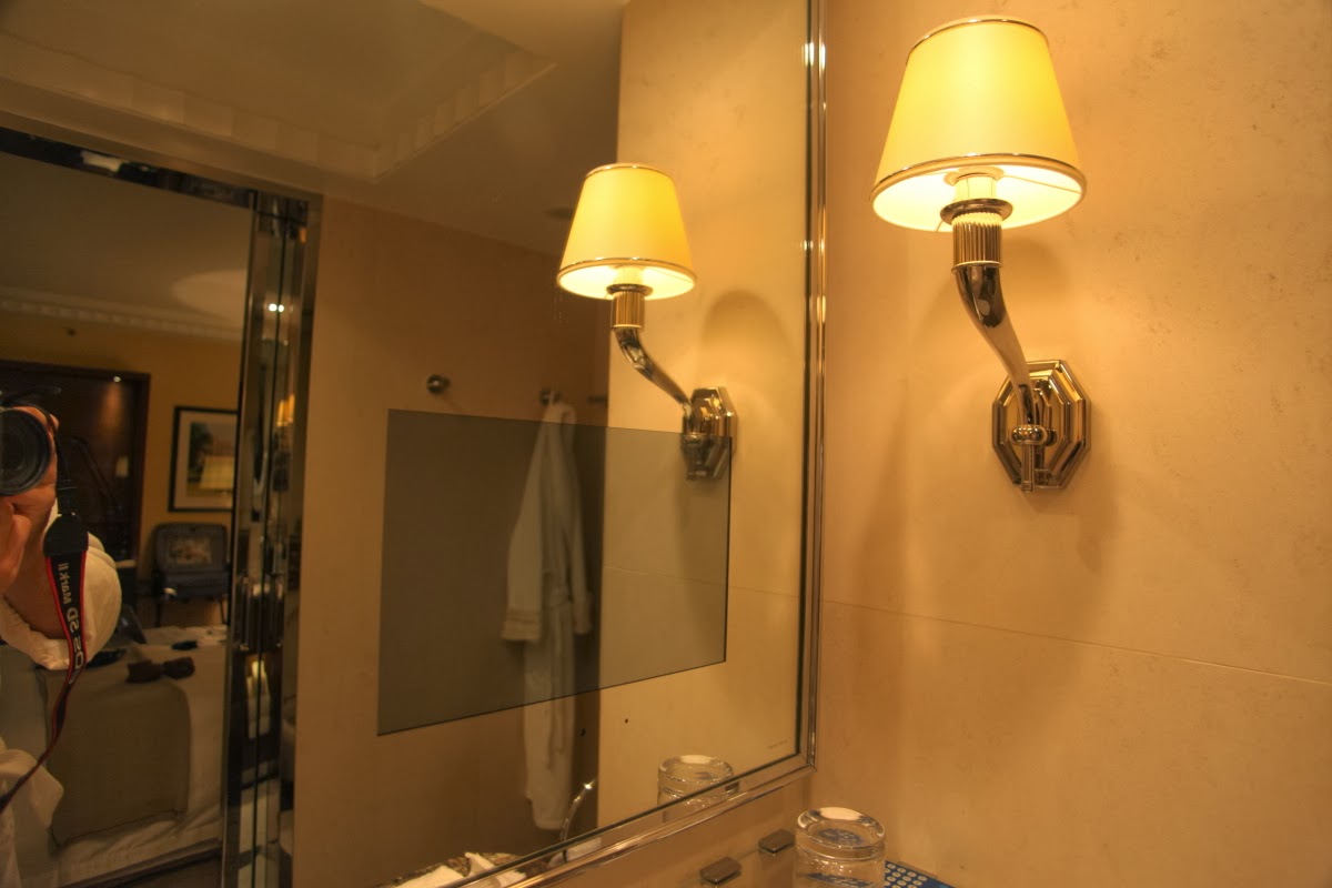
The Four Seasons of London was recently remodeled  with state-of-the-art amenities. I noticed this little box on the bathroom mirror. It was part of the mirror - look at my robe imaged on the mirror. Then I noticed a little thin pad on the shelf - you can see it (barely) on the very bottom of this photograph near the drinking glass. It said, "Electronic remote" on it. I wondered what it could be? So I pressed the power button and the dark box then became a TV!

Yep - you can watch TV and shave at the same time. My apologies to those who were aware of this technology months ago!

Monday, January 06, 2014

Africa and South America - The Journey Begins January 8

This Wednesday, January 8, I will begin a 24-day Private Jet Adventure with TCS & Starquest Expeditions called Cape to Cape. This will be an epic journey to two continents and nine countries along the Atlantic Rim. You can peruse the whole itinerary here.

It will be my pleasure once again to travel with Dr. David Keeling of Western Kentucky University, who will be my lecture colleague and speaking about geography and geopolitics.  David and I shared lectures duties last year on the Around the World itinerary. The Expedition Leader will be Eszter Foldvary, whom I first met many years ago when I used to sail to Antarctica with Society Expeditions. Bios for the whole team can be viewed here.

On this journey, Managua Nicaragua will be a new stop for me. It should be exciting as we will visit the ever-active Masaya Volcano located 30 minutes south of the capital. However, I will be returning to many of my all-time favorite destinations including, Cape Town, South Africa, coastal Namibia, Rio de Janeiro, Buenos Aires, and the Beagle Channel near Tierra del Fuego. We may even make a fuel stop in the middle of the Atlantic Ocean on the volcanic wonderland of Acension Island. This is an awesome itinerary worthy of excitement!

Be sure to tune-in to Earthly Musings regularly during the month of January, as I will be posting photos, videos, and commentary from all of these locations. Thanks for reading.

Tuesday, December 31, 2013

Another Road Slump on a Scenic Southwest Road - The Tijuana-Ensenada Highway Collapse

Scenic road slump south of Tijuana, Mexico. Photo by David Maung
My friend Don K. of Flagstaff made me aware this morning of a monumental collapse of another southwestern road, this one on an important coastal link between the cities of Tijuana and Ensenada, Baja California, Mexico. Readers of this blog will recall the geologic slump that occurred this year on February 20 along a scenic stretch of highway between Flagstaff and Page, Arizona. There the Chinle Formation gave way necessitating a possible two-year road closure.

This collapse occurred just about 10 days after a 4.6 magnitude earthquake struck the area. You can read the official US Geological Survey earthquake summary here. The quake was about 58 miles southeast of Ensenada and 257 miles air miles from Phoenix. It is unknown at this time if the quake and the slump are related.

The San Diego Union-Tribune newspaper published an article about the slump and road closure and can be read here. Attached to this article is a video survey of the damage which can be viewed here. Be sure to look at the photo gallery embedded within the article - it shows clearly how soft the base material is. Makes one wonder how a road was even possible in the first place on such a road base.

Note the murky water offshore, likely from slump material entering the sea. Photo by David Maung

Wednesday, December 25, 2013

Earthly Musings Listed On Geology Degree.org Web Site

Earthly Musings has been selected to be listed on a new online resource that will help geology students and prospective students stay abreast of new trends in the geological sciences. This is the notice I received from Sandra Harris, junior editor at GeologyDegree.org:

"I'm thrilled to let you know that we've published an article entitled Geology Online: 105 Websites That Rock on GeologyDegree.org. Wayne Ranney's Geology Blog known as Earthly Musings is featured on it. 

Geology can be an endlessly exciting and rewarding field to work in. By publishing this list of sites covering all angles of geology, hydrology, and even volcanology, we hope to encourage our readers to seriously consider higher education and eventually careers in the geosciences."

The entire list of 105 web sites can be viewed here. There will be many listed sites that regular geoblog readers will be familiar with, such as Highly Allochthonous, GeoTripper, and Written in Stone- Seem Through My Lens. Happy reading!

Sunday, December 15, 2013

New Interactive Geologic Map of Arizona from the AzGS

The Arizona Geological Survey has just released an interactive geologic map of the state. You can access it here. I played with it and found it to be quite useful, although the scale is too small for extremely detailed work.

The zoom feature in the upper left will bring you in to a scale close to about one inch equals one mile. If you hover your mouse over a particular color (rock formation), its symbol appears in another box in the upper right. If you double click on that box, the legend description appears in a larger box to the right. There is a tab there that takes you to its description in the legend. Here is the geologic map with detail at full zoom, centered on the House Mountain volcano just south of Sedona, Arizona.

The House Mountain volcano (Tb - short for Tertiary basalt) is depicted as the pink "teardrop" shape in the center. I hovered my mouse over that shape and color and the white box at the top appeared, describing the nature of these rocks. Then I clicked on the "View the legend" tab at the bottom of this box and the legend appeared on the right. I screen captured the image to include it here.

It's fun to zoom around the state and see what is where. Enjoy and thanks to AzGS for this tool.

Tuesday, December 10, 2013

China's Rainbow Mountains and the Danxia Geologic Park

China's Rainbow Mountains - Are the colors real or unreal?
You might be tempted to think that I have fallen for the "colorful" hype circulating on the internet these days regarding certain rock formations in China called the Rainbow Mountains. Or maybe you have seen this site that offers even more of the wild photographs. Even Huffington's Post fell for this one. Yes, I have seen these pictures that portray certain soft sediments with wildly psychedelic tones, something that might have been seen on a poster in the walls of a college dorm room, circa 1968.

However, a friend of a friend has apparently tracked down some bonafide renditions of the rocks, with properly colored photographs and a six-minute video of them to boot. There might now be an answer to the question I have received in my "in-box" numerous times this year: "Are these rocks real?"

The short answer is no - with a conditional yes/asterisk/parts of them to follow. The colors that have been portrayed most often are super-hyped in a photo-editing program, one where the operator fell in love with their saturation tool. This has rendered the otherwise interesting rocks into glaring tones that cannot be accounted for by natural processes. However, the texture and erosional form of the strata is real enough. And they bear a striking resemblance to the Colorado Plateau's Chinle Formation, which you will recall was named in the late 19th century by true, red-blooded Americans as the Painted Desert. To which I might add, were rendered in the early 20th century in fanciful hand-colored postcards with colors that resemble those circulating today for the Rainbow Mountains. The Chinese seem to be following the American model to a tee - build a wildly huge military, embrace consumerism, dam you rivers for cheap power, and make your cruddy old mudstones look like a box of Crayloa crayon colors.

Anyway, the quasi real pictures can be seen here. Beware though, there are some links in this site that take you to the same overdone photos. This link has many true-colored photographs, which are downright interesting without the hype. You can also watch the video which shows folks riding their bikes while Chinese music plays in the background. Looks real enough for me there.

I have been near this site just once but we did not venture far enough south to see these rocks. I remember being very impressed by the Quilian Mountains nearby from the window of our train.

By the way, there are two widely separated locations in China with the name Danxia and they both contain geological areas of interest. The first is located in the Human Province which is more humid and contains karst features. One particular landform is called Yangyuanshi (Male Stone). When you see the photos of this you'll know why. The second is in far western China in Gansu Province, which is the arid part of the country and the location of the "Rainbow Mountains". It is specifically called Zhangye Danxia. If you would like to zoom into this location on Google Earth, type in these coordinates - 39° 6'27.52"N   99°58'3.70"E - and check the "photos" box in Google Earth to see more natural pictures in the area.

Before you book a flight to China, you might just want to come to our own Petrified Forest National Park in Arizona. And until then, just read Bill Parker's Chinleana blog, which honors all things Triassic and colorful.

By the way, I have seen at least 3 widely divergent ages for the Danxia rocks, Cretaceous, Eocene, and "thousands of years old". So I'll wait until something more definite comes along that speaks to the real story of this very interesting place!

Monday, December 02, 2013

Thanksgiving at the Bottom of the Grand Canyon and Phantom Ranch

Helen and I have been starting a tradition of hiking seven miles down the South Kaibab Trail at Grand Canyon to enjoy Thanksgiving at Phantom Ranch. We were last here in 2011. This year we led a group of 20 people down to the Ranch and many of them were interested in the geology along the way.


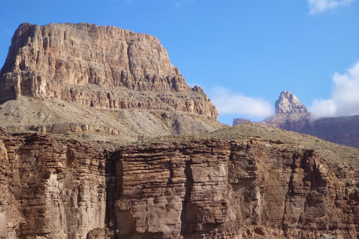
This is a view to the east from the Red and White switchbacks toward Wotans Throne and Vishnu Temple. The pack mules are headed up after taking down some of our gear.


This is my new hiking buddy - Jake from Florida. I will want to have him as a trail assistant in a few years for my backpacking trips.


One of my favorite places along the South Kaibab Trail is this outcrop where boulders of the Shinumo Quartzite (purple chunks) are encased in Tapeats Sandstone (brown layers). This represents a single day way back in the Cambrian time period when waves of the Tapeats Sea washed against an ancient cliff and the boulders rolled down into the accumulating sand. Truly an awesome outcrop right there for everyone to see.


Speaking of Shinumo Quartzite, this interpretive sign has reappeared after an approximate 20 year absence. Where was it for all of this time?

Another favorite place for me is this view of Zoroaster Temple, a stately and symmetrical monument that faces the main tourist area at the South Rim. Ain't she grand?


You can always tell when you are getting close to the Ranch - the Ranchers are very festive for this holiday gathering. Here is ranger Mandy T. showing off her festive mood.

Pumpkins lining the outside of the historic structure, now 91 years old.


Part of our group savoring the start of the feast.

Rub-A-Dub-Dub, lets grab the grub!

Our layover day on Friday included a hike on the Clear Creek Trail with its wide views to the west. In the background are Cheops Pyramid (left) and Isis Temple (with a cloud wreath).


A view to the east up the Inner Gorge of the Colorado River. It is incredible to think that this giant slot canyon has been carved in essentially the last one million years, as the river chiseled its way down through the hard Vishnu Schist and Zoroaster Granite. This is a truly inspiring view.


My finger rests on a surface that was eroded down into the schist, a surface known as the Great Unconformity. The dark rocks in the lower right are 1,750 million years old, while the conglomerate above the angled surface is "only" 525 million years old. This represents a gap in the rock record of about 1,225 million years! The short story is that the schist formed with about 13 miles of additional rock on top of it (minerals within it document this). This 13 miles of rock was eroded during the "gap" and then the conglomerate was deposited on top of the eroded surface.


An inspiring view of Zoroaster Temple (right) and Sumner Butte (left) from the Clear Creek Trail.

Looking at Hopi Point on the South Rim. Note the low hanging clouds within the canyon. There was an inversion that made the international news regarding this rare weather phenomenon. You can read the article and see the pictures from above here.


My friend Chuck L. sent me this image from space of the Four Corners region during the cloud inversion. You can see the Grand Canyon outline in one of the light-colored fog "fingers" stretching out to the left.


Here are the remnants of the inversion around the Village area on the South Rim.


Helen and I on the trail, Thanksgiving 2013.


It just wouldn't be Thanksgiving at Phantom Ranch without a visit to the beach! Note the clean, new sand left from the controlled flood event in mid-November.


Sarah was in love with these ripples from the Hakatai Shale, used by the rangers to give talks at the Ranch.


I got to experience the lighting of a menorah for the first time. Thanksgiving this year coincided with Hanukkah and the next time this will happen will only be in the year 79,811 AD See the details here.


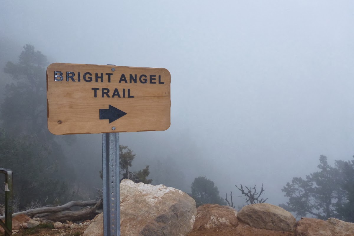
And so on Saturday, we began the 9.5 hike out the Bright Angel Trail. Here we have just crossed the Colorado River on the Silver Bridge.

The rim was fogged in all day - we hardly sweated at all coming out.

A small waterfall in the Tapeats Sandstone.


Jacob's Ladder on the Bright Angel Trail winds its way through the Redwall Limestone.


You never know what you will see at the bottom of the Grand Canyon. Here a French tourist celebrates in a unique way.


The resurrection moss was a lively green on this über-overcast day!


Near the contact of the Coconino Sandstone and the Toroweap Formation (elev. approximately 6,200 feet), we entered the clouds.


And the trail disappreared.


But even as this memorable trek was ending, the Grand Canyon had one more surprise for us - hoar frost on the shrubs and trees just below the rim!

A close-up of the hoar frost that covered all the bushes just below the rim. This was a very unusual Thanksgiving with respect to the weather.


Young Jake at the trailhead after completing his first Grand Canyon hike!

Jake with his mom, Debbie W-S., on the right and Helen with Colin on the left. We so enjoyed this group and look forward to more trips with them in the future.