Friday, July 30, 2010

Geology Festival at Bryce Canyon

Towering cumulonimbus clouds and summer monsoon rains provide the perfect backdrop to the first ever Geology Festival held at Bryce Canyon National Park July 30 and 31. The festival celebrates the geologic heritage on display in one of our nations most endearing national landscapes - Bryce Canyon. It is here that hoodoos are carved in the relatively young Claron Formation, a freshwater lake deposit about 45 to 50 million years old. Although most visitors are captivated by the hoodoos strange shapes and brilliant color, geologists also see a past landscape recorded in colorful layers that stretch from the Basin and Range in western Utah to the high Table Cliff Plateau above Escalante, Utah.

I am one of the keynote speakers at this event along with renown paleontologist Dr. David Gillette. Our hosts are the interpretation team at BCNP and employees of the non-profit Bryce Canyon Natural History Association. We have been treated to fantastic field trips, tantalizing hikes, informative lectures, and a gracious sense of welcoming by all here. We are hopeful that other parks on the Colorado Plateau will see this festival as a way to highlight their own geologic story, for while most people think that the parks were preserved for their scenic values, these same values are derived ultimately from their geologic origin. Here are a few pictures from this mornings field trip to Rainbow Point.

The magnificent landscape at Bryce Canyon, Utah is the setting of the 1st-ever Geology Festival at this world class national park. The Claron Formation was deposited across a broad swath of southwestern Utah in freshwater lakes and by streams that originated in Nevada and Arizona. More recent erosion has sculpted this deposit into interesting hoodoos.

My wife Helen with Gayle Pollock, the director of the Bryce Canyon Natural History Association at the entrance to the parks visitor center. The banner proudly announces the festival to all visitors. At my 1:00 lecture today, there were over 100 people in attendance, many of them hearing of the geologic heritage of this region for the first time. We hope that other parks in this area will make more profound attempts to get their geologic stories out to the general public.

Marilyn Blukley (Education coordinator for the BCNHA) and Dan Ng (Chief of Interpretation for BCNP) pose at Bryce Point for a photo. Everyone here has been so welcoming and accommodating. The festival is a roaring success and plans are already underway for the next festival in 2011.

Janet and Dave Gillette pose at Yovimpa Point on this mornings bus tour. Both are trained as geologists and work at the Museum of Northern Arizona. Dave is a world-renown paleontologist who has dug dinosaurs all over the southwest and worldwide. His lecture topic at the festival is about a dig he completed near Lake Powell on a creature called Therizinosaur. Check it out. Dave is an accomplished researcher and a great speaker.

An example of an ammonite from the Tropic Shale in Bryce Canyon National Park. Most visitors do not know that the park harbors vast paleontological specimens from the Cretaceous time period.

View of the Natural Bridge at an overlook in Bryce. It is one of the most photographed rocks in the park. A natural bridge is different from an arch or window in that it has a stream running through the opening. The bridge here may be misnamed although water does run through it during heavy rains.
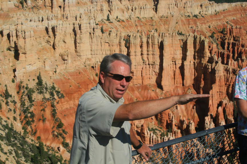
Gayle Pollock in a teachable moment at Bryce Point. Gayle is an articulate and accomplished speaker who shares his knowledge in an easy and comfortable way. I first met Gayle about 12 years ago when we both were employed in lecturing to groups traveling on private trains and jets in the southwest.

An example of extreme hoodoo formation at Bryce Canyon. Note the upper two hoodoos with a thin cap of white limestone "holding up" the softer pink beds below them. There are perhaps more hoodoos here than at any other single place on planet earth.

Part of our group listens to Gayle at Far View Point.

Summer in the southwest is dynamic with respect to its skies. Cloud free mornings soon see the buildup of immense clouds that release their load of rain to the parched ground below. This has been an especially active monsoon season and Helen and I saw many streams, normally dry, that were full of water.

Thursday, July 22, 2010

National Weather Service Report on the Flagstaff Floods

This blog reported on the huge Schultz fire in late June on the east side of the San Francisco Peaks. Now, a strong monsoon pattern has developed over northern Arizona and strong tropical moisture is dousing the forests in our state. While this is great for the pine greenery here, the severely burned area on the Peaks cannot hold the runoff from this rain. The National Weather Service has made an excellent summary of the flooding events here in Flastaff. Look at the National Weather Service site to see what's happening.

Wednesday, June 30, 2010

GIant Whale Fossil Found in Peru

Researchers were recently working in the desert badlands of coastal Peru and unearthed the skull of a giant toothed whale. The deposits that held the skull were middle Miocene in age (about 12 million years ago) and the teeth were enormous. Follow this link for pictures, diagrams and a short video by the head researcher. Wow!

Monday, June 28, 2010

Schultz Fire Mostly Contained; Fantastic Movie of Landslide in Italy

The Schultz fire here in Flagstaff is now 60% contained and crews are just mopping up.

But look at this movie of a landslide that happened in Italy this past January. It is fantastic.

Saturday, June 26, 2010

Other Blog Photos of the Scultz Fire

Friends have been finding and passing along some good blogs and photos about the fire here. Check this one out. Imagine taking a hike to Humphrey's Peak and seeing it blow up right in front of you.

Looks like the fire is getting into the mop-up stage now. 50% containment and some crews moving out to the next flare-up somewhere out west.

Thursday, June 24, 2010

New Shots of the Schultz Fire


From 39,000 feet. The red X is where Wayne and Helen's house is. Thanks to whoever sent these.

It looks like the Peaks are on fire here but it is the hlls east of them.

Same here.

Map of the burn area and the days it torched. Blue June 20, Pink June 21, Red June 23, orange June 24

Like a volcano! (Photo by Lorraine B. Elder)

Tuesday, June 22, 2010

Update on the Schultz Fire

We hear the tanker planes and helicopters flying overhead as they battle the fire. It is at 12,000 acres and counting. One of our citizens says it best below.

The following pictures are from Chuck LaRue and give you a sense for how this thing "blew up" on Sunday. Helen and I were driving back from Prescott while this was the scene.

The wind just grabbed it.

And fanned it hard.

And then it multiplied.

And all anyone could do was get out of the way.

Sunday, June 20, 2010

Additional Fire Photo from Winslow - 55 miles Away

A fire this size creates its own weather from sucking in oxygen. It's massive and consuming all in its path.

Fire in Flagstaff

Many of you have been asking about the fires erupting in Flagstaff (they have made the national news). We are fine - both fires are blowing away from us but there are many people in danger on losing homes on the east side of town. My friend sent these pictures from Wyoming (I don't know how her got them but that's just the way the web works these days. Most likely he has a friend here who uploaded them to him and he e-mailed them to me).

I wanted to take pictures with my camera but it went on the blink today and was too frazzled to understand that I needed to change the battery. Anyway, the Hardy fire (June 19) is mostly under control but Helen and I were up on Mars Hill yesterday and watched 200 foot flames consume whole Ponderosa pine trees. It was powerful. As it was blowing right towards east Flagstaff, they put a lot of resources on it and the wind died down overnight. Then, while we were away in Prescott giving a lecture, the Schultz fire erupted (June 20). It is a monster and the photo's below show that. These flames are most likely 250 feet high.

We were camping last July 1 with some high school friends where this one is burning right now. We are fine but concerned for friends who live out east of here.

From Cedar Hill looking north to Mt. Elden.

Same road different angle

Cedar Hill view

Get out of the way - this is hot and out of control.

Dry Lake Hills burning

We'll let you know more later but right now it's our anniversary!

Monday, June 14, 2010

A One Year Anniversary

After celebrating the 100th anniversary of Rainbow Bridge, Helen and I are ready to celebrate a more modest milestone this week - our one year wedding anniversary! It's been a great year for both of us. The economic downturn couldn't have come at a better time - all of my fancy trips overseas did not happen this year. I got to stay in the United States and be with my sweetie! Thank you greedy-housing-bubble-aficianados! Here are few pictures of our year.

A picture from our wedding day at "Ranney Point" on Grand Canyon's South Rim. The flowers Helen picked on the way to the wedding and the heart rock is from the Mt. Everest Base Camp where I proposed to her.


Our pre-wedding parties overlapped for one night in San Diego. My friends gave me the best bachelor party I could ever hope for - a one week road trip through the Southwest!

On our honeymoon at the El Tovar. We had the Presidential Suite which was unbelievable!

High school friends Chris, Orlando, Vince and Wayne at our reception, Ten-X Campground June 28, 2009.

The article that ran on the front page of the Sedona Red Rock News about our engagement.

Helen with her bridesmaid, Barbara Denny at "Ranney Point"

The happy couple celebrates, June 21, 2009

Helen gets our guest room ready for a new paint job.


Wayne doing the same.

Our first Valentines Day dinner as a married couple

At the Arizona Book Publishers Award Ceremony in Phoenix, May, 2009.


In the Zion Narrows, December, 2009. We went up here while I gave a lecture to the Zion Natural History Association.

A crazy picture with my Best Man Don Webster, on a hike down to Phantom Ranch, March, 2009.

With Don Webster's family at Phantom Ranch.

Monday, June 07, 2010

The 100th Anniversary of Rainbow Bridge National Monument

Question: "What's the difference between the English and Americans?"

Answer: "The English think 100 miles is a long way and Americans think 100 years is a long time."

On May 28 to 30, 2010, I was privileged to experience both an English and American view of life as I took part in honoring 100 years for Rainbow Bridge National Monument. I traveled 100 miles (round trip) in a boat to this impressive natural archway, which was created in 1910 by the Presidential proclamation of the infamous William Howard Taft. I was accompanied during this memorable weekend by my lovely wife Helen and our great friend Gary Ladd of Page.

The festivities began on Friday evening, May 28. I presented a lecture, "Ancient Landscapes of the American Southwest" to about 130 people at the Carl Hayden Visitor Center. Chris Eaton, director of the Glen Canyon Natural History Association, estimated that this was the largest crowd ever for a lecture in the rotunda room. It was a rousing success as I shared the secrets of earth history and the Colorado Plateau with an engaging audience. The lecture was my second as an Arizona Road Scholar, under the auspices of the Arizona Humanities Council. This is a wonderful program that puts speakers in front of audiences statewide.

On Saturday, May 29, we hopped in a boat and traveled 50 beautiful miles to Forbidding Canyon and Rainbow Bridge National Monument. Here we met many of the superintendents of the southwestern parks who were also here to celebrate in the commemoration. A big warm thank you to everyone in Page who made this event so special. This includes Joan Mayer, interpretation coordinator for Glen Canyon National Recreation Area and superintendent Stan Austin. Have a look at some of the pictures!

Gary and Helen viewing the terrain as we proceed up the lake to Forbidding Canyon. Fortunately, the wind was not howling for the first time in many days.

Gary and Helen at the dock in Forbidding canyon.

Gary is best known as an accomplished photographer of Lake Powell. But he is also a gifted and self taught geologist and knows the country here very well. Here he is showing Helen the contact of two rock formations, the Kayenta Formation below which is overlain by the Navajo Sandstone. This contact played a big role in the creation of Rainbow Bridge.

Visitors walk past the contact of these two rock units, both Jurassic in age. Notice the lush growth near the contact - groundwater can percolate through the sandy rocks of the Navajo but when they travel downward and encounter finer-grained mudstone and shale in the Kayenta, the water is forced out horizontally in springs. These springs allow columbines and other plants to grow in perfusion here. Glen Canyon's videographer, David Rankin, filmed a short segment with me in front of the contact here for the parks podcasts.

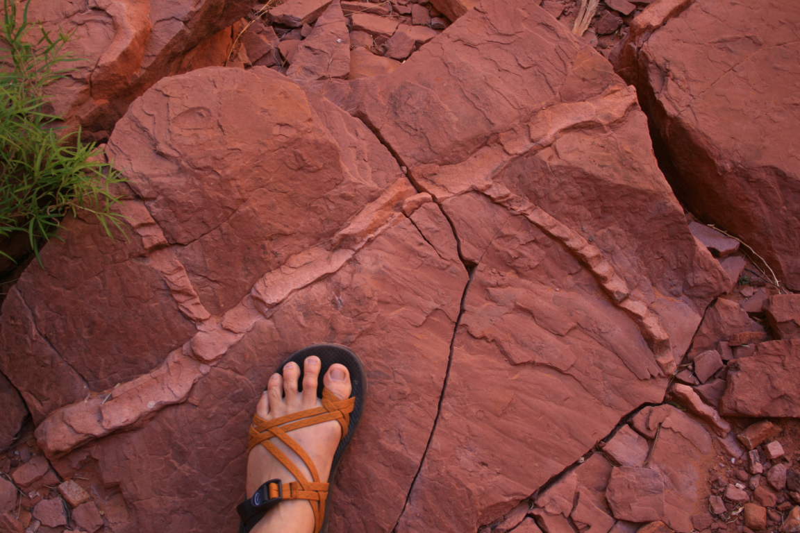
That's my foot on top of the Kayenta Formation at the contact. Note the lighter colored cracks in the rock that were infilled with blowing sand as the Navajo dunes crept over this ancient floodplain, some 190 million years ago.

Here's another view of the contact with visitors walking by. Note the very well developed cross-beds in the Navajo Sandstone (top portion of photo). These represent deposition in sand dunes on their leeward side, as sand was migrating from left to right in this view.

Our first view of Rainbow Bridge on May 29. The opening in the bridge is 290 feet high and about 275 wide. Conceivably, a 747 aircraft could fit within this opening - it may not look that big but I used a wide angle lens on this shot. A natural bridge is different from an arch in that a bridge has a stream running under it.

The day was full of history! Here, Harvey Leake, the great grandson of John Weatherill gives a speech to the many dignitaries that assembled here. John Weatherill was part of the "discovery" party in 1909 that first recorded the existence of Rainbow Bridge to the outside world. Harvey related that his great grandfather was well aware that indigenous people knew of the bridge for centuries before and didn't really think of himself as part of a "discovery trip". Still, the existence of this impressive landform was unknown to the outside world until it was photographed and mapped in the same year that Perry arrived at the North Pole.

Another view of Harvey talking to the superintendents of the southwestern parks.

The "official" delegation that commemorated the 100th Anniversary of Rainbow Bridge

Chuck Davis is the district ranger for Rainbow Bridge and his knowledge of the area is incredible. He is a dedicated public servant to this tiny gem in our National Park system.

Glen Canyon NRA superintendent Stan Austin, delivers some very complimentary words to his district ranger. Stan said that Chuck receives more favorable comments about his interaction with the public than any other ranger there.

Interpretive ranger Doug took this photo of Helen and me as we looked at the bridge. Although the monument is now 100 years old, the bridge itself is much older, perhaps tens of thousands of years older. One estimate is that the hole is 30,000 years old with the exposure of the rock on top of the bridge occurring about 120,000 years ago. Both estimates could involve more or less years but you get the idea.
On the way back to Wahweap Marina, I took this reflective shot of Tower Butte. This monolith is a local favorite because of its symmetrical profile. It is underlain by the top of the Navajo Sandstone, the apron below is part of the Carmel Formation, and the upper neck is Entrada Sandstone and a little Morrison Formation. All of these strata were once continuous with other buttes in the area but vertical erosion has isolated this section of rock.

We stopped on an island in the reservoir that is capped with Colorado River gravels. Look how rounded these clasts are. And they contain rock types that could only have come from upstream. The depth below the water here to the old channel of the Colorado is perhaps 600 feet, meaning that these were stranded here by the river somewhere between 250,000 and 300,000 years ago, when the river had not yet cut Glen Canyon. Awesome!

As we admired the old river clasts, we came across a trackway in the Navajo Sandstone. Here Dave and Gary a looking up the old dune face and along the trackway which carries on towards the photographer. Marvels everywhere in this land of rocks!

Thursday, May 27, 2010

Final Day of the CR_Evolution Workshop

The third and final day of the workshop was reserved for participants to discuss some of the progress made since the Grand Canyon Symposium in 2000 and to identify those areas that need more work and clarification. It is difficult at this time to say where progress has been made. Certainly the techniques used to glean information out of the sparse deposits has improved. Remember, in 2000 everyone gave their presentations with slides on Kodak carousels (and at the 1964 symposium plate tectonics did not yet exist). But advances have been made.

Andres Aslan and Rex Cole presented information on the evolution of the upper Colorado River. It was in place and flowing towards the Colorado Plateau by about 11 Ma and the evidence comes from Colorado River gravels preserved beneath the lava flows capping Grand Mesa. This is a big move forward to understand the upper river. The question becomes, where did that river go? Was there a lake somewhere on the central Plateau? Or did the river continue south towards Grand Canyon and Hopi Lake? Or as others have suggested, did that river turn north and go into an ancestral Green River. Seems that the answer to one question yields additional unanswerable questions. Still, we now have solid evidence for the existence of an ancestral upper Colorado River flowing onto the Colorado Plateau before 11 Ma.

Regarding the lower river, Kyle House and colleagues presented perhaps the most solid story presented here, concerning the river's history in the reach between Las Vegas and Blythe. They have deposits that show the presence of isolated basins that were sequentially filled with lake water, then breached at bedrock divides producing distinctive outburst flood deposits. They are preserved around the Laughlin/Bullhead City area and cluster in age around 5.5 to 5.0 Ma. Irrefutable evidence (we don't get to use that term too often in this story) for the creation and existence of the higher parts of the lower river. Other work from the area around Anza Borrego shows that reworked fossils from the Colorado Plateau arrived in a delta to the Colorado River by 5.3 Ma. So the picture of the lower river is becoming better known as well.

We are still left however, with the mystery of the Grand Canyon. As reported earlier in this blog, evidence was presented for a Grand Canyon cut to near its present depth by 70 Ma, a truly mind-boggling idea. This flies in the face of other lines of evidence for a much younger canyon but it seems that the old canyon idea will not go away, even with the passing 3 years ago of Don Elston. Some at this workshop questioned how a landform could just sit there for all of that time and not appreciably get bigger (or at least develop a soil or something). Other thermochronologic evidence from John Lee suggested that only a paleovalley (and not a canyon) was developed about 18 Ma over eastern Grand Canyon. These discrepancies will have to be worked out.

Concerning the persistent "Muddy Creek Problem" (no Colorado River sediment is found in the deposit, so there could be no Grand Canyon as recently as 6 Ma), yours truly asked the whole group, "If you were looked towards the Grand Wash Cliffs 6 Ma, what would it look like?" Ivo Lucchitta replied, "A wall of rock across the cliff face". Meaning that there was nothing at all of the canyon at that time. But we now know that the river arrived at its delta only 700,000 years later (5.3 Ma). Is it reasonable to assume that we could go from no river to the one we have today in such a short time? Only if spillover is right I guess. If we could answer this one question, (and if you attended the workshop and want to give me your best guess) we might be on our way to understanding if headward erosion, spillover, or sapping is what caused the outburst floods downstream from here.

Another new focus this year was the presentation that rather recent mantle-driven uplift may have affected the southwestern edge of the Plateau in just the last 5 Ma. Presented by Karl Karlstrom, this work suggests that movement on the Toroweap and Hurricane faults in western Grand Canyon may be the result of uplift to the east where removal of the Farallon slab has allowed the hot mantle to heat the overlying crust. The uplift could be what is driving the incision of the Grand Canyon according to this view.

Many came here to bury the idea of spillover from a presumed Hopi Lake (Lake Bidahochi if you prefer). But John Douglass gave a rousing defense of its possibility, even showing the group that in every geology textbook surveyed, not one mention of spillover was included, while stream piracy, antecedence, and superposition are all mentioned. He argued that we as a science are not trained to appreciate the role that spillover can have on the landscape. And given the evidence from the lower Colorado River where spillover seems to be verified, one does have to wonder.

Speaking of unknowns, karst processes were also presented as possible players in the formation of the Grand Canyon. Carol Hill and Laura Crossey did not collaborate on such an idea, yet their results seemed to dovetail toward the roll that groundwater might have played in creating the canyon. In spite of their endorsements for this process, the community remains largely in favor of the surface evidence only, seeming to make John Douglass's point about inherent biases in our training.

At the end of the third day, it was decided that this group should meet more ofter to share data and ideas. Sue Beard motioned that since 2014 will be the 50th anniversary of the first symposium in 1964, that we meet then. It was seconded and passed by those in attendance! So the topic will not soon go away.

I was impressed with the respectful manner that most everyone brought to this workshop. Although very observant ones may have seen a few brief moments of impatience towards those who hold certain disfavored ideas, these were very minor and did not disrupt the general tenor of the community. Everyone here obviously loves their work and would not be involved with it were it not so satisfying. The future looks promising for more cooperation and coordination in this effort to understand the Grand Canyon of the Colorado River.

Wednesday, May 26, 2010

2nd Day of the CR_Evolution Workshop

The 2nd day of this workshop proved to be even more exciting than the first since the topics covered the area of the Grand Canyon specifically and the upper Colorado River in Colorado. Much of the discussion again focused on the evidence gleaned from studying the thermochronology of the rocks (basically studying when they were uncovered by erosion). At this workshop, everyone gets their five minutes but then there are hour-long or even 90 minute discussions where everyone in the room can return to ideas that were presented in a talk. In this way, important concepts are revisited and discussed by all in the room.

I have been impressed at how focused these discussions have been. I think everyone who is attending probably felt that this might be an impossible outcome from this workshop since there are so many divergent views. But the discussions have been as enlightening as the individual talks. Sue Beard discussed the evidence for the Kingman Arch, a pre-Basin and Range high that sat southwest of the Grand Canyon. She showed an image that depicted some Laramide (70 to 40 Ma) paleovalleys that were cut into Tonto Group rocks on the southern Grand Wash Cliffs. (I had just flown over Music Mountain a week before and had seen these remnant valleys from the air). These paleovalleys came off of the Kingman Arch and flowed northeast towards the Grand Canyon (but perhaps, before the canyon was here). See the image below from their talk.

Image from Sue Beard and Jim Faulds workshop abstract showing the area of the Kingman Arch (heavy dashed line, left); three paleovalleys with their names trending onto the Colorado Plateau (small dashed lines); outcrops of the 18.5 Ma Peach Springs Tuff (dark pink) and its suspected source caldera (light pink); and the western end of the Grand Canyon (upper right). The parallel colored lines are the southwestern limit of various Grand Canyon strata.

Ivo Lucchitta showed similar space images from near the Echo Cliffs where, northeast of The Gap, there is a sinuous high-standing ridge of gravel that trends northeast for about 35 miles. Ivo thinks that this may be an ancient main-stem river channel (the San Juan?) that flowed toward the lower end of the Little Colorado River. Some of the clasts in the deposit are identified as coming from the San Juan Mts. in Colorado. Rich Hereford who studied this same deposit 30 year ago thinks it may just be coming from Black Mesa with the clasts being reworked into this.


Composite Landsat and DEM image of Crooked Ridge from Lucchitta and Holm workshop abstract. Note the Echo Cliffs and The Gap (lower left) and Black Mesa (upper right). Crooked Ridge is a sinuous line of gravel between the two. Ive believes this river ran down the monocline of the Echo Cliffs and then turned west into the Little Colorado River.

My name was on two abstracts at this workshop but both of my co-authors gave the talks. (I've been busy transcribing notes). Ron Blakey showed evidence for the age of the Mogollon Rim (> 27 Ma) and we suggested that this feature could have trended all the way to the western end of the Grand Canyon. Carol Hill summarized our work concerning the Laramide to present paleogeography of the Grand Canyon, which includes northeast-directed rivers in some portions of the canyon, and a karst connection between the Marble Canyon section and the rest of Grand Canyon. This karst connection is a tough sell to a group specializes in surface processes but Carol is on to something that may be overlooked in this story.

Having said that, one of the big surprises to me at this workshop is the amount of evidence being presented for the Colorado River going across the Kaibab Arch well before it was integrated with the lower river. This idea means that the ancestral river would have had to leave its present track in the vicinity of Kanab Creek (destination unknown). The time-frame for this is between 20 and 6 Ma. This gets around the problem of how did the river cross the upwarp but still leaves its exit as a problem.

What else? Gosh there was so much. It looks like the Colorado River "instantly appeared" into its delta area around 5.3 Ma. Lots of great evidence for this. And Charles Ferguson really came up with an outrageous idea (not wrong, just outrageous). He thinks that a main-stem river was headed from the basin of Lake Bidahochi (Winslow area) to the Pacific Northwest through the Green and Snake rivers! Not only that, but he believes that this system was intact until integration of the river through Grand Canyon at about 5.3 Ma! That might be tough sell but Charles thinks he has the evidence based on fossil fish assemblages and the gravels. I'll be reporting once more for the 3rd and final day of this workshop.

Tuesday, May 25, 2010

1st Day of the CR_Evolution Workshop

The first day of the Colorado River Workshop has now ended and things are as I suspected they might be for me - exhaustive! I got home at 7:30 last night and couldn't decide if I was wide awake ready for more, or just merely ready for bed. It didn't matter - I woke up at some unruly hour in the middle of the night and couldn't get the river or the canyon out of my head. I missed my morning walk but am using the extra time to write a few words about some of my impressions. I'll be back at the 2nd day of the proceedings at 8 AM today and am listed as a co-author on two of the talks.

Overall, everyone was pretty good natured about presenting their ideas, although the two sets of black boxing gloves visible on one of the entry tables wasn't entirely a joke. At least no one screamed but there was a few hearty discussions concerning the lower river (downstream from Hoover Dam). The format of the Workshop is like this: An agenda has been made and you can read it here. Each speaker gets five minutes to present their findings or ideas and then five minutes of discussion after that. That's not a typo. It's five minutes. And fortunately it's policed pretty stringently. It's enough time to show three or four slides although others push that to ten (and then end up being surprised that the five minutes went by so quickly). A cell phone type ringer goes off when each five minutes are up. It's a pretty good system and keeps things moving without having to endure long-winded talks.

There was at least one earth-shattering idea presented in the morning. Brian Wernicke of Cal Tech proposes that a river carved the entire Grand Canyon to within a few hundred meters of its present depth between 80 and 70 million years ago! Not only that, but this river was going in the the opposite direction towards Colorado and Wyoming. For those of you who have read "Carving Grand Canyon" this may not seem like such a new idea, since Don Elston and Andre Potochnik have also proposed such a vision. But Wurnicke uses a technique called thermochronology, which essentially measures when the now removed, overlying rocks were stripped off the ones we can see in the canyon today. (The two previous ideas spoke to surface evidence only). Wernicke has been a giant in the study of the Basin and Range for the last 20 years and this is his first entry into the Grand Canyon debate.

He calls his river the California River (get it - the modern Colorado River flows into California but the ancient California River flowed into Colorado). You can read his abstract here (although it's unfortunate he did not include a map shown in his talk that depicts the California River going from the Sierra's through the Grand Canyon exactly in the alignment familiar to us today and on into northern Colorado. (Remember the Sierra's were much closer to Grand Canyon before Nevada was stretched into the Basin and Range only after 20 Ma. The Sierra's in this depiction were in the approximate position of Las Vegas). I hope to obtain a copy of this map when I see him today.

On the other end of the time spectrum, Kyle House and colleagues provide outstanding evidence from the lower Colorado River between Hoover Dam and Blythe for the catastrophic filling of basins that overflowed sequentially downstream. These basins were separated by bedrock sills and essentially mirror the dammed basins today (Lake Mojave, Lake Havasu, etc.) All of this occurred in the 5 Ma time frame. You can read their abstract here. This seems to argue for a very young river, at least for its lower reach. Amazing the two frames between Wernicke and House.

Wish I had time to write more this morning but I gotta go hear more. Stay tuned.

Thursday, May 20, 2010

Workshop on the Evolution of the Colorado River next week in Flagstaff

Next week, on May 24, 25 and 26 about 60 geologists will convene in Flagstaff to discuss, debate and pontificate about how the Colorado River may have come into existence. Although there likely will not be a single, defining answer at the end of all this discussion, the field does seem to move incrementally towards greater truths about the mysteries and puzzles of the Southwest's master stream.

Many of the old names will be familiar to those who have poked around in this everlasting debate; Ivo Lucchitta and Dick Young being the main two and the only ones who also attended the symposiums in 1964 and 2000. But many more newer faces will certainly liven up the atmosphere. Look here for a list of the attendees and the abstracts which have been submitted. I will be in attendance for all of the proceedings and hope to post blogs each and every day as the events happen. However, a gathering of minds such as this is bound to be an exhaustive affair and I make no promises! Do look here as often as you can and I will post many interesting readings from the workshop.