At the end of August I was invited to go on a private river trip through Hell's Canyon on the Snake River. This trip had become visible on my radar just a couple of years earlier and so I jumped at the opportunity to something completely different than the American Southwest. Enjoy the ride downstream with me!
The trip began right below Hell's Canyon Dam with a height of 310 feet. A much larger dam (710 feet high) had been proposed to inundate much of the scenery seen on this river trip. But a compromise with conservationists included this dam and two others immediately upstream in order to preserve the most scenic sections of the 652,488 acre
Hell's Canyon National Recreation Area.
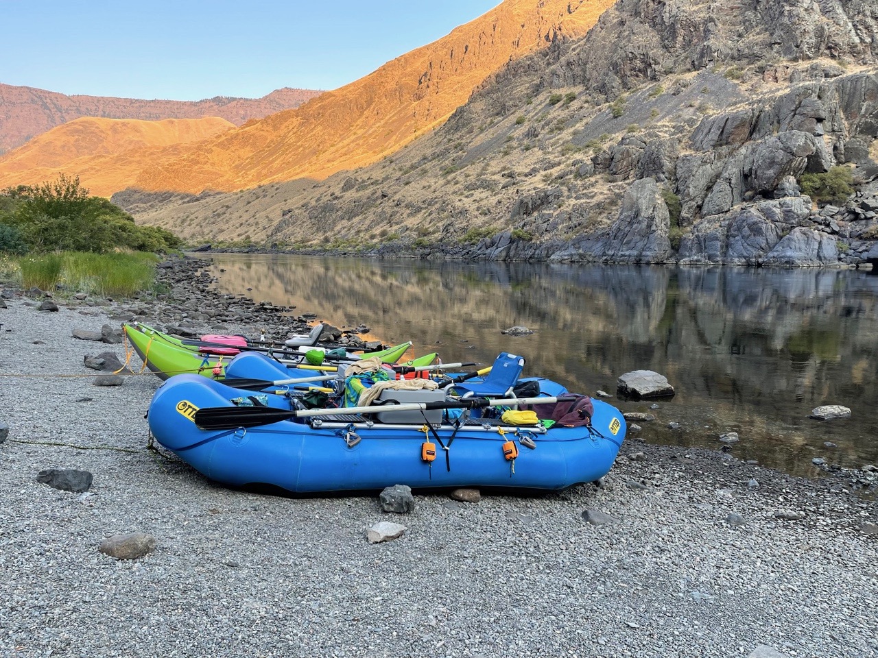
A view of the put-in below the dam. It is quite tight bringing a vehicle down from the USFS Visitor Center and the ramp is steep and narrow.
Location on the border between Idaho and Oregon.
Two other large rivers parallel the Snake River, the Imnaha to the west (shown left of the words "Hells Canyon) and the Salmon to the east (far right). Later in this point I will show the confluence of the Salmon with the Snake.
Legend for the map above.
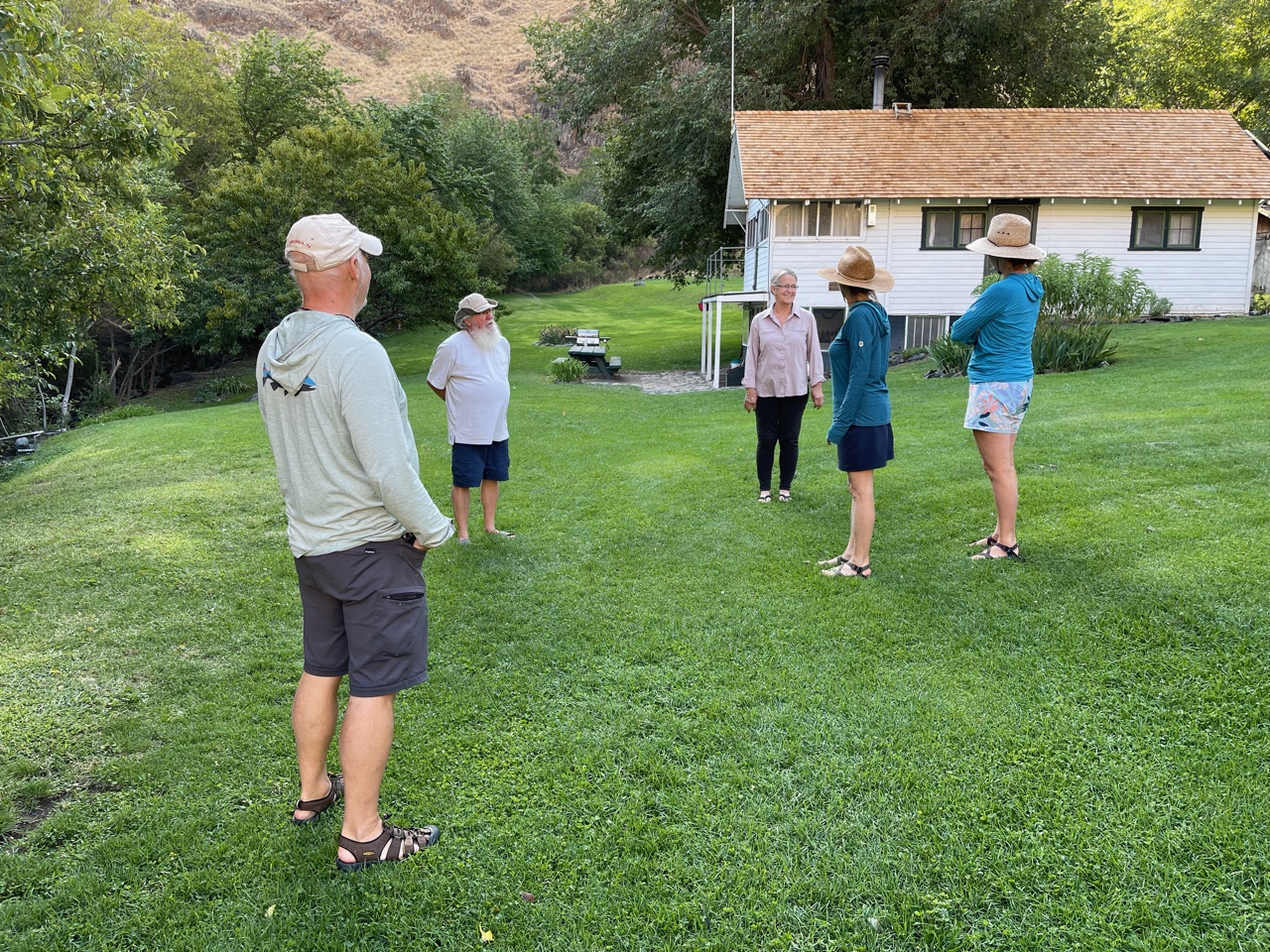
There were five of us in three boats.
There were historical and (some) refurbished cabins along the way.
Scouting one of the Class IV rapids called Wild Sheep Rapids. This was only four miles from the put-in. There were four rapids of this size.
About 67.5 miles of the river is managed under
Wild and Scenic designation, with the first 31.5 miles as Wild and the remaining 36 miles as Scenic. Still, upriver jet boats were grandfathered in as part of the 1975 compromise bill to designate. We saw many.
Native pictographs on river right.
There were forests high up on the cliffs and Ponderosa pines were common along the river in the first half of the trip. Grasslands dominated much of the run.
Waterspout Rapid. This was the last of the Class IV rapids we encountered. Note the hole on the far left known as the Green Room. At much higher water levels (we had relatively low water our whole trip of between 8,000 and 16,000 cfs) this is major hazard to boaters as it recirculates strongly. All guidebooks mention how it is necessary to miss the Green Room. As a passenger on my raft, I wax treated to a perfect run through the Green Room!
I wondered if the grassy environment we saw throughout the canyon might be evidence for prehistory fire regimes altering the ecosystem. It certainly seemed that could be the case.
First nights camp on Johnson Bar and our only camp on the Idaho side.
The fluctuating releases from Hell's Canyon Dam meant that our boats were often stranded in the morning. All of this was reminiscent of earlier days in the Grand Canyon before releases at Glen Canyon Dam were changed to preclude such wide swings in the river level.
Another old cabin along the river in Idaho, this one called Sheep Creek Cabin. The Forest Service places volunteers at these cabins to manage the property and boaters can rent them during the river trip. A fig tree here was full of fruit that the caretaker said was visited by a black bear the previous evening. A large branch was lying on the ground from the visit, denuded of fresh figs. I really enjoyed eating them too.
As we moved downstream Hell's Canyon began to widen out a bit. Then a tall terrace of debris began to appear on either side of the river. In this view of river left, it rises from the riparian zone near the raft, up the grass covered slope about 150 feet.
Here is a more obvious view on river right a bit further downstream. This terrace formed during the Bonneville flood, when Pleistocene Lake Bonneville spilled over its lowest rim and in a matter of a few days was lowered 300 feet. All of the runoff came through Hell's Canyon!
Map of Lake Bonneville and the path of the Bonneville Flood during the Pleistocene, some 14,500 years ago. Lake Bonneville began to overtop its rim in Red Rock Pass in southern Idaho and spilled northward toward present-day Pocatello Idaho where it entered the Snake River. Map taken from Fallschirmjäger - based on a map by Laura DeGrey, Myles Miller and Paul Link of Idaho State University, Dept. of Geosciences.
https://commons.wikimedia.org/w/index.php?curid=25056130.
The Kirkwood Cabin area and its caretakers get a visit by our group.
The Columbia River Basalts began to appear just before we neared Pittsburgh Landing. This area marks the end of the Wild portion of the Snake River. The Columbia River Basalt Group records an epic effusion of lava flows covering 81,000 square miles in the American Northwest. Eruptions were mostly between 17 and 14 Ma but smaller eruptions continued until about 6 Ma. These layered lavas sat on top of the basement rocks we encountered along the rivers edge.
Near Pittsburgh Landing, we saw a Cascade Range ash bed in the riverside alluvium. I am unaware of the provenance of this light-colored ash bed but our river guidebooks mentioned that ash from Mt. Mazama (Crater Lake) was present in the area.
Below Pittsburgh Landing the canyon became narrow once again as the Seven Devils Group was exposed. See an early USGS Professional Paper about this package of rocks
here. These volcanic, volcaniclastic and marine rocks are Late Permian to Triassic in age and have been interpreted as being formed in the Panthalassic Ocean (early eastern Pacific Ocean), perhaps to within 18º of the equator (north or south). These rocks were then transported tectonically to the north, ultimately colliding with the ancient western edge of North America. Some geologists ascribe these rocks as being part of the Wrangellia Superterrane.
Permian-age pillow basalts of the Seven Devils Group along the Snake River in Hell's Canyon.
Another view. Incredible to think of the geologic history these rocks contain!
In the distance looking downstream, note how far down the Columbia River basalts are. I wondered if maybe they have been erupted onto paleotopography? Another likely scenario is that the rocks were faulted low.
Some of the camps (not reserved in any instance) had picnic tables. This is Bob's Camp.
Columnar basalt next to the river. The vertical joints form perpendicular to the cooling surface.
This is the confluence with the Salmon River, seen coming in from the east (left). The Snake River is shown on the right.
Panorama of our last camp at river mile 175.6 and within the state of Washington.
A large fire had scared the Idaho side of the river all the way from the confluence with the Salmon River and the take-out, some 17 miles of river.
At the take-out at Hellar Bar, the Columbia River basalt dominates the landscape. What a trip! Thank you to Mike, Tiffin, Sandy, and Gail for such a great journey down through Hell's Canyon.


Thanks, Wayne! We've camped on the Idaho side, above the dam, and driven all around the Wallowas (recommended!, but only seen the Wild & Scenic parts of the Snake from overlooks high above.
ReplyDeleteFilling that huge hole in the resume?
ReplyDelete