Last week I accompanied my colleague Dr. John Warme, retired professor of geology from the Colorado School of Mines, and three other geologists to look at the Alamo
breccia, a quite out-of-place layer of conglomerate sandwiched within many thousands of feet of fine-grained, shallow marine limestone. The opportunity was not to be missed and so I was off to southern Nevada.
Physiographic map of Nevada showing the location of the type section of the Alamo breccia, about 100 miles north of Las Vegas. Note the fabric of mountain ranges within Nevada that trend north to south. This pattern is due to extension (stretching) of the Earth's crust that began about 20 to 17 Ma (millions of years ago). Blocks of crust were pulled apart, likely as a result of the subduction of the
East Pacific Rise beneath this part of North America. As the crust stretched, once continuous sheets of rock were faulted and rotated along a north/south trend. Nevada has widened twice as much as it was prior to 20 Ma. That's 100% extension!
Dr. John Warme stands in front of the geologic map of Nevada at the beginning of our field trip. The entire state is located within the Basin and Range Province, which also includes eastern California, western Utah and south and central Arizona.
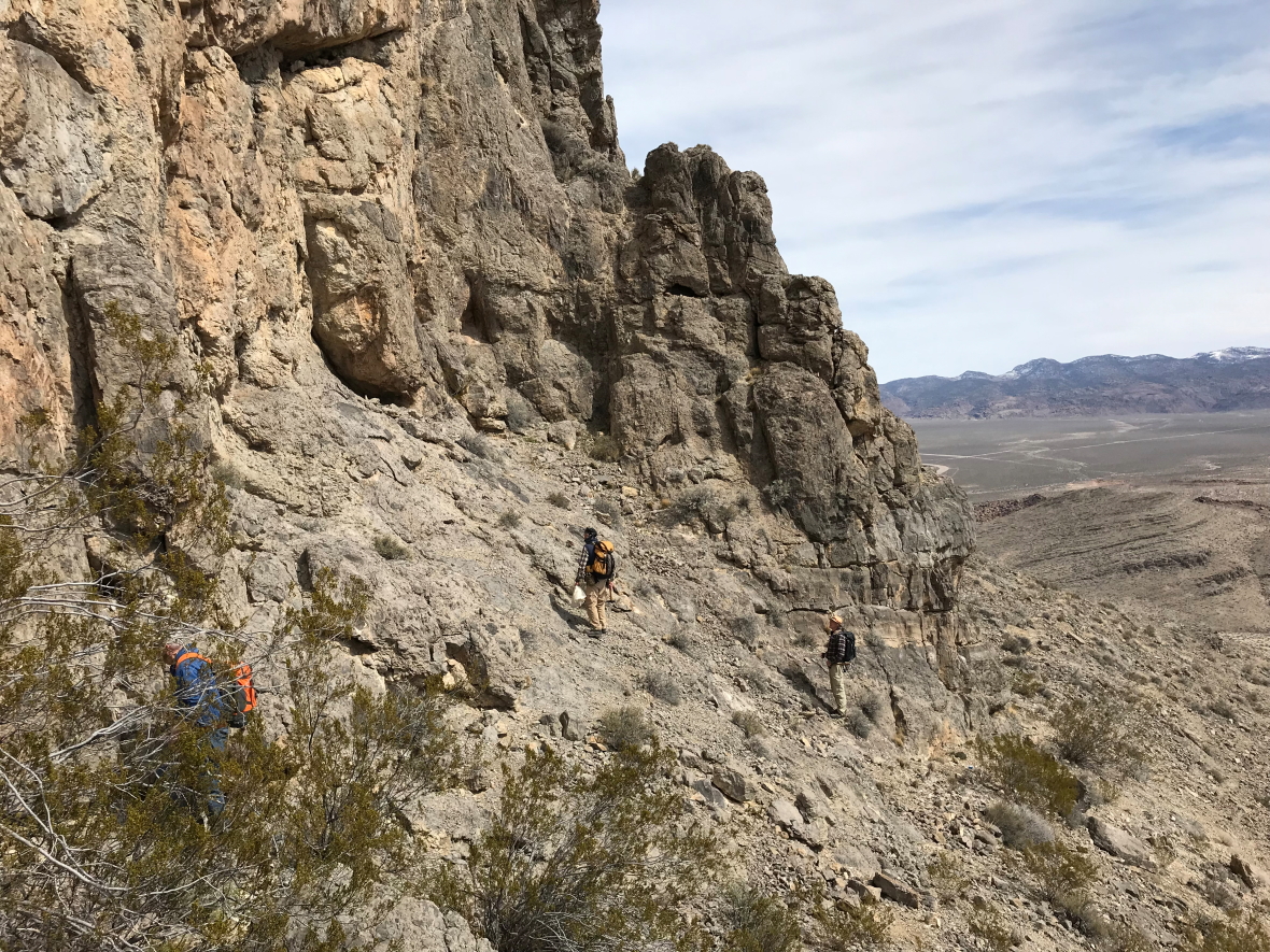
On the ground, this is what the Basin and Range looks like. Rocks in the foreground are also exposed in the far mountain range but they are separated by faults and the extension that occurred here.
To understand this story, it is helpful to see what this part of North America looked like around 380 Ma. The emergent part of North America lay to the east and off the right side of the map. An early incarnation of the Pacific Ocean covered most of Utah and Nevada as was part of the continental shelf. These conditions were present for hundreds of millions of years here! Thick accumulations of quiet-water limestone and shale piled up over this period of time to over 130,000 feet. In spite of their later deformation, the rocks are essentially limestone, after limestone, after limestone.
Evidence from the quiet-water days of the Late Devonian comes from the Guilmette Formation. Here a stromatoporoid sponge fossil lies in quiet repose on a tilted bed of limestone.
These stromatoporoids sometimes made reef-like colonies. Silica-replacement of the calcium "shell" highlights the outline of the sponges.
This example shows the concentric layers within the sponge. These fossils provide evidence for quiet, shallow marine settings. With apologies to paleontologists, this was quite boring tectonically.
Except for this - an approximately 300-foot section of coarse, angular breccia (foreground) found within the Guilmette Formation. This anomalous deposit is the subject of this posting.
To further complicate the setting, this area was compressed and the crust was shortened extensively by a mountain building event before the crust was stretched and thinned. The once horizontal layers of limestone were squished and interleaved along giant thrust faults stacking rocks over themselves. See the diagram above for how the layers became stacked. When a geologist goes into the field here, they have to mentally "remove" the compressive event
and the thinning event to sense the nature of the rocks before they were deformed. This is the how the paleogeography can be envisioned.
One can rather easily see a pronounced tilt to the rocks in this view. But within the tilted beds are numerous thrust faults that reveal that the layers were also compressed and shorted before they were stretched. Yikes - makes a guy like me run for the Colorado Plateau where the rocks are still essentially horizontal like the day they were born!
From the South Hancock Hills near Hancock Pass on State Highway 375 a view of the section can be seen. The lighter-colored bed of limestone in the center of the photo is a part of the Alamo breccia.
A view of the same photograph with the breccia horizon highlighted in yellow.
So, let's look at the Alamo breccia up close. It contains pieces of rock (called clasts) of the very same limestone rocks and are always quite angular when found. This suggests they were emplaced quickly without prolonged agitation, which would tend to round their edges.
There are many beds of this material within the breccia.
The mechanical pencil (center right) lies on the contact between in-place limestone below and brecciated limestone above. This represents the surface upon which the breccia was emplaced.
Close-up of the same contact (photo center). Note the rather distinct bed of breccia with lighter-colored and angular clasts within a darker matrix.
John Warme next to a dislodged boulder of the Alamo breccia.
What is inherently interesting about the Alamo breccia are seemingly coherent beds of limestone within it. Here the 1/2 meter-long rock hammer lies across a brecciated horizon in the middle part of the photo. Note the small clasts within an apparent coherent bed above that. But a lens-shaped block (with its left margin terminating at the top of the hammer) is exposed on top. This suggests that clasts of ANY size can be found in the breccia.
Like this - note the twin beds of limestone "floating" on top of the clastic breccia. These were likely shoved into the mobile mass of breccia without becoming disrupted.
Or this! Note the overturned bed of limestone, surely pushed around to obtain this shape. Wow!
And this - a series of beds that trail off to the left into equidimensional breccia. How does this happen?
Dr. Warme was made aware of this anomalous occurrence of breccia in January, 1991, when a PhD student told him about breccia he saw in the Guilmette Formation. They eventually ruled out tectonic collapse of the continental shelf, since it was rather featureless and was located in a stable environment. Plus, the scale of the breccia and the texture hinted at something more catastrophic, especially when it was found that some clasts are 500 meters long! A meteoroid impact in the Late Devonian was the interpretation!
Rocks of this age are full of fossils called
conodonts and they provide rather tight ages for when this impact might have occurred. Conodonts were ubiquitous in early Paleozoic oceans worldwide but evolved and changed rapidly. Thus, they make great index fossils, since their evolution can be traced in the rocks. The Alamo breccia was emplaced during the
Palmatolepis punctata conodont stage, about 382 million years ago. A paper on Late Devonian conodont stratigraphy in Nevada can be downloaded
here.
Although not age-diagnostic, Warme also took us to these rather large stromatolite fossils exposed beneath the breccia (still in place). Note the cauliflower shape to these 3-4 feet high stromatolites.
Another view of two stromatolites side by side.
These petroglyphs were found on a yellow sandstone boulder that had rolled down from above the breccia horizon. Warme thinks the sandstone may have resulted from uplift of the ocean floor concentrically around the impact zone.
Beautiful Nevada!
This feature in the southern Hiko Hills was our destination on another day of the field trip. We were headed to the lens-shaped beds of lighter-colored limestone in the center of the hill. These are part of the Alamo breccia.
No trails here - just walk where you can.
As we went up the hill, we arrived at the top surface of the breccia deposit, seen here where the lower, darker cliff of limestone gives way to an upper slope that angles down to the left. At the top of the breccia are graded beds (where the clasts get smaller towards the top) interpreted by Warme as
tsunamites - rocks formed when giant tsunamis raced across the sea after impact.
Note this fining-up sequence.
This is not a great example of how these tsunamites fine upward, but the rock is from the tsunami horizon. Incredible to think that all of this - 300 feet of debris - may have been emplaced within a matter of hours 382 million years ago!
Still gotta go higher to see one more thing. Believe it or not, the lighter gray bed in the center of this photo is likely a very large clast that was transported eastward from the impact. It remained largely intact as it came to rest here.
We finally made it to a cliff where a lighter-colored bed, almost yellowish, was exposed.
Closer examination revealed the presence of spheres within a limey matrix.
Closer still, it was observed that the spheres had concentric interiors. Hmm?
The finger points to one of these features. containing a nucleus, a mantle and a thin crust. It turns out that when the bolide (or comet) impacted the earth, it vaporized the previously consolidated limestone layers and water from the ocean. A gigantic cloud of pulverized limestone and vaporized water was injected into the rising and very hot mushroom cloud. The temperature was so intense that the limestone powder was cooked into quick lime - essentially cement. This mixed with the water vapor in the cloud to create nodules of cement that then adhered to more pulverized quick lime (like the way a snowball accumulates more snow as it rolls downhill). Warme was advised early on that these sphere's are technically
lapilli. But not volcanic lapilli, rather meteoroid impact lapilli.
Warme found one example where numerous small lapilli were fused with other lapilli to create a meteorite-impact bomb (cut in half and polished here). Note the similar outline to the shape of a volcanic bomb. As various lapilli were incorporated into the mushroom cloud, they may have risen on upwellings again and again from the rising heat, much as hailstones behave inside a thunderhead.
In this view we can see the orientation of the bomb as it fell to Earth, with its edges trailing upward as it descended to the ground.
State Highway 375 which bisects this area, has been named The Extraterrestrial Highway by the Nevada State Legislature. Rachel, where this photo was taken, lies just outside the boundary of the
Nevada Test Site and
Area 51. For these reasons, the name of the highway was given.
But how appropriate that although the reason for the name is likely a farce, there is something very real about this area containing material that is extraterrestrial - the Alamo breccia and impact.


Wow, what a great set of exposures and what a great story. Found the 2008, Warme, Morrow, and Sandberg, GSA Field-trip paper after reading your post, and this is such a great, classic "locality" (area?). Thanks for posting all these great photos and the narrative. It was neat to find something like this that I had never heard of before (after spending my youthful geo student days crawling around lots of Appalachian Paleozoic carbonate platforms). This is a true geo-blog winner. - Mike Huggins, Irvine, CA
ReplyDeleteDr, Jack Share wrote: What a stellar post (literally) in every way!
ReplyDeleteMike and Jack - Thank you both for your comments. Mike - if you would like to send me the link for the paper you referenced - please do. Thank you both. WR
ReplyDelete