Shinumo Altar from the east — the destination of our hike. It is located to the east of Marble Canyon and west of the Echo Cliffs.
Google Earth view of the region surrounding Shinumo Altar. The feature can be seen far and wide when on the ground.
Closer view showing our route around the top of the landform. The Eminence fault trends northeast between Shinumo Altar and a bit of Marble Canyon (upper left).
Oblique view to the northwest with Marble Canyon in the upper left. The mesa is capped and "held up" by the Shinarump Conglomerate, the basal member of the Chinle Formation. The Moenkopi Formation girdles the mesa top and can be seen here as the gray "apron" around the landform. The Kaibab Limestone makes up the foundation of Shinumo Altar and is obviously dissected by streams that lead to Marble Canyon.
The start of the hike was easy to determine — walk up the small drainage toward the red rocks.
We did not expect to find much in the way of prehistoric artifacts but were pleasantly surprised to first see this ground-stone boulder. Some of us suspected this might be Archaic in age where the people were grinding wild seed rather than domesticated crops.
Not too far from the ground-stone site, we came across a badly weathered granary. The wall rocks here were actually decaying in place rather than falling over. The cement was failing in the sandstone.
Moving uphill toward the top of the mesa, we saw fallen boulders of the Shinarump Conglomerate, with red beds of the Moenkopi Formation poking through.
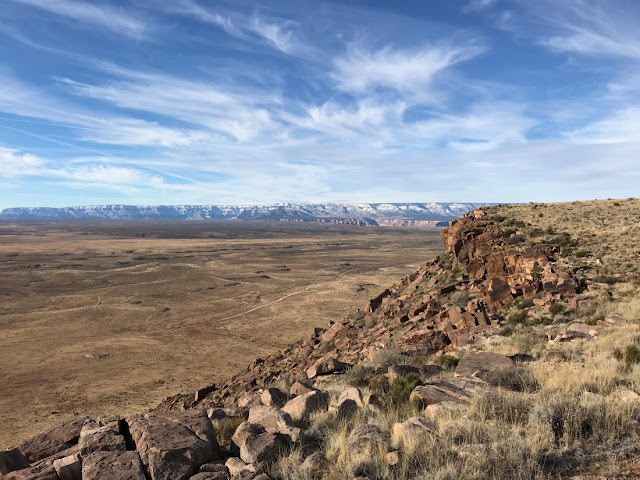
Once on the top (about 700 feet above the Marble Platform) we could look west and see deep into the eastern wall of the Grand Canyon.
The highest elevation on Shinumo Altar is 6,520 feet. There were no trees but the Mormon tea (Ephedra sp.) was quite robust. I joked to my fellow hikers, "At what elevation does the Mormon tea turn to Juniper?"
An eastern view toward the Echo Cliffs.
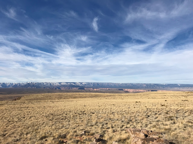
Across the mesa top toward the Kaibab Plateau and uplift.
The clouds were fabulous and I'm starting to realize that high cirrus may be surpassing cumulonimbus-nimbus as my favorite cloud form.
Scott looking into the dissected drainage of Shinumo Wash.
Sandstone within the Shinarump Conglomerate frames a northwest view to Marble Canyon and the edge of the Kaibab Plateau/uplift.
My wonderful hiking companions, shown here, were Tony, Scott, and Tom. The conversation was excellent!
A gravel-rich desert pavement formed from loosened clasts of the Shinarump Conglomerate on top of the mesa. The Shinarump represents the first coarse-grained deposits that were shed northward during the Late Triassic, about 225 million years ago. The source area for this conglomerate was being uplifted in the initial westward drift of North America away from the supercontinent of Pangaea. Thus, the Shinarump is the bellweather deposit signaling the beginning of an active margin in western North America. A few maps of Shinarump time may help visualize the setting.
The breakup of Pangaea initiated mountain building in southern Arizona, which shed sediment to the north as the Shinarump Conglomerate. The small red dot shows the location of Shinumo Altar in this setting. However, I have also placed its current latitude on this map (top yellow line). (Map from "Ancient Landscapes of Western North America" by Ron Blakey and Wayne Ranney, 2018.)
A closer view of the Shinarump depositional basin and fluvial system. The yellow dot is the location of Shinumo Altar. (Map from "Ancient Landscapes of the Colorado Plateau" by Ron Blakey and Wayne Ranney, 2008.)
Within the Shinarump fluvial system, large trees were kicked down in floods and quickly buried. They are now part of the rich petrified log heritage of this deposit and I found a nice specimen on the edge of the mesa.
Toward Marble Canyon from the northern point of Shinumo Altar.
Tom, Scott, and Tony at the large cairn on top of the mesa.
Tony and I are tea drinkers and we each brought a Thermos-full of black tea on the hike. The temperature hovered right at freezing all day but the sunshine and physical activity made it seem warmer. Still it was chilly up there.
A photo of Shinumo Altar at the end of our hike was a wonderful reward. It has been a lifetime goal of mine to visit this prominent landform. I'll never look at it the same way again!


You made a trip I wanted to do. Thanks for the virtual trip.
ReplyDeleteRob and I wondered about the "altar" last summer both coming and going to the north rim. Now we know more! :-) Thanks, Wayne.
ReplyDelete