Approaching the Sierra San Francisco, an incredible desert wilderness in the heart of Baja California.
Location map showing the location of the Sierra San Francisco in central Baja California.
A view south toward the volcano center. The high skyline on the left is made up of the intrusive, central vent rocks with erupted ash flows seen tilting to the right on the right skyline. Our trip would be made entirely within eroded layers of ash flows that emanated to the north out of this volcanic center.
We met our vaqueros at the trailhead where they were organizing all of our food and gear for the six-day expedition. We had four vaqueros who traveled with us the full time and two more, each of who were with us for half of the trip. We also had two interpreters/guides.
Our lucky group! From right, back row: Orlando M., Christine M., George A., Wayne R., front row from right, Bryan B., and Chris C. I can honestly say that our smiles were just as big at the end of the trip, but perhaps just a bit harder to rally! This was an adventure in every respect. At the start, I wondered if maybe I wasn't fully aware of what we signed up for.
We are finally on our way across the upper plateau.
Early on we passed the headwall of Soledad Canyon. We would visit a cave art location in this canyon on day 5.
We had 11 burros to carry our food and gear. They were not tied together, nor were they led on the trail. Rather they were pushed along. Occasionally they would get off trail and the single vaquero responsible for their movement would be required to head off and bring them back. We rarely traveled with the burros - they would leave camp after us, then pass us at some location on the trail and beat us to camp. The whole operation had an air of the disorganized but in reality, it was quite the opposite. The vaqueros and stock worked like a well oiled machine in spite of the momentary madness and confusion.
The boojum tree(Foqureria columnaris) is a member of the Ocotillo family and its English name was given by explorer Godfrey Sykes after a Lewis Carrol book, "The Hunting of the Snark." They are an unofficial symbol of the Baja peninsula.
The leaves of the Boojum are similar to the ocotillo and their presence on the trees here means that the area had received adequate rainfall in the last few weeks. In fact, the remnants of Hurricane Rosa crossed the peninsula on October 2, after previously being the fourth Category 4 hurricane to form in the eastern Pacific. Just two weeks later, the remnants of Hurricane Sergio crossed the peninsula on October 15. The Sierra San Francisco was drenched in both storms and the flowering plants were outstanding this whole trip.
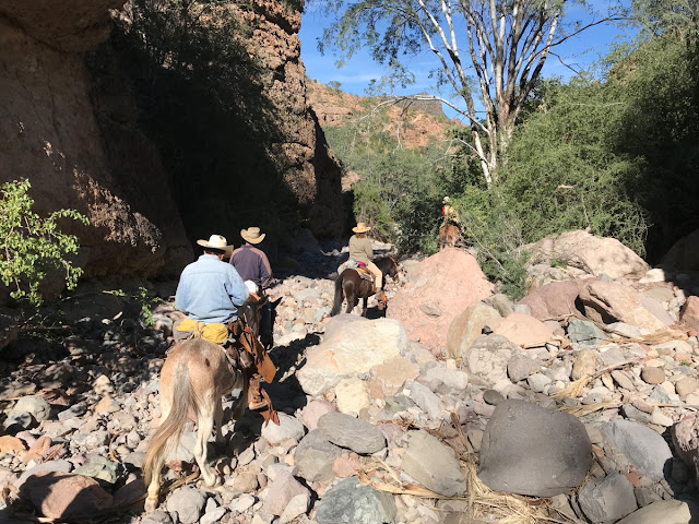
If I had to summarize the landscape of the Sierra, it would be 'rocky.' There are rocks everywhere with very little soil anywhere. This shot into Soledad Canyon reflects the rocky nature of the range.
As the trail began to descend into the canyons, we came to a few areas where dismounting was necessary. Here we traverse through as layer of rhyolite lava below the plateau edge.
Mules awaiting the descent of the last mules.
A view of our initial descent.
The are constructed trails (albeit only marginally maintained) that have been in use since the mission days in Baja California. Some of the trails may even follow routes taken by the cave painters.
Finally, as we neared the bottom of San Gregorio Canyon, the Mexican blue palms (Brahea Armata) came into view. These are elegant palms that only grow where there is near-surface water. The canyons of the Sierra San Francisco are lined in groves of these trees.
The rocky bottom of Arroyo San Gregorio
We rode by very fast but here was an important spring that issued from a bedding plane in the volcanic sequence. This water has likely been underground a relatively long time before making its way to the surface.
This is a partial view of the Rancho San Gregorio, where we camped nearby for the first two nights. The abuelita of the rancho cooked our meals.
Here our interpreter is helping with the preparation of the dinner. A wood-fired stove is used along with kerosene and solar lighting.
Chris and Bryan enjoying our first dinner. So ended our first day on the trail. The next posting will include visits to our first cave paintings.


Such a stream of awesome photographs. Thank you for posting.
ReplyDelete