Things became far too busy on this trip to blog regularly. Now that the trip is over I will catch up .
Esfahan, Iran
Here's the deal - the day we left Iran, Donald Trump withdrew the United States from the 2015 nuclear treaty. National Geographic (using TCS World Travel as their trip provider) has cancelled this destination on their next trip leaving in a few days. What most Americans hear about Iran and what it is like to actually be on the ground is a complete disconnect. We found the people inviting, curious, and very welcoming to Americans. The pictures here focus only on the ancient sights that they wanted us to see But most everyone on our trip was anxious to find out what it was like there today.
This is the 17th century Safavid palace called Chehel Sotun. There used to be about 17 of these places in Esfahan but only three survive today.
This is Persia and not Arabia. So the art in the parks display humans and not merely geometric forms.
Iranians love a picnic and this city is full of green parks (one might never know that Esfahan is located in a parched desert with all the green in the city). Just about anywhere there is green grass you will find some family picnicking.
I was shocked to see the river dry! Last time I was here the river was running. But a drought has been dragging on for a number of years and the river has been diverted and diminished. This is the Khaju Bridge.
Plates can be inserted into the notches on the left that will hold back water making the bridge as much of a dam as a bridge.
These girls (like many others) asked us to take their picture. None of our guests felt that the young people were being told nasty things about Americans. Their smiles and outgoing nature was very evident. There was a calm acceptance in their manner.
This is the
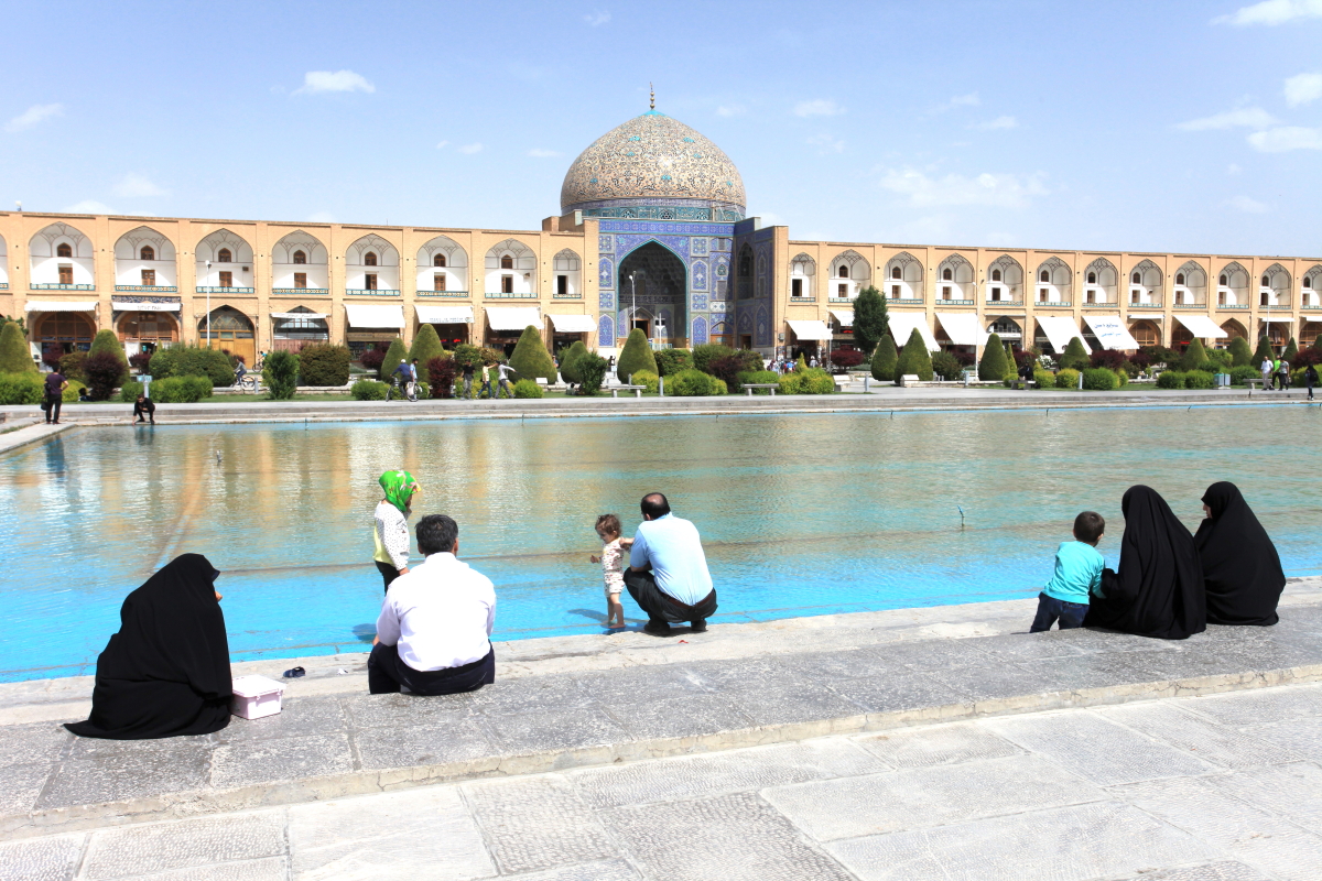
Naqsh-e Jahan Square, said to be the second largest city square in the world (after Tiananmen Square in Beijing). We were standing five stories high in the Ali Qapu Palace (one of the three remaining palaces in Esfahan) looking south to the Shah Mosque. The photo shows only about 1/3 or the square.
This is a view to the north and the other 2/3 of the square. Al of the stalls on the first floor are bazaars where shops sell things.
At the top of this palace is the Music Room. The many niches that are shaped like musical instruments allow for a beautiful sound.
View from the reflecting pool to the
Sheikh Lotfollah Mosque.
View inside of the many blue tiles.
Entrance to the Shah Mosque.
The lobby in the Abassi Hotel. We stayed three nights here and for many, this turned out to be their favorite stop on the whole trip.
Zighy Bay, Oman
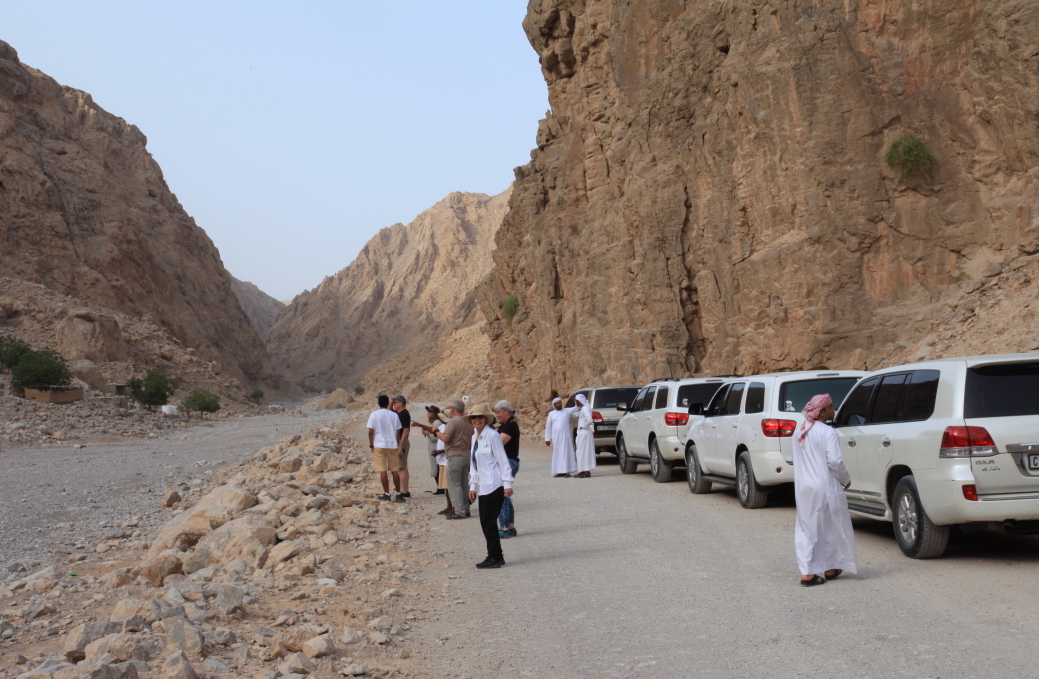
The map shows the Musandam Peninsula, which juts into the Persian Gulf to create the Straits of Hormuz. Zighy Bay is located where the red letters spelling "Oman" are located. The Arabian Plate is drifting northeast and impinging into Iran and the Eurasian Plate. Therefore, the mountains in the Musandam and southern Iran are spectacular! Our jet landed in the United Arab Emirates at Ra's al Khiyamah on the Persian Gulf (just left of the "red Oman") and we drove across the peninsula to the coast of the Gulf of Oman.
Once on the Gulf of Oman side, we took a dhow to access our resort hotel. We had great views of the rugged coast here.
Approaching Zighy Bay and our resort, the Six Senses. The air quality was really bad here and the temperature was above 100 degrees.
I opted for a sunset tour in 4X4 jeeps in order to see more of the landscape.
Much of the tour was in a slot canyon sliced through limestone rocks.
The box canyon.
I gor to walk a portion of the narrowest spot. The limestone ranges in age from Permian to Paleocene and are the deposits of the
Tethy's Sea.
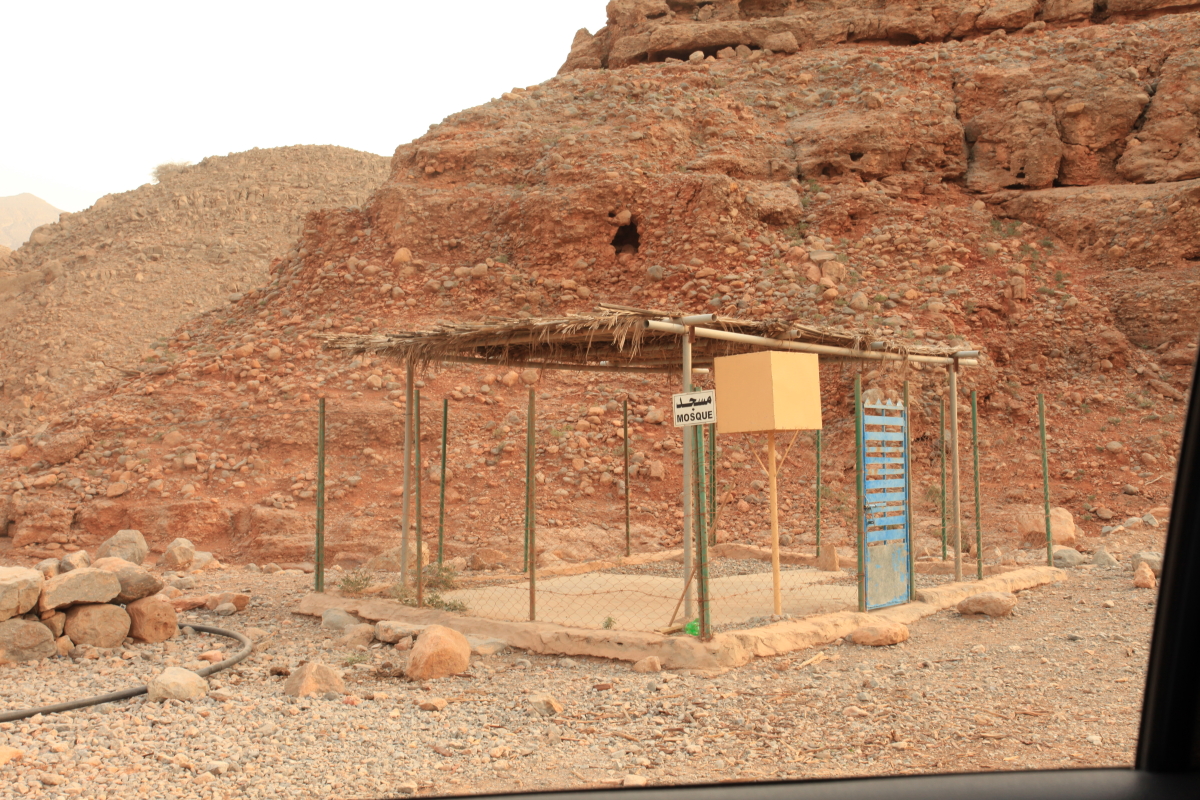
This is a very remote area with people living solitary lives in the hills. This is what serves as a mosque in the area. Compare this to the blue mosques seen in Iran!
Petroglyphs on the limestone.
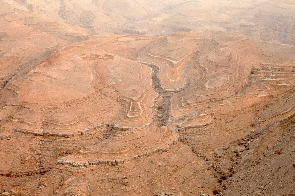
Three mountain building events have affected these rocks and the tilting in the limestone layers is obvious.
Deep dissection into the tilted layers creates patterns that most people find interesting. However, while these forms are easily understood by a geologist, they can be quite difficult to explain to the uninitiated. I usually try by having people imagine a stack of colored construction paper. Then tilt that stack slightly and cut through it with scissors. This would expose the various colors in the cuts.
Sunset occurred well before the sun actually went below the horizon.
It disappeared right after this moment.
Looking north from the sunset viewpoint.
We had a drink while sitting on pillows.
I also did my very first paraglide at this stop. It was great!
Next up - Albania and Romania.


Wayne, Thank you so much for the great introductory section of this story. In particular, how things really are among the people. And your photos and descriptions are wonderful as always. I'm glad your group had this priceless experience! -Deb
ReplyDelete