We are now in the air flying to Iran. There was a social media blackout in Turkmenistan and I was unable post from there. So, I will publish as much as I can in this 2 hour flight and at least get the photos online.
Kyrgyzstan (see link for this country
here)
We flew into Central Asia at the tail end of a wet cold front. You can see the rain disappearing in the upper left.
And we woke up to beautiful blue skies on May 1. These are the Kyrgyz Mountains to the south from our hotel in the capital city of Bishkek.
This is the restored
Burana Tower located on a branch of the Silk Road.
Stone crafted headstones in the cemetery area.
Another headstone made of granite. The mountains in the distance are located in Kazakstan.
A definite East Asian look in this figure.
Mill stones made of granite.
A large fault, the Issyk-Ata fault runs along the base of the mountains. These faults result ultimately from the collision of India with Asia to the east of here.
We also enjoyed an eagle demonstration while at the tower.
A regal bird. I observed a very deep connection between the bird and its master.
The demonstration included the bird flying in to catch a rabbit (already made into meat).
Devouring the rabbit.
The national dish is called
plov (pilaf with a flour crust).
This yurt was assembled in 12 minutes. The ones who assembled it routinely engage in competition of this type.
Turkmenistan (see a link for the country
here)
Flying over the Karakum Desert, 12th largest in the world and covered mainly in sand dunes. The dark areas are oases in the desert.
Note the main canal running across the view, with subsidiary canals and agricultural areas in green. Turkmenistan grows a lot of cotton.
All I can say is that the capital of
Ashgabat is unusual! This is the new international terminal shaped like a falcon. Most buildings are faced with marble, much of it from Carrera, Italy.
The East Asia Games were hosted here in 2017 and this stadium was built for the event.
This is an entirely planned community.
Planted forest within the city.
The horse is revered in Turkmenistan.
Monument to Independence from the Soviet Union (acquired in 1991).
This is the 1st President (1991-2006).
It is a marginally Muslim country but statues of people are everywhere.
View of the "White City" from my hotel room.
The Ancient City of Merv see the link
here)
We used our 757 to "commute" to the city of Mary (pronounced MAR-ee). About 30 miles away is the ancient city of Merv.
Merv is known as one of the great cities along the Silk Road, in existence from the 2nd century BC until the 17th century.
The Sultan Sanjar tomb (left) was built in 1157 for the leader of the Seljuk Empire. The Great Kyz Kala (right) was constructed in the 8th or 9th century.
Close-up with restoration underway.
The Little Kyz Kala.
View from Little Kyz to Great Kyz.
This is the oldest ruin in the Merv complex,
Erk Kala.
View from the top of Erk Kala.
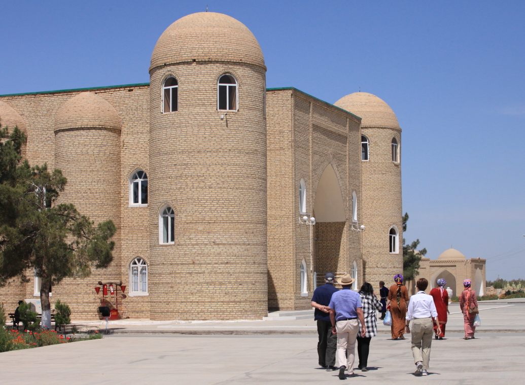
This the Mosque of
Yusef Hamadani. We did not go inside. But that was not a disappointment because there was so much activity outside the mosque...
...a huge religious feast was being prepared for the local people, providing a great opportunity for photographs.
Local ladies outside the mosque.
They walk three times counter-clockwise around this structure.
Meanwhile this Turkman provided an interesting profile.
The tour ends up at the Sultan Sanjar tomb.
It was a lot darker than this inside but I set the ISO setting to 6400 and it all came out right.
The mosque in Mary. Now on to Iran.


No comments:
Post a Comment
If your comment will not post, email me with the problem.