At Lees Ferry, the Paria River was contributing some silty water to the green Colorado. recent rains provided the small amount of run-off.
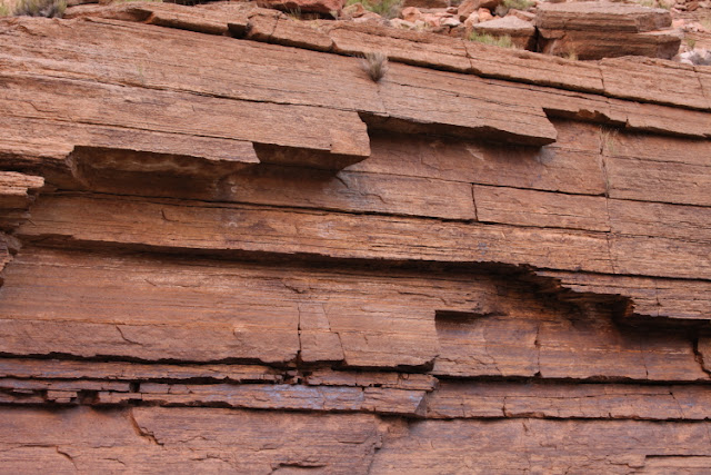
Amazing to think that this is the Grand Canyon! We are only about 2 miles from Lees Ferry and the Kaibab Limestone here rises only about 130 feet above the river. In another 70 miles, this layer will be 5,000 feet above the South Rim and 6,000 feet above the North Rim.
One of our two boats within the Supai Gorge at River Mile 14
Redwall Cavern at mile 33 is carved into the Redwall Limestone
Our first group shot. Most of these people have known each other for many years so there was a great camaraderie on the trip.
Note the large bioherm within the Redwall Limestone just below Redwall Cavern. These form when algae colonies grow into huge mounds forming algal reefs. The overlying sediments are drapped over the algal reef.
A travertine spring spills into the river. Where the cardinal monkey flower is growing is a carapace of travertine and the water is running down inside the hollow shell.
The great Cape Solitude rises 3,500 feet above the confluence with the Little Colorado River
We enjoyed a blue, blue day at the Little Colorado River
Salt stalactites hang from the Tapeats Sandstone below the Little Colorado on river left. The salt likely originated in the Cambrian seas and was trapped in disseminated form within the deposits, where it has been remobilized and precipitated on the walls of the canyon.
The Desert View Watchtower from Upper Tanner beach at sunset...
...and at sunrise
This odd-looking boulder along the river near mile 106 always garners lots of queries. It is a fragment of Bass Limestone or Hakatai Shale (Grand Canyon Supergroup) that has rolled down the slope from up above, placing it next to the much older Zoroaster Granite.
The "lollipop tree" on top of the Powell Plateau near Dutton Point (right) is a Ponderosa pine that has had its lower branches burned off. In 2007, I visited this area when my wife took me on a 16 mile day hike for my birthday.
Wider-view from the same location on the river showing the tilted nature of the Grand Canyon Supergroup (below). The Supergroup once covered the entire Grand Canyon region and is over 12,000 feet thick. However, faulting and subsequent erosion removed it from 90% of the area, meaning that it is found only as discontinuous and tilted outcrops. The preserved sections are those part of the ancient landscape that were faulted more deeply into the ground, thus escaping total erosion. Thank goodness - otherwise we would not have this window into this part of earth history here (a time spanning from 1,250 to 740 million years ago).
Tilted and resistant Supergroup outcrops formed topographic islands in the Cambrian seas. Here, the dark brown Tapeats Sandstone (left center) pinches out to the right against a tilted cliff of Shinumo Quartzite (lighter colored cliff in upper right). Can you follow the contact even though the two units are similarly colored?
Relaxing in the river at the end of the 45-mile long Upper Granite Gorge. This is near Blacktail Canyon.
Water escape structures form when wet, unconsolidated sediment is overloaded with additional sediment. These were seen in recent Colorado River eddy deposits, laid down in a controlled flood in November, 2014.
Spectacular view of Conquistador Aisle where the Tapeats Sandstone dives beneath river level
Note in the middle distance the appearance of two rusty-brown dolomite layers within the Bright Angel Shale. These strata represent the deepening marine conditions that existed to the west in western North America during the early and middle parts of the Paleozoic Era.
Closer view of the two dolomites
A former channel of the Colorado River is filled with lighter colored landslide debris (center). The former canyon walls can be seen in the dark Tapeats Sandstone.
A Bighorn sheep makes its way across ledges in the Muav Limestone. We saw numerous sheep on this trip and our group was keeping a record of each wildlife sighting that will be given to the Park for monitoring.
Close-up view of the Muav Limestone, the uppermost rock unit of the Tonto Group. The Tonto Group is a classic trangressive sequence that records the gradual onlapping of the sea onto the westenr edge of Paleozoic North America.
Ripple marks in the Muav record shallow water conditions at this time
Striking ledges of bedded limestone near river mile 149
Erosion plucks away at the Muav ledges
In Sinyalla Rapid
Much of the widening of the canyon is illustrated in this scene, where undercutting of softer shale beds removed the foundation of the harder limestone. Huge blocks collapse downward and then become entrained in the river when huge (pre-dam) floods sweep down the channel of the Colorado River.
The first Occotillo's are seen near Sinyalla Canyon and represent our gradual descent into the Mojave Desert biome.
Fluting in the Muav Limestone forms when cobbles swish around in potholes during large floods. Eventually, the potholes deepen and open up below into the river.
Paradise spring in the Muav Limestone. I hope you have enjoyed this highlighting of the Muav as it is expressed within the Muav Gorge of Grand Canyon.
A female Bighorn munches on Oregon grape leaves along Havasu Creek
Making our way across the beautiful calcium-rich waters of Havasu Creek
Former travertine dams once blocked the creek bed, forming large ponds where these mammalaries can form in the subaqueous environment.
A cracked-open mammalary showing the concentric layers of calcium that form them
The hikers in the upper right are walking on top of a former (prehistoric) travertine dam (brown colored rock).
At the mouth of Havasu Creek. The Grand Canyon is just so beautiful as this photo attests.
A final group shot on our last morning together. We had great guides from CRATE!
Raven prints on a Colorado River beach
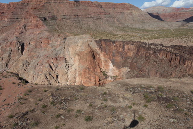
Near Whitmore Wash on the flight out. A lava dam is visible in the middle distance, choking a former side canyon with basalt rock.
Another side canyon filled with basalt lava, this one however is now partially exhumed
A cinder cone is the source area fr some of the flows in the Whitmore area. Grand Canyon is a great laboratory of geology. I have a few spaces left on my July 2016 river trip here.


No comments:
Post a Comment
If your comment will not post, email me with the problem.