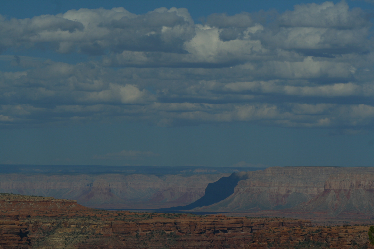
I recently led a small group on a camping and hiking trip to Lees Ferry along the Colorado River in northern Arizona. There are some very nice hikes that captivate the geologist! Here I write about two hikes - one down Cathedral Wash to the Colorado and the other up the Echo (or Vermilion) Cliffs on the Spencer Trail. One hike is narrow; the other has huge vistas.
The hike in Cathedral Wash begins along the Lees Ferry Road and starts out in the Triassic Moenkopi Formation (upper red unit). Here, Ed is standing on top of the Permian Kaibab Limestone (white below) and the contact not only marks a transition in time periods, but between era's too. Below are Paleozoic rocks with Mesozoic rocks above. The gap in time at this unconformity represents about 35 million years.
Burrowing animals left these traces within the Kaibab, part way down the canyon.
The route is quite narrow in places with beautiful refracted light bouncing off of the limestone walls. In a few places, hikers must negotiate some steep cliff descents that require route finding. It is not for beginning hikers.
But you really cannot get lost -just follow the bed downstream until you reach....
..... the Colorado River.
After a night in the campground, we got an early start on the Spencer Trail. This steep trail cannot be seen from the famous ferry site and raft launching area, yet it climbs the cliffs above. In no time the big vistas begin to appear. This is a view to the south where shale in the Petrified Forest Member is being eroded off the top of the Shinarump Conglomerate Member (both the Triassic Chinle Formation). The Moenkopi Formation is along the river bank. This same couplet can be seen in the low bench in the right distance at the base of the Vermilion Cliffs.
Our group ascending the trail in the cool shade of morning. Behind is the Colorado River in its last reach in Glen Canyon. The dam is located about 13 miles upstream from this point. Note the obvious dip in the Mesozoic rocks in the far background - these are tilted along the Echo Cliffs monocline as it crosses the river.
Higher still, the views become quite expansive. The Vermilion Cliffs are seen in the right background with the Echo Peaks on the left skyline. The colorful Chinle Formation is located in the center of the picture. A large detrital fan from the Paria River has pushed the Colorado into its left bank where it has scoured a cliff in the Moenkopi Formation. This is where Mormon pioneers built the road to connect to the ferry site. This old road is known as Lees Backbone.
The Vermilion Cliffs are one the Southwest's greatest landforms and they attain noble proportions in the Lees Ferry area. The light colored rocks next to the river belong to the Permian Kaibab Limestone, the rock unit that makes up the rim of Grand Canyon. These are overlain by the red Moenkopi Formation and the Shinarump bench in the center of the photo. The soft Chinle Formation has eroded back from this bench and forms a prominent terrace beneath the upper cliff, which contains the Moenave, Kayenta, and Navajo formations. This is geology paradise with a large river in an arid environment providing the scenery and geologic history.
The top of the Spencer Trail was achieved in under 90 minutes and the views were terrific.
Standing atop the Navajo Sandstone (foreground) the Lees Ferry area is popular with river runners, trout fishermen, campers, hikers, even fruit pickers.
A large falling dune is seen on the leeward side of the Echo Peaks. These features form when wind carries sand but drops its load as the wind falls behind a rock obstruction such as a cliff. As the velocity of the wind lessens behind the obstacle, its capacity to carry the sand diminishes and the sand falls to the ground. This is an especially large falling dune.
Note the tilt on the Echo Cliffs monocline as well.
On the way down we noticed some well-developed mud cracks in a block of the Moenave Formation. You may also notice the ripple marks that formed in the dark colored mud before it was dried out.
History and geology share center stage at Lees Ferry and here are some of the remains from a gold mining operation that was located here in the early 20th century. The Spencer Trail is located on the cliff in the background.
I will be leading a 7-day river trip down the Colorado River this August and have a few spots left open. If you would like to see Lees Ferry and enjoy a trip kin the Colorado River through Grand Canyon with a geologists, please contact me!
Adventure and foreign travel, philosophical and scientific musings, geology and landscapes, photography and earthly explorations.
Monday, May 23, 2011
Friday, May 13, 2011
"Sedona Through TIme" Wins Another Award
On May 7 the Arizona Book Publishers Association (ABPA) presented an award for my book, "Sedona Through Time". The award was presented in the Science Book category for the entire state.
I want to first of all thank ABPA for their recognition that science is a worthy topic deserving of its own category for an award in book publishing! In a time when science illiteracy runs rampant in our society, this is welcome news. Second, thanks to the judges for selecting "Sedona Through Time". It is self published so there was a significant financial and emotional commitment to see the project through. Third, thanks to my designer, Bronze Black of Flagstaff, who made the book so attractive and scientifically interesting. And lastly (but not leastly), thank you to my wife Helen, who encouraged me to keep this book in print, even when I thought it should just quietly disappear.
The third edition has already sold 1,600 copies in just over a year and has been a great success to me and those who love to learn about the geology of this special place.
You can read about all of this years winners in all categories here at this link.
I want to first of all thank ABPA for their recognition that science is a worthy topic deserving of its own category for an award in book publishing! In a time when science illiteracy runs rampant in our society, this is welcome news. Second, thanks to the judges for selecting "Sedona Through Time". It is self published so there was a significant financial and emotional commitment to see the project through. Third, thanks to my designer, Bronze Black of Flagstaff, who made the book so attractive and scientifically interesting. And lastly (but not leastly), thank you to my wife Helen, who encouraged me to keep this book in print, even when I thought it should just quietly disappear.The third edition has already sold 1,600 copies in just over a year and has been a great success to me and those who love to learn about the geology of this special place.
You can read about all of this years winners in all categories here at this link.
Tuesday, May 03, 2011
Grand Canyon From Toroweap Overlook - A Geologic Gem
I just returned from a fabulous trip to Toroweap Overlook on the north side of the Grand Canyon. I was leading a charter group of folks who have been with me before on many excursions, backpacks and river trips in the southwest. This trip was coordinated through the Grand Canyon Field Institute, who I highly recommend for any of their educational classes at Grand Canyon.
The trip to Toroweap involved car camping and day hiking for four days and three nights. Have a look and learn some geology from this spectacular location.
The famous Toroweap Road - 61 miles long and a real tire shredder if you drive too fast. We escaped this trip without any - on my last trip out here with a film crew we had three! Those are the Toroweap Cliffs on the left hand side and they are on the up-thrown block of the Toroweap Fault. A giant side canyon to the Colorado River was carved along this fault but the Toroweap Valley here is infilled with lava and gravel some 3,000 feet thick! Yep, this is valley fill we're driving on here. There's the south side of the Grand Canyon in the distance.
From our group camp site, we had a fantastic view to the east all the way to the Kaibab Plateau on the horizon. The smallish (looking) butte in the far sunlight is Mt. Sinyala, an erosional remnant that remains out on the Esplanade terrace.
On our first evening, we walked out to a viewpoint and watched the sunset. Across the river to the south, we spotted the first of many volcanic features here, a small cinder cone sitting on the Esplanade platform. Well, it looks small within the Grand Canyon but is likely 500 feet high.
The next morning, we took a walk to the Overlook. Jim has no fear of heights whatsoever and was born to roam in these extreme canyonlands.
Looking downstream for the Overlook to numerous lava cascades that entered the Grand Canyon beginning about 700,000 years ago. You'll notice a prominent bench where the farthest cascade flattens out, then forms a cliff straight down to the river some 1,000 feet. This is the site of a former lava dam across the river and the inner cliff of basalt rock is the remnant of this dam. Perhaps as many of 13 lava dams once existed in the canyon and on at least 5 occasions, these dams failed catastrophically.
Excellent telephoto view of Lava Falls at river mile 179. We watched three groups go through the rapid and many of the boats ran left, signaling to us that the river flow was quite high this day.
We peered over the lip of rock beneath us and saw a large river boat circle around Vulcan's Anvil (the boat is 33 feet long and likely carries 15 people). This prominent block of basalt is interpreted as the eroded remains of a volcanic vent and if this is true, it makes Vulcan's Anvil one of the most unique settings ever for a volcano - right in the path of the Colorado River.
This is a cinder cone that lies perched above the junction of Prospect Canyon (left) and Grand Canyon (right). It appears that some of the cinder cone has already sloughed off into a widening Prospect drainage.
A close-up of the cross-bedding within the Esplanade Sandstone. Cross-bedding records the direction of currents that laid down the sediment and the direction the cross-beds dip (left to right here) show the direction that the current was moving. The Esplanade Sandstone was deposited in coastal rivers some 290 million years ago.
Our group stayed at the Overlook for 3 hours, watching river boats run the rapid and the sun run across the sky.
Looking upstream towards Cove Canyon at Toroweap Overlook. You can see the Cove Canyon fan that is spread across more than half of the Colorado River's channel here, pushing the river into a narrow rapid against the south wall of the canyon. Most Grand Canyon rapids form by debris dams that issue from side canyons into the river.
On day three we headed to a cinder cone located just one mile west of our camp - Vulcan's Throne! It sits right on the north lip of the canyon.
Vulcan's Throne as framed in a small valley on the Esplanade.
We parked the truck and began our 600 foot climb up the loose cinders.
Here is a view of another cinder cone - this one erupted against a slope of Hermit Formation (dark red rocks). Wow!
A valley filled with lava as seen from the slopes of Vulcan's Throne.
Once on the top of Vulcan's Throne, we had a marvelous view to the south up Prospect Valley. Note the partially eroded cinder cone discussed previously on the Esplanade surface, right side of the photo. Prospect Valley has been filled with lava but a new canyon has begun to etch its way back to the south (the prominent v-shape - center).
Group shot on top of Vulcan's Throne - from left Ed Hibbard, Al Astorga, Jim Randall, Jim Gruneisen, Howard Capito, and myself. (Steve Keagy not pictured but part of the trip). Toroweap Point in the background.
A graceful scene on the Esplanade. To read more about this landform see my blog posting from a backpack on the Esplanade here.
Mt. Sinyala highlighted by the shadow of a cloud with the Kaibab Plateau on the far horizon near Swamp Point.
The weather was perfect for us and the clouds a treat.
Near our camp this old pinyon pine made for a wonderful subject at sunrise.
Shadows on a rock.
Driving out, we saw numerous snakes that were basking in the warm spring sun. Here Ed handles a bull snake.
The air quality was fantastic and on our way home we stopped at LeFevre Overlook on the Kaibab Plateau to view the Grand Staircase. The Vermilion, White, and Pink cliffs are clearly seen from this view. The Pink Cliffs are located very near Bryce Canyon. The Grand Staircase was named by Clarence Dutton in 1882 when he recognized that tilted strata had been stripped back by erosion to create one step on top of the other.
The trip to Toroweap involved car camping and day hiking for four days and three nights. Have a look and learn some geology from this spectacular location.
The famous Toroweap Road - 61 miles long and a real tire shredder if you drive too fast. We escaped this trip without any - on my last trip out here with a film crew we had three! Those are the Toroweap Cliffs on the left hand side and they are on the up-thrown block of the Toroweap Fault. A giant side canyon to the Colorado River was carved along this fault but the Toroweap Valley here is infilled with lava and gravel some 3,000 feet thick! Yep, this is valley fill we're driving on here. There's the south side of the Grand Canyon in the distance.
From our group camp site, we had a fantastic view to the east all the way to the Kaibab Plateau on the horizon. The smallish (looking) butte in the far sunlight is Mt. Sinyala, an erosional remnant that remains out on the Esplanade terrace.
On our first evening, we walked out to a viewpoint and watched the sunset. Across the river to the south, we spotted the first of many volcanic features here, a small cinder cone sitting on the Esplanade platform. Well, it looks small within the Grand Canyon but is likely 500 feet high.
The next morning, we took a walk to the Overlook. Jim has no fear of heights whatsoever and was born to roam in these extreme canyonlands.
Looking downstream for the Overlook to numerous lava cascades that entered the Grand Canyon beginning about 700,000 years ago. You'll notice a prominent bench where the farthest cascade flattens out, then forms a cliff straight down to the river some 1,000 feet. This is the site of a former lava dam across the river and the inner cliff of basalt rock is the remnant of this dam. Perhaps as many of 13 lava dams once existed in the canyon and on at least 5 occasions, these dams failed catastrophically.
Excellent telephoto view of Lava Falls at river mile 179. We watched three groups go through the rapid and many of the boats ran left, signaling to us that the river flow was quite high this day.
We peered over the lip of rock beneath us and saw a large river boat circle around Vulcan's Anvil (the boat is 33 feet long and likely carries 15 people). This prominent block of basalt is interpreted as the eroded remains of a volcanic vent and if this is true, it makes Vulcan's Anvil one of the most unique settings ever for a volcano - right in the path of the Colorado River.
This is a cinder cone that lies perched above the junction of Prospect Canyon (left) and Grand Canyon (right). It appears that some of the cinder cone has already sloughed off into a widening Prospect drainage.
A close-up of the cross-bedding within the Esplanade Sandstone. Cross-bedding records the direction of currents that laid down the sediment and the direction the cross-beds dip (left to right here) show the direction that the current was moving. The Esplanade Sandstone was deposited in coastal rivers some 290 million years ago.
Our group stayed at the Overlook for 3 hours, watching river boats run the rapid and the sun run across the sky.
Looking upstream towards Cove Canyon at Toroweap Overlook. You can see the Cove Canyon fan that is spread across more than half of the Colorado River's channel here, pushing the river into a narrow rapid against the south wall of the canyon. Most Grand Canyon rapids form by debris dams that issue from side canyons into the river.
On day three we headed to a cinder cone located just one mile west of our camp - Vulcan's Throne! It sits right on the north lip of the canyon.
Vulcan's Throne as framed in a small valley on the Esplanade.
We parked the truck and began our 600 foot climb up the loose cinders.
Here is a view of another cinder cone - this one erupted against a slope of Hermit Formation (dark red rocks). Wow!
A valley filled with lava as seen from the slopes of Vulcan's Throne.
Once on the top of Vulcan's Throne, we had a marvelous view to the south up Prospect Valley. Note the partially eroded cinder cone discussed previously on the Esplanade surface, right side of the photo. Prospect Valley has been filled with lava but a new canyon has begun to etch its way back to the south (the prominent v-shape - center).
Group shot on top of Vulcan's Throne - from left Ed Hibbard, Al Astorga, Jim Randall, Jim Gruneisen, Howard Capito, and myself. (Steve Keagy not pictured but part of the trip). Toroweap Point in the background.
A graceful scene on the Esplanade. To read more about this landform see my blog posting from a backpack on the Esplanade here.
Mt. Sinyala highlighted by the shadow of a cloud with the Kaibab Plateau on the far horizon near Swamp Point.
The weather was perfect for us and the clouds a treat.
Near our camp this old pinyon pine made for a wonderful subject at sunrise.
Shadows on a rock.
Driving out, we saw numerous snakes that were basking in the warm spring sun. Here Ed handles a bull snake.
The air quality was fantastic and on our way home we stopped at LeFevre Overlook on the Kaibab Plateau to view the Grand Staircase. The Vermilion, White, and Pink cliffs are clearly seen from this view. The Pink Cliffs are located very near Bryce Canyon. The Grand Staircase was named by Clarence Dutton in 1882 when he recognized that tilted strata had been stripped back by erosion to create one step on top of the other.
Monday, April 25, 2011
Geologic Study of Montezuma Well, Arizona
In an arid state like Arizona, water is king. And that would be a Meso-American king if you happen to live in the Verde Valley. As one of the state's most scenic watering holes, Montezuma Well is a gem of a landscape feature that in many ways defies easy description. Last week two geologists gave a series of lectures and field trips at the Well that shed some light on this curious feature.
(By the way, the famous Aztec king, Moctezuma, never had anything to do with this area or its landforms. However, when Anglo pioneers first entered the Verde Valley in the 1870's they assumed that the many ruins found scattered throughout the valley must surely have something to do with the fabled leader. Although his true name was Moctezuma, that was apparently too hard of a sound to replicate and the name was corrupted to Montezuma).
Ray Johnson, a hydrologist with the USGS, and Ed DeWitt, a geologist, completed their study and gave the series of public programs. Their official report will be released next month but you can read an excellent summary article in the Camp Verde Bugle by Steve Ayers here. Steve is a science writer who has the ability to capture the essence of a topic and make it understandable to regular folks. He has published many pertinent geology features in the Bugle through the years.
The study by Johnson and DeWitt states that the water in Montezuma Well originates as precipitation on the Coconino Plateau and travels a lengthy journey within rocks beneath the Mogollon Rim. This subsurface journey, which lasts up to 13,000 years before emerging in the bottom of the Well, is routed through the Redwall Limestone. The Redwall serves as a regional aquifer in northern Arizona and was laid down in a tropical sea some 340 million years ago.
Along the way, the groundwater dissolves some of the limestone, making the water calcium rich and creating carbon dioxide in the process. The water encounters a basaltic dike some 750 feet below the Well floor and this forces some of the water up to the surface. The evidence for the dike comes from tiny olivine crystals that are found in the Well sands. Olivine is a common mineral found in basalt.
This is an excellent study with many avenues available for public understanding. In my opinion, this is the best kind of science. I leave you with a quote about this from George Otis Smith, the director of the US Geological Survey in 1921:
"I am convinced that at its best, science is simple - that the simplest arrangement of facts that sets forth the truth, best deserves the the term science. So the geology I plead for is that which states facts in plain words - in language understood by the many rather than the few."
(By the way, the famous Aztec king, Moctezuma, never had anything to do with this area or its landforms. However, when Anglo pioneers first entered the Verde Valley in the 1870's they assumed that the many ruins found scattered throughout the valley must surely have something to do with the fabled leader. Although his true name was Moctezuma, that was apparently too hard of a sound to replicate and the name was corrupted to Montezuma).
![]() |
| Cross-section showing the flow path of groundwater from the Coconino Plateau and Mogollon Rim (upper right) through the Redwall aquifer (dark blue) to Montezuma Well (labeled) |
Ray Johnson, a hydrologist with the USGS, and Ed DeWitt, a geologist, completed their study and gave the series of public programs. Their official report will be released next month but you can read an excellent summary article in the Camp Verde Bugle by Steve Ayers here. Steve is a science writer who has the ability to capture the essence of a topic and make it understandable to regular folks. He has published many pertinent geology features in the Bugle through the years.
The study by Johnson and DeWitt states that the water in Montezuma Well originates as precipitation on the Coconino Plateau and travels a lengthy journey within rocks beneath the Mogollon Rim. This subsurface journey, which lasts up to 13,000 years before emerging in the bottom of the Well, is routed through the Redwall Limestone. The Redwall serves as a regional aquifer in northern Arizona and was laid down in a tropical sea some 340 million years ago.
![]() |
| Paleogeography of the Four Corner states at 340 million years ago when the Redwall Limestone was deposited. Figure from "Ancient Landscapes of the Colorado Plateau" by Blakey and Ranney |
Along the way, the groundwater dissolves some of the limestone, making the water calcium rich and creating carbon dioxide in the process. The water encounters a basaltic dike some 750 feet below the Well floor and this forces some of the water up to the surface. The evidence for the dike comes from tiny olivine crystals that are found in the Well sands. Olivine is a common mineral found in basalt.
This is an excellent study with many avenues available for public understanding. In my opinion, this is the best kind of science. I leave you with a quote about this from George Otis Smith, the director of the US Geological Survey in 1921:
"I am convinced that at its best, science is simple - that the simplest arrangement of facts that sets forth the truth, best deserves the the term science. So the geology I plead for is that which states facts in plain words - in language understood by the many rather than the few."
Saturday, April 23, 2011
Earthly Musings Chosen as Nature Site of The Week
A pleasant surprise came to me this week. Emma Springfield, who writes a blog called Nature Center Magazine found my site Earthly Musings and awarded it "Nature Site of the Week". You can read about the distinction here. It is nice to get noticed from so far away (Nebraska) and to be told that your offerings are meaningful to others. Thank you Emma and good luck with your work to help people connect with the natural world! We need people like you more and more as time goes by.
Saturday, April 02, 2011
The Mojave National Preserve - A Geologic Paradise
When some people hear the word Mojave, they may think of snakes, centipedes, or spiders. Maybe even cactus, sand, and desolation. But lovers of the Mojave well know its charms, perhaps more difficult to discern in July but here nevertheless. In March, I traveled to the Mojave National Preserve with 11 former students to learn about this varied landscape. What we found more than anything else was the unexpected. Sand yes, but snow too. Cactus and other desert vegetation but all growing next to some pretty fantastic rocks. The weather was challenging but all good things have a rightful price.
We entered the Preserve on the south at Essex Rd. The preserve was created in 1994 to help stop the wanton destruction of this lush desert locale.
Our first stop was at Hole-in-the-Wall, located to the east of the Providence Mountains. Pyroclastic rocks are exposed here and have weathering into fantastic shapes.
We followed a trail into a slot canyon that has been carved during the numerous summer thunderstorms that rack this landscape. The rocks are mostly resistant but cannot withstand the hard boulders washed through here.
A set of ring bolts helps hikers negotiate the steep drop-offs. The trail was bout one mile in length and we got an appreciation for the power of explosive volcanism.
At Hole-in-the-Wall, tafoni textures permeate the rocks. These features begin to form long before the rock is exposed to erosion. Groundwater moves through the ash flow and can dissolve some of the silica. No hole is created at this time - only pockets of weakened rock. Some of the dissolutioned silica is redeposited adjacent to the weakened areas. When the rock is exposed to erosion, the weakened areas form holes while areas with extra silica cement surround them!
Taking a break along the trail. The banded range in the distance is the Woods Mountains and is the center of this explosive volcanic complex. It erupted 18.5 million years ago, making is the same age as the famous Peach Springs Tuff in Arizona. Neither the Mojave nor the Basin and Range were in existence at this time. Rather Woods Mountains Volcanic Complex is one of the last vestiges of the Mogollon Highlands which stood here.
Volcanic stratigraphy exposed near the Hole-in-the-Wall Visitor Center.
During the first night's camp at 4,500 feet, it rained a lot. Thankfully, it did not start until we were snug in our sleeping bags, then let up just before sunrise - Camelot! As we poked our heads from out under the rain fly, this is what we saw - snow in the Mojave! We had come here in hopes of finding Spring, but winter still lurked in the air.
Just 500 vertical feet above us, there was snow that had accumulated to about 3 inches. We drove through this wonderland of volcanic rock and snow.
Pinto Mountain on the southern fring of the New York Mountains. Unfortunately, this meant that we could not visit, hike, and camp at Carruthers Canyon.
So instead we drove south to a lower elevation to hike the Kelso sand dunes. You can see them far off in the distance glowing in the sunshine.
A trail (of sorts) leads to the top of the dunes. I remember hearing in grade school that there were more stars in the universe than grains of sand. When you hike on a dune field like this, it seems almost unimaginable. And then we heard on this trip about a new book, "The Hidden Reality", by Brian Greene, that talks about parallel universes and the possibility that there are many other universes - some that may be just like this one. Sand dunes have a way of making everything seem big.
The sand comes from the Mojave River as it flows into Soda Lake north of here. As the river dries in it's bed, the wind picks up the loose sediment and blows it south towards the Granite and Providence mountains. These ranges create a barrier that slows the wind and the sand grains drop here on the desert floor. Look for pictures and a story about the Mojave River below.
Dark colored minerals such as mica, hornblende, and pyroxene are layered within the more common quartz grains. Settling and deformation of the laminae creates this unusual and striking pattern on some dune faces. In reality, all of the grains reflect the mineralogy of the San Bernardino Mountains, where the Mojave River originates. As it flows north from there, it picks up sediment from other ranges - the Rodman Mountains, Cady Mountains and so on. The sand that arrives at Kelso dunes is the eroded remains of these ranges, piled exquisitely into fashionable dunes.
The Providence Mountains lie east of the Kelso dunes and were laden with wet clouds on the first day of spring, March 21, 2011
The Granite Mountains to the south of Kelso dunes
From the top of the dunes, we could see our next destination on the north horizon, the famous Cima Dome.
We hiked 1.5 miles on the Teutonia Peak Trail to get this view of the Cima Dome from the east. Cima Dome originated as a giant mass of Mesozoic granite that was emplaced as hot magma deep in the crust. The granite was uplifted and exposed to chemical weathering, where the feldspar were degraded, causing the other mineral grains (quartz and mica) to become liberated. This chemical weathering was perhaps aided by fracturing and jointing. As the weathered debris was plucked from the mountains, it could not travel far in the dry desert and the reaming granite mass became buried in its own debris! The Cima Dome.
This is said to be the densest stand of Joshua trees in the world. And my friend and botanist Orlando Mistretta says it is a subspecies too, The Jaeger Joshua (Yucca brevifolia jaegeriana)
Joshua trees and the Ivanpah Mountain in snow.
Next on our geologic tour was a visit to the Cinder Cones and Lava Flow area in the Preserve. Basaltic volcanism occurred here between 7.5 million years ago and 8,000 years ago and left behind 33 craters and cones. Here Louise poses in front of a large volcanic bomb on the slopes of one of the cinder cones.
This is a fantastic area to explore and the scenery was fabulous. Another eruption is likely but no one knows when.
Our final day in the field saw us join up with Dr. Norman Meek of Cal State San Bernardino who showed us some wonderful Ice Age lake evidence in the Mojave. Here is a shingled beach deposit from the shore of Lake Manix.
And a view from this strand line to the west. All of the low ground where the interstate exists today was under lake water about 19,000 years ago.
Note the bed of the Mojave River flowing away from the photographer to the upper right. To the left of the river bed and slightly above it are green clays laid down in Lake Manix. The earth tone deposits on top of these (and in the left foreground) are delta sequences that prograded from the west onto the lake sediments. A glorious sequence indeed!
While standing on top of the delta sequence, we could look across old Lake Manix and see a wave cut terrace of the former lake etched into the north side of the Cady Mountains. Most folks probably don't think of "lakes" in the Mojave Desert, but the Ice Age climate was pluvial at this time.
Dr. Meek pointed out tufa deposits that line rocks along various shorelines of old Lake Manix. Such deposits are still found along the shore of Mono Lake north of here.
Students walking on a ridge towards Lake Manix deposits.
Three sequences can be seen from here in the walls of a side canyon to the Mojave River. The light colored deposits below are granite rich fan material that originated to from the north and were washed south (right) before the river was here. These are overlain by volcanic rich deposits (gray-purple beds just below the ridge top) that came from the Cady Mountains to the south of here. These in turn are overlain by the green lake beds of Lake Manix seen on the ridge top to the right. The source terrain for each fan sequence is still visible in the area and shows what was present in this valley before the lake developed.
Here we see a lake bed remnant on top of the fan sequences. The green color comes from reduction of the iron minerals in the deposit.
Dr. Meek shows evidence for the fluctuation of the lake shore. In the lighter colored bed behind his right hand is a course cross-bedded sand. The greener beds behind his left hand are finer grained clays. The interpretation is that when the lake shore dropped, sand was washed into the area, and as the lake expanded, the lake beds covered the area.
The Cady Mountains fan sequence (brown, irregular eroded beds below) topped with Lake Manix clay sediment (upper green beds). Afton Canyon can be seen in the backgound.
A marvelous sequence that would be entertaining even to non-geologists. Knowing the origin of the scenery just seems to add to the enjoyment of this special place.
Our next stop was up into Afton Canyon, along the track of history.
The Manix Fault rips through the canyon and has upended many of the once flat-lying rocks here. Rainwater then runs down the vertical bedding creating this interesting texture.
It almost reminds one of Bryce Canyon on a small scale.
Afton Canyon
Runoff has carved some spectacular slot canyons into the old alluvial fan sequences.
This canyon became so narrow, you literally needed a flashlight to see in it. Thank you to Dr. Meek for meeting with our group in the desert to share his expertise on Lake Manix and its history.
This is a long blog and I'll end it here with a picture of the Providence Mountains, looking southeast from the Cinder Cone area. It was great trip with challenging weather but the Mojave National Preserve is worth a visit. Bring a geologist with you!
We entered the Preserve on the south at Essex Rd. The preserve was created in 1994 to help stop the wanton destruction of this lush desert locale.
Our first stop was at Hole-in-the-Wall, located to the east of the Providence Mountains. Pyroclastic rocks are exposed here and have weathering into fantastic shapes.
We followed a trail into a slot canyon that has been carved during the numerous summer thunderstorms that rack this landscape. The rocks are mostly resistant but cannot withstand the hard boulders washed through here.
A set of ring bolts helps hikers negotiate the steep drop-offs. The trail was bout one mile in length and we got an appreciation for the power of explosive volcanism.
At Hole-in-the-Wall, tafoni textures permeate the rocks. These features begin to form long before the rock is exposed to erosion. Groundwater moves through the ash flow and can dissolve some of the silica. No hole is created at this time - only pockets of weakened rock. Some of the dissolutioned silica is redeposited adjacent to the weakened areas. When the rock is exposed to erosion, the weakened areas form holes while areas with extra silica cement surround them!
Taking a break along the trail. The banded range in the distance is the Woods Mountains and is the center of this explosive volcanic complex. It erupted 18.5 million years ago, making is the same age as the famous Peach Springs Tuff in Arizona. Neither the Mojave nor the Basin and Range were in existence at this time. Rather Woods Mountains Volcanic Complex is one of the last vestiges of the Mogollon Highlands which stood here.
Volcanic stratigraphy exposed near the Hole-in-the-Wall Visitor Center.
During the first night's camp at 4,500 feet, it rained a lot. Thankfully, it did not start until we were snug in our sleeping bags, then let up just before sunrise - Camelot! As we poked our heads from out under the rain fly, this is what we saw - snow in the Mojave! We had come here in hopes of finding Spring, but winter still lurked in the air.
Just 500 vertical feet above us, there was snow that had accumulated to about 3 inches. We drove through this wonderland of volcanic rock and snow.
Pinto Mountain on the southern fring of the New York Mountains. Unfortunately, this meant that we could not visit, hike, and camp at Carruthers Canyon.
So instead we drove south to a lower elevation to hike the Kelso sand dunes. You can see them far off in the distance glowing in the sunshine.
A trail (of sorts) leads to the top of the dunes. I remember hearing in grade school that there were more stars in the universe than grains of sand. When you hike on a dune field like this, it seems almost unimaginable. And then we heard on this trip about a new book, "The Hidden Reality", by Brian Greene, that talks about parallel universes and the possibility that there are many other universes - some that may be just like this one. Sand dunes have a way of making everything seem big.
The sand comes from the Mojave River as it flows into Soda Lake north of here. As the river dries in it's bed, the wind picks up the loose sediment and blows it south towards the Granite and Providence mountains. These ranges create a barrier that slows the wind and the sand grains drop here on the desert floor. Look for pictures and a story about the Mojave River below.
Dark colored minerals such as mica, hornblende, and pyroxene are layered within the more common quartz grains. Settling and deformation of the laminae creates this unusual and striking pattern on some dune faces. In reality, all of the grains reflect the mineralogy of the San Bernardino Mountains, where the Mojave River originates. As it flows north from there, it picks up sediment from other ranges - the Rodman Mountains, Cady Mountains and so on. The sand that arrives at Kelso dunes is the eroded remains of these ranges, piled exquisitely into fashionable dunes.
The Providence Mountains lie east of the Kelso dunes and were laden with wet clouds on the first day of spring, March 21, 2011
The Granite Mountains to the south of Kelso dunes
From the top of the dunes, we could see our next destination on the north horizon, the famous Cima Dome.
We hiked 1.5 miles on the Teutonia Peak Trail to get this view of the Cima Dome from the east. Cima Dome originated as a giant mass of Mesozoic granite that was emplaced as hot magma deep in the crust. The granite was uplifted and exposed to chemical weathering, where the feldspar were degraded, causing the other mineral grains (quartz and mica) to become liberated. This chemical weathering was perhaps aided by fracturing and jointing. As the weathered debris was plucked from the mountains, it could not travel far in the dry desert and the reaming granite mass became buried in its own debris! The Cima Dome.
This is said to be the densest stand of Joshua trees in the world. And my friend and botanist Orlando Mistretta says it is a subspecies too, The Jaeger Joshua (Yucca brevifolia jaegeriana)
Joshua trees and the Ivanpah Mountain in snow.
Next on our geologic tour was a visit to the Cinder Cones and Lava Flow area in the Preserve. Basaltic volcanism occurred here between 7.5 million years ago and 8,000 years ago and left behind 33 craters and cones. Here Louise poses in front of a large volcanic bomb on the slopes of one of the cinder cones.
This is a fantastic area to explore and the scenery was fabulous. Another eruption is likely but no one knows when.
Our final day in the field saw us join up with Dr. Norman Meek of Cal State San Bernardino who showed us some wonderful Ice Age lake evidence in the Mojave. Here is a shingled beach deposit from the shore of Lake Manix.
And a view from this strand line to the west. All of the low ground where the interstate exists today was under lake water about 19,000 years ago.
Note the bed of the Mojave River flowing away from the photographer to the upper right. To the left of the river bed and slightly above it are green clays laid down in Lake Manix. The earth tone deposits on top of these (and in the left foreground) are delta sequences that prograded from the west onto the lake sediments. A glorious sequence indeed!
While standing on top of the delta sequence, we could look across old Lake Manix and see a wave cut terrace of the former lake etched into the north side of the Cady Mountains. Most folks probably don't think of "lakes" in the Mojave Desert, but the Ice Age climate was pluvial at this time.
Dr. Meek pointed out tufa deposits that line rocks along various shorelines of old Lake Manix. Such deposits are still found along the shore of Mono Lake north of here.
Students walking on a ridge towards Lake Manix deposits.
Three sequences can be seen from here in the walls of a side canyon to the Mojave River. The light colored deposits below are granite rich fan material that originated to from the north and were washed south (right) before the river was here. These are overlain by volcanic rich deposits (gray-purple beds just below the ridge top) that came from the Cady Mountains to the south of here. These in turn are overlain by the green lake beds of Lake Manix seen on the ridge top to the right. The source terrain for each fan sequence is still visible in the area and shows what was present in this valley before the lake developed.
Here we see a lake bed remnant on top of the fan sequences. The green color comes from reduction of the iron minerals in the deposit.
Dr. Meek shows evidence for the fluctuation of the lake shore. In the lighter colored bed behind his right hand is a course cross-bedded sand. The greener beds behind his left hand are finer grained clays. The interpretation is that when the lake shore dropped, sand was washed into the area, and as the lake expanded, the lake beds covered the area.
The Cady Mountains fan sequence (brown, irregular eroded beds below) topped with Lake Manix clay sediment (upper green beds). Afton Canyon can be seen in the backgound.
A marvelous sequence that would be entertaining even to non-geologists. Knowing the origin of the scenery just seems to add to the enjoyment of this special place.
Our next stop was up into Afton Canyon, along the track of history.
The Manix Fault rips through the canyon and has upended many of the once flat-lying rocks here. Rainwater then runs down the vertical bedding creating this interesting texture.
It almost reminds one of Bryce Canyon on a small scale.
Afton Canyon
Runoff has carved some spectacular slot canyons into the old alluvial fan sequences.
This canyon became so narrow, you literally needed a flashlight to see in it. Thank you to Dr. Meek for meeting with our group in the desert to share his expertise on Lake Manix and its history.
This is a long blog and I'll end it here with a picture of the Providence Mountains, looking southeast from the Cinder Cone area. It was great trip with challenging weather but the Mojave National Preserve is worth a visit. Bring a geologist with you!
Subscribe to:
Posts (Atom)