Sunday, April 05, 2015

Cape Horn, Wulaia Bay and Punta Arenas Chile

Better late than never, right! Here a re few pictures from my latest Smithsonian Journey's trip which included a 4-day cruise from Cape Horn to Punta Arenas.

Full moon setting over Cape Horn

A view of Cape Horn - the southernmost piece of land in the America's (note that this view shows land that protrudes to the east - there is actually other land around the corner that is a bit farther south).

Part of the Wollaston Archipelago which includes Cape Horn Island

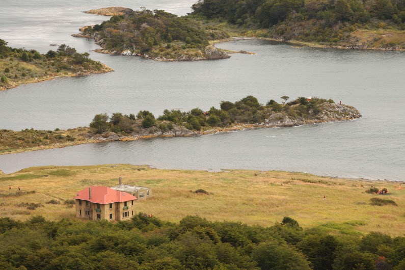
This is a view of Wulaia Bay and the abandoned meteorological station

This plaque adorns the entrance to the meteorologic station. Charles Darwin landed here in this bap on January 23, 1833. Many of our passengers were thrilled to learn of this and I in turn was thrilled at their joy in it.

Looking out from Wulaia Bay toward Isla Hoste

This is actually a pretty nice day for this part of the world. There was no rain and the visibility was decent.

Our ship, the Stella Australis can be seen within the bay

The next day we traveled to the northwest side of Tierra del Fuego Island. The mountains and glaciers were spectacular.

This is the Aguila Glacier in Agostini Fjord

This photo was taken from the ship but shows the beach we landed on and hiked across to the foot of the glacier

Coming ashore by Zodiac

The sun poked through for a moment while on the beach, highlighting the rugged nature of this island

This is most of the folks in our group at the glacier

Low tide in Agostini Sound

Glacier reflected

Fantastic rocks, formed when an oceanic slab was subducted beneath South America

Loading the Zodiac boats

The Stella Australis in the Straight of Magellan

Gull on Magdalena Island

A different gull on Magdalena Island

Full moon setting over the lighthouse on Magdalena Island

The Straight of Magellan was filled with ice during the last Ice Age and Magdalena Island was shaped a this time. Note the erratic boulder on the beach on the distance.

Colorful Punta Arenas along the Straight of Magellan

Another view of Punta Arenas. From here we would travel to Torres del Paine National Park. See my next posting for pictures of that landscape.

Thursday, March 19, 2015

The Southern Cone of South America

I am sorry I was not able to post pictures from my recent South America trip with Smithsonian Journey's. I experienced some computer problems and/or was in places with limited or no internet service (yes, places like that still exist). But here are a few now with more to follow.

This was taken from my room at the Las Yamanas Hotel on the shores of the Beagle Channel. The photo was taken in Ushuaia, Argentina but across the channel is Chile. The channel, named after the ship Charles Darwin sailed in these waters, is the international boundary. The hotel is named after the world's southernmost people, the Yamana's, now gone except for one surviving person. The mounds in the foreground mark the former site of a Yamana camp.

On the grounds they have reconstructed a Yamana hut as it might have looked along the shores of the channel in the 19th century. I gave a lecture about these people as we sailed on the Stella Australis in these waters.

Argentina will not let go of the Malvinas (Falkland) Islands and this full-time, gas-flame memorial pays tribute to those lost in the war in 1982.

Ushuaia has many old houses that line it's streets. The city is known as the southernmost in all the world.

A quiet bay within the boundaries of Tierra del Fuego National Park. Both Chile and Argentina place national parks on their international boundary, as a way to further discourage war-like flare-ups of old animosities. Their boundary disputes are legendary and they almost went to war in 1978 over the boundary. The parks then are used as deterrents to war and so far, it has worked.

The world's southernmost post office is located on a colorful pier in this bay.

These are the rocks of southern Tierra del Fuego. They are metamorphosed sediments deposited in an oceanic trench environment. This trench was quite similar to the modern Peruvian-Chile Trench and formed when South America first split from Africa, some 150 million years ago. The sediments were subducted and metamorphosed, then stretched out to the east to their current position.

This is the official end (or the beginning) of the Pan-American Highway in Tierra del Fuego National Park. One day I do want to travel this highway from Alaska to Argentina.

And then, it is time to board the Stella Australis for a four day cruise around the southern cone. I'll be posting pictures and stories for the next few days.

Monday, March 02, 2015

Buenos Aires, Argentina

Arrived safely in Argentina. Don't know why the world is so cruel? I leave town after 3 months at home and it snows like crazy on my lovely wife. Nary a flake while I was there to help her. Some would say it's a sign - stay home! I agree it's a sign. But it tells me - bring her with you!

Here are some views of Buenos Aires in the dog days of summer.

Buenos Aires is the capital of Argentina and serves as the New York, London, and Beijing of the country. But BA has trees. Sycamores to be exact. It is great to have been transported to the heart of summer time. That is the National Congress building in the distance, looking west on Calle Mayo.

Buenos Aires City Hall on the Plaza de Mayo. It has a very European feel to it.

 Everywhere are reminders of the Falklands or South Atlantic War (1982).

Veterans of the conflict have been camped here on the lawn for as long as I have been coming (since 1994). They seek more government restitution for their sacrifice and service.

This is the Pink House or the Presidential Palace. The current president Cristina Fernandez de Kirchner lives far out of the city and takes a helicopter to work here every morning (as other recent presidents have done). On March 1 when this photograph was taken, the National Congress began its yearly session and tradition has the President welcoming them back. She gave a four hour speech today. In the Legislative elections, the national quota law says that 33% of the candidates must be women. Voting is mandatory in the country for those between the ages of 18 and 70. 16 and 17 year olds have the option to vote.

 Did I mention it was summer time?

The La Boca district is colorful and artsy. Here is a wall mural of the family "Waiting for the Ship". La Boca is the site of the old harbor and here is where many immigrants settled, giving the district its Bohemian flair.

 More murals from La Boca

 Pope Francis from Buenos Aires greets visitors on Caminito street.

More wall art

Outdoor cafe

 Have your picture taken as a tango dancer. We saw an incredible tango show while here.

 Original cobblestone streets.

Enjoy my plastic human series. Pasta Man.

 Pizza man.
Beer stein man.

Real tango dancers luring us for lunch.

 I took this picture in 1998.

Same vantage in 2015.

 The Clock Tower in Retiro district - a gift from the British before the conflict.

BA is a city of trees, parks, and avenues. It is the second largest in South America (after Sao Paulo, Brazil) but seems much more livable than many other cities. It is one of my favorite to walk in.

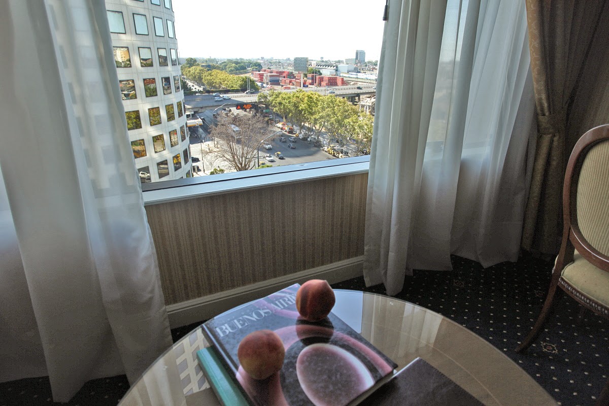
Fresh peaches in my hotel room.

And my $11 steak at lunch. They eat a lot of meat here.

On to Ushuaia and Patagonia next!