Wednesday, January 12, 2011

A Short Trip to Sonora Looking for Warmth

 Winter in the Western US has been downright brutal for us non-skiers and sun seekers who normally expect cool, clear days in the American Southwest. But extremely cold temperatures, numerous snow storms and a large number of cloudy gray days have made this a winter to forget. So I took the opportunity to head to Mexico to see if I could find the sun. My lovely wife, Helen, encouraged me to go knowing that she would have one happy boy upon his return. Here are a few pictures.

I traveled to the Gulf coast of Sonora and the little hamlet of Puerto Lobos. Near there we found a volcanic remnant that looked ripe for hiking to. Here we are wandering through the senita cactus towards the top.


Ocotillos still had a few red flowers from the October rains and the sky finally turned blue.

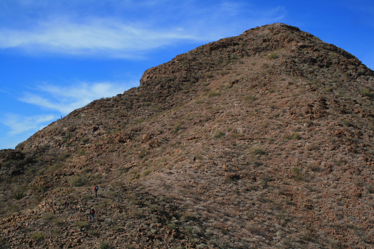
Can you spot the three hikers? (two in the lower left of the photo and the other in the center)

Elson stands on top of "El Diente de Tiburon" (the shark's tooth) with Puerto Lobos visible in the back.

Here is a closer look at the little fishing village.

And closer still with the lighthouse clearly visible here.

From the top of El Diente looking south along the Sonoran coast of the Gulf of California. This is very wild country and was the last part of the entire coastline to receive a highway in only the last year.

A group shot from atop the shark's tooth.

Elsewhere to the southeast are isolated ranges of uplifted granite. There are likely bighorn sheep in such ranges that hardly ever see people.

A senita cactus fell victim to the recent drought atop el diente. Puerto Lobos in the background.

This is a typical Sonoran winter day! Cactus, blue sky and wispy cirrus clouds splayed by the winds.

This is what we live for! Shimmering skies and not a breath of moisture.

Elson and Cindy have a rustic but comfortable abode in Lobos that would make any desert rat feel at home. We played cards at night and hiked in the day.

Sunset on the veranda, January 6, 2011.

My stay was too short and there is much more to explore. I will be back. 

A Lobos sunset.

On January 7 I left Lobos and headed north and west to Alta California. A new coastal highway was opened in the last year and I decided to take it. After driving 120 miles to Puerto Peñasco (Rocy Pt.) I turned on Highway 003 towards San Luis. This route passes through the Pinacate Bioreserve and there were some great interpretive signs.


The signs are state of the art and bilingual.


The geology interpretation was quite good. This one explains the 2 million year history of the Pinacate Volcanic Field. Cerro Pinacate can be seen in the distance.

After passing through the volcanic rocks, the new highway skirts the north edge of the gulf coast. This was formerly quite inaccessible country due to the aridity. In this photo you can see Colorado River sediments in the foreground with the mountains of Baja California in the background. 

This last photo shows the main street in El Golfo de Santa Clara, a small fishing village with a quaint charm. The tacos were muy excelente!

Saturday, January 01, 2011

Hike to Some Flagstaff Craters in the Snow

Flagstaff is surrounded by volcanic cones and craters. There are approximately 600 of them in the San Francisco Volcanic Field alone. I listened to my wife who encouraged me to forgo a day of writing (indoors) and  go out with three friends and hike a bit around some craters (outdoors). She's very smart that way. Here are the photographs from our hike.


Our intention was to hike to the top of SP Crater but the drifts of snow were too large to crash through. So we looked to the north and found this crater with access. Views of SP Crater would be had from here.

Once on the side of our chosen crater we could look to the west and see SP. That's it with the partial shadow on its northern flank. SP Crater was recently dated at about 4,000 years old, quite a bit younger than a previous date from the 1970's. A resistant carapace of agglutinate - red hot spatter that welds on impact - can be seen capping its crest. A lava flow spilled from its northern base.....

.....and this is the distal end of that same flow, which is about 4 miles in length.

The views everywhere were spectacular. Here is a shot to the south showing the San Francisco Peaks strato-volcano in the left distance and Colton Crater with a deep shadow on the right background. The snow seemed to bring out the color and textures of the various flows and ash beds.
Looking to the west northwest is Mesa Butte, which erupted along a fault line of the same name. The picture is small but to the right of Mesa Butte in the far background in Red Butte, located just south of Grand Canyon's South Rim. The air quality was spectacular this New Year's day.

The crater we walked had wonderful rocks and wind-swept Mormon tea shrubs.

Here you can see the pyroclasts that were ejected from the vent during the eruption. The textures on the pyroclasts was quite fresh and I suspect that this crater might be similar in age to SP Crater. The lichens that grew on the rocks was brilliant orange and lime green.

The snow accentuated angular lines and inviting shapes. Not that far removed from the winter solstice, the shadows were long providing much contrast.

The crater was linear in outline from north to south and I suspect that the eruptions began as a curtain of fire along a fissure. There seemed to be a few cirques on either side of the elongation and I wonder if a few cones coalesced to make this single landform. Look at the San Francisco Peaks in the background, heavy with snow in this La Niña winter.

Another view of Mesa Butte. I want to hike this famously named crater next.

There must have been 500 Babbitt-owned cows near the water tank on the way out to the crater. That was one cold night for these cows.

Friday, December 31, 2010

After the Storm

It was a good one! The last snow storm dropped 19 inches here at 255 E. Hutcheson Drive and now its really cold in Northern Arizona.  At noon today the sun is shining brightly and the temperature is 16 degrees! Here are some pictures of our house.

You may recall from a blog I posted here on January 23, 2010, of my pick-up truck buried in snow. We'll, just about 11 months later here it is again at the new house.


Our backyard is the south side and this will melt off first in the sunshine.


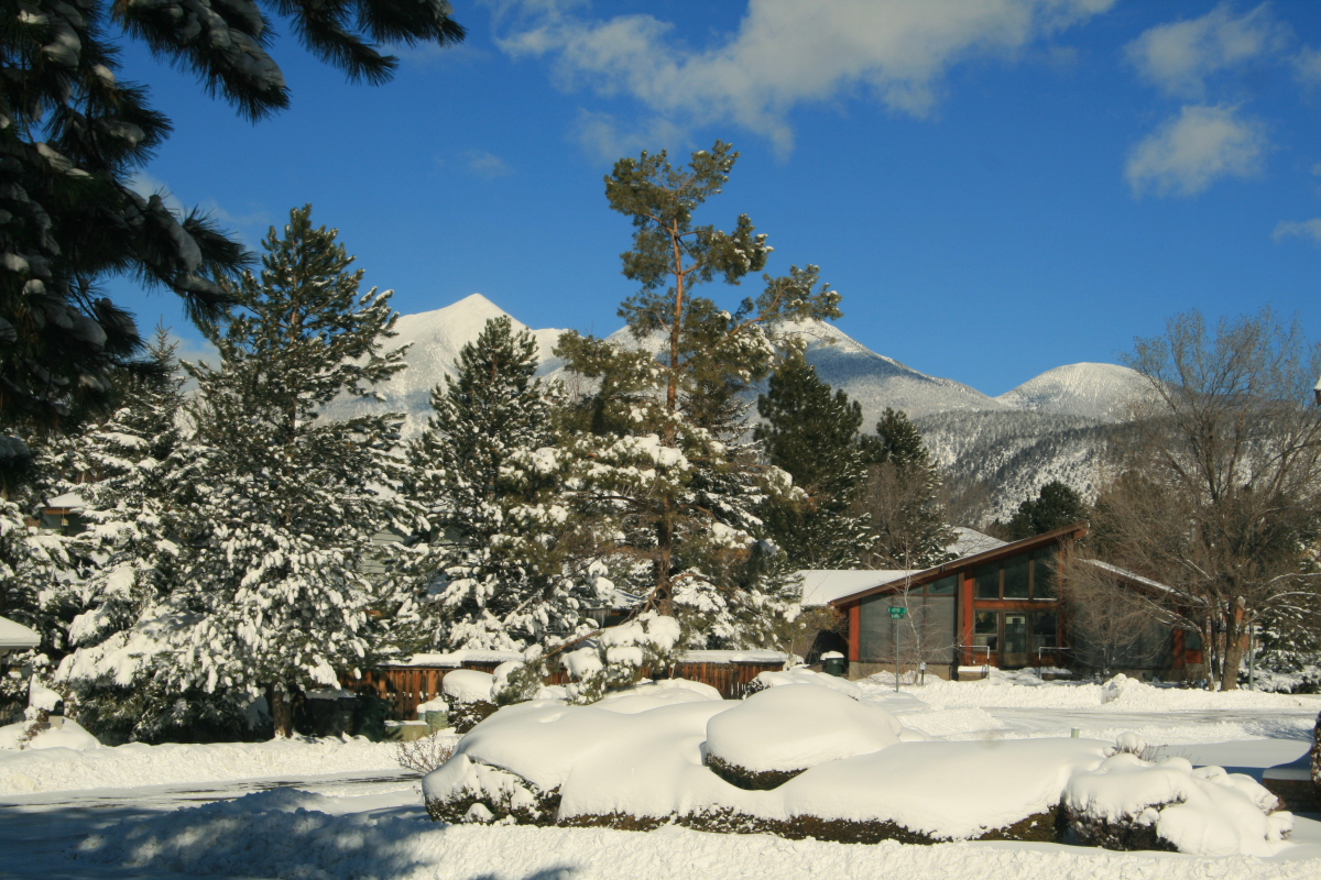
The view from our front yard looks toward the San Francisco Peaks.


The front of our house. Note the pile of snow from the road grader which is about 5 feet tall.

"Walking in a winter wonderland......"

Scenes like this really get me thinking of the summer days in Buenos Aires right now. It's probably close to 92 degrees and folks are sitting out on the grass drinking beverages in the sunshine. I really do not like snow.

Come on sun, melt it all away!

You might be able to see one tiny geranium flower in the window. It's nice and warm in our home.

The view out of our front window.

Friday, December 17, 2010

A "Ground Zero" Hike Into Meteor Crater, Arizona

The Barringer Meteor Crater in Arizona is Earth's best preserved extraterrestrial impact site and is located  35 miles east of Flagstaff. The understanding that this feature is extraterrestrial in origin is complicated by the fact that it lies adjacent to the San Francisco volcanic field, where over 600 volcanoes are strewn across the landscape. After seeing it for the first time in 1891, none other than the eminent 19th century geologist G.K. Gilbert concluded that the feature was formed by a volcanic steam blast through rock and groundwater. However, a self-taught geologist from Philadelphia, Daniel Barringer, was convinced that it was an impact site and set about to prove this through careful field study, borehole drilling, and persistence. Although he never lived to see his ideas widely accepted, the evidence is overwhelming now for an impact origin.

On Wednesday, December 15, I had the pleasure of hiking down to the floor of the crater with Barringer's grandson, Drew Barringer. I serve with Drew on the Board of Trustees of the Museum of Northern Arizona and when he offered to take myself and other geologists and friends on a hike to the floor of the crater, I jumped at the chance. It was certainly one of the top "bucket list" destinations for a geologist. (Note that liability and safety concerns render hiking to the floor of the crater off limits to the general public. For this hike, Drew wanted the chance to visit his childhood "playground" with a few friends who are also trained geologists. Do not attempt to hike to the bottom of Meteor Crater without prior permission).

Travelers heading east on Interstate 40 from Flagstaff can see the upturned edges and ejecta blankets of rock that outline the crater (background). Prior to its interpretation as the site of an impact, the low hills were locally known as Coon Mountain or the Franklin Hills. Most travelers have no idea these low hills are Meteor Crater or that a 550-foot deep hole exists within them. 

Here is Drew Barringer besides the largest meteorite ever found from this impact. It is on display within the museum present on site. Incredibly, this stone weighs over 1,400 lbs. and was discovered about 5 miles from the impact! Look at how the flash from my camera is superimposed on the aerial image of the crater behind Drew. It makes it looks like the bolide is on its way into the ground.

Drew leads us west along the Rim Trail, walking on a blanket of ejecta material.

A view to the west along the Rim Trail showing the overturned ejecta blanket that rests on top of Meteor Crater. The light colored material on top is the Kaibab Limestone which is overturned in this position. It rest on reddish Moenkopi formation of which about half is overturned as well. Bedded Kaibab Limestone, which is locally brecciated from the impact, makes up the tilted strata below. 

A view of the south (shadowed) and west (sunlit) crater walls and floor from the rim. The crater is about 550 feet deep and is deeper than the surrounding plain outside the crater. Studies indicate that between 100 and 150 feet of post-impact material has washed into the enclosed crater.See the following image to know something of the size of the bolide that created the crater.

Same photo as above with a red dot indicating the interpreted size of the bolide, about 150 feet in diameter. This image shows how small of an object it takes to create such a large landform. The bolide hit the earth at between 26,000 and 32,000 miles per hour. The kinetic energy was enormous. The crater is about 4,000 feet in diameter and 2.5 miles in circumference.
Image taken from the publication, "Guidebook to the Geology of the Barringer Meterorite Crater, Arizona" by David Kring, 2007. This image has the postulated Ice Age vegetative zones superimposed over the modern landscape (note the Spruce Forest Zone on the left which no longer exists in this part of Arizona). The red circle denotes the 12-mile diameter scorch zone where everything was burned upon impact. The yellow ring denotes the 20-mile wide zone where all large animals were killed or wounded. And the blue ring denotes the 40-mile wide zone of hurricane force winds away from the blast.

Starting down the trail into the crater. The ruins of the original visitor center building can be seen in the background.

View of the ejecta blanket from inside the lip of the crater. Remember that the white Kaibab Limestone lies stratigraphically below the red Moenkopi Formation. But here, blocks of white Kaibab lie over the Moenkopi as ejecta was forcefully thrown from the impact site.

As we approached the floor of the crater, I was taken by these eroded blocks of Kaibab Limestone that have dislodged from the walls of the crater and come tumbling down the slopes.

Our group approaching the borehole site on the floor of the crater. 

The borehole site is fenced for safety and on it is a cut-out of an astronaut and a real American flag.

A piece of the ruined equipment near the borehole.

Giant levers on the wench serve as artful beacons on the floor of Meteor Crater.

Author Rose Houk and geologist Michael Collier pose in front of the old boiler on the floor of the crater. We did not find any coal debris around the boiler and we were stumped as to how the boiler could have been fired.

As we made our way uphill along the steep trail, the clouds of an oncoming winter storm framed the crater walls. Thankfully, the storm held off until our return to the visitor center.

Not everything we saw related to the impact which is thought to have occurred about 50,000 years ago. Here in beds of the Moenkopi Formation are the burrowing remains of some Triassic critter (right of the lends cap) and in the block above this are impression of rip-up clasts within sandstone. To learn more about rip-up clasts, see my blog from a Henry Mountains field trip here.

Near the top of the trail are many old artifacts from days gone by. This looks to be some kind of contraption for use with mules that brought supplies to the crater floor. 

Scott Harger inspects a huge block of ejected Coconino Sandstone on the rim of Meteor Crater. This specimen retains original Permian-age cross-bedding within it but was thrown out of the impact site. It is most likely overturned in this position.

This is a close-up view of the same block, which can be seen to be brecciated but still retaining original cross-bedding.

Looking into the ruins of the old visitor center on the rim of the crater.

Debris is strewn about the ruin site and documents a time long gone in northern Arizona.


Our group returning back to the museum area ans walking on top of a slab of Coconino Sandstone ejecta.

 Here is a normal view of the Coconino Sandstone ejecta blanket on Meteor Crater's south rim. See the next photo for a clearer view of it.

Enhanced view of the Coconino Sandstone ejecta blanket. The rocks outside the colored area are Kaibab Limestone ejecta which is more golden in color.

A view northwest to the oncoming storm. The photograph was taken on the crest of the ejecta blanket and looks down about 120 feet onto the surrounding landscape. Thanks to Drew Barringer for allowing us geologists to experience this world-class landform from its central heart.

Tuesday, December 07, 2010

More on the Cardenas Party

My most recent blog post was written with the intent to inspire thoughtful discussion. There has been a multitude of discussion about it with some at Grand Canyon National Park. I admit up front that I am more accepting of newer ideas than most others. Some people prefer to initially react in the negative when new ideas are presented - until those ideas can be proven to be right. I tend to accept things more readily because I believe that it can be a faster way to the truth, whatever the truth actually is. In my field of Grand Canyon's geologic evolution, the skeptics hold all of the cards and you know the status of where we are with that.

Anyway, I agree that it is more likely that this inscription was made by someone from Bass's era (hired help or tourist). But Dr. Kenny's hypothesis rightfully should spur a new round of thought on how exactly did the Cardenas party spent their time at Grand Canyon? "Three days on this bank looking for a passage down to the river..." is a powerful description of men looking for a route down into the canyon. To me, the Desert View to Moran Pt. area is not conducive for this, especially to flat-landers like the Spanish. Whether the inscription itself is from the Cardenas party or not, I find it plausible that the Spanish would meander along the rim and attempt a descent as soon as the Esplanade came into view - ironically right here where the Grand Scenic Divide first comes into view as one approaches from the east.

I was told by park staff last night that the esteemed archaeologist Robert Euler visited the site in the early 1980's and proposed that the inscription was left by some Bass era person. However, since the proposed location of the "first view" was first offered in the late 19th or early 20th century, our knowledge of how people interact with landscapes has grown exponentially. A re-evaluation of the "norm" seems to be warranted.