Sunday, January 29, 2017

Roaming Through the Yucatan 39 Years On

In 1977-78, I undertook a fantastic three month journey of discovery to Mexico, Belize and Guatemala. There was no schedule per se, just a finite amount of money ($350 if I recall) and some vague stories of Mayan ruins, tropical jungles, and beaches. After a whirlwind of a year in 2016 with five Grand Canyon river trips, a Private Jet trip to South America, and three Smithsonian Journeys trips, I was ready for a little get-away. So the day after Christmas, Helen and I attempted to visit many of the places from that epic 1970's trip. This posting covers the Yucatan portion of the trip. Two post to follow will cover Belize and Guatemala. Not much geology in this posting but there will be in Guatemala.

Our first stop was Cancun but only to arrive at the airport. We hopped on a ferry and went directly to Isla Mujeres. I had missed this destination in my 1977 trip and wanted to see what it was all about. I'm afraid I was 39 years too late. Here Helen stands in front of the sign facing the Caribbean Sea.

This is the northern and windward side where the waves crash into the island.

It was a nice place but definitely has been discovered.

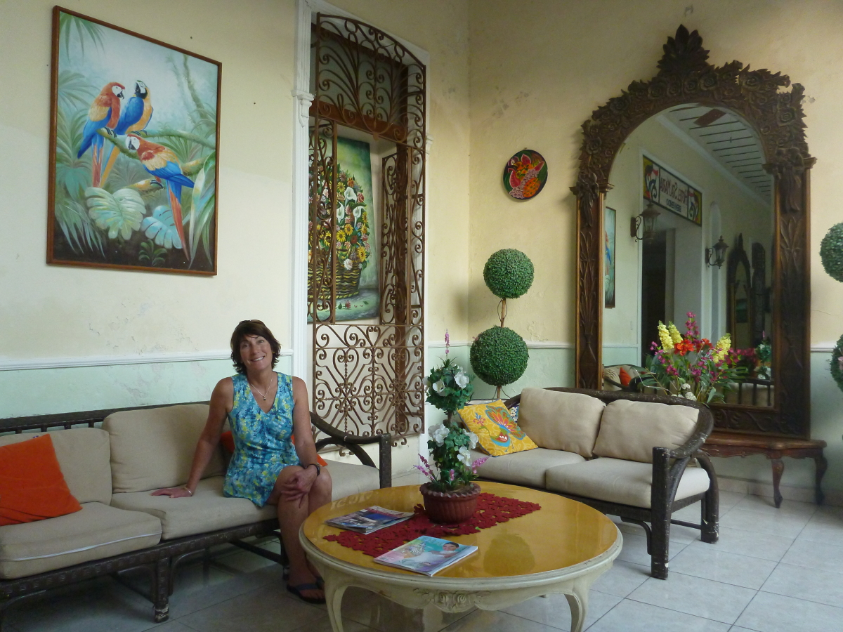
Next stop was the colonial city of Merida, capital of the state of Yucatan. Mexico is a great bargain with the exchange rate right now and nice hotels like this were had for about $50 per night for two people.

Many of the colonial buildings are undergoing renovation. We saw a few modern buildings among the older ones - what a shame. But there is enough to see here to delight the traveler.

This was Helen's first visit to a Central American market and it was a good one! So many colorful items for sale and the vendor aisles are very lively.

These are habanero peppers which we saw everywhere for sale and added to many dishes here.

This is the southern start to the Paseo de Montejo, an elegant tree-lined boulevard that was developed during the henequen boom years in the late 19th century. Many of the former mansions have been turned into museums, offices, restaurants and nightclubs.

This is one of the old homes that is now a museum to the henequen boom in Merida.

We visited the Mayan Museum on the north end of town. It was far enough away that we didn't want to walk. So we took a public bus and got lost in the suburbs. We did however, find our way back to the Museum.

These chairs were developed in Merida and were meant to keep young lovers far enough apart to preclude hanky-panky while they could still gaze into each others eyes. These two are found in the main square near the church.

Next stop was the Mayan site of Chichen-Itza. This is a view of the Observatory from the doorway at the Hotel Mayaland outside the archaeological reserve.

We took a guided tour early the next morning as we stayed at the Hotel Villas Archaeologicas, just outside the entrance to the site. We were inside the reserve hours before the hordes arrived from Merida and Cancun.

This is the largest ball court in all of Meso-America. I was proud to tell my guide that we live near the northern-most ball court known, located at Wupatki National Monument just outside Flagstaff. Having never traveled much, he seemed to not be impressed.

Carvings of skulls on a wall in Chichen-Itza.

To say that things have changed in these 39 years is an understatement in the extreme. In 1977, the highway ran through the site and was located just to the right of El Castillo in this view. At that time, the admission price was 5 pesos or 25 American cents. (I did not remember it but I Googled, "Admission price, Chichen-Itza ruins, 1977" and found this 1977 travel article in the Chicago Tribune mentioning it - you've got to admit it is an amazing future we live in these days!).  We paid 232 pesos per person this time (much devalued since 1977) or $11.60. Back then, we could climb El Castillo but is now off-limits since January 8, 2006 when a woman fell to her death while descending the pyramid.

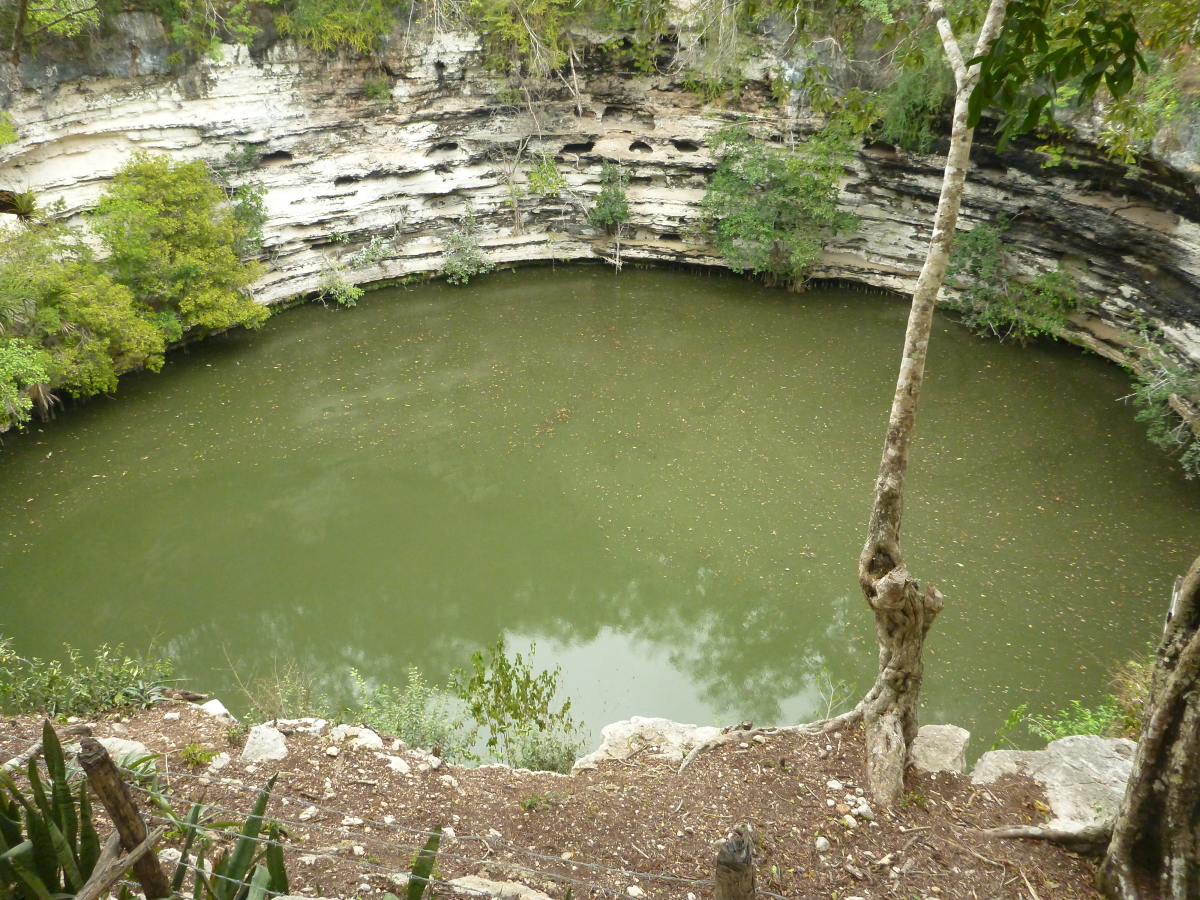
This is the sinkhole or Sacred Cenote (Chen Ku) located to the north of the ruin. The Maya would throw sacrifices, even human ones, into the cenote to appeased the god Chaac.

In the center of the photo is the famous Chaac Mool of Chichen-Itza. In 1977, one could climb the steps and gaze at the site where human hearts were placed as soon as they were taken out of a victims chest. I remember staring at the Chaac Mool then and pondering its importance. I think I even sat on it then. A great description of the Chaac Mool can be read here.

In the south portion of the archaeological site are some wonderfully preserved glyphs.

This is called the Nunnery and much stucco is preserved on its façade.

Later in the morning, the sun came out to illuminate El Castillo.

It is a marvelous piece of architecture and is the second pyramid at this location. The other one is inside El Castillo! Stucco with colored paint would have made this a most impressive building during its occupation around 600 AD.

One of the many serpents with its tongue sticking out. We loved out time here but would highly recommend visiting in the early morning before the rush of people make it unbearable - 8,000 people on some days.

We spent New Years Eve in the colonial city of Valladolid. In 1977, our bus just passed by the church here and it left such an impression on me that I made a mental note to come back. It wasn't exactly how I had remembered it but here we can see a cresent moon and the planet Venus on the far right.

Street scene in Valladolid.

We got around on various kinds of First Class buses in the Yucatan. The three hour ride from Cancun to Merida was about $20 and included a bottle of chilled water. They has gender specific bathrooms and fully reclining seats.

Our last stop in the Yucatan Peninsula was the Mayan site of Tulum, located right on the coast of the Caribbean.

This is one of the interpretive signs found inside the site. They were very well rendered and this shows the site as it would have looked during its period of occupation. There were Maya living here when the Spanish sighted it in 1519 arriving from Cuba, thirsty for gold.

The architecture at Tulum displays this angled look.

This is the tallest building at the site and is called El Castillo (The Castle).

An impressive view can be had here looking out to the Caribbean.

An iguana lounges on a wall in the winter sun.

A final look at Tulum in late afternoon light. This is another site much changed since my last visit.

Wednesday, January 25, 2017

Zion National Park - Land of Landslides


Rockfall from the January 13, 2017 event on Zion National Park's Scenic Road
Earthly- Musings is back from vacation and I will be posting photos and stories from a fantastic trip to the Yucatan, Belize and Guatemala soon.

While the blog was on vacation, Zion National Park in southwest Utah experienced some amazing rock failures. These events were due to over saturation of soils from recent rains and freeze/thaw conditions. However, the bedrock geology inside the Park and surrounding areas lends itself as well to these types of catastrophic events. The main trigger is the presence of hard-over-soft strata, whereby cliff-forming rock units such as the Shinarump Conglomerate or the Navajo Sandstone, lie above very soft, easily eroded rock units like the Petrified Forest Member of the Chinle Formation and the Kayenta Formation (respectively).

Hard-over-soft couplets that can lead to undercutting and rock failure (from Kansas Landscapes, Frank Wilson, 1978)
When soft units erode, they undercut harder units above them and rock failures occur. (Recall a massive rockfall that happened just outside the Zion Park boundary in Springdale Utah in December 2013. In this event, two people were crushed to death in their home. The event was triggered when huge blocks of Shinarump Conglomerate were undercut and fell on the home. See the E-M's post for this event here and another newspaper article about the couple killed here).

This year, Zion closed two trails on January 10 when rockfalls and river erosion affected them. They were the Emerald Pools Trail and the Sand Bench Trail. See the official Park announcement here. Then three days later on January 13, 200 tons of rock in the Kayenta Formation fell on the Scenic Road north of the Zion Canyon Lodge. See the official announcement here. The Scenic Road was reopened a few days later with the official announcement visible here. Note from the photo at the top of the page that interbedded sandstone and mudstone in the Kayenta Fm. were involved in the slippage.

Just last year, researchers announced new data on the massive Sentinel landslide that occurred in the canyon some 4,800 years ago. An article in Earth magazine appeared in October, 2016 and can be read here. GSA Today published an extensive article on the work in their June, 2016 issue and can be read here.

Saturday, December 24, 2016

Earthly-Musings on Vacation for Five Weeks

Earthly-Musings will be taking short break but I will be back refreshed and ready to go by February 2017. Have a great Holiday and a wonderful 2017! Here are a few photos from this years trips. Cheers!

December 27, 2015 Near Palmer Station Antarctica

Winter hike on the South Kaibab Trail

Death Valley from Dante's View, February, 2016

Cross-section of columnar basalt, Iceland September, 2017

 Misty day at Machu Picchu Ruins, Peru, February, 2016

 Classic cars in Habana Cuba, October 2016

 Honanki Ruins, Sedona Arizona, August 2016

 Saddle Canyon waterfall, Grand Canyon, September 2016

Iguaçu Falls from the Brazilian side, October 2016

Fisher Towers near Moab Utah, April, 2016 MNA Ventures trip

Sunday, December 11, 2016

A New Exposed Trackway on the Bright Angel Trail in Grand Canyon

Artists rendition of how the new trackway was created from Figure 8 in the paper. Art by Emily Waldman. 

SECOND ADDENDUM 

AUGUST 20, 2020: Today I received from Professor Steve Rowland at UNLV notice of his publication on this amazing trackway along the Bright Angel Trail in Grand Canyon. When I first came upon this newly fallen boulder in December, 2016, I knew it was something special just by looking at the detail encased on its surface. However, the authors have studied the entire trackway and setting in detail and conclude that: 1) these are the oldest tetrapod trackways in the Grand Canyon; 2) two sets of tracks are present on the dislodged block and are separated in time by only hours or days; 3) a light dusting of new sand (windblown) separates the two sets; and 4) the animals walked up a dune slope that was at an angle of 20° and that the animals walked at a speed of about one foot per three seconds. The trackways resemble those of the ichnofauna (trace fossil) Chelichnus, a common form found in younger layers above such as the Coconino Sandstone.

This paper is Open Access and can be downloaded here.

Citation: Rowland SM, Caputo MV, Jensen ZA (2020) Early adaptation to eolian sand dunes by basal amniotes is documented in two Pennsylvanian Grand Canyon trackways. PLoS ONE 15(8): e0237636. https://doi.org/10.1371/ journal.pone.0237636

Editor: David M. Lovelace, University of Wisconsin Madison, UNITED STATES

Received: October 21, 2019 Accepted: July 30, 2020 Published: August 19, 2020

Copyright: © 2020 Rowland et al. This is an open access article distributed under the terms of the Creative Commons Attribution License, which permits unrestricted use, distribution, and reproduction in any medium, provided the original author and source are credited.

-----------------------------------------------


Here is a paleogeographic map of the Southwest during Manakacha Formation time. Courtesy of Ron Blakey, at deeptimemaps.com.


ADDENDUM

February 12, 2018: Since I made this post, Professor Stephen Rowland at UNLV has made a closer examination of the trackway and has determined that this was a single animal walking sideways with the toes pointing in one direction while the trend of the overall trackway is about 40 degrees clockwise from the direction the toes are pointing. He thinks the animal may have been fighting against a current, presumably wind, that was pushing it to the right as it struggled to move forward. 

-----------------------------------------------

ORIGINAL POST 

December 11, 2016: 

Last month Helen and I got to visit Indian Garden located 4.5 miles down the Bright Angel Trail in Grand Canyon. Down in the Pennsylvanian Supai Formation, about 2.5 miles in, we came across a new exposure of a great reptile trackway. I took a few pictures and share them here.

During the summer monsoon, a number rocks were dislodged from the cliff on the left and rolled down onto the trail. Since then, the trail crew has cleared the rocks from the tread and placed them alongside the trail. This is a place where parallel joints are evident in the sandstone. These joints are parallel to the Bright Angel Fault and slivers of rock are always falling at this location.

Blasting was needed to move the rocks off the trail and it is unknown to me if the new trackway was exposed when the rocks fell off the nearby cliff or from subsequent blasting. What is known is that the trail crew was aware of the trackway and placed this boulder in perfect alignment to admire it.

Being closer to the trackway shows some well preserved claw marks in the individual prints (bottom). This must have been a lumbering type of reptile with each track closely spaced but the individual prints about 3 to 4 inches wide.

More claw marks. Two ichnofauna's are described from the Supai - Limnopus and Batrachichnus. A web search did not specify which these might belong to. Another likely candidate for these is Eryops and fossil skeletons that are Pennsylvanian in age have been found in nearby New Mexico. A description of this animal can be found here.

An example of Eryops reconstructed from fossil bones.

A fossil specimen of Eryops on display at the National Museum (Smithsonian, Washington D.C.)

It is possible that this is a set of two individuals walking one after the other. Most descriptions of reptiles from this time period suggest that the back and front tracks are nearly on top of each other and there are four lines of tracks here.

The block is big enough that it should remain in place for a long time.

Thanks to the Grand Canyon trail crew for making this specimen so readily observable.