In October of this year, I completed a 17-day rafting trip on the Colorado River in Grand Canyon. We experienced perfect weather on this trip; the few times there was a breeze it was always blowing in the downstream direction. I worked as a volunteer as part of a vegetation survey, linked to a larger and longer survey concerning sand bars and beaches along the Colorado River in Grand Canyon. Scrambling through the dense riverside vegetation was very tough work and I found the going quite tough. Fortunately, I was working alongside Dr. Ryan Crow of the US Geological Survey who was much more agile through the brush than I. We both served as volunteers on this trip in order to travel together and field check our upcoming "Geologic Guide to the Colorado River in Grand Canyon" (working title). The field work was a great success!
This is mostly a photo essay of our trip and I provide only short captions where desired. Enjoy the trip!

 Which way does the river go? The answer will be in the geologic guide but the answer is, left. A barbed tributary (a stream that enters the master trunk against its downstream direction) called Soap Creek comes in on the right.
 Reptile trackway on an upright boulder on RL (River Left) at RM (River Mile) 15.0.
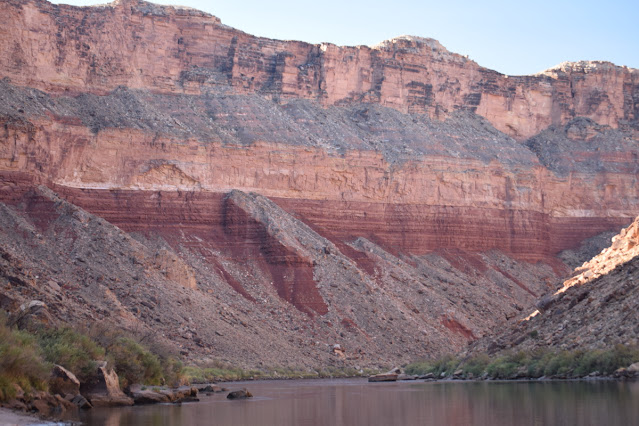
 Sheer Redwall Limestone cliff near RM 27.0
 Stanton Cave on RR at RM 32.0. This is a geologic gem of a cave! Fossils of Harrington's mountain goat, teratorn (large carnivorous birds), river otter, horse, and camelid have been recovered from it. Over 80 split twig figurines were found as well.
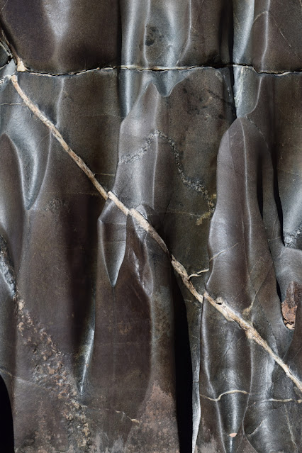
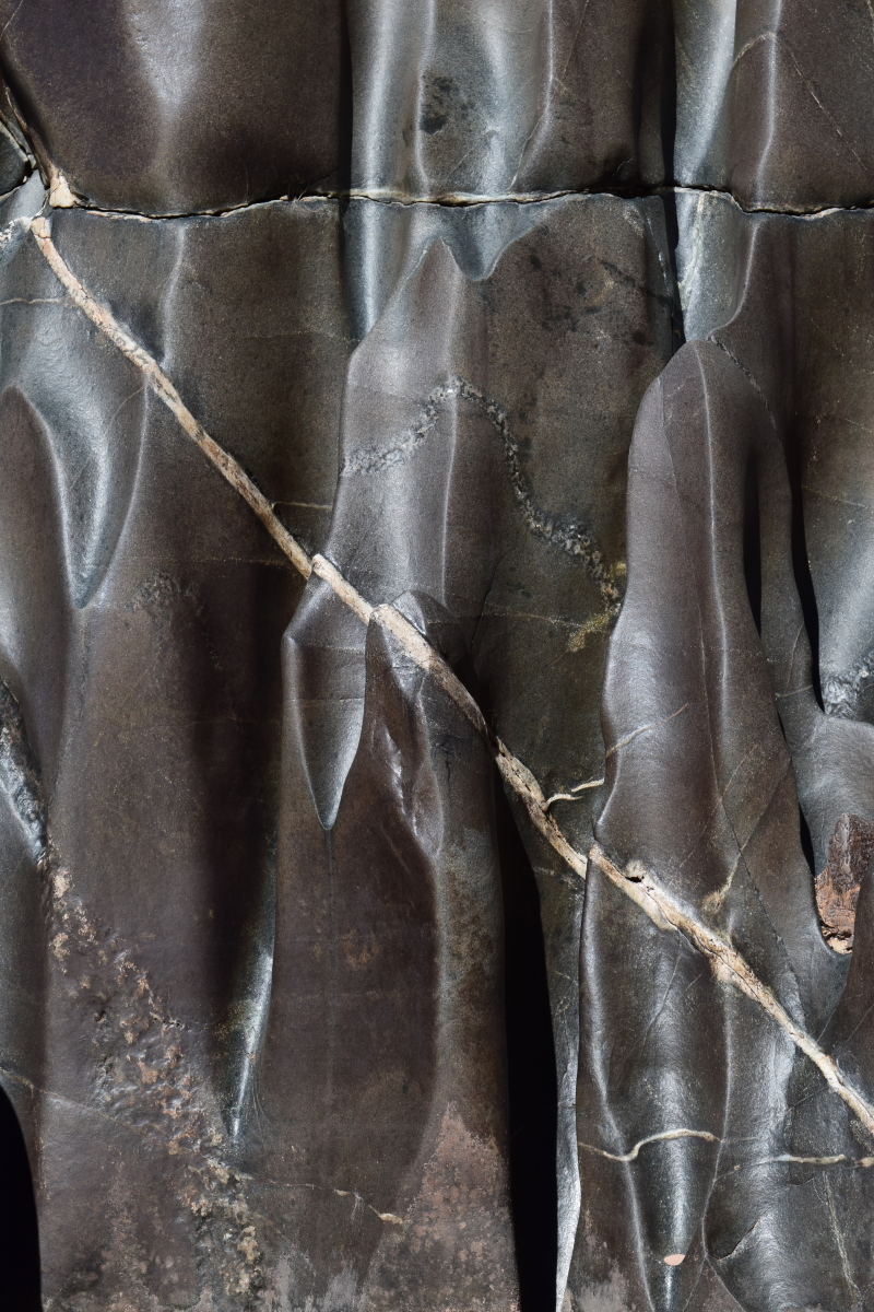
 Chemical weathering on a Redwall boulder in camp at Nautiloid Canyon.
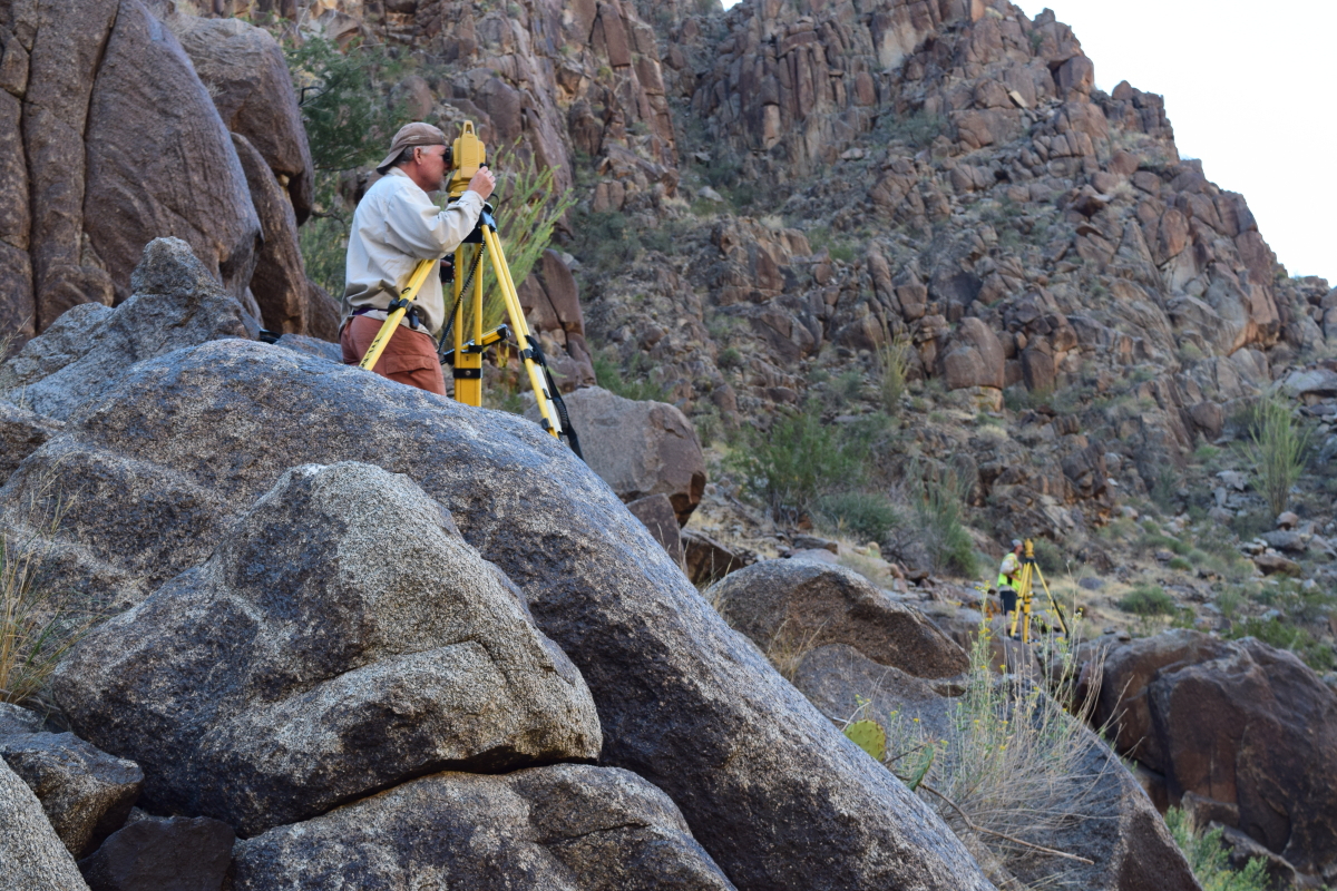
 Part of the sandbar survey with Namdor's (Rodman spelled backwards).
 Obvious contact of the newly described and blocky Frenchman Mountain Dolostone (above) underlain by the more thinly bedded Muav Limestone (below). Photo on RL near RM 36.8.
 Boat in repose at Buck Farm Canyon.

 Dr. Ryan Crow points out the rocks.
 View downstream to Nankoweap Mesa, where landslide deposits rest on top.
 Colorful Bright Angel Shale.
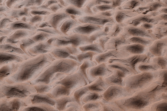 Ripple marks in the wet sand.
 Smooth sailing in Marble Canyon.
 Grey's Castle on RL at RM 55.5 is composed mostly of Muav Limestone.
 Travertine buttress adjacent to the Bright Angel Shale below Kwagunt Rapid. Then travertine is dated between about 100,000 and 400,000 year old.
 It was actually hot some days.
 Exposed ripple marks along the Colorado River at Carbon Creek.
 Looking upstream at sunset from the beach at Basalt Canyon.
 Looking downstream at sunset from the beach at Basalt Canyon.
 The Colorado River meanders below Comanche Point.
 Two fresh rockfalls can be seen beneath the Palisades of the Desert.
 The dike at Hance Rapid runs through the red Hakatai Shale.

 There were 8 boats in our entourage.
 A tamarisk tree grows out of a bedrock knob in the river near Salt Creek.
 Pegmatite within the Zoroaster Granite at Schist Camp.
 Vishnu Schist foliation near Emerald Rapid.
 Contrails turning to cirrus clouds on October 9, 2020.
 The Monument fold at RM 116.3.
 Fluting carved by the river within the Elves Chasm Gneiss, the oldest rock unit in the canyon at 1,840 Ma.
 Two rusty brown dolostone beds within the Bright Angel Shale in Conquistador Aisle. These beds make excellent stratigraphic markers in the canyon when it grades westward into the "limestone wilderness."
 Curious extensional features in the Middle Granite Gorge.
 One of my favorite features in the canyon is the onlap of the Tapeats Sandstone (brown cliff, lower left) onto the uplifted, tilted and eroded edge of the Shinumo Sandstone (same colored cliff disappearing behind the right hand shadows). Note the different bedding angles between the two rock units.
 I sat and watched this dragonfly for 30 minutes as it hunted in the mouth of Matkatamiba Canyon.
 A small paleovalley in the Redwall is filled with the Surprise Canyon Formation at Fern Glen Canyon.
 The ever-perplexing Red Slide at RM 175.3 is likely formed from a series of rock falls from cliff failures above. Some sections of the debris are rich in red Supai boulders, others in gray Redwall boulders. Coarser material is often on top of finer material.
 Vulcan's Anvil at RM 178.3 is a volcanic vent within the river! The long Black Ledge lava flow (86 miles long) may have issued from this vent. The plug is dated at 530,000 + 30,000 years.
 At RM 212.6, black granodiorite forms a small bedrock gorge along the river.
 An upstream view of scoured potholes in Tapeats bedrock and limestone boulders at RM 212.9.
 Joe Hazel "guns" a beach upstream from Diamond Creek. This was the 45th and last beach surveyed on this trip.


Matt Kaplinski rows our boat through the Inner Gorge. Dr. Ryan Crow sits on the tube (right). Photo by Geoff Gourley.

Dissected talus aprons in the Hermit Formation.


Gunner stands opposite the Namdors to take location readings of the sandbars.


From Zoroaster beach looking up to the Great Unconformity, where the Tapeats Sandstone is thinning across (left to right) a crystalline rock highland.


On October 6, 2020, I marked my 45th anniversary as a member of the Grand Canyon community. On October 6, 1975, I started down the Bright Angel Trail as a volunteer with the National Park Service. What a life the canyon has given me!
For the first time ever, I was the oldest person on the trip. That awareness came to me about halfway through the trip. What an article of note!
Photo by Geoff Gourley.
Nice write-up Wayne! It was a pleasure to reconnect and share in the adventures of Grand Canyon. It's truly a privilege to do science down there.
ReplyDeleteGlad you got to celebrate your 45th IN the Canyon! Look forward to the new book, now that you've checked our your data. Say hi to Geoff for us.
ReplyDeletehi Wayne - great trip, great photos, thx! Your picture: "The dike at Hance Rapid runs through the red Hakatai Shale" shows something that is hinted at in other photos I've seen. Does the dike morph into a sill at the top of the shale at the contact with the overlying formation? Sure seems to flatten out parallel to the bedding there?
ReplyDeleteThx!, Paul
Yes - the dike does seem to be flattening out as it trends upwards through the red shale. But as the whole section is dipping east, it goes underground in the upstream direction so that we cannot tell precisely. I have seen sills elsewhere in the canyon in these intrusions. Along Bright Angel Creek just south of Cottonwood Camp, a sill detours to a lower bed, then reverses and goes back to the original bed. Fascinating!
ReplyDeleteYes, at this spot it turns from the contact between the Shinumo and moves upward through the Shinumo... just to the right and upstream of this photo.
DeleteIs Larry Stevens still around?
ReplyDeleteYes, Larry is the Director of the Springs Stewardship Institute and the Curator of Ecology: https://musnaz.org/research/ecology-and-conservation/.
DeleteMust have been a super fun and interesting trip! Looking forward to the guide you mention! On your Frenchman call, what was the last member of the Muav beneath this point? Another point... the 'rusty brown' railroad tracks so prominent here are different members than the two 'rusty browns' in western Grand Canyon!
ReplyDeleteLaurie - Thank you! The uppermost member of the Muav Ls. lies just below the newly described Frenchman Mt. Dolostone. That is the Havasu Member. Regarding the rusty brown dolomites, yes, those appear first in eastern exposures as dolostone, then thicken to the west turning to limestone. New rusty brown dolostone present themselves in the same manner further west along the river corridor. We are aware of the different horizons where they appear within the shale and will make sure that these are clearly explained in the final copy. Thank you for bringing this up with us.
ReplyDeleteThank you for this and the other efforts to help everyone understand and appreciate the Canyon a bit more. My first trip was working with Bob Webb on a research trip as part of the 1996 experimental flood. Can't wait to go again.
ReplyDeleteWayne, thanks for sharing your great photos and geology descriptions, and CONGRATS on 45 years in the Canyon! In the Western canyon, seen from the river approaching Columbine Falls and below, are the rusty brown Frenchman Mountain Dolostone layers also the layer above the Muav Ls, or are they topping the Bright Angel Shale in that area?
ReplyDeleteUnknown - Near Columbine Falls (or Emery Falls if you are a fan of Merle Emery), there are additional rusty brown dolostone's that have developed within the Bright Angel Shale. These would be in addition to the two rusty brown dolostone's that are first encountered in Conquistador Aisle. The Frenchman Mountain Dolostone is gray in color and looks for the most part just like the Muav Limestone. I they were "my rocks", I would have the Frenchman Mountain Dolostone merely as a member of the Muav. Cheers - WR
ReplyDelete