


... when the earthquake hit at 11:56 AM local time, the hillside on the right let loose and completely covered the village in debris. Such is the power of thrust-related earthquakes. In all, nearly 9000 people lost their lives in this quake and another 23,000 were injured. It is estimated that 3.5 million people were left homeless.
 Our tour began with a walk to the Buddhist temple called Boudhanath. This has been a holy place since about the sixth century. The 2015 quake badly damaged the spire which had to be removed from the top and rebuilt. It reopened in 2016.
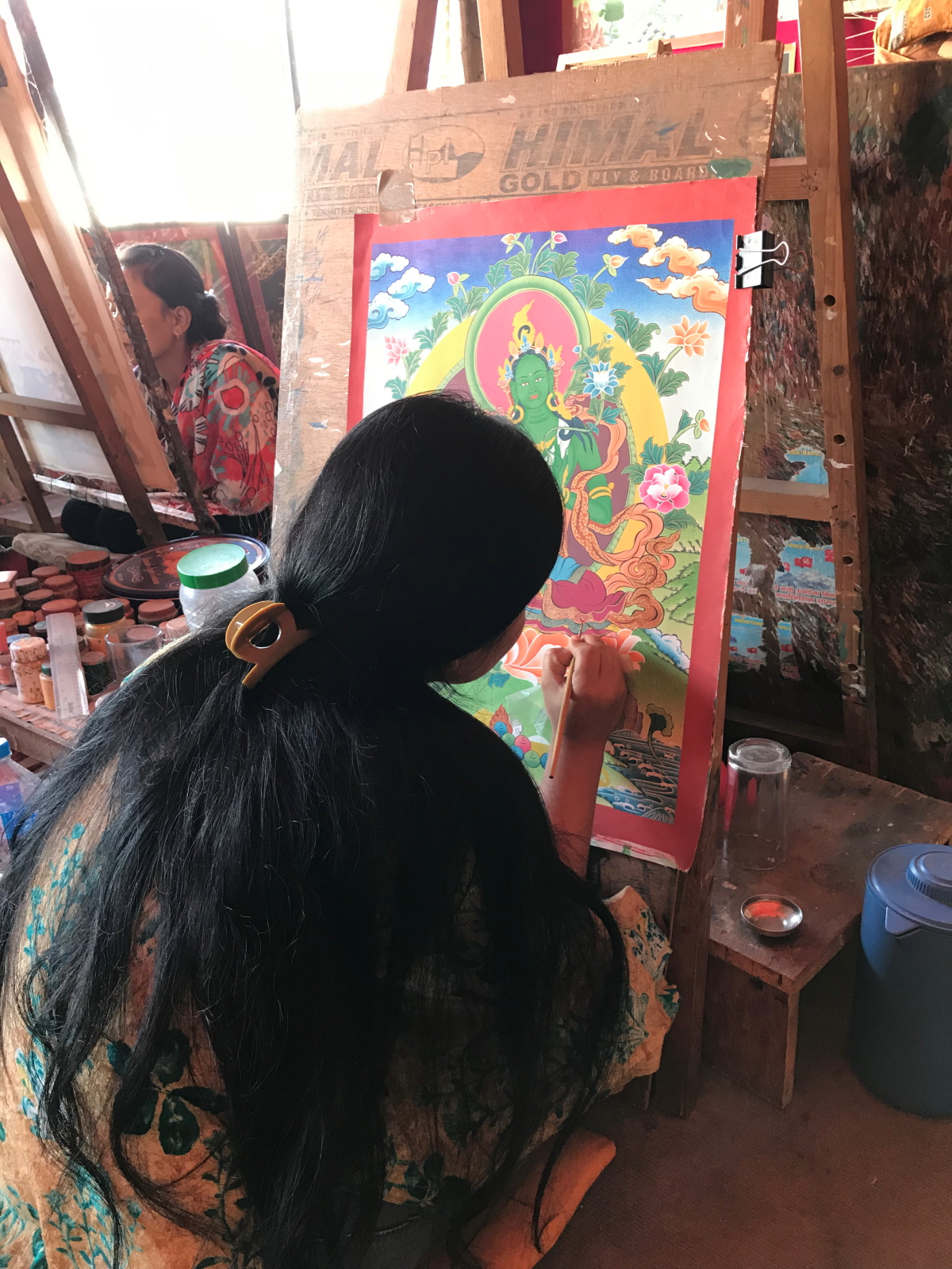
 Thankas are colorful Buddhist paintings that depict the teachings of Buddha. This girl was intently working on her painting in a shop we visited near Boudhanath.
 A New World food crop, the chili pepper, is widely used in Nepal and Bhutan and these colorful pods were for sale on a street market.
 When the trip is ended on October 25, I will have been in Nepal and Bhutan for 14 days and in all of that time, every single sidewalk I will have seen is paved in this silvery, muscovite schist. Note the brown garnets as emergent knobs in this example. Garnet can be used to determine the depth of metamorphism as the various species form under specific temperatures and pressures. These rocks were deformed in the collision between India and Asia and began life as layers of sandstone or shale that accumulated in the Proto-Tethys Sea, a precursor to the Mesozoic Tethys Sea.
 We visited the Durbar Square in Lalitpur which also received considerable damage in the 2015 quake. The temple complex was first founded in the third century BCE on top of a small hill south of the Bagmati River. The hill is an eroded remnant from an ancient lake that once filled the Kathmandu Valley between 2.5 and 0.015 Ma. Most of what you see here is reconstructed after the quake.
 Panorama of the main thoroughfare in Lalitpur.
 A hidden courtyard where we enjoyed lunch.
 The entrance to this courtyard has been rebuilt since 2015 using steel reinforcements that match the ancient styles.
 Sculpture of a water buffalo in Lalitpur cut into gneiss.
 Finally, we visited the Durbar Square in Kathmandu proper, where the reconstruction is still ongoing.
 Buildings here are still being held up with retaining posts. The walls are constructed with adobe blocks.
 Close-up of the protective posts.
 This is a red brick monument where the two girls enjoy the appearance of safety from the retaining posts.
 Kathmandu is a city of four million people that can only be described as organized chaos. One must dig deep to find the charm of so many people crowded together in a mix of cars, motorbikes, buses, pollution and thousands of electrical wires on poles. Still, the fascination remains.
 As an anecdote to the bustle of the city, our tour tour included two nights at a hilltop resort called Nagarkot located 30 miles outside the city. Here is a sunrise through the haze of the Kathmandu Valley.


The high Himalaya as seen from Nagarkot. The world's tallest mountains are formed by the collision of India with Asia. Large blocks of crust are thrust south and over the northern edge of the Indian subcontinent. As the uplifted block rises, it is subjected to the forces of erosion, which shapes the crust into jagged, high-standings peaks. Thus what we see here is mainly the work of erosion acting on an uplifted block. Spellbound, we move on to the kingdom of Bhutan.
beautiful photos
ReplyDeleteFantastic overview! Sometime I would like to share our experience apply into the noble gas methods we honed in the Grand Canyon/Colorado Plateau/Western US to the high Tibetan Plateau, where our results are providing information about the complex stresses in the lower tectonic plates related to the ongoing nature of this incredible collision of India and Asia! A Tale of Two Plateaus!
ReplyDeleteI found your this post while searching for information about blog-related research ... It's a good post .. keep posting and updating information. comemorating 31st anniv. of devastating earthquake
ReplyDeleteVery good sir
ReplyDelete