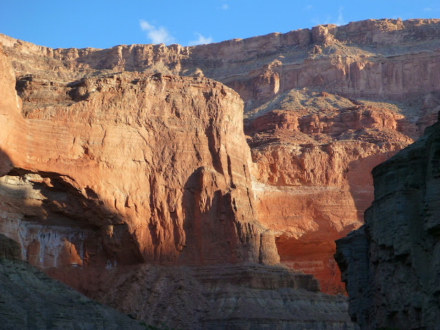
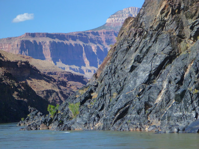
Making our way down into Marble Canyon, we are treated to seeing each and every sedimentary layer rise up from below river level. Not only does the river chisel down into the strata at about 8 feet per mile, but the layers are arched up as one moves downstream such that the Grand Canyon deepens a total of about 70 feet per mile.
While moving through the Supai Group rocks, we saw a very nice reptile trackway, whose viewing was accentuated by a recent light rain on the rocks.
Some rock surfaces are quite durable and become coated through time in an exceedingly dark layer of desert varnish. It is now known that up to 70% of the coating is composed of clay size particles that act to trap iron and manganese oxide grains that arrive on the wind.
A happy group of geology travelers on the Colorado River. The upper portion of Marble Canyon was the coolish part of our trip. We had plenty of great weather but some days at the start were cool.
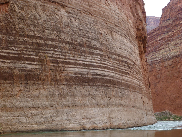
Dropping into the Redwall Limestone is always a thrill for me as its sheer walls make for a spectacular run down along the river.
The Redwall is Mississippian in age (about 340 Ma) and is composed of different kinds of limestone and chert. The banding here is the result of weathering on different types of limestone. The darker bands are limestone beds that hold readily hold a dark varnish on their surface, while the lighter colored bands have smooth surfaces that expose the true color of the limestone.
Springs are quite abundant in Marble Canyon and Vasey's Paradise is one of the more spectacular of these. It was nice to see it running so full as the last few years it has had greatly diminished flow.
This is a little spring right at river level that has created a travertine cone around it. As you float by, you can hear the water running gently inside the cone.
A small cave in the Redwall that has some large specimens of calcite crystal known as dog-tooth spar.
Early morning light illuminates the Triple Alcoves in the Redwall Limestone at Saddle Canyon camp.
And a downstream view at Saddle Canyon camp on the Colorado River in Marble Canyon.
The name Marble Canyon extends down to the confluence with the Little Colorado River at river mile 62. The dry, spring weather meant that the water from Blue Springs (located 13 miles upstream from the confluence) would actively color the water, rather than the brown sediment that colors it when runoff is in the river.
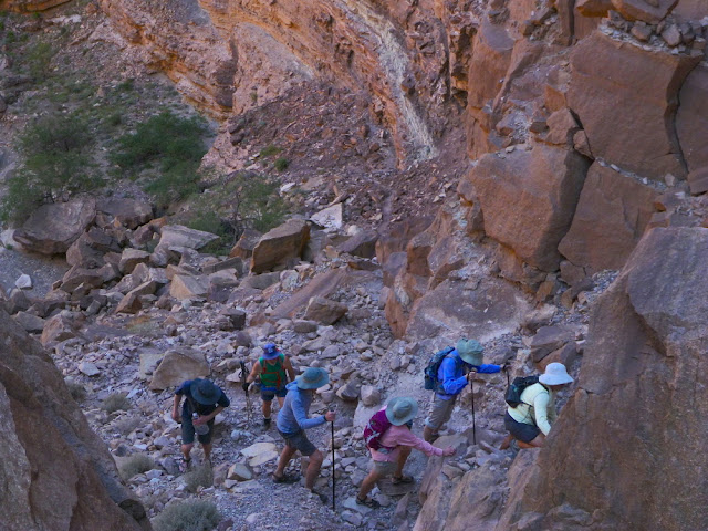
Later in the day, we completed the 4.5 mile Carbon Canyon/Lava Chuar loop hike. Here we climb up through a spectacular rock slide that occurred in pre-historic time.
As we finished the loop hike, we returned to the river across from the Palisades fault that places the upthrown Cardenas Lava on the right, next to other rocks (left). The fault is part of the Butte fault system and propagates all the way to the the low saddle on the rim in the background.
Comanche Point on Grand Canyon's east rim is actually connected to the lower-appearing rim behind it. The entire section of rock is visible here from top to bottom.
Passing Desert View on the rim (barely visible on the highest part of the South Rim) we enter the "big bend" area of the Colorado River. It is here that the river makes a great westward turn after traveling southwest from Utah.
And immediately after the "big bend" is Tanner Rapids on a beautifully clear day.
A nice dinner circle was made while overnighting at Rattlesnake camp. I would say that this is one of my favorite times of the day, when our day hikes and river running is complete and we can relax and enjoy the clean air, some conversation and the company of like-minded friends. I often will help folks to 'fill in the blanks' on their river guidebooks in settings such as this.
And doing the down-climb into the canyon while on the Shinumo Quartzite.
Entering the Upper Granite Gorge of Grand Canyon, where the Vishnu Basement rocks squeeze in close to the rivers edge. I was not always enamored with these rocks, I being a student mainly interested in sedimentary rocks. But a fantastic story of crustal growth during the Precambrian Eon was unraveled in the 1990's and now the story of the Vishnu Schist and Zoroaster Granite is one of my favorite stories to tell on river trips and guided hikes.
Here the Zoroaster Granite (pink) has intruded into dark black meta-basalt rocks called amphibolite.
Traveling down the river in the Inner Gorge above Bass Rapid.
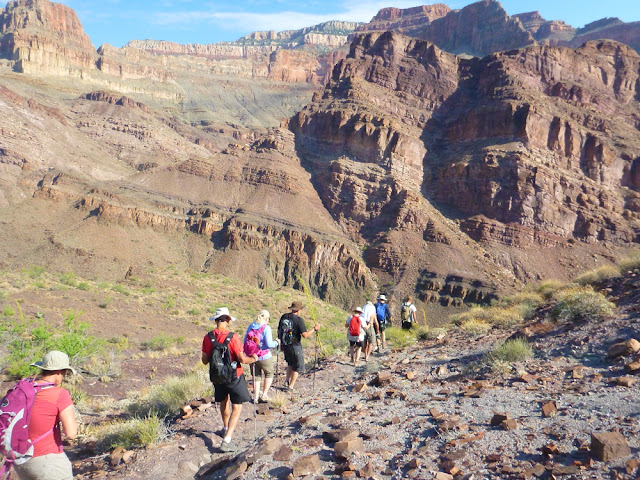
We were able to complete a great hike on the North Bass Trail from our camp at Hotauta Canyon. This was six-mile round trip hike into Shinumo Canyon and William W. Bass's Shinumo Gardens.
Looking back down to the river in the Upper Granite Gorge.
Group picture at the saddle along the trail.
Tilted and faulted layers in the Grand Canyon Supergroup beckons our hikers into Shinumo Canyon. The Supergroup contains nine different formations and two groups of formations. They have a cumulative thickness of over 12,000 feet. This entire sequence was deposited across the whole Grand Canyon region by the latest Precambrian. Later uplift, faulting, and erosion removed most of it but the faulted blocks that remained lowest in the ancient landscape escaped this erosion and thus preserved as isolated blocks within the canyon.
Artifacts from W. W. Bass's Shinumo Gardens location.
More meta-basalt in the Middle Granite Gorge.
This is a spectacular part of the canyon that can normally be seen only on river trips. There are very few trails in this section of the canyon.
We were very lucky to find the Stone Creek camp open and available to us when we arrived near the end of our day. This is one of the most popular camps along the river in Grand Canyon.
Scenic relaxation!
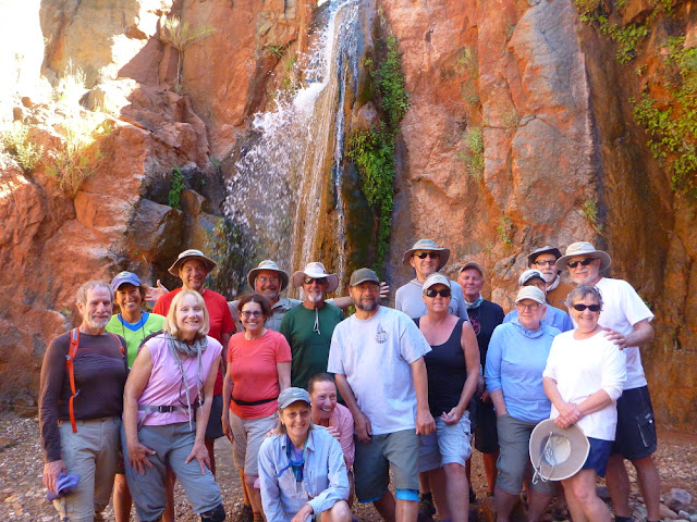
Group shot at the Stone Creek waterfall.
Colorful scene along the river near Tapeats Creek.
The Owl Eyes beneath the Great Thumb Mesa are alcoves that have formed along the Kaibab-Toroweap contact.
Making our way back into the Deer Creek Narrows. The cliffs are composed of Tapeats Sandstone and the ledges are formed in thin shale horizons.
A barrel cactus as seen from above.
At the Deer Creek "patio" is this interesting contact. The view is to the west so the bedded deposits on the left (south) are covered with landslide debris that came from the right (north). The contact represents an old canyon wall that was north-facing before it was covered in the landslide debris. I wonder if this canyon wall might have been within the canyon of the Colorado River or maybe Tapeats Creek before the landslide caused the reorganization of the drainage system? Whatever the story, something big happened here!
Back in the main canyon looking west from Deer Creek, we can see more spectacular evidence from a landslide - Poncho's Radical Run-up. Note the rusty-brown dolomite layer in the Bright Angel Shale in place on the far left. This is viewed within the south wall of Grand Canyon. But note also that this same layer can be seen in the lower right on top of the dark brown cliff and trending up through the center of the photograph to near the upper left. This is where the rusty-brown dolomite from the north side of the canyon became mobilized in a landslide and in-filled the canyon of the river. It actually ran uphill from the momentum of the slide. A remnant of Redwall Limestone can be seen just left of center in the photograph that was riding on top of the dolomite sled!
Small and intimate camp at Olo Canyon with the river nearby.
Another spring along the river.
We took a very nice hike along Havasu Creek. On this trip we visited two of three largest springs in Arizona - Fossil Springs is the other outside of the Grand Canyon.
Walker Mackay was a great leader for this trip and executed the itinerary to perfection. Thank you Walker and great thanks to all of our rafting companions!


