There were just two more stops on this Smithsonian Journeys trip to Australia and New Zealand and both were on the North Island.. I had not previously been to the North Island so I was curious to see just how different it was from the South.
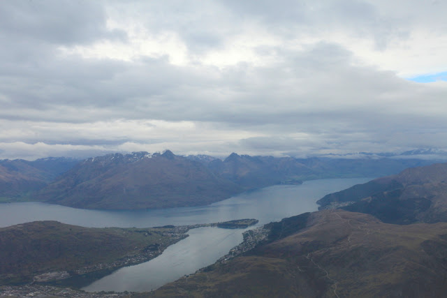
Leaving Queenstown we got a great view of Lake Wakatipu. At 50 miles long, it is New Zealand's longest lake and one of the deepest at 1,250 feet. The mountains around the lake (center) are known as The Remarkables.
These are the Canterbury Plains south of Christchurch, one of the largest growing regions in the country.
The mountains seemed endless on this flight! One usually thinks of New Zealand as a small place but the topography actually makes it a very big place. This is the Kaikoura Range with a maximum elevation of 9,465 feet on Mt. Tapuaenuku.
This is the Marlborough Sound in the extreme northeast corner of the South Island. Note the clear-cut logging occurring on the lower slopes of the peninsula.
This is the Cook Strait located between the North and South islands
While flying over the Cook Strait, I could look ahead to the west and see the Egmont volcano, now known by its local Maori name of Mt. Taranaki. Note the parasitic cone on its left (south) flank known as Fanthanms Peak, This beautiful strato-volcano is one of the most symmetrical in all the world and began forming some 135,000 years ago with its last eruption in the 1850's. See a good article on the volcano here and look at the unusual national park boundary around the cone here.
I was sitting on the correct side of the airplane because next in view was the Ruapehu volcano. Note the blue crater lake on its crest. A lot of geologic information about this cone can be found here on the Volcano Discovery web site.
Just north of Ruapehu is Ngauruhoe volcano
And just north again is the Blue Lake (bottom). What a spectacular geologic flight this was! I will have to come back and check these out on the ground one day.
After landing in Rotorua, we walked through a memorial grove of California redwood trees that were planted in 1901 to replace the native forest that was being cut for agriculture. The trees have grown quite large in this humid environment in their 114 years - see the person at the base of the left hand tree.
Although not as tall was the redwoods, the tree ferns were also spectacular
The Maori have opened a cultural park around the Te Puia geothermal area, just four miles from the city center of Rotorua.
Many aspects of Maori culture are on display here including wood carving, fabric making, geothermal cooking, and crafts.
This is the Pohutu geyser which is in constant eruption! It never stops.
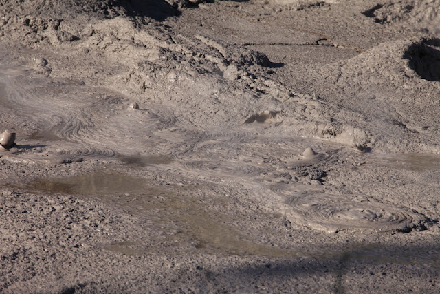
Boiling mud pots on the way to the geyser can be seen and are always a fan favorite in geothermal areas.
Closer view of Pohutu geyser
Close-up view
That evening, we enjoyed a meal that was cooked in the ground in the traditional Maori way. Here the chefs are removing the food from the underground oven.
This is the former bath house in Rotorua, now the main museum in town. It has excellent exhibits which are a must-see when in Rotorua. Well done!
View of the sulphur bay on Lake Rotorua from the roof of the museum
Lake Rotorua sits within the caldera of the same name. This 14-mile diameter depression was formed about 240,000 years ago when a volcano lots its top and the region sank on top of an empty magma chamber. The activity is not over but there has not been an eruption here since about 25,000 years ago. All of these feature are part of the Taupo Volcanic Zone.
Black swan on Lake Rotorua
Rotorua has numerous examples of toon trees, which have been introduced from China. We were here just in time to see the leaves before they turn green.
I liked this view seen upon entering the Maori village of Ohinemutu in Rotorua. A Maori icon set against the European steeple of a church.
This is the front side of the Maori icon. Note the tongue distended with wide eyes, a typical Maori show of strength.


No comments:
Post a Comment
If your comment will not post, email me with the problem.