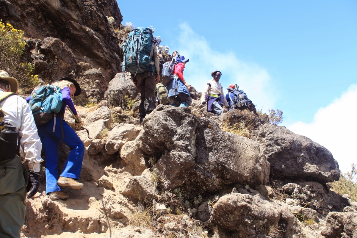
Many of you know that I have been in Africa this August traveling with my wife Helen. We have been on safari to Serengeti and Ngorongoro Crater, as well as partaking in a trek with friends to the top of Mt. Kilimanjaro. We have just returned home and are beginning to process the myriad emotions, information, photographs, and memories. A blog posting seems too simple a venue to express all that we have experienced in these 19 days. In a word, the trek was hard but doable, especially with the positive outlook our group maintained throughout the trip. The conditions were cold near the top and very dirty throughout. The word dirty may not convey the fineness of the volcanic dust that resides on that mountain, getting into pores and fabrics. There was precious little oxygen at this extreme elevation. Many will ask, "Why undertake a trip with such daunting obstacles?" It is a fair question. Perhaps this series of blog postings will help me to illuminate the reasons we took this trip.
The sign on top of Uhuru Peak welcomes those who have successfully made the trek. But first, a trip such as this must be conceived and imagined. It was Chris Hansen-Nelson's idea. I seemed powerless to resist his desire to celebrate our significant birthday this year with some extraordinary trip. This trek certainly fit that billing.
The trip starts with a bus ride from our lodge in Arusha, Tanzania to the trailhead. Freshly showered and hoping to remain clean as long as possible, we were certainly naive to the way of the mountain.
Through corn fields, potato pastures, the rural landscape of humanity creeps right up to the national park boundary.
The roads turns to dirt and the adventure begins. Our porters who were traveling on another bus experienced a vehicle breakdown on this road and the start of our trip was delayed three hours.
Here our group signs in at the Park entrance station.
The porters are selected by the head guide at the gate. They will each carry upwards to 25 kilos (almost 60 pounds) on their heads and backs. Our group of nine required 35 porters, almost four per trekker. We also has three assistant guides, one head guide and a cook. Our entourage was 40 people.
Adventure and foreign travel, philosophical and scientific musings, geology and landscapes, photography and earthly explorations.
Wednesday, August 27, 2014
Running Out of Ground - Trekking to the Roof of Africa on Mt. Kilimanjaro - Part 2 - The Approach - Days One and Two
In spite of the inevitable delays on such a grand undertaking, we were trekking by about 4 PM on August 13. At first we walked on a 4X4 road, then a bonafide trail. Our route up the mountain would be the Lomosho Route.
Near the start of the trek, we travel through carrot and potato fields.
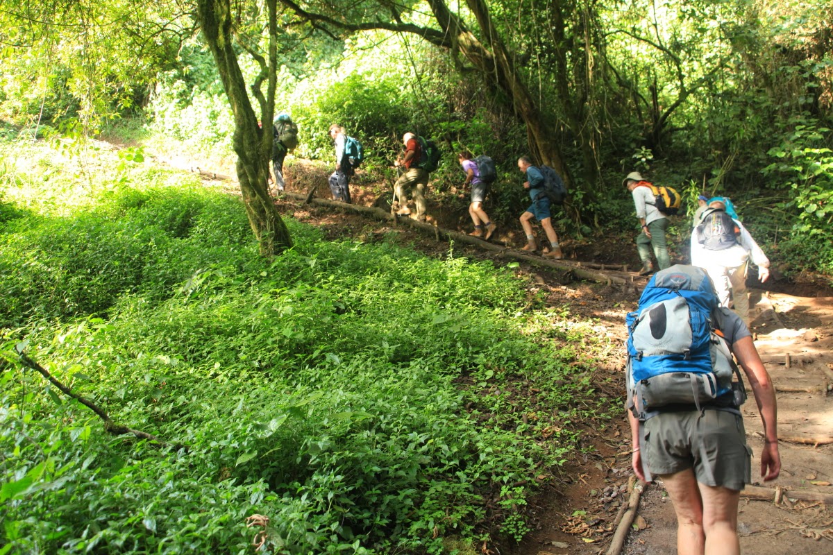
After entering the National Park, the forest is preserved and quite beautiful.
One of our porters carrying eggs for the trip.
Forest hiking.
Colubus monkeys were quite numerous in the trees overhead. The are colored just like skunks with long fur.
Camp was set up at Mti Mkubwa ("Big Tree" in the Swahili language) beginning about 6:30 PM. We mitigated a late start by walking fairly quickly.
August 14 and ready to go!
This proved to be one of the toughest days going from Mti Mkubwa to Shira 1 Camp. Lots of uphill and a very long way.
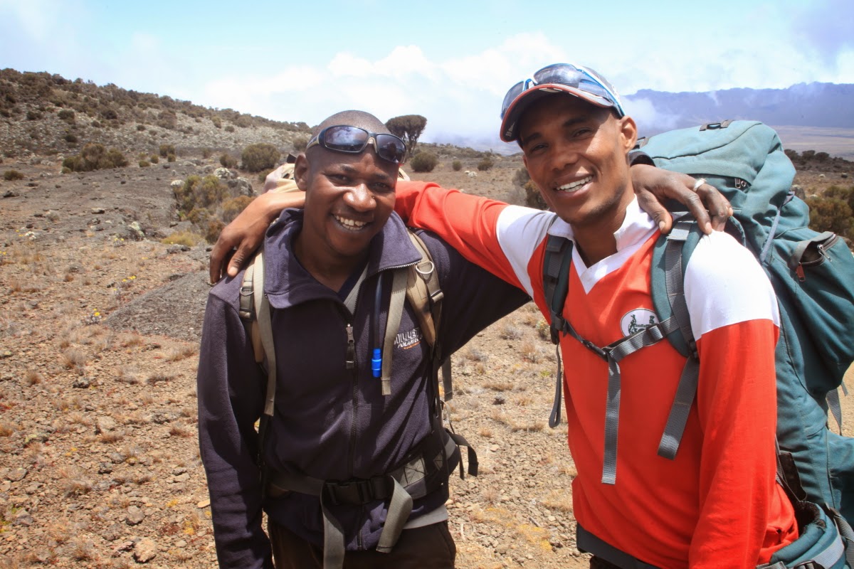
The man in the stripped shirt, Jeffer, carried my duffle the whole way and also served as our waiter in the dinner tent. One night I casually joked with him, "Tell us a story." He fumbled a little bit with his words and said, "Later." The next night, quite out of the blue, he announced, "story" - he had not forgotten and was likely practicing his English all day on the trail. The Tanzanian people are easy to laugh, gentle, and friendly. It was highlight to interact with them on this trip!
Helen hiking in the Kilimanjaro forest.
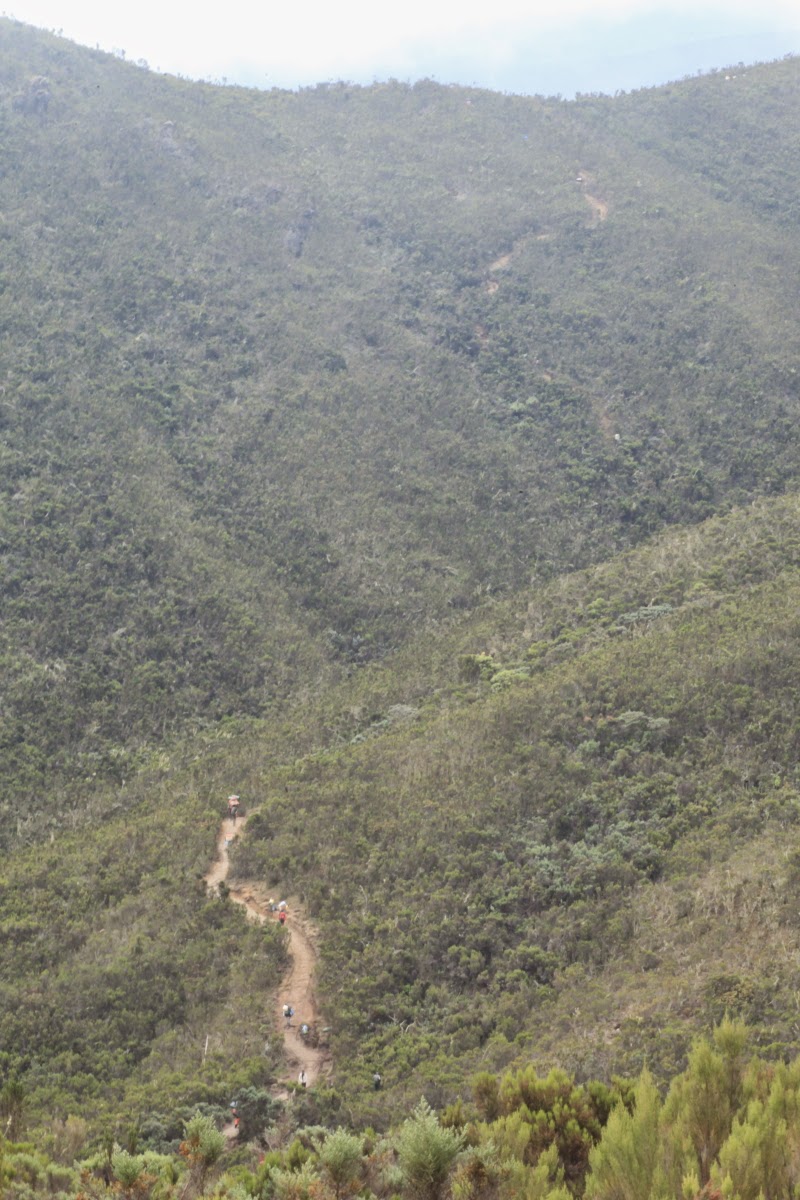
Note the trail snaking uphill on its way to Shira 1 camp.
Our group on the trail. We still have not seen many rocks because of the soil formed on the forest floor. But this would change soon enough.
Climbing upwards to Shira 1.
Looking west (with ta elephoto lens) back to where we have come from.
And looking east to the shrouded summit of Kili.
Note how the forest and heathlands have been left behind as we gain the surface of the Shira Plateau.
Everlasting flowers on the Shira Plateau with Kili in the background.
Shira 1 camp. This completed our two day approach to the mountain. Now we would walk beneath its sheer southern escarpment. Note the tiny looking black tower of rock at the base of the mountains slope. This is "Lava Tower" and would be the site of our fourth nights camp two days from now.
Running Out of Ground - Trekking to the Roof of Africa on Mt. Kilimanjaro - Part 3 - Skirting the Mountain's Base - Days Three, Four, and Five
Day 3 - Shira 1 Camp to Moir Hut - August 15
Leaving Shira 1 Camp, the porters set out for their destination - Moir Hut Camp.
The landscape has definitely changed since the rainforest.
The Shira Plateau is really a valley surrounded by mountains. The valley now is a lava-filled caldera. But previously it was a huge volcano like Kili, before it lost its top. The Shira Volcano was the first volcanic cone built here, and the oldest lavas on it are about 1.6 million years ago. To think that this was the site of Kili-sized volcano, then catastrophically losing its top, only to be partially buried by lava flows from Kilimanjaro is incredible. The trekkers here are walking on the lava-flow surface.
This is a close-up of the main type of rock seen on Kilimanjaro - the rhomb porphory lava. These crystals grew inside a magma chamber beneath the volcano and were then erupted out with the lava like a modern-day slush drink.
Trekker crossing the Shira Emergency Route off of the mountain. This route is used to get people who suffer from AMS (Acute Mountain Sickness) off the mountain quickly.
Lobelia plants growing in the rocks. Stay tuned to the blog for other photos of the strange looking plants that grow on the slopes of Kilimanjaro.
Head guide James (left) and Assistant Guide Mathew.
We had two female porters in our group - Beatrice (left) and Tarasia.
Don W. and James examining a pyroclastic flow deposit on the slopes of Kilimanjaro. There were many outcrops of these flows, which originate in huge eruptive columns that collapse downward and outwards from the central vent. It is an chaotic arrangement of lava bombs and clasts often cover by finer ash-flow deposits.
Arriving at Moir Hut Camp August 15.
Helen celebrating her birthday on the mountain with Moir Hut Camp in the background.
Assistant guide Clemons checking his phone messages. There is cell service in many of the camps on Mt. Kilimanjaro.
Joe A. giving a wave on our acclimatization hike.
Returning to camp in late afternoon at Moir Hut Camp.
The clouds parted and we got our first good view of the mountain!
Leaving the Moir Hut area in the morning.
Looking back to the west to the Shira Plateau (valley) and Shira Peaks. The Peaks outline the edge of the Shira caldera.
We were constantly keeping reference to our elevation and marked the moment we surpassed the elevation of Mt. Whitney in California at 14, 495 ft.
Some of the trekking involved climbing up rock faces.
Looking back to the Shira Cathedral to the south. These peaks are eroded remnants of the Shira caldera.
Note the trace of the trail heading east (bottom of photograph) toward the Lava Tower in the background.
Eroded hoodoos on the way to Lava Tower. These were originally laid down in a hot, glowing ash and rock cloud called a pyroclastic flow. When a volcano erupts and send rock and ash skyward, the material ultimately begins to fall back toward the earth. The increasingly concentrated mass of rock and ash compresses a layer of gas next to the ground surface and the rocks flow downhill on this cushion of gas. Pyroclastic flows therefore can move downslope extremely rapidly because they are frictionless on the gas - upwards to 100 miles per hour or more! Imagine a wall of glowing hot rock charging down a slope at these speeds. These rocks are the eroded remnants of such an event on Kilimanjaro.
More fantastic rocks on the trek to Kilimanjaro. Here welded fine-grain, ash flows cap an ignimbrite deposit. Ignimbrite is the term for rocks deposited in pyroclastic flows. These flows are extremely violent when erupted. To walk in the presence of these now cooled rock and ash clouds was an amazing experience.
Approaching the Lava Tower.
View toward the Kilimanjaro massif with frozen waterfalls on its side. The is a very cold trip, even if only at 3 degrees south of the equator.
View down into the Arusha plain.
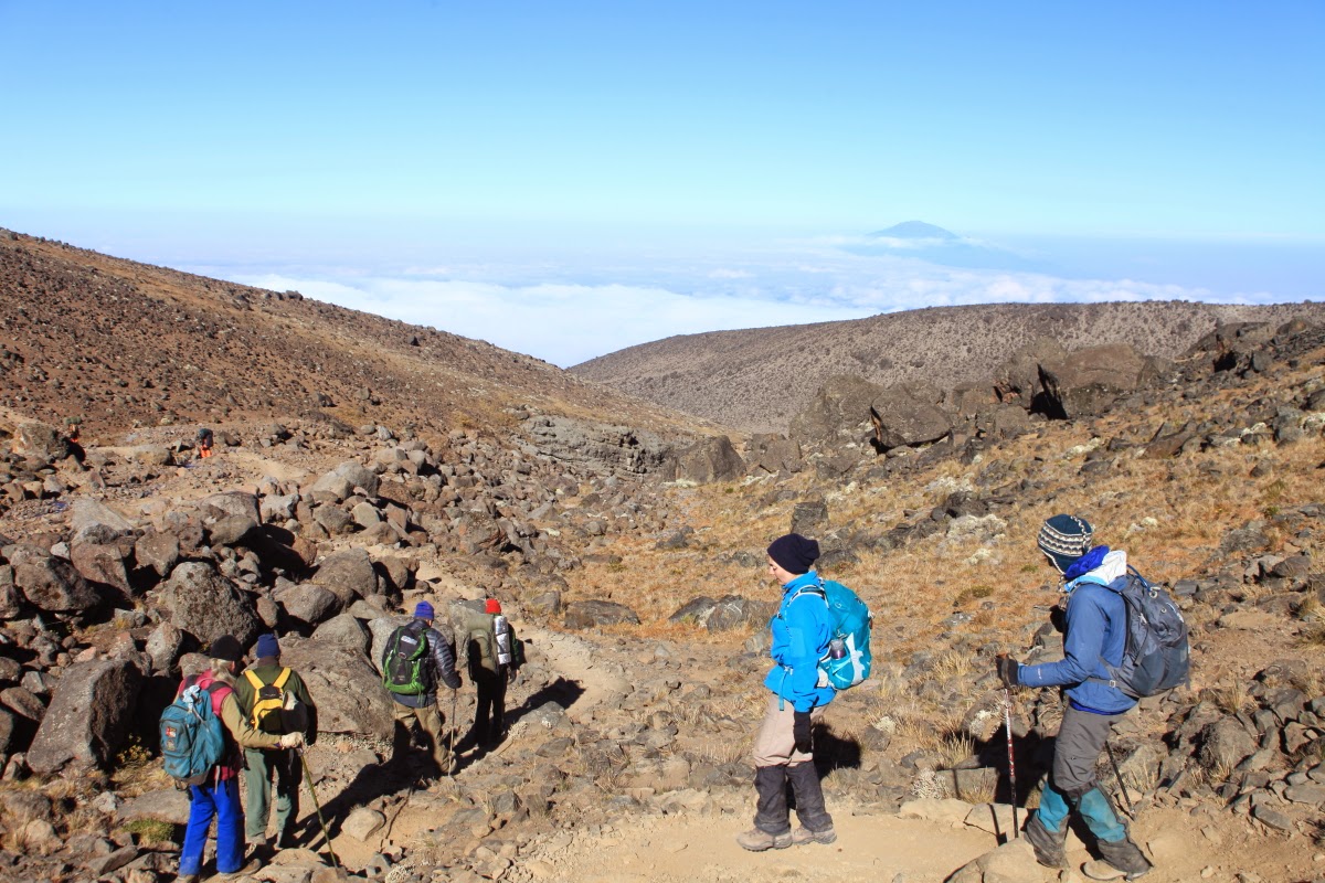
One of our first views on Mt. Meru to the west near the town of Arusha.
Looking up 4,000 feet to the top of Kilimanjaro near the Western Breach. Note the thick set of lava flows on the crest.
The dining tent where we took our meals. Only twice did we have to pack a lunch for the trail. Our hiking for the day was usually done by noon so that we could enjoy a hot lunch in the tent. The trail lunches included hard-boiled eggs, fried chicken, local peanuts, Cheese sandwiches on delicious white bread (!), and chocolate bars. The food was truly outstanding!
Day 5 - Lava Tower Camp to Barranco Wall and Karanga Valley- August 17
Sunrise on the Lava Tower.
Day 5 involved a net descent of over 2,000 feet to Barranco and Karanga valleys. I hated to give up such precious-won elevation but the descent helped with our acclimatization on the mountain. No one in our group ever felt the effects of altitude sickness.
Down through the rocks from Lava Tower Camp.
There was very little vegetation at this elevation but that would soon change.
Helen R. points the way, while Lauren looks on.
Much has been said in recent years about the shrinking of the glaciers on Kilimanjaro. These glaciers began their retreat in the mid-1800's with the end of the Little Ice Age. Since that time Kili's ice has shrunk by about 90%. In this photo the Kersten Glacier is seen draping over the south slopes of Kili.
Here is the Kilimanjaro senicio tree or giant groundsel (Dendrosenecio kilimanjari). You will have to "endure" a few of these pictures as we romped through the Garden of Senicios.
They appeared much like the Southwest Joshua Tree but had leafy tops.
With Kili in the background.
The trail went right through this garden of plants. The guides were keen on making time but a few of us wanted to photograph this other-world scene and lingered a little longer through this stretch.
With the Barranco Wall in the background.
Awesome scene with Senicio's on Kilimnajaro.
Note the hiker in the background (lower left).
The clouds began to move in as we approached the Barranco Valley.
Looking up to Kilimanjaro.
Climbing the lower sections of the great Barranco Wall.
It's not really a trail at this point but the climb is only about 15 minutes long.
Near the top of the Wall, Don W. contemplates our good fortune to experience this foreign world.
Leaving Shira 1 Camp, the porters set out for their destination - Moir Hut Camp.
The landscape has definitely changed since the rainforest.
The Shira Plateau is really a valley surrounded by mountains. The valley now is a lava-filled caldera. But previously it was a huge volcano like Kili, before it lost its top. The Shira Volcano was the first volcanic cone built here, and the oldest lavas on it are about 1.6 million years ago. To think that this was the site of Kili-sized volcano, then catastrophically losing its top, only to be partially buried by lava flows from Kilimanjaro is incredible. The trekkers here are walking on the lava-flow surface.
This is a close-up of the main type of rock seen on Kilimanjaro - the rhomb porphory lava. These crystals grew inside a magma chamber beneath the volcano and were then erupted out with the lava like a modern-day slush drink.
Trekker crossing the Shira Emergency Route off of the mountain. This route is used to get people who suffer from AMS (Acute Mountain Sickness) off the mountain quickly.
Lobelia plants growing in the rocks. Stay tuned to the blog for other photos of the strange looking plants that grow on the slopes of Kilimanjaro.
Head guide James (left) and Assistant Guide Mathew.
We had two female porters in our group - Beatrice (left) and Tarasia.
Don W. and James examining a pyroclastic flow deposit on the slopes of Kilimanjaro. There were many outcrops of these flows, which originate in huge eruptive columns that collapse downward and outwards from the central vent. It is an chaotic arrangement of lava bombs and clasts often cover by finer ash-flow deposits.
Arriving at Moir Hut Camp August 15.
Helen celebrating her birthday on the mountain with Moir Hut Camp in the background.
Assistant guide Clemons checking his phone messages. There is cell service in many of the camps on Mt. Kilimanjaro.
Joe A. giving a wave on our acclimatization hike.
James checking his phone messages on the mountain. He was in constant contact with the office updated them about our progress.
The clouds parted and we got our first good view of the mountain!
Mt. Kilimanjaro from Moir Hut Camp.
Day 4 - Moir Hut Camp to Lava Tower Camp - August 16
Looking back to the west to the Shira Plateau (valley) and Shira Peaks. The Peaks outline the edge of the Shira caldera.
We were constantly keeping reference to our elevation and marked the moment we surpassed the elevation of Mt. Whitney in California at 14, 495 ft.
Some of the trekking involved climbing up rock faces.
Looking back to the Shira Cathedral to the south. These peaks are eroded remnants of the Shira caldera.
Note the trace of the trail heading east (bottom of photograph) toward the Lava Tower in the background.
Eroded hoodoos on the way to Lava Tower. These were originally laid down in a hot, glowing ash and rock cloud called a pyroclastic flow. When a volcano erupts and send rock and ash skyward, the material ultimately begins to fall back toward the earth. The increasingly concentrated mass of rock and ash compresses a layer of gas next to the ground surface and the rocks flow downhill on this cushion of gas. Pyroclastic flows therefore can move downslope extremely rapidly because they are frictionless on the gas - upwards to 100 miles per hour or more! Imagine a wall of glowing hot rock charging down a slope at these speeds. These rocks are the eroded remnants of such an event on Kilimanjaro.
More fantastic rocks on the trek to Kilimanjaro. Here welded fine-grain, ash flows cap an ignimbrite deposit. Ignimbrite is the term for rocks deposited in pyroclastic flows. These flows are extremely violent when erupted. To walk in the presence of these now cooled rock and ash clouds was an amazing experience.
Approaching the Lava Tower.
Lava Tower from camp. We went to the top of the tower.
All of us were pretty sure that we went to the top of the Tower only so the guides could see how well we climbed on rock walls - in preparation for the Great Barranco Wall the following day.
View of Lava Tower Camp from the top of the Lava Tower. Note our group of tents on the far right (six) with the yellow and red dinner tent right of them.
View down into the Arusha plain.
One of our first views on Mt. Meru to the west near the town of Arusha.
Looking up 4,000 feet to the top of Kilimanjaro near the Western Breach. Note the thick set of lava flows on the crest.
The dining tent where we took our meals. Only twice did we have to pack a lunch for the trail. Our hiking for the day was usually done by noon so that we could enjoy a hot lunch in the tent. The trail lunches included hard-boiled eggs, fried chicken, local peanuts, Cheese sandwiches on delicious white bread (!), and chocolate bars. The food was truly outstanding!
Day 5 - Lava Tower Camp to Barranco Wall and Karanga Valley- August 17
Sunrise on the Lava Tower.
Moonset over the Lava Tower.
Down through the rocks from Lava Tower Camp.
There was very little vegetation at this elevation but that would soon change.
Helen R. points the way, while Lauren looks on.
Much has been said in recent years about the shrinking of the glaciers on Kilimanjaro. These glaciers began their retreat in the mid-1800's with the end of the Little Ice Age. Since that time Kili's ice has shrunk by about 90%. In this photo the Kersten Glacier is seen draping over the south slopes of Kili.
Here is the Kilimanjaro senicio tree or giant groundsel (Dendrosenecio kilimanjari). You will have to "endure" a few of these pictures as we romped through the Garden of Senicios.
They appeared much like the Southwest Joshua Tree but had leafy tops.
With Kili in the background.
The trail went right through this garden of plants. The guides were keen on making time but a few of us wanted to photograph this other-world scene and lingered a little longer through this stretch.
With the Barranco Wall in the background.
Awesome scene with Senicio's on Kilimnajaro.
Note the hiker in the background (lower left).
The clouds began to move in as we approached the Barranco Valley.
Looking up to Kilimanjaro.
Climbing the lower sections of the great Barranco Wall.
It's not really a trail at this point but the climb is only about 15 minutes long.
Near the top of the Wall, Don W. contemplates our good fortune to experience this foreign world.
Helen R. making her way down into the Karanga Valley. The mountain was completely obscured in clouds at this point as we made our way to Karanga Camp. This moment was bit deflating to me, The descent meant that we had to climb another wall to the camp. The clouds were gray and gloomy. The fine dust had penetrated every part of us. I wondered, "Why?'
Subscribe to:
Comments (Atom)


