One of the hidden geologic gems located just east of the Colorado Plateau and the Rio Grande Rift is the
Great Sand Dunes National Park and Preserve. In July, I approached this interesting area with colleague Jack Share while traveling from Durango, to the Continental Divide at Wolf Creek Pass, and across the Alamosa Valley located in the floor of the rift. It is a beautiful and interesting place.
The Sangre de Cristo Mountains loom behind the dunes. This view is to the northeast and behind us to the southeast, the range terminates at Blanca Peak, elevation 14,345. It is only 50 feet lower than Mt. Whitney in the Sierra Nevada and is the third highest peak in Colorado. We could not photograph Blanca Peak because it was perpetually in clouds.
On the approach we could see the dunes had been recently drenched in rain.This was the time in July when the Rocky Mountain front range was ablaze with fire and these are the rains that quenched the blazes.
Sunset in the Sangre de Cristo Mountains, July 8. The low angle light on the feldspar-rich granites are what gave the mountains their name (blood of Christ).
Sunrise on the dunes, July 9
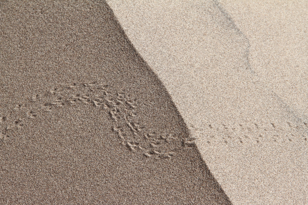
We took a walk up the dunes to observe modern eolian processes. Here is a trackway of an insect that has been active the night before.
Some areas of the dunes had a blackish tinge and closer inspection showed that this was due to iron-rich minerals being winnowed from the quartz sand into discreet pockets. Density differences between these two mineral types causes this winnowing, much the same as gold-panning will winnow gold to the edge of the pan. It is the inclusion of these iron-rich minerals in the white quartz sand that could eventually turn this future sandstone red - when the whole package is buried, groundwater can infiltrate the sand and dissolve the iron component, whose solutions then coat each sand grain with a red coating.

The iron-rich minerals are derived from the granites in the Sangre de Cristo Mountains. But they do not simply travel from the mountain front to the dunes. First they must be washed to the west into the Alamosa Valley, where huge piles of sediment have filled the Rio Grande Rift. During the Ice Age, this valley contained Lake Alamosa, which would repeated fill and dry out. Then the wind picked up the dried sediment as sand and blew it to the east where it encountered the high range causing the wind to slow down and dump its load of sand here. What a journey the sand makes!
The recent rains made walking easier for us
And the vistas were superb. We both felt as if we were walking in some Jurassic dune field on the Colorado Plateau (although those dunes were much more Sahara-like and not so Alpine.
Low-angle light easily differentiates the windward and leeward sides of these wind ripples - the wind in this instance is blowing towards the person
The sand is trying to climb up into the range but this is about as far as it gets. Zebulon Pike came through this area in January, 1806 while surveying the new international boundary between the United States (Louisiana Purchase) and New Spain.
Looking north across the dunes to the northernmost part of the Sangre de Cristo range
As we left the park, we could see that another day of rain was building up
In a nine-day trip across southern and central Colorado, this was the biggest surprise (out of many). Here, the iron-rich grains are easily highlighted in the dunes.


My husband and I were just there last week. Thank you for this great information, Wayne.
ReplyDelete