Monday, November 09, 2015

Mt. Cook National Park, South Island New Zealand

One of New Zealand's most iconic natural treasures is Mt. Cook National Park, located in the Southern Alps southwest of Christchurch. The area has been in the consciousness of the Kiwi's since the 1880's when the 12,214 foot peak was first climbed. The Hermitage Hotel was built a few years later and excursions to the park have continued since.

Leaving Christchurch across the Canterbury Plains, the landscape soon gave way to our first view of the Southern Alps, still snow and ice clad in this spring time scene.

As series of three glacially-carved lakes are found along the route. Two of the lakes have their elevations raised by hydroelectric schemes, including Lake Tekapo.

The lake is situated 2,300 feet above sea level and covers an area of about 32 square miles. The glacier that carved the lake basin came out of the Southern Alps in the background.

This is the Church of the Good Shepard built in 1935 and one of the most photographed churches in the entire country. As you can see we had a beautiful day.

Towards the end of the day and as we neared the high mountains and the park, clouds had obscured the view of the majestic mountain. It is said that Mt. Cook is only visible 30% of the time. There is nothing to obstruct the weather from the wild Southern Ocean between the Southern Alps and Antarctica. 120 inches of precipitation on the western side of the range proves it.

The next day was also quite cloudy and a fresh snowfall was evident on the lower slopes of the mountain.

However, I decided to take a lift on one of these ATV vehicles, called an Argo. Developed in 1967 in Ontario Canada, these vehicles can tackle very rugged terrain and an amphibious version is also made. We drove by 4X4 vehicle to a parking lot and then by Argo on the track shown here.

The objective was to travel along and then walk on top of the lateral moraine of the Tasman Glacier. Here is the moraine as viewed from along the road in. The moraine is about 70 feet high here and note the large boulder that has rolled off of the top.

At the destination, it was an easy 5-minute walk to the top of the moraine and then the world opened up before us! The photo was captured using a wide angle lens (17mm) so the features seen here are much larger than they appear. This is a view to the northeast with the present day snout of the Tasman Glacier (photo center) sticking out into Tasman Lake. The glacier is covered with thick mantle of rock and dirt up to 50 feet thick. This is material that has fallen off of the walls of the mountain and onto the conveyor belt of the Tasman Glacier, which is New Zealand longest at 17 miles long.

This is looking south from the same vantage. The road we took up is visible in the small valley on the far right. Tasman Lake (left) is now 3 miles long and one mile wide. However, it was just a minute fraction of this size only 20 years ago and in 1973, there was no lake at all!. The glacier has been retreating about 600 feet per year since the 1990's and as it has retreated, a large lake has formed where the ice used to be.

Each winter, 160 feet of snow accumulates on the top of the glacier in the headwall area. At the end of the summer, only 21 feet of that amount remains but that is enough to power the downward trend of the ice.

It is projected that the Tasman Glacier will be gone within about 20 years and that the lake will attain its largest dimension at 10 miles long. Here is a space photograph of the area from about 15 years ago. Note the small size of the Tasman Lake beneath the words "Mt. Cook." I took my photographs above from where the black arrow begins just left of the label "Mt. Cook."

Across the way were thick sequences of moraine material

A last view toward the south along the west side of the Tasman Glacier and Lake. Imagine ice filling the space on the left side of the photograph only a few hundred years ago.

The Hermitage Hotel was a delightful place to stay. The hotel has produced a film about the life of Sir Edmund Hillary, a native New Zealander who first fell in love with the outdoors, camping, and climbing here at Mt. Cook National Park. The film was excellent!

Later in the day, the mountains began to appear from behind their cloud cover

And we got a quick view of Mt, Cook

But by the following morning, it was out in its regal glory, standing two miles above the photographer

These are glacial scenes very reminiscent of what is found in Antarctica with entire slopes buried in hundreds of feet of year round ice.

This is a view looking up the Hooker Valley to the mountain

Crevasse appears to be tumbling down over the rocky slopes

This is Lake Pukaki with a view of Mt. Cook in the distance as we drive on towards Queenstown

Mt. Cook has been uplifted along the Alpine Fault (behind the mountain) in the last 10 million years. It is a beautiful mountain!

Saturday, November 07, 2015

A View of Christchurch New Zealand Nearly Five Years After the Big Quake

On February 22, 2011 at 12:51 in the afternoon, Christchurch experienced a magnitude 6.3 earthquake which devastated huge portions of the city's infrastructure  181 people lost their lives and the Mercalli Intensity Scale was listed as VIII (Severe). The quake had a focus (depth of rupture) of only 3 miles on a blind fault (one not previously recognized). We visited Christchurch and saw how the city was faring nearly five years on.

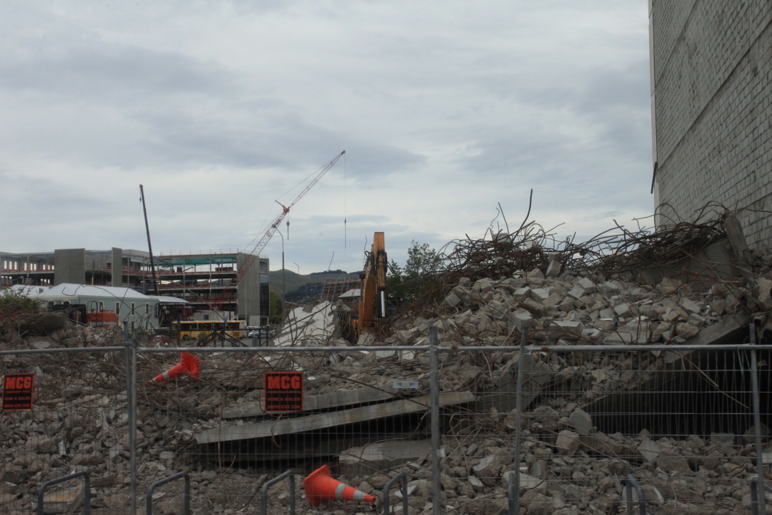
After five years many buildings still stand dilapidated and unusable

But in some respects there is a good reason for this - the city has decided to completely recycle all of the waste rather than just dump it. The concrete is being crushed from each building and used in new aggregate. The steel rebar is being recycled. Everything is being repurposed and so the demolition going much more slowly than one would expect as normal.

Many old structures were damaged and are so beloved by the local population that they have been propped up until a decision can be made on what to do with them.

Anywhere there is an empty lot signifies a place where a building (usually multi-story) has been demolished. On this lot, 181 plastic chairs are a reminder to those who lost their lives. 115 people were killed in the collapse of one building. Eight were killed while riding in a Red Bus (city transport) when a building wall fell on the bus. One American was among the many fatalities.

Map showing the epicenters of two main shocks and their many aftershocks. The September 4, 2010 Darfield quake has a green star and green circles, while the February 22, 2011 Christchurch earthquake has a red star and red circles. The rupture lines are also shown with a solid red line denoting a previously recognized surface fault trace and yellow dashed as sub-surface. Some geologists propose that the less intense Christchurch quake is an aftershock of the Darfield quake, while others pointing out that they were on two separate faults and thus separate events. It looks to me like the ruptures are 'on strike' and thus perhaps related. Note the obvious rounded mountain in the lower right of the map. This is the Banks Peninsula and it is a late Miocene (11 to 6 Ma) volcano that is now highly eroded and flooded with seawater.

This is the Catholic cathedral and it too is still standing as no one quite knows what to do with it. I have visited cities that were destroyed by the Nazi's (Norway) or leveled by earthquakes in the 17th and 18th centuries (South America). Today, those cities stand strong, having been rebuilt. If the people of Christchurch could only see that life will eventually go on after this tragedy. One day, Christchurch will be a new city but it may take 50 or more years before it fully recovers.

In 1912, Robert Falcon Scott lost his life on a return journey from the South Pole (along with his four companions) only five weeks after Roald Amundsen of Norway beat him to it. A statue of Scott used to stand on the foundation shown here but was toppled during the quake. In 1987 when I returned from my first journey to Antarctica and the South Pole, I took a picture of the statue from this exact spot. I cannot wait to get home and dig out that old photographic slide I have  and compare it to this.

We stayed at the new Rydges Hotel only two blocks from the old one - still standing and cleared for reoccupancy. But the chain does not want the building.

One of the biggest reasons for the extensive damage to buildings was the liquefaction that occurred in the soils in and around Christchurch. This composite diagram of a photo (top) of a sand volcano and cartoon (bottom) shows what happened during and immediately after the quake. Water-saturated sand and clay was mobilized during the shaking and structures had no solid foundation to stand on. Look at some incredible photos of the effects of liquefaction here.

The earthquake caused the land surface to sink between two and three feet. Christchurch is prone to more flooding now as a result. This was the cover of GSA Today magazine in March, 2015.

The famous Christchurch Cathedral (Anglican). This used to be in the heart of a vibrant downtown but it stands in ruins with many surrounding building sites full of weeds. Incredible!

Soon after quake, some businesses decided to use ocean going containers as temporary buildings, soon dubbed as Project ReStart. It is now one of the most active business areas in the city and itself a tourist attraction.

The ANZ Bank has a branch here

And there are many other businesses as well. Our tour director experienced her first visit to Christchurch since 2010, suggesting that tourists are beginning to return to Christchurch.

I hardly recognized the place from 1987. Then, it was full of trees and every corner looked like a bit of England. The city was humbled in just 10 seconds of shaking. To read more details about the earthquake, check out this site here. My next posting will be from Mt. Cook National Park.

Monday, November 02, 2015

Brilliant Australia - The Sights of Sydney

After more than a week in green, blue and red Australia, we headed next into what I call brilliant Australia - the amazing city of Sydney. But even this urban paradise had a few geologic and faunal treats for our group to enjoy.

 Flying into Sydney International Airport, the high-rise of the city center was visible from seat 3A

Our first stop was the Royal Botanical Gardens, a space of 74 acres established in 1816 as Australia's first scientific institution. It was conveniently located across the street from our hotel.

The view from Macquarie Point was outstanding with the Harbor Bridge and the Sydney Opera House visible across the bay.

The First Fleet of eleven ships arrived from England in January, 1788 with about 1,200 people, 700 of whom were petty criminals signed on to work off their sentences for 7 years labor. In 1816, the convicts had built this "chair" at Macquarie Point for the Governor's wife, Elizabeth.

Another view from the Botanical Gardens to the city center. Sydney has a population of 4.5 million people, equalling the entire population of New Zealand.

View across Double Bay to the city. There are so many neighborhoods in Sydney and many hug the many miles of shoreline in the harbor known as Port Jackson.

One cannot go through this city without noticing the ubiquitous sandstone that is exposed in all of the road cut and in the walls of many of the historic buildings. The convicts were forever shaping this rock into building blocks for the early city.

It has natural exposures here in the Botanical Gardens

And can be seen when visiting South Head, the pinch point at the entrance to Port Jackson

It is called the Hawkesbury Sandstone and is Triassic in age, about 245 Ma - the same as the Moenkopi Formation in Arizona.

Here are some water escape structures within the sandstone

This tafoni texture is found near Manly, a northern suburb of Sydney

There are some coarse pebbles within the coarse sand, giving it the appearance of the Shinarump Conglomerate. The deposit is interpreted as fluvial (river) coming from a highland source that is now located in Antarctica.

It is everywhere seen in the city. The first settlers wanted to establish the colony at Botany Bay where James Cook had landed 18 years earlier but the shoreline there was flat and marshy, and subject to flooding. So the First Fleet relocated to Port Jackson around the corner, where the exposures of the sandstone made city building easier.

This is the famous Bondi Beach. No mystery where the sand on this beach comes from!

Sydney's most famous icon the Opera House, with a local ferry boat sailing in front of it

The unique design was submitted by a Danish architect who took part in an international competition to suggest a building for the Sydney Symphony. More mundane designs were almost chosen but this one rose to the top - even before it's structural integrity could be known.

The site was the location of an Aboriginal home, a fort, and a wharf. But in 1959 it was chosen as the location for the new Opera House.

Sepia tone image taken from the balcony on the Opera House tour

There are two main halls, the opera and the concert

This is the interior of the larger of the two halls. The seats are ergonomically designed and are quite comfortable. But more than that, they are designed so that the acoustics are just as good when few people are in the seats as when it is full.

Inside the entryway to the concert hall

View of Circular Quay from the Opera House. This is the location of the original settlement.

A glorious spring day in Sydney

View of the Harbor Bridge with hikers seen on the top span. The fare to do the span hike is $298 AUD (about $215 US) and you cannot bring your own camera so I opted out.

From beneath the Harbor Bridge

Australia produces 85% of the world's opals and some Mesozoic fossils have been opalized.

Close-up of the fossil (a pliosaur) showing the opalization in the center bone. To learn more about opals, see here.

Next it was off to the Wildlife Park in Blacktown. This is a Wombat.

The koala

A dingo

Australian frilled-neck lizard

Centralian blue-tounged lizard

Splendid tree frog

The Inland Taipan - the world's most venomous snake

The kangaroo

Kangaroo

Look at those nails!

Australian King parrot

Tasmanian Devil

The echidna

Echidna