Each year, I lead a trip for the Grand Canyon Field Institute for 10-days of rafting and exploring the Colorado River. We use the outfitter Arizona Raft Adventures (AzRA). On this years trip 14 lucky passengers experienced the wonder and awe of the Grand Canyon by boat.
I have another rafting trip scheduled next year from July 15 to 21. Leave a comment below if you would like to join in on the experience.
Our first stop on this trip was across from the boat ramp at Lees Ferry (background). Here we could see the tilted Mesozoic strata that sits on top of Grand Canyon's rocks.
The reason for the stop was to look at a huge and beautifully preserved petrified log within the Shinarump Conglomerate Member of the Chinle Formation.
The Vermilion Cliffs rise above the Kaibab Limestone, the first of Grand Canyon's many rock layers.
At River Mile 4, the Coconino Sandstone crops out sandwiched between the overlying Toroweap Formation and the underlying red Hermit Formation. In these northern exposures, the Coconino is only about 40-feet thick but will thicken to the south near Desert View to over 400 feet.
Ten Mile Rock is an obvious feature standing in the river. It is a remnant slab of the Coconino Sandstone that is likely part of a much larger debris field. It would be virtually impossible for this slab to land individually in this upright position. The Colorado is constantly removing obstacles in its path.
Which way does the river go? This is looking south to the junction of the Colorado and Soap Creek. On these trips, I always ask the question and the answers are generally 50-50, right or left. One of these canyons is a tributary of the Colorado that comes into the master stream pointed in what is now the upstream direction. Numerous side streams enter the Colorado in this fashion in Marble Canyon, suggesting that this part of the system might have previously flowed in the opposite direction (north).
Intriguing to say the least. You'll have to come along on a trip to find out the answer!
These cross-beds are within the Permian Esplanade Sandstone and have been sculpted by higher flows on the Colorado.
The intersection of cross-bedding and exfoliation fractures
Although it appears as perhaps only three rock units in this view, there are actually five formations exposed at about river mile 15 - from the top, Kaibab Limestone, Toroweap Formation and Coconino Sandstone make up the white cliff, with a red slope of the Hermit Formation and red cliffs in the Esplanade Sandstone.
Approaching the Boulder Narrows, another rockfall remnant in the middle of the Colorado River
Our first hike was in North Canyon. This is a typical view of a Grand Canyon hike - some scrambling around boulders but nothing really undoable.
Lush datura plant growing in North Canyon
More cross-bedding and exfoliation planes intersecting in North Canyon
Note the scale of the exfoliation in these canyon walls
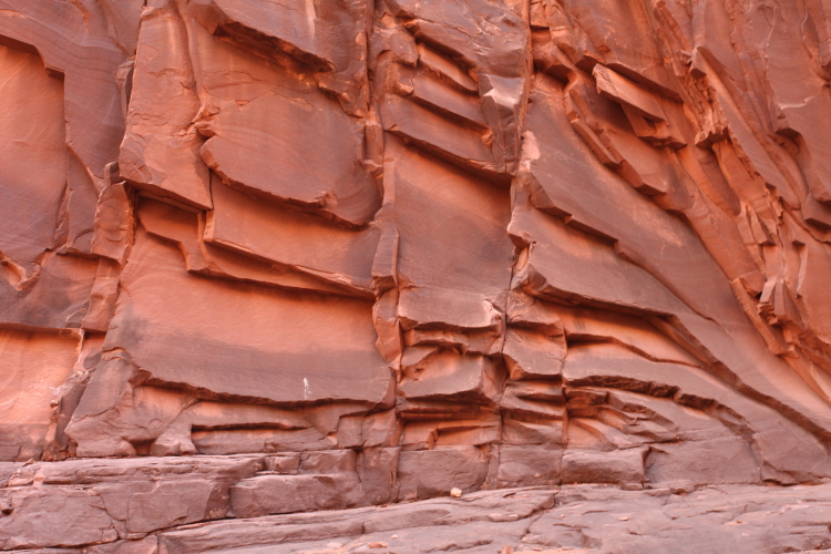
This view downstream in North Canyon from the reflecting pool shows the evidence for how the exfoliation formed. Before the canyon was cut, all of these rocks were held in place by the pressure of surrounding rocks. As the canyon was excavated, these confining pressures were removed and the rocks "popped" outwards parallel to the canyons' walls and floor. Notice how the exfoliation planes are parallel to the walls and floor of the canyon.
This is an ancient river channel filled with conglomerate in the Supai "Formation." I call these channel forms, "smiley faces." I am a proponent of changing the term Supai Group (with four formations) back to a single formation with four members. This is a much more convenient and easier to use classification.
Back on the river, the Redwall Limestone is the next unit to appear from beneath the river. Note how ordinary it looks here.
But soon it takes on its massive appearance as the river slices deeper into it
The Muav Limestone is at river level now as we approach the Triple Alcoves and Saddle Canyon
Near the mouth of Saddle Canyon
Hiking up into the wonderland of Saddle Canyon. Curiously, the trail does not follow the creek bed but rather climbs on the south slope far above the bed of the creek.
Attaining the highest spot on the trail reveals the reason for the long detour - a massive cliff failure (landslide or rockfall) is still blocking the channel such that a dam is constructed across the stream bed. Saddle Creek is busy removing this obstacle but it will still take some time to return to its "normal" gradient.
Behind the dam is a valley filled with sediment, allowing the growth of a profusion of plant life
The "final" falls within the Muav Limestone
Our group at Saddle Falls
Looking downstream to the mouth of the Little Colorado River. The main channel of the Big Colorado River is barely noticeable to the far right. It appears that the course of the LCR and the Colorado were once linked here, with some kind of a capture or spillover event creating the main channel to the right. All of this would have occurred high up in the strata and not at present river levels.
The beautiful waters of the Little Colorado River. This is absolutely no place for a tramway or restaurant in the bottom of the Grand Canyon. Support www.savetheconfluence.com.
Near Tanner Rapids, these barrel cactus thrive below Comanche Point on the East Rim and the Palisades of the Desert
The Dox Formation is a MesoProterozoic nearshore deposit of sandstone and mudstone. The mudstone here at Rattlesnake Camp, sandwiched between two thin sandstone beds, looked like recent river mud but is actually about 1.1 billion years old. This completes Part 1 of the trip to Phantom Ranch.
Adventure and foreign travel, philosophical and scientific musings, geology and landscapes, photography and earthly explorations.
Thursday, May 28, 2015
Thursday, April 30, 2015
Exploring Grand Staircase-Escalante National Monument with the Museum of Northern Arizona Ventures Program
In late April I took nine enthusiastic Venturers to the Grand Staircase-Escalante National Monument in southern Utah. The area is astounding and contains colorful and interesting rock formations, many Native sites, a few streams and waterfalls, and more scenery than one can possible assimilate in one week.
Our group beginning our first big hike at Lower Calf Creek Falls
These three guardians can be seen by observant hikers along the way in
After nearly 3 miles of walking, the falls come into view
They are truly unique in GS-ENM and even the whole Colorado Plateau. The water very likely originates as snow on the top of Boulder Mountain (Aquarius Plateau), making its way in the aquifer to the springs that feed Calf Creek.
Another shot of the group in front of the falls
The falls descend through the Navajo Sandstone, relatively resistant to erosion thus forming a constriction along the stream. Once the creek "falls" through to the Kayenta Formation, which is softer and more easily eroded than the Navajo Ss., the canyon widens up. This view looks upstream on Calf Creek at the point where the change in the canyon's width occurs. The Navajo is generally white here and the Kayenta is more reddish and interbedded with sandstone and siltstone.
A juniper relic from one of the previous droughts in the southwest
This is the 100 Hands panel above the Escalante River near Calf Creek
Looking upstream from the confluence of Calf Creek and the Escalante River
A petroglyph panel along the Escalante River
Day 3 saw our group down on the Hole-In-The-Rock Road and wandering down into the Dry Fork of Coyote Gulch
These narrow passages are fairly young features on the landscape, thus their youthful (narrow) character
Down to the bedrock bottom of the Gulch
Within the walls of the Dry Fork are excellent examples of the cross-bedding in the Navajo Sandstone. We observed textures related to sand avalanches (when the ancient dunes became over-steepened and sloughed down the leeward side) and climbing translatent strata (textures left by wind ripples across the leeward side of the dune). Additionally, we saw these iron concretions in the sandstone where extra iron precipitated out from fluids to make spheres of hardened sandstone. When dislodged from the cliff, they become "Moki marbles."
Virga occurs when rain evaporates before reaching the ground
The Straight Cliffs along the Hole-In-The-Rock Road form one of the most beautiful escarpments in the whole Southwest
A delicate arch form in the Devil's Garden section of the Monument is carved in Entrada Sandstone. This is the same rock unit that holds the arches in Arches National Park farther east.
The Devil's Garden
Another group shot near the rocks
We were lucky to have so many wonderful clouds to frame our sky this time of the year. Spring is normally dry in this part of the world.
We also made a stop at the new Escalante Heritage Center on the outskirts of Escalante town. Here is a replica of the wagons used in the Hole-In-The-Rock expedition.
On day 4 we headed east along the Burr Trail and found a narrow slot canyon beautifully back-lit Box elder trees (the state tree of Utah)
Into the slot
What a precious place, this one cut into the Wingate Sandstone
Next up was a short hike to the Wolverine Petrified Wood Area (south of the Burr Trail). While not as colorful as the petrified wood in the national park in Arizona, the area is rich in giant logs with great preservation.
In some specimens, knots can be seen where branches grew out of the trees
The switchbacks on the Burr Trail are exciting. We hiked along the road while two volunteers brought our vehicles down the twisting road, originally built in the 1950's as a uranium haul road from the Circle Cliffs to the mill's farther south.
Looking up at the dip on the Waterpocket Fold. The contact is the same as seen in Calf Creek with the reddish Kayenta lying below the white Navajo Sandstone.
Once below the fold, we could look up and see how the strata are being stripped off it. Reddish Carmel Formation form flat-irons against the underlying Navajo Sandstone.
Sign at the trail-head for the Strike Valley Overlook, one of my favorite places in the whole Southwest
On the way in we saw a huge juniper tree that had obviously been hit by lightning. No other trees were burned and it was splayed open and burned from the center outwards.
The enjoyable walk up....
...yields this reward! The Strike Valley in Capitol Reef National Park.
Looking south along the Waterpocket Fold
Looking north along the fold
The more resistant units stick up out of the valley while the softer units are covered by alluvium in the valley floors
Way in the distance, the Henry Mountains laccolith have punched through the sedimentary rocks. Note the Navajo Sandstone upturned along the edge of the intrusion. To see pictures from the contact up close, look at my blog posting here.
I just could not stop taking pictures on this picture perfect day!
On the return to Flagstaff, we stopped in the Monument at a place called the Toadstools
This is Entrada Sandstone with loose boulders of the Dakota Sandstone serving as the cap rock
Heart rock in the Entrada Sandstone
A family of hoodoos. These can tell us how fast the floor of the valley is "deflating." They began as rockfalls onto the valley floor and have protected the softer rocks below to create pedestals. And if we could know the rate at which the softer rock erodes, we could know when the rockfall occurred.
A great ending to a great trip
Yucca in bloom. My trip next year is already scheduled - April 25 to 29. Join me!
Subscribe to:
Posts (Atom)