Friday, February 17, 2012

Hiking in the Remote Galiuro Mountains

Addendum: On August 15, 2013, I received an e-mail from independent filmaker Cameron Trejo, who is completing a documentary film on the Power shootout. I watched the trailer of the new documentary here and it looks interesting. If you would like to follow his project on Facebook, click on the link here. It seems that this shootout is an Arizona story that after almost 100 years will not die!

Last week I made a 5 day backpack with friends into a remote mountain range in  southern Arizona. The Galiuro's are a place no one seems to know and the trails are little used, overgrown, and rocky. One of the highlights was seeing gobs of bear shit everywhere but they must have been in hibernation in early February because we saw none. But the volcanic rocks, erupted between about 30 and 25 million years ago were spectacular. Throw in some authentic Arizona Wild West shootouts that occurred here and you have a real adventure. 

The US Forest Service wildlife ranger, Chuck, drove out from Safford to meet our group and to help us along with trip planning. This was the first of many "old time"  courtesies that we experienced on this hike. When was the last time you "cold called" a government bureaucrat and they agreed to meet with you on your way to the trail head to get you situated. Amazing!

The trail head we used is on the east side of the range at Deer Creek. The oak trees and brown grass reminded us we were in southern Arizona.

We managed to put in about 3 to 4 miles on the first day to a place near Mud Springs.

Reminisces of the Old West were everywhere to be seen on the Tortilla Trail. Those are the PinaleƱo Mountains near Safford in the distance.

The agaves were healthy and seemed to be well watered, although they can withstand a lot of drought.

On our first night's camp we had a fantastic view to the east and a lot of wind. This was to be the worst weather we would encounter on the whole trip.

On day 2 we crested the range at Topout Divide and got a great view west into Rattlesnake Canyon. I am an experienced map reader but I and the rest of the group had a difficult time reading the contours in this particular area. We kept thinking we were father along than we actually were. The elevations are not extreme - we started at 5,000 feet and got as high as 7,200 feet. But there is little flat ground here and I couldn't make sense of the contours. This is a view down Horse Canyon towards Rattlesnake and we had to descend this on a trail that looked to have not been used for 10 years.

Scrambling down Horse Canyon

Brian getting water out of a tinaja. The water was kind of scarce on our trip but small pockets could be found in most canyons.

Joe enjoying our campfire on night 2 near Rattlesnake Canyon

This is the sign at the end of our day as we reached the confluence of Horse Canyon and Rattlesnake Creek.

On day 3 we decided to abandon our plans to head up Field Canyon to the West Divide. The bushwhacking was just gobbling up too much of our time and so we headed up Rattlesnake Canyon towards Powers Garden.

The cabin at Powers Garden. It looked as if the USFS trail crew uses this cabin regularly and it would be a great way to get out of the weather on a snowy night.

One of the many evidences for mining in the Galiuro's.

This is the famous Powers gold mine in Keilbach Canyon.

And the Power's Cabin where the famous Shootout occurred on February 9, 1918. You can read about it here.

I had not heard of this famous shoot out before our hike but after reading about it, I became fascinated with the tale.

Here is one book I read that gave an account that seemed favorable to the Power's side.

The night 3 campfire at the junction of Rattlesnake Canyon and the way to Holdout Spring

Up the trail (recently brushed by some trail crew) to Holdout Spring

Fresh water!

We saw much old growth in the floors of the canyons. This area was too inaccessible for logging and the trees were fantastic.

George beginning the big grind uphill to the East Divide Trail. I had a few difficulties here as the weather became hot and I was dehydrated.

Colorful oxidized rocks near the floor of one of the many caldera's we saw.

The signs were reminiscent of much earlier times in the wilderness

View northeast from the East Divide

These rhyolite ash beds may show their original bedding, or this could be the dip imprinting on them as the range was faulted

A pair of dikes coarsing upwards through ash beds

Hiking out on the final day. Within two days of our hike's ending, the range received more snow.

The group (left to right) George Abbott, Joe Alston, Norm Henderson, Wayne Ranney, Bryan Brown, and Frank Romaglia. What a treat to have such good friends to share stories, hiking and campfires!

Monday, February 13, 2012

Arizona is 100 Years Old

Arizona is 100 years old today! Most Arizonans are proud of our landscape, our national and state parks, our independent people, and our glorious climate. Many of us are not too proud of our misguided politicians who seem to think that guns on college campuses is a priority for making us safe. But I'll put that aside for now because our statehood is being celebrated today!

Happy Birthday Arizona! We love you!

100 years ago today Arizona became the 48th state in the Union

Here I am with the Arizona State Flag that traveled with me twice to the North Pole in 1998 and once to the South Pole in 2002. This flag has gotten around.


The "Arizona Group" standing at the North Pole, July 10, 1998. From left to right Hugh and Ruth Downs, the Herbergers, and Buzz Aldrin.

The official stamp from the US Postal Service to commemorate our state

Monday, January 16, 2012

Update to: "Google Honors A Geology Giant"

Friend Al Tomas of Phoenix forwarded a link so that you can view the January 11 doodle on Google that honors the 374th birthday of Nicholas Steno. Peruse it here.

Wednesday, January 11, 2012

Google Honors A Geology Giant

You'll have to be quick - these things only stay up for about 24 hours. But today, January 11, Google is honoring the birthday of Nicholas Steno, the "Father of Stratigraphy" and much more to the science of geology. Check it out at: www.google.com.

Just click on the "stratified" word that says Google. (In case you are too late to see it, I have added a photot of my desktop with the entry page for Google on January 11, 2012.

And Happy Birthday Nicco!

Friday, December 30, 2011

Earthquakes in Flagstaff?

The city of Flagstaff sits among some of the most beautiful western scenery to be seen anywhere, with graceful Ponderosa pines and the San Francisco Mountain nearby (both shown above). But the Lake Mary fault is a potential hazard in this idyllic setting, that could unleash a 6.9 magnitude earthquake in the area. Other large quakes were felt in here in 1906, 1910, and 1912. Their magnitudes were 6.0 and 6.2.

Watch a five minute video with Dr. David Brumbaugh who explains many of the particulars about this Falgstaff geo-feature: http://www.youtube.com/watch?v=vi3TVP8l7rc

Map of the Lake Mary Fault system, courtesy of the Arizona Earthquake Information Center at Northern Arizona University

Friday, December 16, 2011

Trail of Time at Grand Canyon National Park Receives Award

Regular readers of this blog will remember a posting from October, 2010 when the world's largest geo-science exhibit was dedicated at Grand Canyon National Park. My blog posting on the Trail of Time  can be recovered and viewed here. This exhibit recently won an award from the National Association for Interpretation. You can read the official NPS release about the award here.

Here's to the Trail of Time at Grand Canyon!

Sunday, December 11, 2011

Back to the Antarctic - the 100th (and 75th) Anniversaries of the First Person to Reach the South Pole

Roald Amundsen and four others from Norway had been trekking across the Antarctic continent by sled and dog team for 54 days when they finally arrived at 90° south on December 14, 1911. Amundsen and his team were thus the first people to ever stand at the very bottom of the Earth! Wednesday marks the 100th anniversary of this exploration milestone and in honor of it, I am sharing some of my photographs from my stint at the South Pole Station in December/January, 1986, when the 75th Anniversary of Amundsen's feat was commemorated. In this portfolio you will also see images of McMurdo Station from the winter of 1986-87. At the South Pole Station on December 14, 1986 about 46 of the 64 persons stationed at the Pole that day went outside on a bright and sunny day and remembered Roald Amundsen, Robert Scott, and their men.

This is (or was?) the National Science Foundation headquarters at McMurdo Station in 1986. The flags of the original 13 Antarctic Treaty signees fly in front of the building. Antarctica is the only continent dedicated to science and peace.

A view of a "street" in old McMurdo Station. I am sure that the buildings here have now been replaced.

Playing hacky-sack in front of the church in McMurdo, January, 1987. A bit of Observatory Hill is visible in the right background.

Here is the entire McMurdo Station as viewed from the top of Observatory Hill in November, 1986. Note the frozen Ross Sea in the upper left. Scott's Discovery Hut (1902) is located on the small peninsula jutting out into the sea.

I volunteered to help various geologists conduct their research. Here I am (on the left) working a tool that drills through the sea ice. Yes, we are out to sea in this photograph and standing on frozen ocean, where the sea ice is about 10 feet thick. Once we drilled a hole in the ice, we dropped a coring device that hit the ocean bottom about 1,600 feet down and brought up whatever sediment had accumulated there over many thousands of years. This was research being conducted by Dr. Rob Dunbar, then of Rice University but now at Stanford.

An outdoor picnic at McMurdo Station, November, 1986.

On December 13, I received orders to report to the South Pole Station at 90° south. Here we are flying over the Shackleton Glacier (or was it the Beardmore?) with the Trans-Antarctic Mountains in the distance. These mountains are about 5,000 miles long and are a fantastic trove of earth history

Of course, the bottom of the world is upside down and when I walked off the C-130 airplane, this is what I saw. I'll turn the rest of the photographs "up-side down" so that you can see them better.

The old sign in front of the South Pole Station. Back in these days it was called USARP - the United States Antarctic Research Program. Now I believe it is called simply USAP - the United States Antarctic Program.

This is the main entrance to the old dome as it looked in December, 1986.

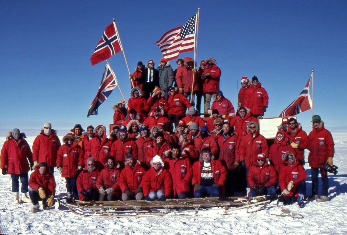
Here is the official 75th Anniversary photograph on December 14, 1986. We were commemorating the first arrival of Amundsen and his men at the South Pole on December 14, 1911. I am in the front row, third person on the right (light colored shirt beneath the jacket). We decided to hoist the Norwegian, British and American flags for the commemoration. Why not - Scott arrived only five weeks later and after 100 years, that is essentially the same time. I think Amundsen would agree that it's close enough.

I stepped out from the group photo to take one of my own in color

The galley crew made a cake for the occasion that shows the old South Pole Station on top of it. Nice!

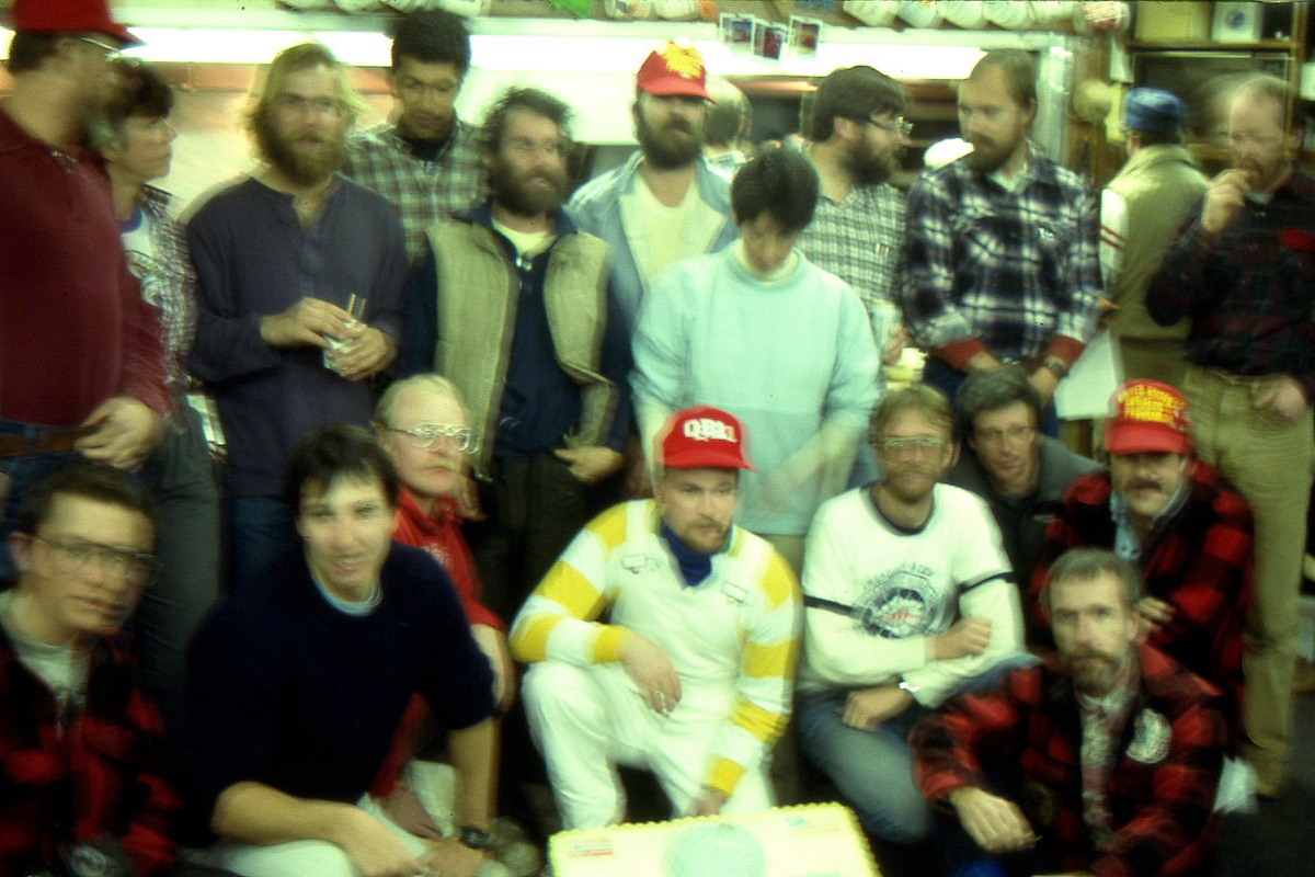
This is a blurry photo taken of the group after we returned to inside the dome, with the baker kneeling in front of the cake below. It was dark in there and this was film photography, so that is why the photo is blurred.

A rousing celebration at the South Pole on Christmas Day, December 25, 1986. Even though a lot of work is performed at these stations, every day is a holiday at the South Pole. Temperature here a brisk -30° F.

The reason for my stint at the South Pole Station is that the Clean Air Facility (about 10 years old) was becoming buried in snow drifts and we were sent to hoist it up using pneumatic technology. Previous attempts in other southern summers had failed. The conditions were cold and windy. I saw a wind chill of -60° F, and the warmest it ever got was -6° F. Not cold you say, but this was summer time!

After three weeks, we had the building up on steel girders and were ready to lock it in place. The snow accumulated here at about one foot per year, so all buildings are subject to being buried.

After only 20 minutes in the cold, one's beard begins to get heavy

There was a "warm-up" hut located nearby with hot coffee and soup and most of us needed to go inside at least every 30 minutes - even with our Antarctic clothing

The glacial ice "drifts" over the pole of the earth at about 10 meters per year. This means that the official marker must be moved each year. You might see a small marker located between the two poles on the sign - this was the exact pole position on January 1, 1987. My feet frame the view (below).

The sign shows that the land at the South Pole is very close to sea level but that the ice thickness is about 9,000 feet. Not only is it cold here but there is not much oxygen!

In December of 2002, I returned to the South Pole with a group of visitors. We took an eight hour flight (with a refueling stop on the ice along the way) to the Pole from a camp we were staying at.

This is the view about half way to the pole. 90% of the planets fresh water is tied up in Antarctic ice!

At this time, a new South Pole station was being built near the old dome.

The material for this station was brought in overland from McMurdo Station on an Ice Highway. Read about it here. This station is designed so that it can be uplifted as the snow begins to pile up around its base.

Research in Antarctica continues today and to read a recent article about a sub-glacial mountain range on the White Continent, click here. And to read the blog of Dr. Ed Stump who has conducted 40 years of research in the Trans-Antarctic Mountains, click here.