For the month of March I am lecturing on a Smithsonian Journeys trip to Australia and New Zealand. The flight over on the Airbus 380 was relatively easy - I can highly recommend the comfort on this exquisite and roomy jet (and I flew on cattle class!). I was able to take in four movies - The Shape of Water, Three Billboards Outside Ebbing Missouri, The Man From Snowy River, and Crocodile Dundee. Good fun. Once on the ground here, the distances are vast and we can only see but a small slice of this immense landscape. However, the rewards are grand and varied, from tropical forests, to deserts to a very expensive city.
We arrived in Cairns after torrential rains. This is the Barron River in flood.
The spray coming up out of the gorge behind the gondola is from the Barron Falls, normally a small trickle (due to dewatering in a hydro-electric scheme) that falls 900 feet.
This is Barron Falls in late October, 2015 - the last time I visited here.
View from the same platform in March, 2018. You can watch a one minute video of the flood
here.
The newspapers were full of stories about the rain and the floods.
Some areas received 24 inches in three days and a few towns were cut off when bridges went out.
The rain had stopped by the time we arrived and our walk through the rainforest was on the cool side.
I wish I could remember the name of this emergent giant in the rainforest. Almost as tall as a California redwood, the species was harvested for wood and is nearly gone from this forest.
The Daintreee is considered the oldest continuously existing rainforest in the world, perhaps as old as the Cretaceous time period. The Daintree may be 125 million years old.
On to the Great Barrier Reef at Michaelmas Caye. The following are shots I took with my underwater camera. With over 600 species of coral found here, I have no idea what the names are.
But they are beautiful.
Corals are very tiny organisms that build calcium "homes" for themselves. The colonies are the great limestone factories on planet Earth.
A large colorful parrotfish.
Brain coral and giant clams.
Close-up of a giant clam, which can weigh over one ton! Here the animal has its shells wide open. Another brilliant snorkel on the Great Barrier Reef. This time I had no issues with water leaking into my mask as I lathered the Vaseline real thick on the mustache.
So, it is time to leave green and rainy Queensland behind and head west to the Outback! Note the difference in color between this near-coastal scene and the one that follows from the interior of the continent.
Landing at Alice Springs in the Red Center of Australia. Note the water gap running through the upturned ridge of rock - that is Hevitree Gap cut by the Todd River.
Australia is no different from any other country in having its war memorial to remind the citizens that they are warriors. The many signs leading up to the hilltop view list every single war Australia has participated in. The one for Afghanistan still has no end date.
Although most people conflate the Outback with desert, this area is more akin to semi-arid with many trees and the invader grass called bufflegrass. The Outback as well had received a lot of rain in the previous 10 days.
We experienced an Aboriginal encounter with the local tribe. Here they are selling their art painted on canvas.
Mark is showing how to throw the boomerang.
We got to try a bit of kangaroo tail. It tasted like pork.
And we enjoyed some hot tea from the billie.
Next, on the open road west from Alice Springs along the MacDonnell Ranges. These Precambrian quartzite and shale rocks were folded during the Alice Springs Orogeny between 350 and 300 million years ago. Many water gaps are cut through these linear uplifts.
These are cycads, an ancient plant that evolved as early as the Jurassic period, some 200 to 145 million years ago. These MacDonnell cycads (
Macrozamia macdonnellii) were seen in the Standley Gorge as refugia specimens held over from wetter times.
The sheer walls of the Standley Gorge, cut into the Hevitree Quartzite.
We visited another water gap called Simpson's Gap. This is my favorite as its form is gentler and more welcoming.
This is the reflecting pool in the narrows of Simpson's Gap.
An example of the Hevitree Quartzite, deposited as sandstone around 900 to 800 million years ago.
Now we are making our way over 450 kilometers from Alice Springs to the southwest and Uluru or Ayers Rock. The road was quite good and fairly lush given the recent rains.
That's Mt. Connor in the distance rising about 1200 feet above the plain. It is composed of a hard sandstone/quartzite caprock underlain by softer shales and mudstones.
Close-up of Ayers Rock with a nice cirrus cap.
The bare sandstone monolith funnels water off of the top into numerous pools at the base. These were much sought-after locations for water and animal resources, which were also attracted to the water.
View to the northeast on the south side of Ayers Rock. The rock is technically composed of a sandstone called arkose. These are sandstones that contain much pink feldspar, which suggests that the source area was not far away when this was deposited 550 Ma. Feldspar tends to weather chemically more rapidly than other minerals and its presence here means there was not much transport distance. See below for an explanation.
This is the northwest side of the rock and where the trail goes to the top. It was announced while we were here that climbing of the rock will be outlawed officially on October 26, 2019. It is now heavily discouraged but still attainable, although it is forbidden on days when the temperature reaches 36ºC.
This is the beginning of our champagne sunset from the viewing area.
We saw this one with about 700 other people. About 500,000 people visit Uluru every year.
Last shot of the evening.
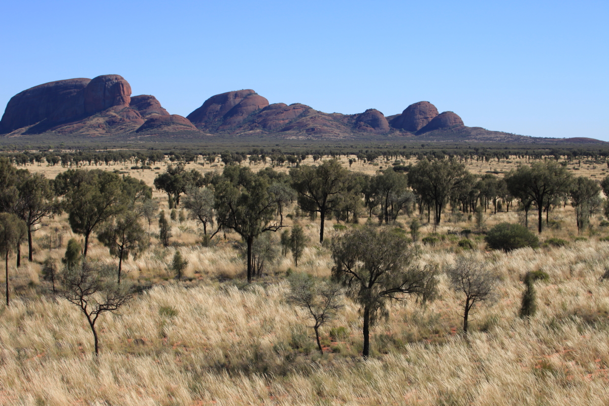
The next day we headed further west to Kata Tjuta, formerly known as the Olgas. Kata Tjuta is the local Aboriginal name meaning "Many Heads" for the 36 domes of rock.
Telephoto shot of the Olgas across the plain.
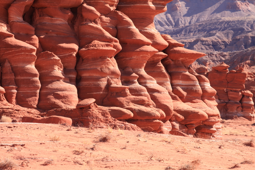
While only 16 miles away from Uluru, the rocks here are much coarser being composed of boulder and cobble conglomerate. Some of the large clasts are well-rounded, while others are sub-rounded or even sub-angular.
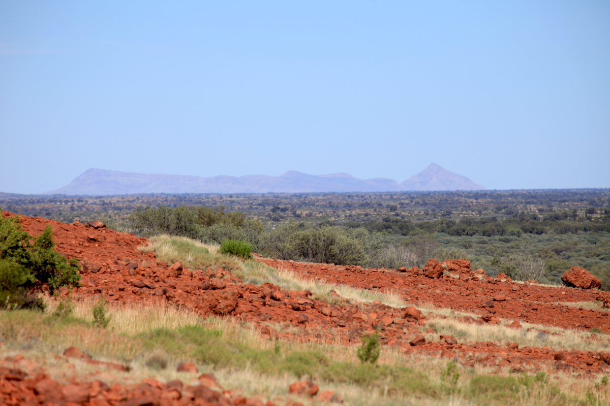
The clast compositions suggest that the material was derived from the nearby Petermann Mountains, observed to the southwest of Kata Tjuta. I find it amazing that after 550 million years, the source area is still standing and still presumably shedding debris outwards!
Basalt clast from the Pertermann Mountains. This was the end of our Outback experience.
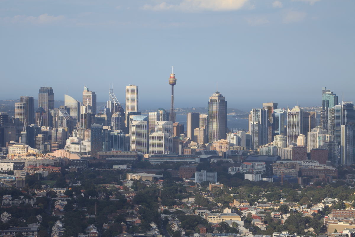
Flying into the city of Sydney, Australia's largest.
It is really quite scenic and easy to get around (at least in the city center where we stayed - the suburbs have terrible traffic).
The iconic Harbor Bridge and Sydney Opera House as seen from Lady MacQuarie's Chair.
This is the entrance to Port Jackson (Sydney Harbor) looking north. The open Pacific Ocean is to the right and the peninsula across the way is called North Head with the photo taken from atop South Head. Within this harbor are numerous inlets. Sydney-ites are obsessed with home prices and we were told that the median home price today is $1.2 million AUD.
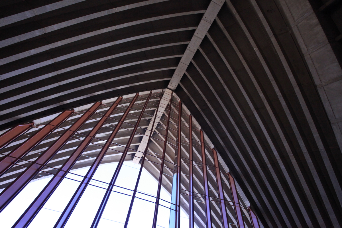
Inside the Sydney Opera House.
It took 13 years to build and there really is no other structure quite like it. Inside of it are five venues offering everything from operas to ballets, to theater, to rock concerts!
The shells are covered in ceramic tiles made in Sweden.
The Harbor Bridge as seen from the upper terrace of the Opera House.
Sydney is known for its beautiful sandstone buildings and convict labor was used to quarry the stone. Near the Opera House you can see where carving of the sandstone has occurred. The deposit is called the Hawkesbury Sandstone and it is a Triassic fluvial deposit showing minimal mudrock lenses within Sydney. The source area was located to the south (modern coordinates), likely from a place now covered in ice in Antarctica!
It really has some beautiful textures and colors as seen on this wall on MacQuarie Street. This completes my 2018 trip to Australia. Now on to New Zealand!