Sunday, October 25, 2015

Green and Blue Australia

Tonight, as I was looking over two days worth of photographs from here in Cairns, Queensland, I realized that there is a distinct color theme running through them. Yesterday the major color was green as we traveled into the Daintree Rainforest. Today, it was blue as we snorkeled and swam at a small portion of the Great Barrier Reef. Tomorrow we will head out to the Outback and the next posting may very likely be called Red Australia. But I get ahead of myself....

Green Australia


Green Australia begins at the Freshwater Station of the Kuranda Railway. This is now a tourist railroad of 23 miles length but was originally conceived in the 1880's as a way for the tin miners in the Macallister Mountains to get their ore out to the port at Cairns.

Train pulling into the Freshwater Station

There were 12 passenger cars in the train's consist pulled by two diesel engines that took us up the 2,000 foot incline to the Atherton Plateau.

The bridge over Stone Creek

Stone Creek Falls. This is the end of the dry season with the wet season beginning in a few weeks. With over 80 inches of rain annually, these falls become huge in February.

Looking to the rear of the train whilst on the Stone Creek Falls Bridge

Close-up of the train through the forest

Looking to the south across the coastal floodplain as the Kuranda Railroad winds upwards into the mountains.

The Daintree is one of the oldest rainforests on earth considering that this part of Australia has not experienced an Ice Age since the forest was first established in the Cretaceous time period. It thus may be as old as 100 to 140 million years.

Barron Falls during the dry season. Imagine the entire rocky area running with water.

This is an obvious knickpoint on the Barron River, where the gradient undergoes a substantial change from that found both upstream and downstream. It was interesting to see that the river had a low gradient both above and below this point but that the falls (at over 600 feet high) were placed in the middle of this. I know of no obvious faulting downstream from here or uplift upstream. Perhaps rock type has determined the presence of this knickpoint?

At the Kuranda Station where numerous tropical plants line the platform

The Barron River Gorge slices through the Atherton Plateau

Note the relatively flat top above the gorge. Superposition? Antecedence? I was struck by how the river seems to have been "let down" into the plateau here.

There is a gondola called the Skytrain that takes visitors down from Kuranda to the coastal plain and this photo was taken from that gondola.

I got into a gondola with a glass-bottomed floor and took this picture of the pattern of a tree fern, growing near one of the gondola towers.

At the end of the day we were invited to a presentation by a biologist about koala's. Everyone got to hold this two-year old female named Nellie.

She was quite calm during the whole event, which lasted about an hour. Nellie, as you can imagine, charmed the daylights out of the people in our group.

They eat the leaves of the gum tress (eucalyptus)

A little less attractive but no less interesting was this giant crocodile within an enclosure. This concludes the photos I took from Green Australia.

Blue Australia
The next day we boarded the Ocean Spirit for a two hour ride out to Michaelmas Cay

The skyline of Cairns recedes into view

Approaching Michaelmas Cay. The Great Barrier Reef is one of the Original Seven Wonders of the Natural World - the other six are Grand Canyon, Mt. Everest, Victoria Falls, the Northern Lights,  the harbor at Rio de Janeiro, and Paracutín Volcano (Mexico).

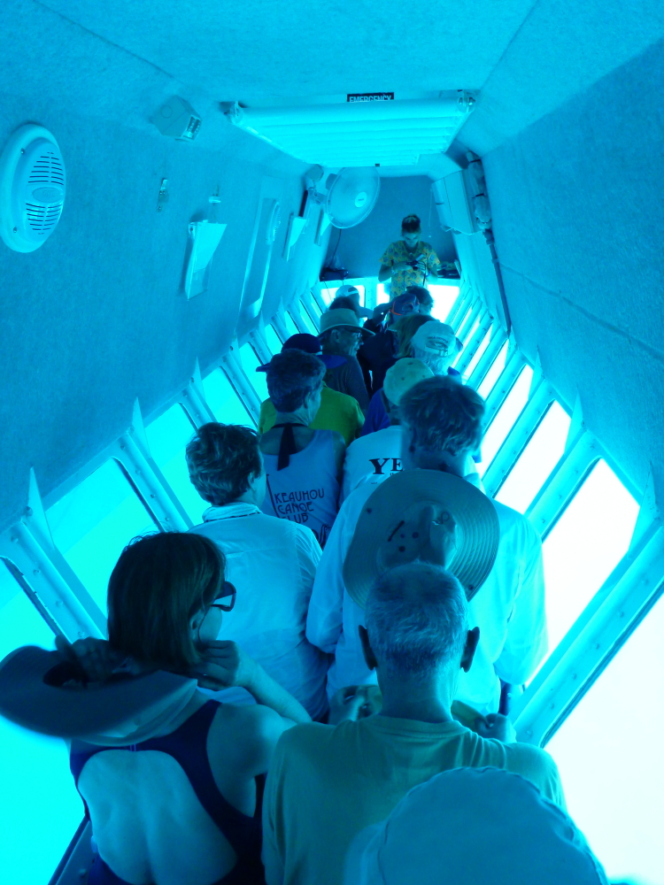
Remember that ride at Disneyland? Well, there is a submersible craft at this cay that we were privileged to ride in.

The view from the inside of the submersible

And the view outside

This spaghetti coral waves back and forth in the water currents

 Boulder coral

"Sam" has been working on the Ocean Spirit for about 6 months and here she approaches a noddy sitting on the egg.

Close-up of the noddy

There are as many as 16,000 birds nesting on this coral sand island

A view of the egg

I had one of my best days ever snorkeling over this part of the reef. Here a giant clam rests on the sandy bottom.

Close-up of branching coral.

Colorful branching coral. I was using my Panasonic underwater camera for the first time in water and was pleased with the results (although after having looked a the photo's, I know I could do better a second time). My mustache made the mask leak water and I was constantly fighting the intrusion of salt water into my eyes.

The great limestone factory of the barrier reef

These all have names but I never heard what there were and would not remember them if I had

Blue branching coral on a boulder coral

Canyon and monuments of coral

Corals are tiny soft polyps that secrete a calcium chamber for themselves, one on top of the other

I chased this guy for good while through the canyons

Or was he leading me away from the rest of them?

I have always told my geology students that if they wanted to attain a certain kind of immortality that they should write in their will that they want to be "buried" at the the Great Barrier Reef. Then when Australia drifts northward and collides with Asia sometime in the future, their fossilized bones will be uplifted in a Himalayan-type mountain range and might become exposed on a high-standing ledge of limestone. And then, here I was snorkeling on the reef! Magic...

Michaelmas Cay

The ride back into the city of Cairns was fantastic. I had never been on a catamaran before and the experience was quite pleasing.

The sail was hoisted but we never did turn off the engine

Returning to the harbor in Trinity Bay. We are now going to travel into the heart of the Australian continent to Alice Springs and Ayers Rock (Uluru). Stay tuned!

Wednesday, October 21, 2015

Australia and New Zealand Adventure Begins!

Ayers Rock in the Northern Territory, also known as Uluru in the native language
I am off to the Land Down Under and will be blogging from Australia and New Zealand. Be sure to follow me as we explore the Daintree Rainforest, Ayers Rock (Uluru), the great cities of Sydney and Christchurch, as well as Mt. Cook National Park, Milford Sound, Queenstown, and Rotorua, New Zealand. This is a trip with Smithsonian Journeys and the entire itinerary can be found here.
Milford Sound, New Zealand

Saturday, October 17, 2015

New Mexico's Chama River - A Geologic Gem!

Note to the readers of Earthly-Musings:  I apologize for a seeming lack of postings in the last month but I have been busy with trips and numerous weddings. Stay tuned - an Australia and New Zealand adventure with Smithsonian Journeys will begin next week with many postings from down under.

For some, New Mexico may be the one Four Corner state least likely to be associated with the Colorado Plateau. This is not for a lack of colorful sedimentary rocks so much as its lack of famous national parks that might highlight its subtle charms. There is no Grand Canyon or Petrified Forest, no Zion, Bryce, or Canyonlands, and no Black Canyon of the Gunnison, Mesa Verde or Dinosaur National Monument. Only the isolated and southern Carlsbad Caverns come to mind when thinking about parks in New Mexico. But recently, some friends and I explored the officially designated Wild and Scenic Chama River  in northern New Mexico found northwest of Santa Fe. It is a hidden geologic gem!

The river is located just east of the Continental Divide and is tributary to the Rio Grande. The Chama was dammed in the 1930's to regulate its seasonal fluctuations for farmers downstream. I found it curious that one of the dams buttress walls was constructed within the Cretaceous Mancos Shale.

The El Vado reservoir is a high elevation recreation area with water added to the system from the San Juan River on the other side of the divide. A pumping system brings New Mexico their share of their Colorado River allotment. We were floating on San Juan River water but east of the divide.

 Stratigraphic column for the Chama River rocks taken from the BLM guide to the Chama River

After leaving the put-in, the rock strata show an obvious down-dip in the upstream direction. Thus we were getting into older strata as we moved downstream. Here, sandstone in the Morrison Formation  was at the surface.

Downstream view of the river from our first camp

None the tarp - we experienced some significant rain on the front end of this river trip but it did nothing to dampen our spirits for the extraordinary scenery we saw and warm comraderie of opur small group of eight.

The BLM  manages the river and has built some very nice sandstone approaches into the campsites. The ranger on duty at the put-in apologized for the "intrusion" into the wilderness but I thought they were well done and did not detract anything from the  experience.

A large boulder of Morrison sandstone attracts kayakers

Fall colors had begun in some box elder trees, even though this trip was over the Labor Day weekend

Beneath the Morrison Formation was the Todilto Formation, a gypsum rich deposit

This unit is commonly seen in northern New Mexico and was deposited along the arid shores of a shallow Jurassic sea.

As the rocks continued to rise up from the river channel, the next unit was the Jurassic Entrada Sandstone, the "star" of the Chama River corridor.

Our second night's camp was across from a beautiful cliff of red sandstone with conifers growing on it. This was great spot to watch the big rain that came later in the afternoon.

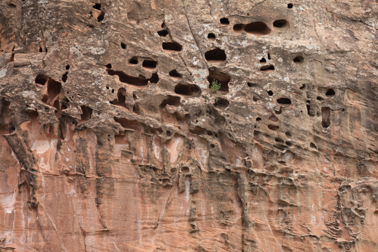
Tafoni in the Entrada Sandstone, fired from case-hardening of the sandstone.

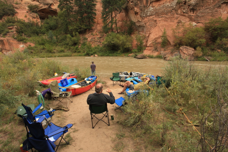
Camp scene on the Chama River. From here we hiked up the cliff behind the camp.

And began to get a great view of the river canyon

One usually doesn't associate a red rock canyon with lush conifers but the Chama is a located in a special place next to higher country that draws in the precip.

What a place!

Telephoto view of the Chama River Canyon

Wide angle view downstream in the Chama River Canyon. The rain began shortly after this photo was taken.

A very foggy third morning greeted us after a night of rain and dampness

John paddles down into the receding cloud cover - the storm had passed

Bill and Don share a quiet moment on the river. Most of the "bigger" rapids on the Chama are located in the final stretch of the river trip. They are really fun Class II and III rapids.

More floating through the Ponderosa pines

The Todilto Formation caps th colorful cliffs of Entrada Sandstone at the southern end of the river canyon. The lower tree-covered slopes are part of the emerging Chinle Formation. In other words, there is no Glen Canyon Group in northwestern New Mexico.

A Benadictine monastery, Christ of the Desert, is located at the southern end of the river canyon and is connected to the outside world by a 15 mile dirt road. Check out the link I have provided to find out more.

Happy boaters! Many times during this three day trip, I reflected on how lucky I am to have such wonderful friends - all who own the proper gear and experience - that places us in such spectacular settings, doing wild and grand adventures!

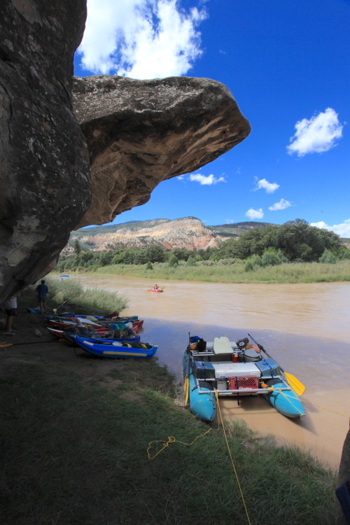
Our last lunch was beneath an overhang in the Shinarump Member of the Chinle Formation

View upstream from the overhang

Alcove forming at the contact with the Entrada Sandstone and the shale within the Chinle Formation. These alcoves are common where aquifer rocks sit on top of an aquitard or aquiclude. The groundwater (before any canyon cutting) is "ponded" on top of the shale, thus weakening the cement in the overlying sandstone, such that when it is finally exposed, it weathers away faster.

Near the Gallina River coming in from the west

The lowest unit encountered on the trip is the Shinarump Member of the Chinle Formation, a coarse sandstone and pebble conglomerate deposited in a braided stream environment some 225 Ma.

Close-up of the Shinarump cliff near the Big Eddy take-out. This was a fantastic trip in a wonderful area. The Chama River charms and enchants!