I've been in Iceland for the last week, lecturing on a
Smithsonian Journeys natural history tour. This is the same itinerary I participated with in September of last year and many of the places visited are the same from that trip.
Hraunfoss (literally Lava Falls) near Reykhold. The dark line of rocks above the falls is a porous post-glacial lava flow that spread over and above an older, denser lava flow. Snow and rain water seep into a shallow water table and emerge at the contact of the two lava flows.
Near Arnarstapi on the Snæfellnes Peninsula. Note the color and texture difference within this single lava flow in the high cliff. The top (orange) part is called the
colonnade and the gray lower part is called the
entablature. The irregular joint pattern in the entablature is due to water seeping into the flow while it was cooling. The colonnade cooled in the absence of water. In the Grand Canyon and elsewhere, these textures may be reversed when river water flowed over the top of cooling lava flow.
This lava flow erupted in sea water during the last glaciation (more than 10,000 years) and the lower part of the flow became protected when it cooled and so the colonnade is located on the bottom.
Beautiful coastline on the Snæfellnes Peninsula.
The bay at Arnarstapi and a highly eroded lava flow.
Iceland flags over the North Atlantic Ocean.
At Lóndrangar along the southwest corner of the peninsula, one can view the inside throat (or core) of a volcano. The towers are the eroded remnants of the vent material, with the whitish cliffs to the right composed of tephra (ash) erupted from the vent.
We were very fortunate to travel the whole day on the peninsula with the geologist who made the
geologic map of Iceland, Haukur Jóhannessen. Traveling with his map allowed me to know what rocks we were looking at during the entire trip.
Sitting in the North Atlantic, one is never far from bad weather in Iceland. But it does have a certain drama to it.
We visited the Volcano Museum in Stykkisshólmur and saw this engraving of the Snæfellnes volcano by Carl Emanuel Larsen, completed in 1845. Note the three-masted ship anchored in the bay to the right.
Near Stykkisshólmur, this rhyolite volcano exposed colorful rocks.
And then Haukur mentioned that this was the site of an ancient landslide, which I have outline here on the same photograph as above. For more pictures of the Snæfellsnes Peninsula, see my blog posting from September 25, 2016
here. Now we move on to the North Coast of Iceland.
Leaving the town of Akureryi headed to the North Coast.
In the little town of Husvik, a monument to the training of the Apollo astronauts in 1965 and 1967.
Atlantic Puffins (
Fraturcula artica) nest on the hillside facing the north shore of Iceland near Tjörnes. People love puffins!
A view of the
pseudo-craters at Lake Myvatn, where hot lava poured over marshy ground about 2,800 year ago, causing stream blasts that created these "rootless" cones. Features like this are often called maars in North America.
The geothermal area at Lake Myvatn. My-vatn means midge-water in the Icelandic language and we saw zillions of them. They do not bite but swarm around everywhere.
Dettifoss waterfall, considered Europe's largest.
At Dettifoss, the car park is about 1/2 kilometer away from the falls and one must walk across this channel of an outburst flood, which in Icelandic are called
Jökulhlaups.
This outcrop is located to the west of the car park and is the highest deposit from the outburst flood.
I have outlined the extend of this channel (above) but the floods were much bigger than this. Three of them have been documented since the end of the last Ice Age coming to the north from the Vatnjökull glacier.
The geothermal area at Hvirir has lots of steam vents, boiling mud pots, and hissing springs.
Here, sulphur deposits ring the openings in a steam vent. I like the smell of the Earth's interior!
View to the south from near Lake Myvatn. The giant
Skjaldbeiđur shield volcano looms on the horizon. For more pictures of the North Coast of Iceland, see my blog posting from September 27, 2016
here. We now move to the South Coast where I experienced my best weather ever for this part of Iceland.
The Gulf Stream rams against the south shore of Iceland making this the wettest side of the island. Consequently, there is much greenery here along with hundreds of waterfalls.
Sk
ógarfoss on the South Coast.
The Alaska lupine was brought here in 1885 but was planted widely to control soil erosion beginning in 1960. It
is now rampant across the landscape, outcompeting native species.
It is a beautiful plant however.
South Coast view across a lupine field.
Flowers on top of the basalt columns near Reynisfjara.
Sea stacks at Reynisfjara are the eroded remains of a volcanic vent.
Hyaloclastite rocks (lava quenched after erupting into water or ice) have tumbled down onto the black sand beach here.
Close-up of a hyaloclastite.
Top view of basalt columns at Reynisfjara.
Typical Icelandic scene on the South Coast.
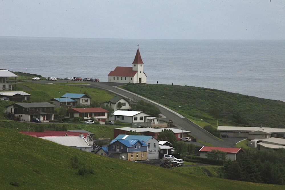
The church at Vik, the southernmost town in Iceland.
Sejalandsfoss.
This waterfall can be accessed from behind and when doing this, a rainbow sometimes appears.
Mt. Hekla, Icelands most dangerous volcano. It last erupted in 2000 and poses a major threat
due to its explosiveness.
On our last day we visited a geothermal plant where they had a great rock collection from the island.
A section of insulated pipe that brings hot water to Reykjavik.
It looks like a street map of Reykjavik but it is actually a map showing the hot water distribution system in a typical neighborhood.
The turbines are powered by steam.
Geothermal plants are very carbon-friendly and only generate about 15% of the CO2 that an equivalent carbon-fueled plant would make. However, Iceland is a
very forward-looking country and this amount is deemed unacceptable. So the geothermal companies have developed a way to inject the CO2 back into the volcanic rocks, setting up a chemical reaction that deposits limestone on the basalt (the white on this basalt rock).
I highly recommend a visit to this fascinating country and will be leading another tour for Smithsonian Journeys July 5 to 15, 2018. Whomever you go with and whenever you go, take a geologist with you - there is so much to see and learn about.
Mike DeVault took this picture of me at the end of our trip while visiting Reynisfjara. Thanks Mike!


Great photos and commentary (as always)! And great blue sky! Wish we had that two weeks before with 60 mph pelting rain and 40 degrees.
ReplyDelete