In late March we obtained a permit to undertake a five-day backpack in Grand Canyon along the Grandview and Tonto trails. Great weather and geology awaited us.
Here is our group at the Grandview Trailhead - Helen, Wayne, Chris, Bryan and Mike. I decided not to bring my 15 lbs. of Canon camera glass and steel so all off these images are taken with a small Panasonic camera. The results are less than stellar by my standards but not having to carry the weight was pure joy!
It was a bit chilly as we started and the reported "ice at the top" was non-existent. Winter in northern Arizona ended two months prior. The trail here is descending through the Kaibab Limestone with the eastern arm of Grapevine Canyon seen on the floor of the canyon in the distance.
The Grandview has a few narrow places near the top within the Kaibab.
Into the Coconino Sandstone now, we pick up the rip-rap, likely made by the copper miners who made the trail in the 1890's.
Mike admires the beautiful stonework on a switchback in the Hermit Formation.
Bryan admires their work as well. The trail is steep here as you can see.
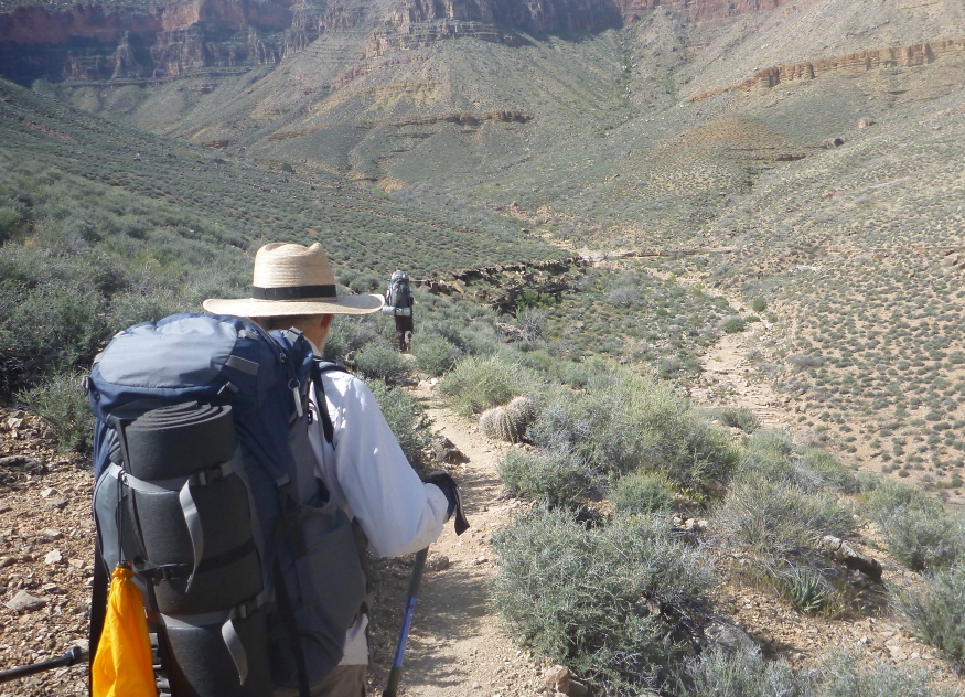
After a three-mile hike, Helen looks back to the top toward Grandview Point.
Chris explores one of the ruins from the 1890's mining era. The Last Chance Mine was a small but very rich copper deposit emplaced during the Laramide Orogeny, some 55 million years ago when much of the uplift of there Colorado Plateau occurred. Samples of copper ore from the Last Chance were about 55% copper. To put this in perspective, copper is being economically mined today in Arizona with concentrations as low as 0.3%.
Tin can midden from the era of the Last Chance Mine.
Excellent view to the west of the Grandview-Phantom monocline as it trends through the Redwall Limestone. It looks like the Redwall was greatly fractured when the fold was formed and can be seen where the break on top of the cliff is located.
Descending the Redwall cliff is always in a treat for one's quad muscles!
This was an especially steep and rugged spot in need of repair.
But we finally made it through to the Muav/Bright Angel slope. The small-looking notch in the right cliff-line (with two tiny "peaks" right of it)) is a saddle where the Grandview Trail passed through.
Entering the realm of Cottonwood Creek - the location of our first nights' camp. There are few things better than camping next to these tiny streams full of life, color, and song
On our second day we began life on the Tonto Platform. It's hard for me to imagine the Grand Canyon without the Tonto - it is a break and a reprieve from utter steepness. Here a "normal" world of generally flat ground dominates and makes the walking not only tolerable, but pleasant.
And in spring, the wildflowers are riotous.
But so too are the rocks and they never fade of color no matter the season. Here the Bright Angel Shale shows its stuff.
Down below the Tonto is the Grand Canyon Metamorphic Complex with its pink-colored Zoroaster Granite dikes ripping through the Vishnu Schist. The diagonal dikes seen here are approximately 75 feet thick.
View of the Inner Gorge of the Grand Canyon and the Colorado River. View looking west toward Zoroaster Temple on the right skyline.
Here is a view directly across the north side of the river to Wotan's Throne (left) and Vishnu Temple (right).
We were entering the many fingered gash in the South Rim known as Grapevine Creek.
The vegetation gave away the presence of running water, which we used to fill to our one gallon capacity. This would allow us to move out of the drainage for an enjoyable night out on the Tonto.
'
Off to the west I noticed something odd. A butte with two parts to it.
As we moved along the boulders as pygmys in a forest of rock, it was obvious that the two parts of the butte were not all that similar.
After a nights rest on the Tonto edge, early morning light revealed an answer. The main part of the butte (right) is in-place Bright Angel Shale and Muav Limestone. But shadows in the center of the photo highlight a fault that has dropped Redwall Limestone from a now eroded cliff down next to the shale. This is likely a landslide (rather than a tectonic fault), that has placed the Redwall sliver plastered against the shale. This small structure escaped detection in the making of the geologic map of this area. so there was no warning it was here.
The moon frames the scene later in the morning.
Day three into Tonto bliss. I could walk here forever and never tire of the endless nooks and crannies that bring ever more scenery.
Purple sage in bloom along the Tonto Trail.
Agave utahensis happy in its chosen home.
Beavertail prickly pear tends to turn purple when it is drought stressed and we saw numerous examples of it on this late March hike.
Near where Clear Creek and Zoroaster Creek enter the Colorado River on the north side, an ancient landscape reveals itself to the informed viewer. It was here that a resistant knob of granite and schist (photo center) had formed a hill 400-foot high in an otherwise flat and eroding landscape. Then, some 525 million years ago, the sea began to encroach upon the hill from the west before it could be flattened. The sea washed continental sand around the hill but not upon it and today the Tapeats Sandstone thins from every direction around this hill.
I have viewed this ancient topography many times while hiking down the Kaibab Trail but now I was face to face with it on the Tonto Trail. The Colorado River gorge slices through the ancient hill in the center of this photograph. If a hill resists erosion in an ancient landscape and no one sees it, is it still there?
Dog weed flowers to end the hike. What a trip! Thanks for reading.


ReplyDeleteCan't wait to get back to the canyon. Thanks for posting Wayne. I just love it. All your posts!
Wow, what a trip! Hats off to you all.
ReplyDelete