Friday, May 31, 2013

Status Update - The Highway 89 Slump and Road Closure

 Image courtesy of the Arizona Department of Transportation (ADOT) web banner

For those following the closure of US Highway 89 near Page, AZ on February 20, 2013, the Arizona Department of Transportation (ADOT) has just issued an update on the geotechnical work underway at the road failure site on the slope of the Echo Cliffs. You can view the video of what's been found here. I've watched this video twice now and am impressed with the level of professionalism and expertise ADOT has brought to bear on the matter so far.

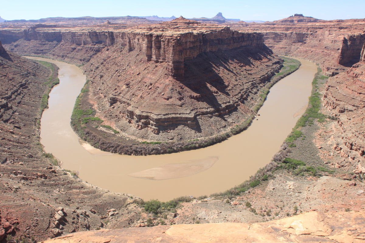
In the video you will hear some technical jargon but it's possible to break it down into simpler English. First, you'll hear about what has been going on at the site since February 20. Thus far, seventeen holes have been drilled at levels above, at, and below the roadbed, as geologists and engineers attempt to "map" what's in the subsurface beneath the slump. About 500 feet of roadway was affected by the slide but downslope there is a 1,200 foot wide swath of rock that is involved (picture an inverted cone of rock that has failed). Drillers have found that the breaking point, or shear zone is between 105 and 125 feet deep beneath the roadbed. That is still within the confines of the Chinle Formation, the clay-rich deposit that is responsible for so many slumps in both the Echo and Vermilion cliffs. In the video you'll see images of technicians pulling clay cores from the drill holes and how saturated the clay can be at these depths.

The Vermilion Cliffs (background) and its slope-forming Chinle Formation at the base of the upper cliff. The foreground shows a huge slump block on the Echo Cliffs near the present road failure.

Inclinometers have been placed within the drill holes to see if the slumped block of Chinle Formation is still gradually moving downslope. This information is critical in determining what the future might hold for Highway 89. It also explains why it seems to take so long for an answer from ADOT - they are assessing what is going on here and it takes time to see if the earth is still moving beneath the roadbed. Gathering information with the long view in mind will help to frame the central question that everyone in Page is asking, "How long will it take to fix the road?"

If you listen carefully at the end of the video, a deeper question and more important aspect of the problem is expressed, "How should we proceed in the future with this particular road alignment?" The larger meaning of course being, "Is it entirely certain that we should rebuild here." The paraphrasing and emphasis is entirely mine but is gleaned from the ideas alluded to within the interview. You will hear one of the geotechnical engineers state that they are asking the central question, "Can it be fixed here" or even "Should it be fixed here." The rebuilding of the highway here is not yet a done deal and that's refreshing in my view and let me explain why.

First, I think (and hope - along with every citizen in Page) that ADOT will attempt to rebuild the highway here if they possibly can. It's just too damned scenic and loved. And everyone loves the view! However, from a completely geologic standpoint this is not an automatic slam dunk. Especially in light of the fact that Navajo Route 20, now a dirt road of 28 miles, is in the initial phases of being paved, with completion set for sometime in August.

The "Big Cut" through the Kayenta and Navajo formations, immediately uphill from the February 20 slump. A large amount of rock was blasted from here to make the current alignment of Highway 89. Curiously, a much simpler route existed along what is now Navajo Route 20. 

I've driven Navajo 20 twice since the February 20 slump and have repeatedly asked myself, "Why wasn't the original alignment of Highway 89 to Glen Canyon Dam placed here instead of the BIg Cut?" This route is very direct and the climb up the Echo Cliffs from Gap is much gentler than at the Big Cut. At most, it may be only two miles longer than the route through the Big Cut and it would not have required such a massive excavation of rock. Simply put, there is a gap in the Echo Cliffs at Gap. In my estimation, the length of Route 20 is nearly exact to the mileage traveled on Highway 89 through the Big Cut and it may even be a tad bit shorter.

 Map of the area involved showing US Highway 89 (dark blue dotted line) between Gap and Page. The location of the Big Cut and the nearby slump are labeled in red, Navajo Route 20 shown as the dotted red line. The dotted light blue line represents a possible scenic spur road between the two routes should engineers determine that rebuilding Highway 89 is unfeasible. This road is entirely a creation in my own mind as I ask myself whether rebuilding Highway 89 makes sense or not.

Perhaps the engineers will determine that rebuilding 89 in its present alignment is safe for the time being. Maybe they won't. But geologically, it makes perfect sense to close the current route of Highway 89 and instead use the alignment of Navajo Route 20. That's because as geologists, we are used to thinking long term. In the long run, there will be much lees maintenance needed on the newer alignment. Rebuilding 89 could prove quite costly in the long run and is more dangerous to travel. If a spur road to the Big Cut were made from the newer alignment (about 4.5 miles long), everyone would be happy and the view could still be had! Exciting times ahead as the geotechnical studies continue.

This seminal event marks a curious intersection between humanity and geology. Our knowledge and exploratory techniques allow us, as never before, to visualize many possible futures that could occur here. Preliminarily, one must ask the question, "Why should we rebuild the road here?" Even a cursory examination of the slope aspect, underlying rocks, and the geologic inheritance that is found here, leads one to accept that maybe this is not the best place for a road. When you toss in the viable alternative presented by Navajo Route 20 (less steep, less Chinle Formation, no history of slippage, and perhaps even shorter in length) then you have a real dilemma for highway managers. Stay tuned!

Thursday, May 16, 2013

My 2013 Canyonlands River Trip - Part IV

After traveling down the length of Stillwater Canyon and exploring the confluence area, it was time to begin our descent through the rapids of Cataract Canyon. The river picks up speed and narrows considerably.

Here the raft is entering Tilted Park, an obvious name given by the Powell party. The tilted block is a huge slump that has attempted to fill in the void made in Cataract Canyon. The toes of such slumps constrict the river and makes rapids.

Capsize Falls, the site of many a ruined day in historic times. The water level is low at about 6,000 cfs (cubic feet per second) but this was an increase from the levels we saw in Stillwater Canyon. Warm temperatures started to send the spring melt downstream.

Here is one of many inscriptions we saw on the right bank of Capsize Rapid. We also saw a faint "Georgie White" inscription beneath a toppled boulder. This inscription reads:

Col Grand Canyon
M. C. Impt. Co.
July 22, 1891 No. 1 Wrecked

G. M. Wright
Sept. 18, 1892

[Colorado Grand Canyon Mining and Improvement Co. - also known as the Best Expedition]


Here is a downstream view of Big Drop II, also known as Little Niagara. Note the large boulders that have tumbled down to the river from a slump block on river left.

And here is a look at Big Drop III, also known as Satan's Gut. Many rocks were present in the channel at this low water but the rapids receive their reputations from conditions when the water levels are much higher. Here they are just rocky runs but at higher water they become fitful torrents with many boils and eddies. I chose this time of year to run the trip to take advantage of gentler flows in the rapids and to enjoy spring wildflowers and ideal daytime and nighttime temperatures.

Running the rapids! When the Powell reservoir was at its highest level, lake water backed up to the foot of Big Drop III. The reservoir level is now down more than 100 feet from full pool and so many once inundated rapids have reappeared.

But a new formation has appeared at the lower end of Cataract Canyon (bottom of photo) - it is the Lake Powell formation. It is composed of sand, mud, and clay deposits left by high water in the Powell Reservoir. It is everywhere now being destroyed by gravity that pulls whole sections down into the reemergent river.

 Ultimately though, Lake Powell is encountered and we motor out through Narrow Canyon

The take-out at Hite, Utah, where the ferry boat once ran. Glen Canyon National Recreation Area spends virtually no money for upkeep of their two important river take outs (the other one being at Clay Hills Crossing on the San Juan). What an embarrassment to the National Park Service, as thousands of recreationists use these facilities.


The tumbleweed laden shore of the Colorado River near Hite

Time to fly back to Moab! Here is the old boat ramp at Hite from happier days when Lake Powell actually had water in it. The river is located about 2 miles in the distance against the red cliff. This ramp likely cost hundreds of thousands of dollars to construct and is useless. Meanwhile river runners continue to use Hite but virtually no upkeep is managed for.

In the Maze section of Canyonlands is The Land of Standing Rocks, erosional remnants of the Organ Rock Formation.

Spanish Bottom from the air with the Doll House visible in the upper left. If you look closely on the left side of the Bottom, you may see the trail we walked up

I jus thad to show the confluence of the Green and the Grand one more time!

Anderson Bottom and Bonita Bend on the Green River. Anderson Bottom is the site of a cut-off meander on the Green, which has shortened its course two miles by cutting though the gooseneck at Bonita Bend.

Upheaval Dome from the air. This is the first time I have offered a geology-themed rafting trip in Canyonlands but it won't be the last. The area is full of geologic curiosities and is a great place to explore the southwestern geohistory. Thanks for reading!

My 2013 Canyonlands River Trip - Part III

In Part I and II of this posting, we traveled from the put-in at Mineral Bottom through Stillwater Canyon and hiked on the Stovepipe Trail. Here in Part III, we arrive at the confluence of two great rivers - the Green and the Grand. (Before 1922, the upper part of the Colorado River was known as the Grand River. I just love the saying, "At the junction of the Green and the Grand" and so I plead for the state of Colorado to give up the mistaken notion that it's part of the river is "Colorado". How about by 2022, we begin again to refer to this branch as the Grand River!). From here we head downstream into Cataract Canyon, and its well regarded rapids. But first, we will take another hike to the outer rim of the Canyonlands.

The junction of the Green (left) and the Grand (right). Here the two rivers merge and become the true Colorado River. This is a fantastic place!

On the way home after the river, we took a scenic flight over the river we had floated. I can't resist adding two photos of the great confluence here, to give the bird's eye perspective. This first view is looking upstream with the Grand River being the darker of the two.

Another angle - the Green comes in from top center and the Grand enters the confluence from the right. It takes quite a distance for the waters to mix.

Rock and river heaven! Where the river disappears downstream is Spanish Bottom, the location of our next hike out.

Back on the ground at the confluence, we see an inscription from the Stanton Expedition in 1889. The inscription reads:

Sta 8489 + 50
D. C. C. & P. R. R.
May 4th, 1889

"Sta" stands for a station number assigned to this place. "D. C. C. & P. R. R." stands for Denver, Colorado Canyon and Pacific Railroad. This is one of the most historic inscriptions in all the southwest.

More colorful claret cup (hedgehog) cactus

Our first view of the Doll House from the river. This is the location of our next hike.

On the 5th morning we walked 3/4's of a mile upstream from Brown Betty Camp top Spanish Bottom, where a trail leads up to the Doll House. Here we begin the climb.

Spanish Bottom is an unusual "park" in the bottom of canyon country. We speculated if maybe this was once the site of a cut-off meander in the Colorado River? Or was it the site of a salt dome? More on that below.

Arrival at the top!

And a world of strange sandstone shapes. These are spires cut into the Permian Cedar Mesa Sandstone.

Once on the top, we could see the La Sal Mountains, across the entire width of Canyonlands. What a view

Cirrus clouds frame sandstone spires in the Doll House

There were many cracks to explore with narrow winding passages

Kids playing on ledges of sandstone - what fun!


We enjoyed lunch on this bench of sandstone overlooking Surprise Valley. The entire block of light-colored rock outboard of the viewer has broken away from the cliff he is standing on and slid down into Cataract Canyon. You can see the back tilting on the top surface of the Cedar Mesa Sandstone. Slumps like these are common in Cataract Canyon and serve to form rapids on the river where the slides are pinching the river channel.

Fantastically preserved granaries in a sandstone overhang

Making our way back to the beach through the Doll House

At the mouth of Lower Red Lake Canyon (where the small delta has formed in the Colorado River), a salt dome is exposed. Note how the usually flat-lying strata are unturned in a domal shape across the mouth of the canyon, with strata dipping away on the left and right. The salt has intruded upwards from the Paradox Formation, through to the overlying Honaker Trail Formation. See the next slide for a graphic illustration.

This is the same photograph with graphic aids added. The yellow dome highlights the location of the salt dome, now partially dissolved at the surface. The dotted red arrow shows its direction of movement. Layers of salt behave like flowing plastic when covered by heavy sediment. The other two red lines show deformed beds of the Honaker Trail Formation that were domed upwards as a result of salt intrusion. Compare the two photographs and see what geologists see!

A Princes' plume (Stanlea) frames our return to the bottom of Cataract Canyon. Now it is time to run the rapids after 5 days of gentle floating.

To be continued.....

Wednesday, May 15, 2013

My 2013 Canyonlands River Trip - Part II

On the 3rd day of our river trip in Stillwater Canyon, Canyonlands National Park, we traveled seven short miles and made an early camp at the foot of the Stovepipe Trail. This is a rough climb up to the top of the Cedar Mesa Sandstone, which only 12 miles upstream was not yet even exposed above the river. It turned out to be an exquisite hike!

At the foot of trail heading up about 10:30 AM. These lower limestones belong to the Elephant Canyon Formation.

After a very short but steep climb, we began to get a view of Stillwater Canyon. The slope and lower part of the cliff are in the Elephant Canyon Formation, with a cap rock of Cedar Mesa Sandstone.

Finally topping out on the lip of the Cedar Mesa Sandstone and into sandstone bliss! The river is not visible from here but the outer terraces of the Canyonlands are in their prime.

This was a great time of the year to see wildflowers. Here a claret cup cactus shows its vibrant colors.

For the first time in days, we were ambling on flat terrain. The goal was a window in the sandstone we were told about.

 
Turning a corner, there it was! A sandstone alcove with two perfect windows in its top.

Close-up of one wondow

The second window. As water drips into this hole, it trails down the under surface and leaves a streak of desert varnish on the ceiling.

Shadows cast from the windows above make it look like there are four windows in the recess. The alcove here was formed because the underlying shale (bottom sunlit strata) retarded the downward flow of groundwater, dissolving some of the cement in the sandstone above it. When this sandstone became exposed, the grains were weathered rapidly and formed an alcove. Meanwhile, an ephemeral stream above was chiseling down from the top and abraded two holes through the thin ceiling rocks. The result is a sandstone symphony!

A group shot. We spent the better part of an hour here just listening to the stillness and grandeur of a place seldom seen.

A final look

On the way back down, we spied an old cowboy camp on the ledge of Cedar Mesa Sandstone. Nearby, an old road was carved into the site. That is likely how these old beds got in here.

This is the view from the cowboy camp, with Ekker Butte in the distance

A view straight down 800 feet to our camp. The Green River and Stillwater Canyon are beautiful.

Happy daredevils in repose on the lip of the canyon

The afternoon light was wonderful. This was an unforgettable day.

To be continued.....