I'm on vacation on the island of Maui in Hawai'i where Helen and I completed an eleven and a half mile hike on May 30 through Haleakala Crater. The summit of this impressive volcano rises 10,023 feet above sea level and after adding the 16,000 feet of height that is below sea level, this volcano is over 26,000 feet high! Take a look at some of the photos from the summit and inside the crater.
The view towards West Maui volcano. We set our alarm for 5 AM so that we could begin the hike well before the clouds build up. This is not how most visitors to Hawaii spend their day (alarm clocks, fleece jackets, hiking shoes and socks, etc.) but I can highly recommend this activity while visiting here. This view to the west is towards the West Maui volcano, already cloaked in clouds at 7 AM. The lowlands in the foreground is the valley between the two volcano's and is where most people reside on this island.

Our first view of the crater was from Kalahaku Overlook at 9324 feet along the summit road. The parking area reveals nothing but a short walk to the edge brings visitors to a most spectacular view. Haleakala is not an eruptive crater but rather is a depression that has formed from repeated slumping on the summit. In this wet tropical climate, moisture seeps into the volcanic rock, causing large portions of the mountain to slide down to the sea. This photo was taken on the west rim of the crater and looks across to the south rim, about two and half miles away. The obvious cinder cone on the floor of the crater is called Ka Lu'u o ka O'o.

Swinging the view farther to the left on the crater floor brings one to a cone called Kama oli'i. You can see that a lava flow issued from its right hand side, which flowed downhill to the east and around its near side. A typical sequence in many cinder cone eruptions is that gas charged lava erupts first in fountains of lava droplets. These cool and form the cinder cone around the vent. Once the gas is gone out of the lava, it cannot be thrown up into a fountain and pools within the cone. It then breaches the side of the cone as a lava flow.
Swinging our view even further left brings this scene. The lava flow that erupted from Kama oli'i has almost completely engulfed a previously formed cone (seen embedded in the middle of the lava flow). Another cone is present beyond the flow and it is called Pu'u o Maui. Maui is the demi-god namesake of the island.
A last look from Kalahaku Overlook with the highest mountain on Earth visible in the far distance, Mauna Loa on the Big Island of Hawai'i. It is over 13,000 feet above sea level and is higher than Mt. Everest with it's submarine portion included in its height. The air quality was outstanding this day to achieve this view.
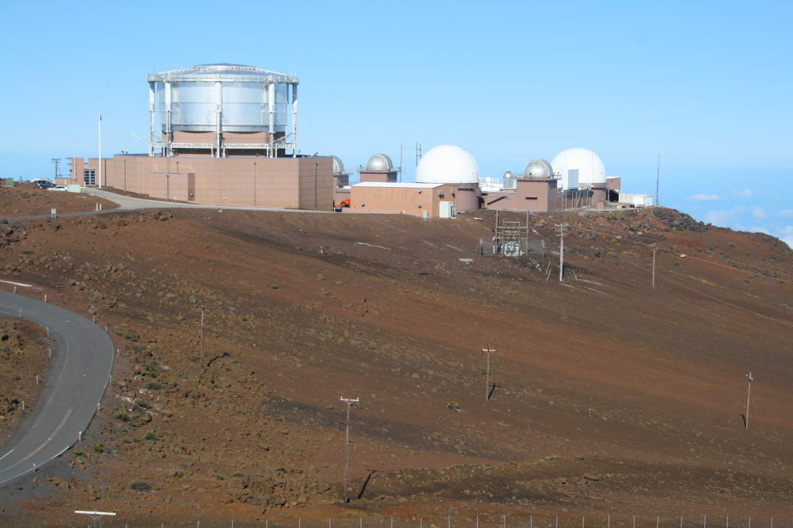
On the summit of Haleakela are a number of astronomical observatories and NASA space tracking facilities. They are off-limits to the public but easily visible from the summit which has a small hut for viewing out of the wind or snow (when they have snow).
Helen beginning the hike at about 8:30 in the morning. In the entire 11.5 miles, we saw perhaps six people on the trail.
This is a view to the west as the trail switchbacks down the side of the crater.
A view to the north back towards the direction of Kalahaku Overlook. The spectacular wall in the distance is the cliff we would ascend to exit the crater about five and half hours later.
The
silversword (Argyroxiphium sp.) is an endemic plant on Haleakala that takes 5 to 50 years to bloom, signaling the end of its life cycle.
Silversword close-up. I took a side hike on the Silversword Loop where hundreds of these were growing in their native habitat of rocky, well-drained soil.
Looking back to the west towards the summit of Haleakala (located on the flat-looking ridge top left). The chain of craters was formed along a rift present beneath the volcano.
The floor of the crater has some green growth on it, especially where the windward side rains spill into it. Here you can see some clouds moving into the crater from the windward side.
Here is a a view of Pu'u o Maui from the floor of Haleakala Crater. Compare this view with the one from the overlook above.
I accidentally hit a button on my camera and then about 60 of my pictures were taken in black and white. Here Helen approaches our lunch spot near a spatter cone or hornito. The lava globules in the walls of this were fantastically preserved.
Just before our ascent we looked back up at the wall we had to climb. Good thing I took the photo at this moment as the clouds began to roll in off of the Pacific.
In Hawai'i, volcanic features are so easily seen and observed. Here along the trail in the floor of Haleakala is a lava tube partially obscured by a patch of grass and flowers (upper left). A pahoehoe flow issues from this with lava levees on either side of it. This is textbook volcanology!
After finishing the hike we looked out into the Pacific Ocean and saw the area near Big beach with ts shoreline cinder cone. The little islet in the sea is called Mokulini and is a crater that is breached on one side with the ocean inside it. Te island of Kaho' o lowe is in the distance.


I am not sure I have words to tell you how I appreciate the pictures you share here. The scenery is absolutely glorious.
ReplyDeleteFantastic!
ReplyDeleteI've seen a lot of pictures from Hawaiian vacations, but they looked nothing like this. Are you sure you were in Hawaii?
ReplyDeletejg:
ReplyDeleteThere is a lot more to Hawai'i than sand and sea. We discovered that. Thanks for your comment. WR