Winter in the Western US has been downright brutal for us non-skiers and sun seekers who normally expect cool, clear days in the American Southwest. But extremely cold temperatures, numerous snow storms and a large number of cloudy gray days have made this a winter to forget. So I took the opportunity to head to Mexico to see if I could find the sun. My lovely wife, Helen, encouraged me to go knowing that she would have one happy boy upon his return. Here are a few pictures.
I traveled to the Gulf coast of Sonora and the little hamlet of Puerto Lobos. Near there we found a volcanic remnant that looked ripe for hiking to. Here we are wandering through the senita cactus towards the top.
Ocotillos still had a few red flowers from the October rains and the sky finally turned blue.
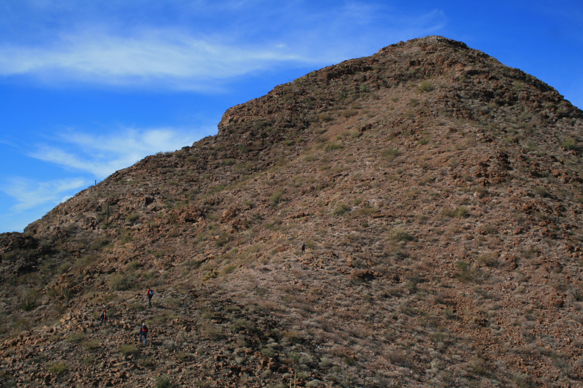
Can you spot the three hikers? (two in the lower left of the photo and the other in the center)
Elson stands on top of "El Diente de Tiburon" (the shark's tooth) with Puerto Lobos visible in the back.
Here is a closer look at the little fishing village.
And closer still with the lighthouse clearly visible here.
From the top of El Diente looking south along the Sonoran coast of the Gulf of California. This is very wild country and was the last part of the entire coastline to receive a highway in only the last year.
A group shot from atop the shark's tooth.
Elsewhere to the southeast are isolated ranges of uplifted granite. There are likely bighorn sheep in such ranges that hardly ever see people.
A senita cactus fell victim to the recent drought atop el diente. Puerto Lobos in the background.
This is a typical Sonoran winter day! Cactus, blue sky and wispy cirrus clouds splayed by the winds.
This is what we live for! Shimmering skies and not a breath of moisture.
Elson and Cindy have a rustic but comfortable abode in Lobos that would make any desert rat feel at home. We played cards at night and hiked in the day.
Sunset on the veranda, January 6, 2011.
My stay was too short and there is much more to explore. I will be back.
A Lobos sunset.
On January 7 I left Lobos and headed north and west to Alta California. A new coastal highway was opened in the last year and I decided to take it. After driving 120 miles to Puerto Peñasco (Rocy Pt.) I turned on Highway 003 towards San Luis. This route passes through the Pinacate Bioreserve and there were some great interpretive signs.
The signs are state of the art and bilingual.
The geology interpretation was quite good. This one explains the 2 million year history of the Pinacate Volcanic Field. Cerro Pinacate can be seen in the distance.
After passing through the volcanic rocks, the new highway skirts the north edge of the gulf coast. This was formerly quite inaccessible country due to the aridity. In this photo you can see Colorado River sediments in the foreground with the mountains of Baja California in the background.
This last photo shows the main street in El Golfo de Santa Clara, a small fishing village with a quaint charm. The tacos were muy excelente!


I am really jealous. Warm weather, blue skies, good hiking and company. Sure sounds like a great combination.
ReplyDeleteThanks, Wayne, for yet another great blog post. We visited Lobos @ Elson's place in 1996 (maybe 1997). His place was extraordinarily primitive back then. Now it looks like a palace! It's amazing there's a paved road out there. The road back then was The Worst we've ever traveled anywhere--ever. Thanks also for photos of the interp on the new highway. Sure sounds like a Loop To Do. San Luis down to Rocky Point and then back up through Sonoita. You blog is GREAT!
ReplyDelete