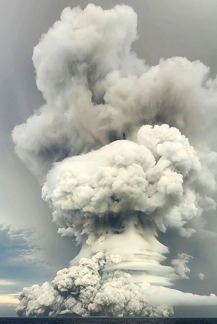
It's all over the news and there is good reason. At 16:28 local time in Tonga on January 15, a powerful submarine volcanic eruption rattled the area. Satellite photos are astounding. The noise from the explosion was heard as far away as Aukland New Zealand (1300 miles away) and tsunami warnings are posted for much of the Pacific Rim.
Check out this link from Forbes and all of the embedded links. They are pretty astounding.
If you follow Twitter here is a video of the tsunami coming ashore in Tonga. (We have a neighbor who has done anthropologic research on the island and the proper pronunciation is Tong- ah).
Thanks to the folks at the Arizona Geological Survey for this first hand description of the geology of the volcano and published first of The Conversation. The maps are very instructive.
Geology Hub is another good resource to check out. Watch the whole video as the last half of it has the geologic story of this caldera. Note that some of the photos to illustrate a tsunami are not from this event and may not be of tsunami waves at all. A tsunami wave typically moves 500 miles per hour when in the open ocean and may only be six inches high. But as the wave approaches land and the water shallows, the wave height increases.
Great videos can be watched here.
We hope all will be all right and all will be safe from this.
UPDATE ***My colleague George Marsik, forwarded this pre-eruption view of Hunga-Tonga volcano using Microsoft Flight Simulator. There are some great views of what this volcano used to look like before January 15.***
2nd UPDATE: Please see Roseanne Chambers geology blog as well for a great description of the eruption and tsunami: https://roseannechambers.com/tsunami-troubles/.
 |
| This satellite image taken by Himawari-8, a Japanese weather satellite, and released by the agency, |
