Tuesday, June 13, 2023

The 4th NAU Geology Alumni River Trip in Grand Canyon

In May of this year, 19 alumni of the Geology Program at Northern Arizona University gathered in Flagstaff for the 4th-ever alumni river trip in Grand Canyon. What a wonderful time traveling with old and new friends. Many of the participants this time were from my era at NAU. Some were from the 2000s and we had three from the 1970s. NAU Geology Rocks!

Dr. Jim Gaherty of NAU was along as faculty along with his wife Dr. Donna Shillington. Here Jim is talking near Sunset Crater and the San Francisco Peaks about the migration of volcanism in the region.

Two dear friends from NAU Geology in the 1980s - Ralph Hopkins (center) and Mike Darr (right). We are at the Desert View Watchtower on the pre-river trip field trip.

At Lees Ferry getting ready to depart.

Reptile trackway in the Coconino Sandstone. Avalanche features are also present on this surface.

Vasey's Paradise is back after a bountiful snowpack on the Kaibab Plateau this past winter. This voluminous spring was virtually dry the last few years due to a lack of precipitation.

The "hump" of limestone seen in the photo center is a mud mound within the Redwall Limestone. Algae likely was growing here on the seafloor some 340 million years ago, trapping silt and clay size particles.

Rafting past Grey Castle carved into the Bright Angel Shale in Marble Canyon.

Garnets found in the Vishnu Schist give an indication at what temperatures and pressures the schist was metamorphosed from shale or sandstone. This species of garnet forms at temperatures and pressures that today, are about 10-15 miles below the surface. Incredible to think that these rocks, now returned back to the surface, were once buried in that amount of crust! Where did it all go? Not to outer space - it was eroded onto the ancient landscape somewhere. But so much time has passed, who knows where it is now.

A typical camp scene - this one at the lower Garnet Camp near river mile 114. The Powell Plateau is on the top left skyline.

The oldest rock in the canyon is the Elves Chasm Gneiss, dated at 1.84 billion years old. This makes it 90 million years older than the Vishnu Schist.

I am enamored with cavitation pits that form on limestone near the rivers' edge. As fast moving river water encounters a tiny protrusion on an otherwise smooth boulder surface, it hydraulically forces the water away from the rock surface, creating a vacuum between water and rock. When the vacuum collapses, the concussive force pops off a piece of the boulder creating the scalloped pits.

I can never say it again - no one ever photographs this site - and landslide composed entirely of limestone debris. Fellow river runner Jon Hirsch was the first person to notice and describe this landslide.

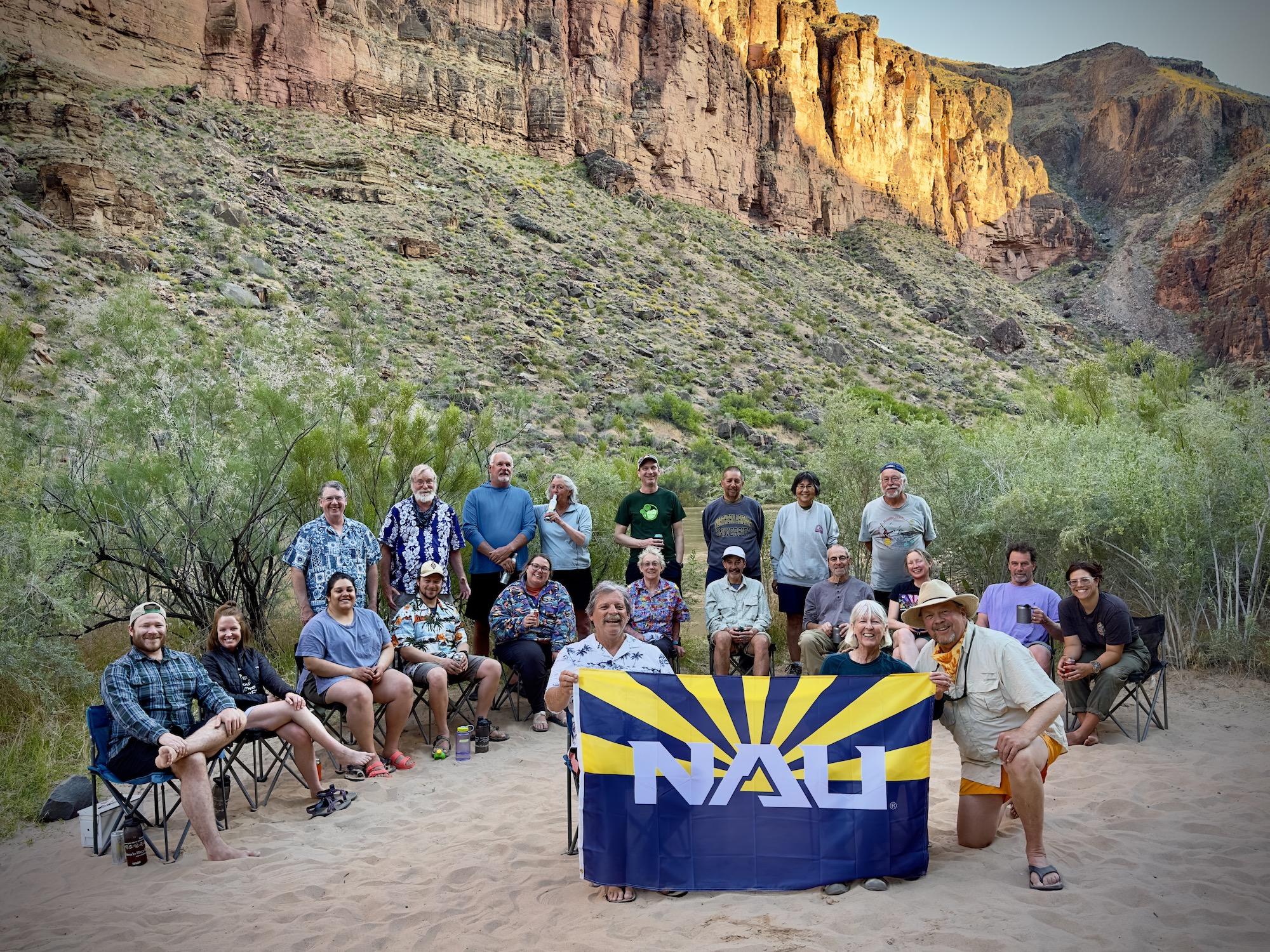
Our group - what a wonderful trip. So many memories and new ones made on the river in Grand Canyon!

Wednesday, May 03, 2023

Two Billion Years in Two Minutes - The New IMAX Film at Grand Canyon Premieres

Can you believe it's been 40 years since the first IMAX movie at Grand Canyon premiered? Yep, it was 1983, the year of high-water out of Glen Canyon Dam, when "Grand Canyon: The Hidden Secrets was filmed and released. The original river scenes in the movie captured some of the high-water drama and the organic debris left from the flood in riverside tamarisk trees. The production received only luke-warm accolades from the locals, who saw the plot, if plot it could be called, a bit simplistic and fanciful with quasi-true recreations of historical events. The general public however, must have liked it with 40 million viewers watching it in 40 years.

On March 30 this year, IMAX premiered a brand new movie for Grand Canyon at the theater in Tusayan. The new film is called, "Grand Canyon: Rivers of Time." This new version was the result of comments received from viewers of the original film, expressing a desire for more substantial information about the canyon. Happily, the new version contains more science and Voilá! a new film 

**Don't leave this post just yet - a short video clip of the new film is attached to the end of this posting and includes spectacular time-lapse sequences in the canyon and the full geology portion of the film!** And please note that all of the still images used in this posting were provided by Alan Markowitz, the visual effects producer, who shared his PowerPoint presentation with me about how the film was made. He presented his PowerPoint to the attending delegates at the Giant Screen Cinema Association (GSCA) Film Expo, held in March, 2023, at Universal Citywalk in Los Angeles.

Poster for "Grand Canyon: Rivers of Time"

In early 2020, just at the start of the pandemic, I was approached by Rick Gordon of RPG Productions in Los Angeles California. He asked a simple question: Could the 2 billion-year-long geologic story of Grand Canyon - get this - be told in two minutes! At first, I thought it was a joke. But Rick was quite serious as the owners of the film and the theater franchise were tasked with including geology in a new version of the film. I was brought on as the geologic consultant. Work on the project began in March, 2020 but, unfortunately, the pandemic stopped production work for two years. The project resumed in March, 2022.

Two billion years of earth history in two minutes! Looking at the bottom line here, it's clear
even Alan admitted to the daunting task.

One of the biggest challenges geologists face when asked to contribute to documentary or popular films is getting enough air-time to fully describe their subject matter. Other topics are also covered in these types of productions, and geologists must share the few precious seconds of air-time with charismatic wildlife, extreme sports action, or some other spine-tingling footage. Additionally, geology may seem too static or unchanging to those who crave action in their films, or do not know the joys and rewards of earth science. A tendency to minimize geology's underlying importance can take hold. This was not a concern for Rick since he was charged with including the geologic story.

I worked closely with Rick Gordon, Alan Markowitz, and Mario Kourasis on the geology portion
of the film, helping to conceive images and video and writing script.

Back to the question posed by Rick, "Can the 2 billion year-long geologic story of Grand Canyon be told in two minutes. I've had a bit of experience distilling complex geologic ideas into more digestible phrases and images. But this would be an especially daunting challenge. Nevertheless, I replied to his team, "Yeah, we can do that." Of course, I was concerned some parts of the story would have to be left out. So I gently suggested on getting an extra 30 seconds or maybe even a whole minute in the ultimately 40 minute-long film. "No way," was the answer as 70% of the original production is re-used in this 2nd edition of the film. 

A slide from Markowitz's PowerPoint showing some of the storyline and pre-production ideas. You
can seen the lower right that they utilized some of my lectures on YouTube for help. 

For my part, the first thing to decide was how much of the story should (or could) be told in only two minutes. Could we mention the Grand Canyon Supergroup, a complex and sometimes confusing deposit found in only some parts of the canyon? Would it be a good idea to include this or would it tend to minimize other parts of the story? What about the Mesozoic rocks that once covered the canyon landscape but are now mostly eroded and gone? Should they be mentioned? All of this had to be carefully considered so I sent Rick a short description of the full story.

These are some of the web based images the group found to help them better understand the various aspects of the story.
Note that they were coming into the production without a basic understanding of Grand Canyon geology
and so had to learn what to portray in images and say in words for the narrator.

There was some great collaborations between myself and the group and eventually a script was written and adopted. At this stage, Alan and Marios began developing a visual component of the story. One of the hardest aspects involved was explaining to the animators (untrained in geology) how a line of island arc volcanoes, over 1,750 million years old, were formed by a subduction event; then transported into an oceanic trench where the sedimentary and volcanic rocks became compressed, metamorphosed, and melted into Vishnu Schist and Zoroaster Granite. This is a complex process involving a few different steps. But they hit on an idea to have inset boxes displaying concepts in cross-section, while the larger image of the surface remains visible. This technique was utilized in other sub-chapters of the story, I think with great effect (see the inset below in the next image and in the video at the end). 

Panel animations for two time slices. On the left is a depiction of an island arc approaching a continent (Precambrian time).
On the right is a depiction of a sandy desert and the deposition of eolian sand. Note the inset boxes
in each that show what was happening in the subsurface for each time slice.

In spite of the two-minute time limitation (hey, that's 1/20th of the entire film!), we were still able to include information about these many events in the final product:

1) the location and geographic dimensions of the canyon;
2) the volcanic arc sequence that ultimately gave rise to the Vishnu Schist and Zoroaster Granite;
3) erosion of 13 miles of crust down to a low-lying plain;
4) deposition of the two-and-a-half-mile-thick Grand Canyon Supergroup layers;
5) deformation, faulting, and tilting of the Supergroup blocks;
6) erosion down to a near-sea-level, hilly terrain;
7) deposition of the Paleozoic layers of the canyon in seas, rivers and sandy deserts;
8) deposition of the Mesozoic layers (the dinosaur-age rocks);
9) near complete erosion of the Mesozoic layers; and finally,
10) the uplift and carving of the Grand Canyon.

Kudos to the production team as I would have never imagined at the start of production that all of these seminal events that formed the Grand Canyon landscape could be compressed into two minutes!
 
Not all of these concepts were used in the end but it gives an idea for the possibilities.

And now, please enjoy this four-minute clip of the introduction and the geologic story of the new IMAX film, "Grand Canyon: Rivers of Time." (Please excuse the low-resolution limitations for uploading). 


Four minute clip of "Grand Canyon: Rivers of Time"

The next time you are a the South Rim of Grand Canyon, be sure to view the new movie. If you cannot take the time, imagine watching this on a huge, six-story IMAX perforated screen, with sound coming to your ears in surround sound from all directions - including sound from behind the perforated screen! Many thanks to Rick, Alan, Marios, and everyone involved with IMAX for including the geologic story of Grand Canyon in this production. The canyon's geology will now be portrayed to millions of viewers, through many decades!

Saturday, April 29, 2023

In 2018, Helen and I established the Wayne and Helen Ranney Geosciences Educator Award at Northern Arizona University. We are pleased to announce at this time that the first awardee is Rhyleigh Abel, a senior in the geology department at NAU. The award allows her to partake in a 7-day, geology-themed rafting trip in Grand Canyon with fellow alumni and professors. 

The award is an endowed fund that takes interest earned to support the award in perpetuity. If you would like to contribute to our goal to encourage professional earth scientists to share their enthusiasm and passion for landscapes with the wider public, you can contribute, at any level of support, here: https://securelb.imodules.com/s/1898/giving19/form.aspx....

Congratulations Rhyleigh and see you on the river!

May be a selfie of 2 people, people smiling, eyeglasses and text

Sunday, January 08, 2023

An Interesting and Scenic Maar Volcano near Santa Fe, New Mexico

I love Santa Fe, New Mexico. So when I got the opportunity to present a lecture on the Colorado River for Southwest Seminars, we took a few extra days to explore more of the area. My colleague, Kirt Kempter invited us along to see first hand the results of his pandemic project, making a detailed map of a maar volcano to the southwest of the city. These features form when magma interacts with groundwater to create a steam explosion, forming a shallow depression after the explosion. The depression can become filled with scoria (cinders) and lava flows, and sometimes a lava lake, which upon subsequent erosion can leave the post-maar volcanics standing in high relief. This is a difficult thing for beginners to understand since the maar formation creates a depression but the modern feature is a mountain (the infilling lavas are more resistant than the surrounding materials)

Santa Fe's historic Plaza is where the western terminus of the Santa Fe Trail is located. The wooden structure seen in the center of the Plaza here hides an obelisk and plinth that was erected in 1867 to commemorate the perpetuation of the Union after the Civil War. However, one side of the obelisk praised "The heroes who have fallen in the various battles with savage Indians in the territory of New Mexico." In 1974, the word "savage" was chiseled out by an unknown person. On October 12, 2020, the obelisk was toppled and the city began a community conversation on the future of the monument.

We always visit the small town of Chimayo where we buy our year's supply of red and green chile powder. The Virgil Store shown here had a For Sale in front of it - oh the horror!

At the Santuario de Chimayo.

On a nice sunny day, Kirt took us southwest of the city to the Diablo volcano, where he has completed a detailed study of its history and mode of formation. This is a view to the west looking downstream to Diablo Canyon, carved by the intermittent stream of Cañada Ancha.

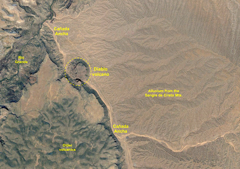
Google Earth image of the Santa Fe area. The city and the Sangre de Cristo Mountains are on the right. The Cerros del Rio volcanic field and Diablo volcano are on the left. In all of my visits to Santa Fe I never explored to the southwest of the city. I had been east, north, south and west and was always curious about the hills to the southwest of the city. I have also been intrigued for why Santa Fe grew so far from the Rio Grande and on a relatively featureless alluvial plain at the foot of the mountains. I always wondered why the Camino Real diverged from the course of the river to climb onto the alluvium (there was a pueblo village here of some importance). Nevertheless, what existed between the city and river? I soon found out.

Close-up of the Google Earth image. The broad alluvial plain is carved into the Tesuque Formation and overlying Ancha Formation. Note that the Diablo volcano is partially bisected by Cañada Ancha - a big part of this story that will be revealed below!

Beginning our trek up to the top of the volcano, located in the Diablo Canyon Recreation Area. The location is popular with rock climbers who find the columnar joints in the walls of the gorge inviting.

Along the way, volcanic bombs were strewn over the ground, documenting a sub-aerial origin in this instance.

A view to the west of the Lengua del Diablo (Tongue of the Devil). Note the floor of Cañada Ancha on the far left and the Jemez Mountain and caldera on the horizon. The colorful rocks in the ridge of Lengua del Diablo are composed of tephra deposits from the maar explosion (the greenish, lower cliff formed by phreatomagmatic processes), capped with dark basaltic lava, scoria and ash (photo center) that was erupted after the formation of the maar. Note the vertical dike within the phreatomagmatic deposit. This dike episode actually fed the flows on the uppermost part of the cliff. Within the phreatomagmatic deposit a very large blocks of the Tesuque Formation that were also thrown outwards from the steam blast. One of these large, pink-colored clasts can be seen at the base of the green cliff and left of the dike (partially hidden by a small juniper tree. An amazing exposure!

A large dike (center) intrudes through older scoria layers.

Complex interplay of maar tephra (golden color) and post-maar scoria and dikes.

A close-up of the previous photo showing the dark basalt dikes intruding the older tephra (golden).

View to the west from the top of the maar toward the Jemez Mountains and Chicoma Peak. Cañada Ancha is seen in the floor of the valley.

Panoramic view with Kirt Kempter pointing out features.

Another view of the Lengua del Diablo. After spending a few hours looking at the internal features of the volcano, I became curious about its eruptive setting. Kirt had explained that the age of the Cerros del Rio volcanic field is mostly constrained between 2.7 and 2.4 Ma, straddling the time boundary between the Pliocene and Pleistocene. Kirt further explained that the sequence of events went from initial phreatomagmatic eruptions that created a maar depression, which gave way to scoria cone formation and subsequent fluid lava flows and the formation of a lava lake. In the back of my mind, I kept thinking, "Why are we so high above the surrounding terrain? The answer of course, is that 2.5 million years ago, top of the maar was the floor of the valley and erosion of Diablo Canyon had not yet commenced.  

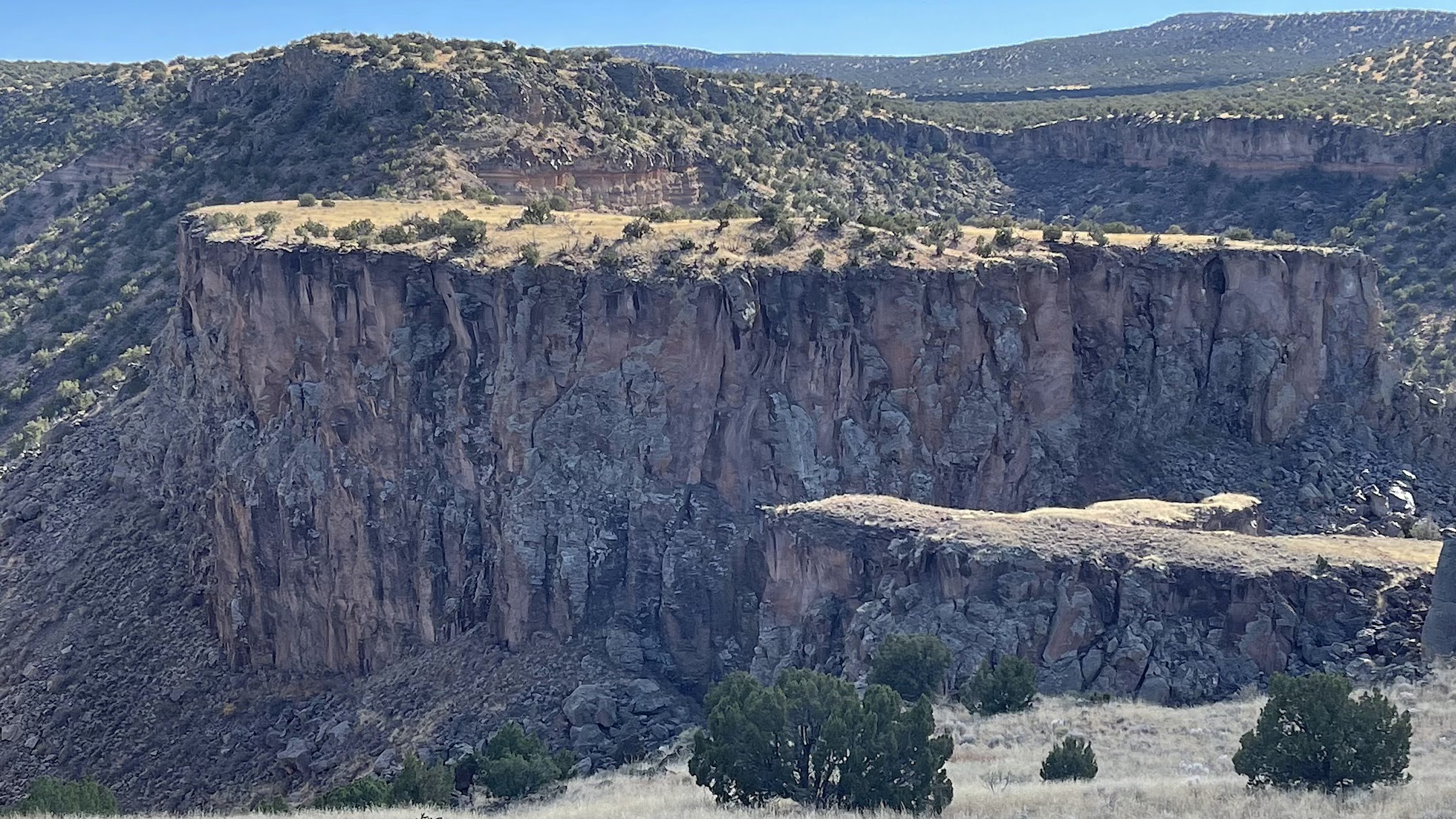
And boy was this evident as we went to the lip of Diablo Canyon! Across Diablo Canyon and Cañada Ancha is a detached portion of a lava lake basalt that once filled the central maar. It has been separated from the foreground by incision of the stream. Thus, Diablo Canyon is approximately 2.5 Ma.
 
Close-up of the far-side mesa. Note the small rise on top of the mesa - this is composed of rounded cobbles and sand from Cañada Ancha when it was flowing on top of the lava lake. The stream had no idea that its course was on top of the edge of lava lake deposits and as it incised downward its course was not deflected away - superposition in action! How fortunate that these remnant cobbles are left on the high-standing mesa for this interpretation.

Diablo Canyon from the top looking southeast and upstream on the bed of Cañada Ancha. Spectacular.

Kirt with his dogs looking across the top of the maar volcano to the Sanger de Cristo Mountains.

Our group at the end of the hike - Helen, Kirt and John. Thank you Kirt for a great day and a wonderful field trip! Kirt will soon publish a paper on his work and I will add an addendum to this post when it is ready.

Sunday, January 01, 2023

2023 Has Arrived!

At Plateau Point, Grand Canyon, November 2021. Photo by Helen Ranney

A new year has dawned along with the realization that I have been remiss in keeping up with this blog. Blame it on the pandemic and its lack of travel, these uninspiring times, or whatever. I'm aware of it and not pleased either, especially when I look back at some of the detailed and lengthy posts I previously typed here (I simply will not post if there is nothing to say). And, I've also been contemplating what the next phase of this online blog might be? I think readers this new year (if any of you remain) will still see posts pertaining to my love of geology and travel. But I also anticipate more personal reflections. Let me explain.

While everyone seems to wish, hope, pray, and implore that this new year will be everything that the last few have not, for me it is something a bit more. 2023 marks the beginning of a long string of 50-year anniversaries for me that define the beginning my independent, adult life. For the next few years, being completely captive to my insatiable appreciation for the endless march of time, I will mark the the half-century anniversaries where I first took to some fantastic hitchhiking explorations across the continent, fell in love with river trips and backpacking, and living at and within the Grand Canyon.

What sparks this little introduction is my rather sudden awareness that it was the year 1973 - 50 years ago - that I took my first steps at being an adult, stepping away from my cherished place of origin in Southern California and began to explore the larger world that lay beyond the 'California Dream.' I've always been proud to be a native of California, where I could enjoy a childhood of outdoor explorations in the foothills of the San Gabriel Mountains and the last of the area's orange groves. Me and my brothers caught wild frogs and fed them to our pet snakes. We rode our bikes across the entire width of our hometown and only came back in time for dinner. As a freshman in high school, I found a nestling red-tailed hawk that had become separated from its nest and raised it to adulthood. I was a child of nature in a burgeoning urban wave.

But by the time I graduated from high school, urban California had lost its charm. So, in 1973 I set out on the first of some really great adventures. I hope to share these stories with you beginning this year.

Thank you for hanging in there with me. And if this is not the reason you come here to this blog, I understand and will not be offended if you leave. But maybe this is the beginning of the story of my life.

Wednesday, October 26, 2022

The Montevideo Inscription in Grand Canyon

On November 30, 2010, I posted a piece about an inscription found near the South Bass Trail in Grand Canyon. It is in a neatly ornamented style with the word "Montevideo." You can view that posting here and the story that goes with it. A few days later, I posted an addendum and that can be viewed here.

Recently, a friend of my wife visited the site and literally stumbled onto another adjacent inscription that shows the year 1896. While this does not prove that the Montevideo inscription was left in the Wm. Wallace Bass era at Grand Canyon, it does show that Bass was leading people to this site at that time. I think the nearby inscription lends credence to the idea that Montevideo is more recent than the 1540s and from a member of he Cardenas party. The photos above and below are courtesy of Larry Kinser.


Sunday, October 16, 2022

An Autumn Hike in the San Juan Volcanic Field, Colorado

In early October, Helen and I journeyed to southwest Colorado and the San Juan Mountains near Ouray. We embarked on a five-day, four-night backpack along the Dallas Trail, traveling hut to hut. Thus, we carried no sleeping bags or tents to make the load lighter. The fall colors were at their peak and admittedly, this post is more about autumn than the San Juan Volcanic Field.

We had a group of seven and this is near the start of the hike.

Some of the route was along old logging roads.

This is our first hut, called North Pole hut. One of the peaks near here is called North Pole Peak. If you would like to know more about the hut experience you can view San Juan Huts here.

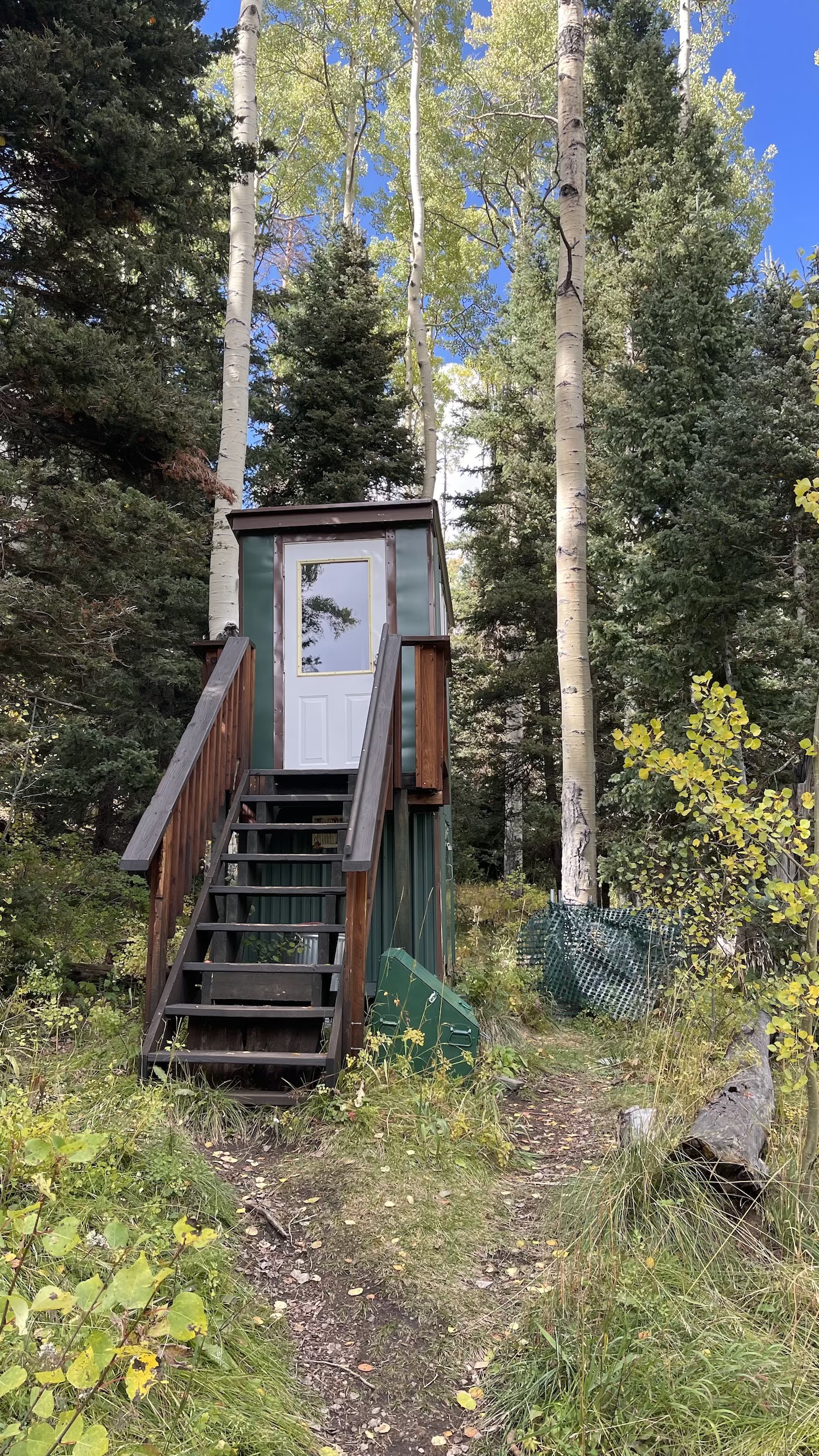
Each hut comes with a separate outhouse not far from the sleeping hut. These were very clean, modern, and well kept.

A view to the northeast toward the Cimarron Range of the San Juan Mountains. Ridgway Colorado sits in the valley of the Uncompahgre River in the valley below.

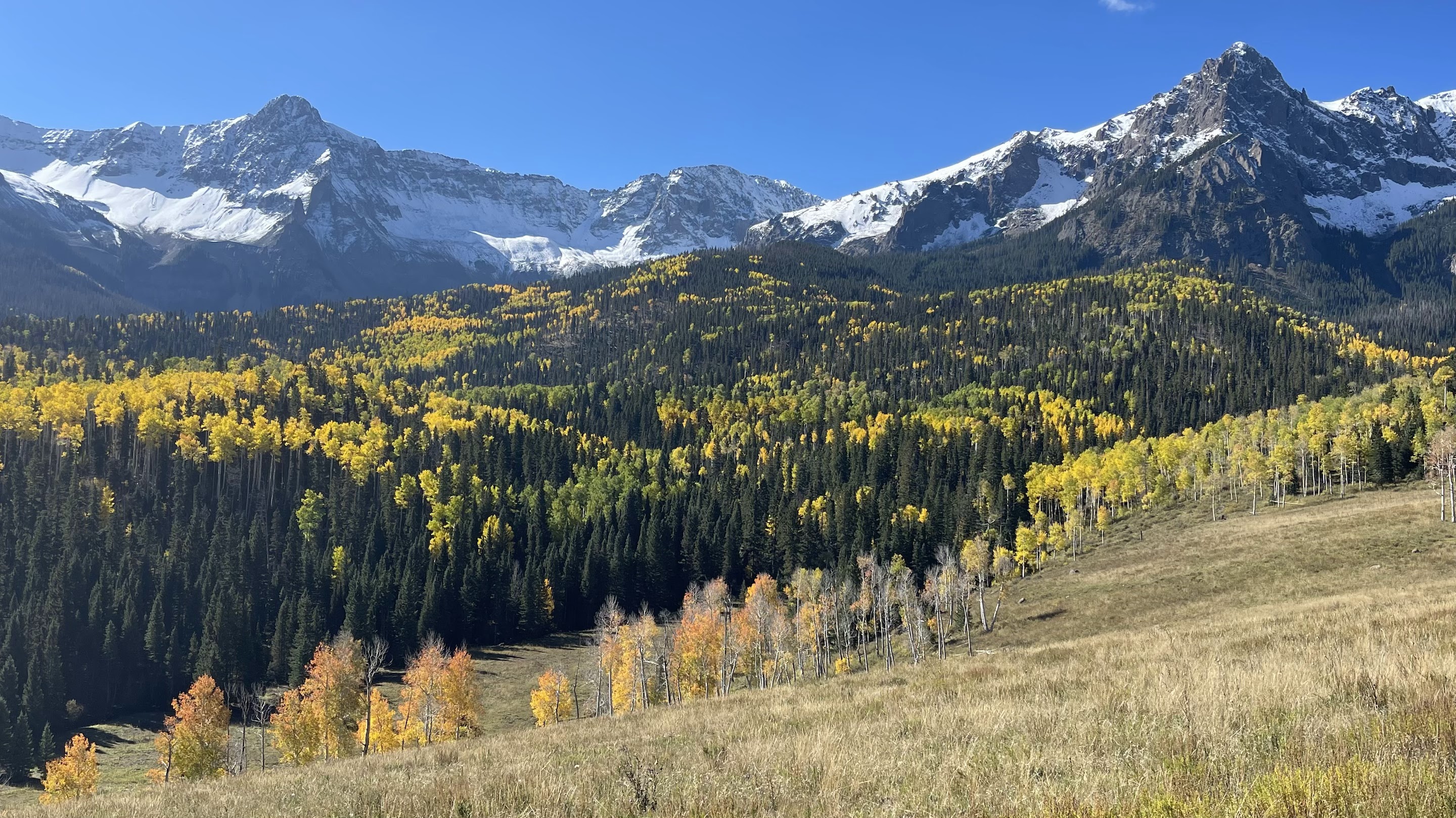
The Sneffels Range loomed large to our south as we made our way from west to east. An early season snow made the views dramatic against the changing aspens.

More Sneffels Range.

The average elevation of the hike was 10,000 and never deviated from between 11,000 and 9,500 feet.

A wild geranium also was in on the colorful show.

Most of the hike was through forests of aspen and conifer.

An early morning frost.

Finally, we reached Wilson Summit at 11,000 feet and were rewarded with a spectacular view!

Note the previously glaciated valleys in the distance as we took our lunch at the summit.

There was always a threat of rain during the five days (forecasted) but we managed to avoid precipitation.

In the Ridgway hut on night 3 planning the next days route.

An especially beautiful section of trail on day 4.

Aspens, aspens everywhere.

Burn Hut, our fourth and last hut.

Near Burn Hut.

Roots and aspen leaves vie for sunlight.

Approaching our final descent into the Uncompahgre Valley.

Across the way, the San Juan volcanics sit atop a basement of Paleozoic sedimentary rocks. We saw mining shacks at the contact of the two rock types.

Colorful descent - this time in. rocks!

As we descended below the San Juan volcanic rocks, the basement was composed of the Cutler Formation, a Pennsylvanian sandstone, shale and conglomerate that was shed off of the Ancestral Rocky Mountains.

A channel of very coarse conglomerate is set within floodplain mudstone and shale. A very good trip with great people and fantastic weather!