In July, I participated in a wilderness river trip that began in the Yukon Territory of Canada and then entered British Columbia and Alaska. The trip was run through Colorado River and Trail Expeditions - CRATE - the outfitter I use in the Grand Canyon. To call this a "vacation" would convey a sense of easiness that seemed to elude us. We had great weather as you will see. Yet the specter of bad weather, bears, rain and cold were never far away. The trip was enjoyable nevertheless, dare I say, fantastic.
I had never before set foot in the Yukon Territory so this was a real treat.
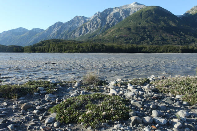
Note the canyon of the Tatshenshini River below the mountain peaks. These mountains are part of
Wrangellia - an exotic terrane formed about 225 Ma. It later drifted in from the Pacific Ocean and attached itself to North America by about 120 Ma.
Here is a map of the various exotic terranes that are now part of North America. Our river trip is shown as the yellow line - the Denali fault separates Wrangellia from other rocks near the trips beginning.
The put-in at about 2,500 feet in elevation. We would end up at sea level in only 136 miles.
And we begin going downstream on about 5,000 cfs. We would end the trip on the Alsek River at about 130,000 cfs.
Entering the first canyon with oxidized rocks in the canyon walls.
It is a pretty narrow passage here.
This is Bear Bite Rapids. The rapids on this trip were Class III only.
Exiting the first canyon at the end of day 1, the rocks ahead are part of the Alexander terrane.
Wolf tracks on a beach...
...and bear tracks.
Colorful rocks in the Alexander terrane.
Entering the second canyon.
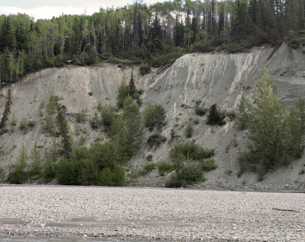
These are glacial debris deposits which we saw along the river corridor from time to time.
Dewey and John cooking up some illegal eggs (Canada restricts egg importation due to Bird Flu concerns).
On our first hike up Sediments Creek.
Bear claw marks on an Aspen tree.
Looking south along the course of the Tatshenshini River.
And back to our camp at the confluence of Sediments Creek and the river.
Howard and Chris yuking it up around the fire.
This is
Dryas, a widespread Arctic plant. There is a glacial stadial (shorter time period) called the
Younger Dryas, when planet Earth went from relatively warm glacial conditions back to glacial conditions between about 12,900 and 11,500 years ago. It is believed that the onset of the Younger Dryas occurred over a short
10-12 year period and that it ended over an equally short 40-50 year period.
Leaving Sediments Creek, we were treated to sunny skies.
Awesome weather.
A relatively fresh wolf trackway.
On a hike along Alkie Creek.
Patterns in tundra vegetation.
Sunny skies and warm temperatures cause the snow to melt and the rivers to rise quickly, cloudy conditions reverse this just as fast. We saw many areas where the side streams had risen and overtopped their banks just days prior to our arrival.
An unnamed peak at nearly 9,000 feet.
Alkie Creek from the river.
Monkey Wrench Rapid.
Tilted sedimentary rocks...
...and folded sedimentary rocks - this area has it all.
Howard and Ed enjoying the ride with Gregg.
I personally saw only one bear but cumulatively there were four spotted. The salmon were not yet running upstream and so the bears were likely still upslope eating berries.
This is a crop of the previous picture.
Amazing dikes running through the thin bedded limestone.
Approaching the Fairweather Range mountain front near Towagh Creek.
Lunch stop.
This is a sediment rich river basin and the rocks on the river bank provided wonderful collecting opportunities.
Floating down to the Fairweather Range.
Camped near the confluence with the Alsek River at Melt Creek.
Ed, John and Gerry, and Howard on a day hike.
On Melt Creek.
Fireweed at Melt Creek.
I watched this eagle go about its business all day, flying across the river for food from the nest.
And he had some luck.
Late evening light on the Fairweather Range.
In camp.
A beautiful evening.
Last light to the east of Melt Creek.
Fairweather Range.
It never got very dark at these northern latitudes.
The next day was clear as well.
This the junction with the Alsek River looking north, where the discharge is tripled.
A slight variation color between the two systems. We are on the Alsek River from here on out.
The Noisy Range rises near the junction of the two rivers.
Glaciers are found in most of the tributaries down here near the high standing Fairweather Range.
Fantastic U-shaped valley.
In the glacier in the background you can see the rim around the ice where recent recession has occurred.
The river is quite wide in this reach.
Can you see the international boundary between Canada and the US, slashing through the forest in the center of the picture. This is where the trees were cut in 1910 during the survey days.
We gathered firewood each night for our camps.
Black bear print in the mud.
Trackway.
This is Walker Glacier where we did a layover camp. We had four layover camps in 11 days of rafting.
The following day we rowed the boats into the pro-glacial lake and then hiked up on top of the glacier.
It was obvious that this glacier is receding considerably with many melt water streams and lakes on its surface.
The ice front at Walker Glacier.
Rowing home at the end of the day.
Ptygmatic folds in the schist rocks.
The next day we said goodbye to the Walker Glacier.
This is the Sapphire Glacier.
It rained most of this day but by the time we arrived at Alsek Lake, we could see the icebergs.
View from the hill above Alsek Lake.
Iceberg jam in Alsek Lake.
Mike, Debbie, Gerry, John, Les, Chris, and Dewey near Alsek Lake.
Lush vegetation of the temperate rain forest.
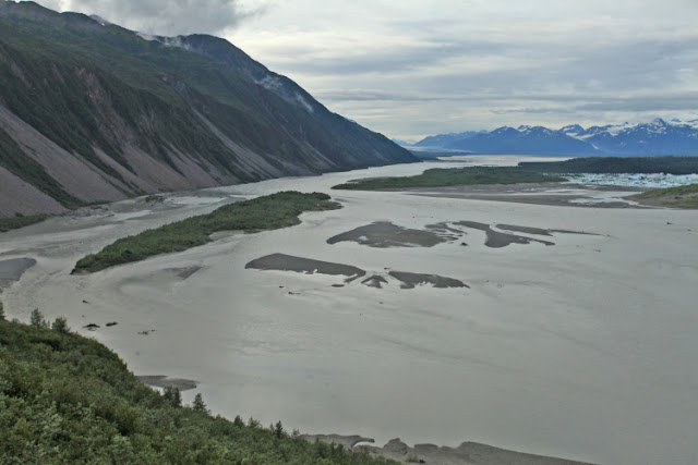
This is the delta of the Alsek River where it spills into Alsek Lake. The scale of things here is astounding. The Novatak Glacier can be seen upstream in the far distance to the north. The line of mountains on the left is called the Brabazon Range and it is being uplifted along the Fairweather fault, a northern extension (sort-of) of the San Andreas Fault.
Novatak Glacier through the telephoto lens.
On our last morning the Fairweather begins to reveal itself from beneath the cloud cover.
Morning light on icebergs.
Back on the river after our lake interlude.
The Fairweather Range.
Bald eagle hunting on the bank of the river.
Spectacular last look at the Fairweather Range.
At the take-out we must de-rig everything and put it on a cart to the airstrip four miles away.
Then this refurbished single Otter takes everything back to Haines Alaska. We were ferried later to Yakutat and then a commercial flight to Juneau.
From the air we could see the mouth of the great Alsek River emptying into the Pacific.
On the commercial flight to Juneau, the Tatshenshini River made an appearance (top) as we flew over the Fairweather Range.
The mountains at Glacier Bay National Park. This was a difficult trip in some respects but a fantastic one after it is all said and done.


