The trip begins in downtown Flagstaff, which is quickly becoming a place full of public art. Here is one on the side of the Will McNabb Jewelry store showing a Northern Arizona University scene (right) and Homecoming Parade (left).
About 30 miles south of Flagstaff is the largest natural lake in the state, Mormon Lake. This basin was formed when the Lake Mary fault blocked surface drainage to the north. The foreground shows the upthrown block with the lake situated on top of the downthrown block. One professional colleague of mine has suggested that this type of setting could eventually develop into a larger and deeper valley, much like the Verde Valley located on the opposite side of Mormon Mountain (on the horizon). Time will tell. The recent Southwestern drought has drawn down the level of Mormon Lake considerably.
Mormon Mountain is a dacite dome volcano that has given an age date of 3.1 million years. It's slopes are carpeted in a thick stand of Ponderosa pine trees, revealing that the eruptions are long dead here.
Farther along the road, there is a nice view to the north of San Francisco Mountain, affectionately known as The Peaks locally. This strato-volcano collapsed its top about 400,000 years ago (although there is another idea that it blew its top Mt. St. Helen's style) giving the crest its jagged outline. Mt. Kendrick sits to the west of the Peaks and is a 2 million year dome volcano. To read a detailed account of the geology of the San Francisco Peaks, see Written in Stone, the blog of my colleague Jack Share.
The Coconino Sandstone is exposed in a road cut along the north side of the highway. As is typical of this eolian sandstone, the cross-bedding evident dips to the south and east, documenting the dominant wind direction during the Permian Period some 275 million years ago. The Coconino attains its thickest section here along the Mogollon Rim and it thins northward beyond the Grand Canyon.
Here is a classic view of the Mogollon Rim just north of Payson and east of Highway 87. The lack of vegetation on the scarp is due to the Dude fire that scorched the trees in 1990. The rocks visible in the Mogollon Rim are Upper Paleozoic in age (about 285 to 270 million years old) and dip slightly to the north (left). This dip was imprinted in the rocks during the Laramide Orogeny when the Mogollon Highlands were raised in central Arizona (located far to the south or right in this photograph). As these Highlands were destroyed by Basin and Range faulting beginning about 17 million years ago, the Rim country became differentially elevated and the Rim emerged!
Approaching Payson, I look back to the north and see the lower Paleozoic section exposed at the base of the Rim. Seen in the cliff is the Tapeats Sandstone, most famous from exposures in the bottom of the Grand Canyon. The slope beneath the cliff is cut into the basement rocks.
The Great Unconformity is exposed in a road cut farther south. The bedded Tapeats Sandstone lies atop the basement rocks, here named the Payson Granite. More than 1,200 million years of earth history are missing at this contact.
Close-up of the Great Unconformity
The Tapeats Sandstone is a coarse-grained deposit interpreted to have been deposited along the shore of a Cambrian beach (525 million years ago). If you would like to see some of the trace fossils found in the Tapeats Sandstone from near the Payson area, see this blog here for descriptions and photographs.
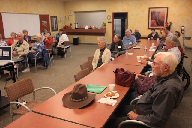
My lecture was given to the Library Friends of Payson, a support group for the public library in town. They have an active group that meets monthly and use the Humanities Speakers Bureau for much of their meeting content.
There were 28 members present for the lecture and I think it was a rousing success. They learned many of the new ideas on how the Grand Canyon may have formed. Our country's public libraries are the backbone of our civilization and I was taken by a quote that appeared in the group's monthly newsletter. It was by Carl Sagan, the esteemed astronomer:
"I think the health of our civilization, the depth of our awareness about the underpinnings of our culture, and our concern for the future, can all be tested by how well we support our libraries."
This is part of the reason why I enjoy giving these lectures about the geology of our state so much. These people are "salt of the earth" kind of folks, yet they rarely have an opportunity to learn about our science. When they are exposed to it, they not only enjoy it but can understand it and relate to it. We had a great time sharing with each other on this glorious fall day in Payson.


