Day 3 - Refugio Lavarella to Refugió Scotoni
The entire nine-day trek was off-the-charts fabulous. But Days 3 and 4 stand out in my own mind as something very special. Maybe it was the great weather or the blue skies, maybe the spectacular rock exposures or the highest elevation attained that make me feel this way. Or maybe it's that two older men were strangely transported as Wedding Crashers, high at a Dolomite refugió - read on! In any case, these were an exceptional highlight of the trip.
 |
Google Earth image - Day 3 (yellow) and Day 4 (green);
red lines are journeys on cable car and chair lift |
On Day 3, we hiked about 7 miles with a total descent of about 1,800 feet with a subsequent ascent of the same amount. Day 4 was 7.5 miles long with a 1,900 ft ascent to Refugió Lagazuoi, a trip on a cable car downhill to Pian Falzarego and then up on a chair lift (both shown as red lines in the map above) to a place near our overnight accommodation.
The Alps experienced their driest February and wettest April in years. We were lucky that not much snow greeted us during this early season trip. I chose this time of year because I wanted to be here before the drab summer haze. I wanted the bluest sky possible. And we got it!
 |
Beginning the climb out from Refugió Lavarella
|
Only a short climb of about 250 feet took us to an elevated plateau above Lavarella, providing a good warm-up to the day.
 |
| Looking north toward the prior days' approach to Lavarella |
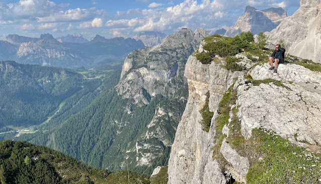
The mountains surrounded us and each step brought more phenomenal vistas. Some mountains were eroded into sharp pinnacles; others reflected the bedding planes of the gently dipping limestone. Some vistas had both forms with broad aprons of talus on their slopes.
 |
| Refugió Lavarella with Cima Nove Neuner on the summit above |
There was brilliant sunshine to begin but we did notice that clouds were building fast. The weather can be quite changeable in the mountains.
 |
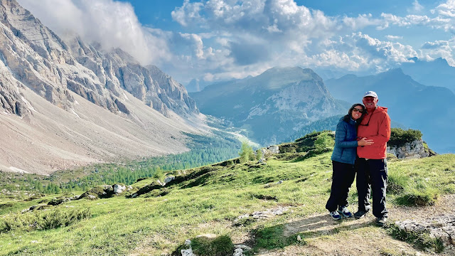
| Self portrait, Wayne and Helen, above Lavarella |
 |
| The plateau offered a gentle descent to the south |
Like many places around the globe, there is an ebb and flow to the "traffic" as everyone begins their day at about the same time. As we made the short climb uphill there were many others on the trail including some mountain bikers. But after an hour or so, the fast ones were gone and we found ourselves alone on the trail.
 |
| Folded and contorted limestone beds |
Before coming here, I was under the impression that the Dolomites would be made up mostly of highly contorted and vertically oriented limestone, resulting from the Alpine orogeny. As mentioned in an earlier post, there was a pervasive and gentle northeast dip to the strata throughout the range. But here on the plateau between Lavarella and Scotoni, I finally did see crumpled beds. There may also be a few thrust faults in the photo above, where the bending of the strata broke through the folds and ultimately slipped, one block shoved over the other.
 |
| More contorted beds |
The limestone originated in the Tethy's Sea about 220 million years ago (short article here and a good cartoon of the seaway here). This sea separated the northern continents of Laurasia from the southern ones of Gondwana. Geologists think the main bulk of the limestone was deposited in shallow, quiet lagoons that fringed the edges of the continents.  |
| The trail skirts a massive rockfall |
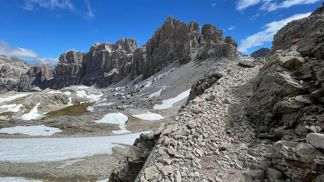
One of the highlights for me was seeing many instances where huge sections of a cliff had collapsed and fallen. The size of the bounders was truly impressive. Above, you can see one of these rockfalls, passed on Day 3. This fall had to have occurred in only the last 8,000 to 10,000 years, since glaciers completely filled these valleys prior to that time. The next advance of glacial ice will bulldoze this rockfall material away. It is interesting how the upper sections of the rockfall are devoid of vegetation (a lack of soil?) but the toes of the falls had trees and shrubs (where pulverized rock formed more soil perhaps).
 |
| A Google Earth image of the rockfall and trail shown above |
 |
| Water fountain and artwork at Capanna Alpina |
In spite of the depiction shown above, these fountains actually yield potable water for hikers! To wait out the rain we stayed inside the Capanna Alpina for about 90 minutes. When it stopped we began the short uphill trek. |
| The ski run next to the trail that brought us 870 feet to Scotoni |
It was hard for me to figure out how the skiing works here. In the photo above, you can clearly see a ski run and snow making machines were evident (yes, there are water pipelines in the ground to feed the snow making). But here there was no lift to carry skiers uphill?
 |
| Refugió Scotoni is set in a fabulous location at elevation 6,693 feet - it was idyllic. |
 |
| View to the east showing the drainage of our next mornings climb |
 |
| Don peering out of our dorm room at Refugio Scotoni, elevation 2040 meters |
 |
| Helen stands inside our dorm room where the four of us slept |
 |
| View to the west |
 |
| Inside the refugió restaurant |
 |
| Brilliant sunshine and sunset at Refugió Scotoni |
 |
| An end to a great day in the Dolomites! |
Day 4 - Refugió Scotoni to Refugió Cinque Torri
 |
| The switchbacks out of Refugió Scotoni are well-maintained |
We soon found why this is so! A natural spring issues from the rocks above Scotoni and is used as a source of bottled spring water in Europe.
 |
| This small wall plaque is found 394 feet above Scotoni |
It reads, "2160 meters (7,087 feet) - Here in the heart of the UNESCO Dolomites, from the "Scotoni" source, is born the highest mineral water in Europe. The water "EGA." So now we had been to the highest brewery at Lavarella and the highest bottled water source in Europe! Yes, they had pipes in the ground bringing the water downhill.
 |
| Climbing up with a view down to Scotoni |
The view above is down the Badia Valley that holds the Ega River. 94% of the population in this valley speak Ladin (not a misspelling). See more about this small linguistic group and culture
here and
here. A map of the Ladin area can be found on the last link.
 |
| Higher still! |
 |
| View to the west with Refugió Scotoni in the shadows of the valley floor |
It was a blue-bird day! The previous days' rain has dissipated and the air was washed clean. We eventually rose above tree line, which here is about 7,500 feet.
 |
| Above tree line toward Refugió Lagazuoi |
I was surprised that the tree line was as low as 7,500 feet at this latitude - about 46º 33' N.
 |
| On the right skyline is the Refugió Lagazuoi, our destination for lunch |
To the southwest from Lagazuoi we saw a glacier coming down the north slope of Marmolada, the highest in all the Dolomites at 10,968 feet. Before World War I the border between Italy and the Austro-Hungarian Empire was through the summit of this mountain. Amazingly, it lies only 62 miles from Venice and can be seen from there on a clear day.
 |
| View to the southeast to Lastoni di Formin ridge (shadowed face) and Croda da Lago peaks |
The photo above shows the rest of the days' trek. The craggy peaks form the Croda da Lago (literally Crags of the Lake), one of the more famous landmarks in this section of the Dolomites. The shadowed ridge in front of the crags is formed on the northeast dip of the limestone beds, angling down to Cortina d'Ampezzo. It is called Lastoni di Formin. Both of these features would provide a stunning backdrop to the end of our day at the Refugió Cinque Torri. These towers can also be seen in the photo foreground and against the forested slope left of center. More about these later. Note the small building to the right of the Cinque Torri and the trails and roads leading to it. This is the Refugió Scoiattoli, where a surprise would await Don and I later in the day.
 |
| Pian Falzarego |
Sadly, we had to leave Lagazuoi, although overnighting there is something we might pursue on another trip. We took the cable car straight down to Pian Falzarego on the road between Cortina and Bolzano (The Great Dolomites Road). Hiking instead would have required an additional 15 miles on the trail. A huge bike race was occurring on this Saturday, making the place quite busy.
 |
| The cable car coming down from Lagazuoi to Pian Falzarego |
 |
| Don and I on the cable car up to Refugió Scoiatteli |
We hiked a fairly flat one mile to the next ascent. However, since it was a Saturday there was a large trail running event in addition to the bike race on the road. I was not interested in competing for trail space with runners and found a kindred spirit in Don. So, he and I took a chair lift to save ourselves from the throngs and an additional climb.
 |
| The view southeast from Refugió Scoiattoli to Lastoni di Forman and Croda da Lago |
It was another spectacular view from the ridge top at the end of the chair lift! The weather could not have been better with puffy clouds and no rain. A perfect day!
 |
| What is this doing up in the mountains on a nine-day trek? |
As we admired the mountains, our eyes occasionally glanced over to some very well dressed people who also were enjoying the view but were not hikers. We had noticed them getting on the chair lift down below but didn't give it a second thought at the time. We hovered around a bit watching it all - the mountains, the suits and dresses, the pouring of champagne. A private wedding party was underway necessitating the closure of the refugió to outside visitors for the day. Note the formal red rope around the private party, with Don focused on the humans.
 |
| A wedding party had taken over the entire refuge and it was closed to visitors |
I could only take so many photos of the beautiful mountains, so I then began to photograph the party that was underway. It is difficult to see in this small rendition of the photo, but directly above the head of the lady in pink is the Refugió Lagazuoi on the tilted peak.
 |
| Don watches double magnums of French champagne being poured! |
While I wandered around the roped off area taking pictures of the mountains ('don't want any riff-raff sneaking in, now would we'), Don, with obvious delight, became further fascinated by the party and inched closer to the active pouring of those magnums of champagne. I was ready to make the final push to our own refugió for the night, only half a mile away. But then Don asked me if the guy pouring the bubbles might give us a glass? My first reaction was, "Of course not, don't even try." That was not the answer he wanted to hear and fortunately he completely ignored what said. So, he snuck in closer to the action and popped the question as we ingratiated ourselves with a few of the guys first, and then some nicely dressed women.
 |
| Champagne on the trail! |
It turns out that anyone at a party is only too happy to have other "guests" join them in the fun and festivities! Soon we were chatting up those who were near the serving table. A couple of guys told us all about the wedding - the setting, who was getting married (a power couple from Cortina) and what was planned for the evening (dinner, music, more champagne!). Being Italians, there were no rules about outsiders. And we were harmless (and unique) guests.
 |
| A selfie inside the ropes! |
They were as intrigued by us as we were of them. What a day it turned out to be - Don and I were officially wedding crashers high in the Dolomites!
 |
| A wedding guest |
What fun! The woman above wanted to come over and find out who the new guests were. We had a nice chat with her on topics ranging from politics to mountain weddings. Note the date and abbreviation of the bride and groom on her sunglasses. Soon, I mentioned to Don, "Hey Don, weren't our wives walking up the trail with those trail runners sometime earlier today? ...Oh yeah, I guess we should go...."
 |
| The Cinque Torri |
Back on the ridge, we moved along a trail toward the famous Cinque Torri. The elevation of the Torre Grande is 7,746 feet. The rock is a well-known climbers paradise.
 |
| On the trail to Refugió Cinque Torri |
 |
| This was our refuge for the night! |
At this link for the refugió, you can see a photo of its dramatic setting beneath the rock formations of the same name. In that photo, also notice Refugió Lagazuoi on the skyline in the background.
 |
| Cinque Torri today |
The refugió was built in 1902. See this link for historic views of the hut and some great images of old postcards. The next five photos have only captions and show what this historic refugió looks like on the inside.
 |
| The breakfast table |
 |
| The coffee and Aperol Spritz bar! |
 |
| Staircase to the sleeping area |
 |
| The view out of our bedroom for the night |
 |
| Each refugió had their own monogramed napkins |
 |
| Sunset on Croda da Lago |
 |
| Sunset on Croda da Lago |
If you made it this far reading - congratulations! It's a long posting. The next ones will be shorter.


