Addendum: On August 15, 2013, I received an e-mail from independent filmaker Cameron Trejo, who is completing a documentary film on the Power shootout. I watched the trailer of the new documentary here and it looks interesting. If you would like to follow his project on Facebook, click on the link here. It seems that this shootout is an Arizona story that after almost 100 years will not die!
Last week I made a 5 day backpack with friends into a remote mountain range in southern Arizona. The Galiuro's are a place no one seems to know and the trails are little used, overgrown, and rocky. One of the highlights was seeing gobs of bear shit everywhere but they must have been in hibernation in early February because we saw none. But the volcanic rocks, erupted between about 30 and 25 million years ago were spectacular. Throw in some authentic Arizona Wild West shootouts that occurred here and you have a real adventure.
The US Forest Service wildlife ranger, Chuck, drove out from Safford to meet our group and to help us along with trip planning. This was the first of many "old time" courtesies that we experienced on this hike. When was the last time you "cold called" a government bureaucrat and they agreed to meet with you on your way to the trail head to get you situated. Amazing!
The trail head we used is on the east side of the range at Deer Creek. The oak trees and brown grass reminded us we were in southern Arizona.
We managed to put in about 3 to 4 miles on the first day to a place near Mud Springs.
Reminisces of the Old West were everywhere to be seen on the Tortilla Trail. Those are the Pinaleño Mountains near Safford in the distance.
The agaves were healthy and seemed to be well watered, although they can withstand a lot of drought.
On our first night's camp we had a fantastic view to the east and a lot of wind. This was to be the worst weather we would encounter on the whole trip.
On day 2 we crested the range at Topout Divide and got a great view west into Rattlesnake Canyon. I am an experienced map reader but I and the rest of the group had a difficult time reading the contours in this particular area. We kept thinking we were father along than we actually were. The elevations are not extreme - we started at 5,000 feet and got as high as 7,200 feet. But there is little flat ground here and I couldn't make sense of the contours. This is a view down Horse Canyon towards Rattlesnake and we had to descend this on a trail that looked to have not been used for 10 years.
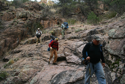
Scrambling down Horse Canyon
Brian getting water out of a tinaja. The water was kind of scarce on our trip but small pockets could be found in most canyons.
Joe enjoying our campfire on night 2 near Rattlesnake Canyon
This is the sign at the end of our day as we reached the confluence of Horse Canyon and Rattlesnake Creek.
On day 3 we decided to abandon our plans to head up Field Canyon to the West Divide. The bushwhacking was just gobbling up too much of our time and so we headed up Rattlesnake Canyon towards Powers Garden.
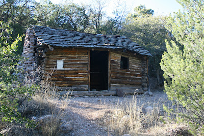
The cabin at Powers Garden. It looked as if the USFS trail crew uses this cabin regularly and it would be a great way to get out of the weather on a snowy night.
One of the many evidences for mining in the Galiuro's.
This is the famous Powers gold mine in Keilbach Canyon.
And the Power's Cabin where the famous Shootout occurred on February 9, 1918. You can read about it here.
I had not heard of this famous shoot out before our hike but after reading about it, I became fascinated with the tale.
Here is one book I read that gave an account that seemed favorable to the Power's side.
The night 3 campfire at the junction of Rattlesnake Canyon and the way to Holdout Spring
Up the trail (recently brushed by some trail crew) to Holdout Spring
Fresh water!
We saw much old growth in the floors of the canyons. This area was too inaccessible for logging and the trees were fantastic.
George beginning the big grind uphill to the East Divide Trail. I had a few difficulties here as the weather became hot and I was dehydrated.
Colorful oxidized rocks near the floor of one of the many caldera's we saw.
The signs were reminiscent of much earlier times in the wilderness
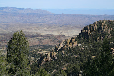
View northeast from the East Divide
These rhyolite ash beds may show their original bedding, or this could be the dip imprinting on them as the range was faulted
A pair of dikes coarsing upwards through ash beds
Hiking out on the final day. Within two days of our hike's ending, the range received more snow.
The group (left to right) George Abbott, Joe Alston, Norm Henderson, Wayne Ranney, Bryan Brown, and Frank Romaglia. What a treat to have such good friends to share stories, hiking and campfires!


Nice country to hike in, but very different than the canyon.
ReplyDeleteAs always, I love hearing about your adventures Wayne!
ReplyDelete