Sunday, February 13, 2022

A Spectacular and Unusual Trilobite Trackway in Grand Canyon

I enjoy sharing my 47 years of experience in the Grand Canyon with interested readers. Although much travel has been suspended during the Covid pandemic, I reach back into the archives of photos I have accumulated to share interesting items of Grand Canyon and World geology - enjoy!

The Grand Canyon is nearly 280 miles (450 km) long! And no less than 26 named rock units are exposed in its walls. John Wesley Powell, in seeking funding for his river trip survey in the 1860s wrote to Congress saying, "the Grand Cañon of the Colorado will give the best geological section on the continent."

Paleogeographic map of the southwest USA 505 Ma when the Bright Angel Shale was deposited. The red dot denotes the location of the fossil in this posting. Map courtesy of Ron Blakey and DeepTime Maps

In far western Grand Canyon, the Cambrian Bright Angel Shale thickens and becomes more carbonate-rich, documenting the continental transgression of the paleo-Pacific Ocean onto the edge of North America. Recently dated at about 505 Ma (Mega-annum or million of years ago) this progressive onlap of the sea occurred only 37 million years after the Great Cambrian Explosion, when more simple life forms evolved into many of the genera familiar to marine biologists today. Mollusks, corals, arthropods, and other forms made their appearance and were abundant in the area that was to become the Grand Canyon.

One form of arthropod is the trilobite and about 10 years ago, a river guide in Grand Canyon showed me this spectacular trace where a specimen crawled around in the soft, limey mud.

This is the largest slab of rock, which fell from the cliff above to expose a fossil-rich bedding plane.

Note the gentle and discreet symmetrical ripple marks on the right hand side of the slab. When the ripple marks are symmetrical in cross-section, they denotes fluctuating current directions (as opposed to asymmetrical ripple marks formed from singular current directions as in rivers). These here likely formed in oscillating currents in relatively shallow water.

Two individual specimens are represented on the slab as the trackway to the left's a bit smaller in diameter than the more obvious trackway on the right.

This ichnofossil (or trace fossil) is called Cruziana. (Yes, trace fossils have binomial nomenclature like the animals that created them). This one is really well-preserved and shows where the appendages of the animal pushed the sediment backwards, leaving an axial groove in the middle. We can also tell something about the direction of movement of the animal from this view. It appears that the animal came and "landed" in the sediment from the top right quadrant, then traveled down before turning left. It then makes the large loop around to the right on top before looping again within the larger loop. All of this can be ascertained because of the way the "exit track" on the middle far right seems to cross over and disturb the underlying track. This is amazing preservation.

Here is another Cruziana, this one from Deer Creek father upstream in the Grand Canyon. The detail of appendage push-back textures and the axial grooves are wonderfully preserved.

Many folks are more familiar with the many annelid worm burrows that are present in the Bright Angel Shale in Grand Canyon. They are also abundant here.

The fossil slabs in context to the river.

Our boar drifts by the trackway site.

In the lower left quadrant, it appears that the trilobite "took off" once again after making the two loops.

Another view with lens cap for scale.

Please do not disturb in any way fossil track sites. These are extremely precious specimens that must be preserved. And enjoy the Grand Canyon!

Saturday, January 15, 2022

Geology of the Eruption in Tonga

January 15, 2022. Courtesy of the Tonga Geological Survey

It's all over the news and there is good reason. At 16:28 local time in Tonga on January 15, a powerful submarine volcanic eruption rattled the area. Satellite photos are astounding. The noise from the explosion was heard as far away as Aukland New Zealand (1300 miles away) and tsunami warnings are posted for much of the Pacific Rim. 

Check out this link from Forbes and all of the embedded links. They are pretty astounding.

If you follow Twitter here is a video of the tsunami coming ashore in Tonga. (We have a neighbor who has done anthropologic research on the island and the proper pronunciation is Tong- ah).

Thanks to the folks at the Arizona Geological Survey for this first hand description of the geology of the volcano and published first of The Conversation. The maps are very instructive.

Geology Hub is another good resource to check out. Watch the whole video as the last half of it has the geologic story of this caldera. Note that some of the photos to illustrate a tsunami are not from this event and may not be of tsunami waves at all. A tsunami wave typically moves 500 miles per hour when in the open ocean and may only be six inches high. But as the wave approaches land and the water shallows, the wave height increases.

Great videos can be watched here.

We hope all will be all right and all will be safe from this.

UPDATE ***My colleague George Marsik, forwarded this pre-eruption view of Hunga-Tonga volcano using Microsoft Flight Simulator. There are some great views of what this volcano used to look like before January 15.***

2nd UPDATE: Please see Roseanne Chambers geology blog as well for a great description of the eruption and tsunami: https://roseannechambers.com/tsunami-troubles/.

This satellite image taken by Himawari-8, a Japanese weather satellite, and released by the agency, shows a volcanic plume produced by Hunga Tonga-Hunga Ha'apai volcano on Saturday, Jan. 15, 2022.

Sunday, December 26, 2021

A Quick Trip -- To Antarctica!

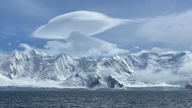
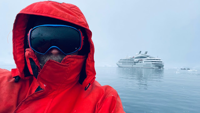
Livingston Island with lenticular clouds, December 7, 2021

On Tuesday morning November 9 (not quite seven weeks ago), I received the following email: 

"Hi Wayne, One of our staff members has a family situation that came up last minute. You were the first one I thought who could replace him. The dates are November 28 – Dec 12, 2021 – our Total Solar Eclipse cruise. Please let me know. Thanks, Julia" 

I've received a number of inquiries like these through my career, working as a roving Geologist Will Travel and I can honestly say that I have NEVER been able to accommodate a request like this on such short notice. Nevertheless, I looked unceremoniously at my digital calendar and to my delight and surprise I saw something unusual before my eyes - blank space. There was absolutely nothing to preclude me from saying YES and joining this expedition as a Zodiac driver and geologic lecturer. I then recalled that this was a trip that I had requested 18 months prior, as I have become a bit of an eclipse chaser. After a quick discussion with my wife about the advisability of my going, I replied,

"The answer is yes! I can help you. Let me know the details, Wayne

The elapsed time from query to acceptance was one hour and four minutes. I was going to Antarctica for my 30th time! There was lots of paperwork to be completed and many tests needed for entry into Argentina. But I was willing and the Ice was calling once again.

Poster by Tyler Nordgren

I soon learned that other friends who work as guides or lecturers on trips like these were also headed south. Rob was going with Wilderness Travel and Tyler was on with Betchart Expeditions and The Planetary Society. Tyler created the poster above and you can view more of his space artwork here.

Avenida Presidente Roque Sáenz Peña Buenos Aires Argentina

After all of the preliminary necessities to fly 1/5th of the way around the world (and during a global pandemic), I found myself once more in the heart of one of the great cities of South America, Buenos Aires. I love this city for its elegant character and as I soon learned, its humility in the face of the pandemic. Never before had I seen it so calm, so introspective. Nearly everyone wore masks, even outdoors on the sidewalks. We stayed in a hotel for three nights that had been closed entirely for 18 months. Staff were still trickling in after the long layoff. It was refreshing to see a society that had come to terms with what was needed to move on from the microscopic enemy that has no regard for the safety or health of the human endeavor. Here, there was no hint of the "keep-your-hands-off-of-my-body" type of mentality that still permeates the United States 245 years after its rebellious Declaration of Independence. Civil-ized - that's what I thought of as I explored the Recoleta, Palermo, and Barrio Norte neighborhoods.

This meal was enjoyed at Fervor restaurant on Avenida de Libertador 

I was with six of my shipmates, who had flown in from South Africa, Italy and the United States. We were an eclectic group who soon bonded in sheer joy at being somewhere, anywhere, after the long lockup. It is summertime down south and 80 degree weather always brings a smile to my face. The exchange rate was VERY favorable to a Norte Americano and I took great pleasure in sitting at an outdoor restaurant and ordering one of the world's great steaks, grown on the Argentinian Pampas (grass-fed) and grilled to perfection over open flame. 

View of Isla Navarino from Ushuaia Argentina on November 30 2021

But enough of that. We soon flew to the world's southernmost city of Ushuaia, located on the Beagle Channel and on the south coast of Tierra del Fuego. The city was essentially devoid of the usual numbers of visitors (because of the pandemic) and as it was imperative that we arrive at the ship without infection, I found myself aboard Le Lyrial, which set sail at 9:30 PM on November 30th, bound for the South Orkney Islands.  

Sunset on the Scotia Sea, at 9:24 PM local time, December 1, 2021

I had only been to the South Orkney Islands a few times before and in the earlier days of Antarctic exploration, when the trips were more free-form and unscheduled. Today, the trips follow strict scheduling procedures due to the sheer numbers of ships stopping at the few choice places to set foot on the continent. The South Orkney Islands are considered a part of Antarctica since they lie below 60° south latitude. We made one landing here at Shingle Cove and were 'blown-out' of a Zodiac tour at another location due to strong katabatic winds.

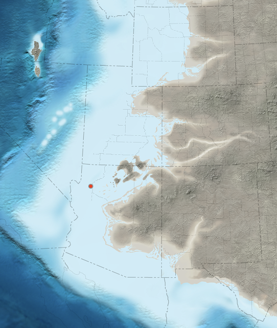
Map of the South Orkney Islands with stops labeled

The beach at Shingle Cove looking east in South Orkney Islands, December 3, 2021

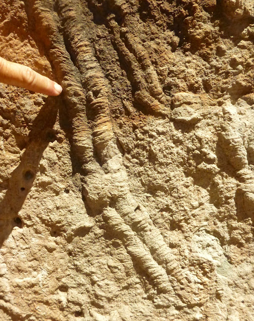
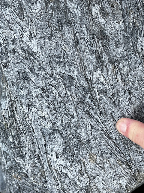
Metamorphic fabric in the Scotia Metamorphic Complex at Shingle Cove. The rock unit is described as "ocean floor-derived sequences of uncertain but perhaps Permian to early Jurassic age..." Ref.: British Antarctic Survey Geological Map of the South Orkney Islands, 2011.

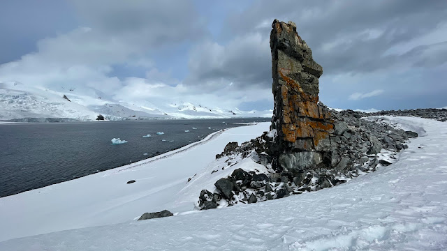
Looking southwest along the shore of Shingle Cove

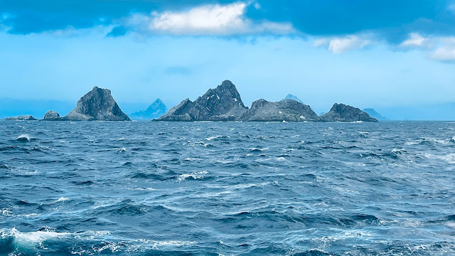
View to the northeast to the skerries near Powell Island, where we viewed the eclipse

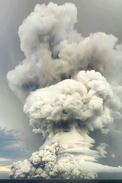
The eclipse on December 4 would occur at 4:08 AM local time. But not to worry - the sunrise at this latitude was at 2:33 AM, meaning that the sun would be up for a full one and half hours before the disk of the sun would be obscured. Unfortunately (and not at all unexpectedly for this part of the world), the sky was completely overcast without a chance of the sun peaking through. Still, most people were up at this early to see and experience what would happen. And even though we did not see the moon travel in front of the suns entire disk, it did get dark for one minute. One of my fellow shipmates and naturalists, Rich Pagen, captured this time lapse (below) of the celestial event.

Sixteen second time lapse video from the back deck of Le Lyrial of the December 4 total solar eclipse

Crossing over to the Antarctic Peninsula, we had some very rough seas. But when we arrived at the Peninsula, the weather was fine.

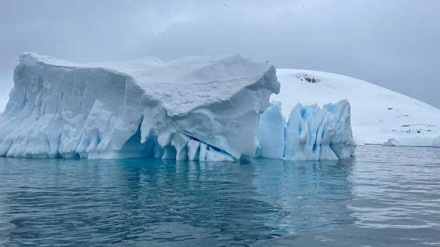
Tabular iceberg in the Antarctic Sound, also known as Iceberg Alley
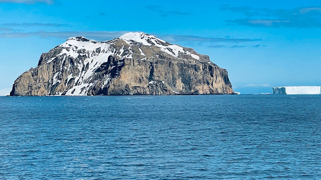
Rosamel Island is a tuya, a volcano that was erupted beneath the glacial ice when it was more extensive

Adelie penguins on a sunny day on an iceberg

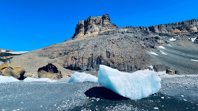
Brown Bluff is another popular stop and is another tuya belonging to the James Ross Island Volcanic Group, a series of Pleistocene cones now emergent from their glacial carapace

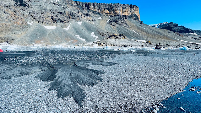
A low-tide delta of sand that has formed from sapping - when the tide went out, water ran out from the higher beach sand and transported it to where it spilled into a delta front

Half Mood Island with Livingston Island in the background. Both belong to the South Shetland Islands group

Hikers on Half Mood Island

An iceberg with teeth!

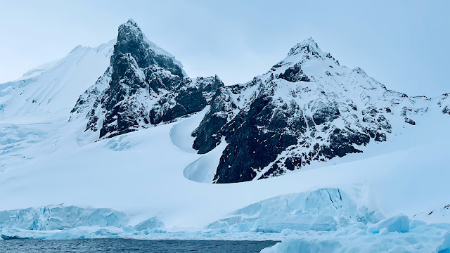
Orne Harbor on the Antarctic Peninsula - note how the wind and solar radiation has scalloped the snow and ice away from the base of the peak (center)

Copper mineralization near Paradise Bay, Antarctic Peninsula

A tilted unconformity between Permian and Pennsylvanian basement rocks overlain with Triassic and Jurassic volcaniclastic sediments.

I am back home now but am scheduled to return to The White Continent three more times this season. Stay tuned!
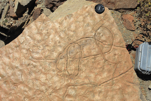
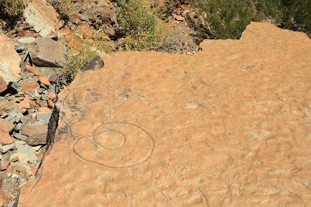
Monday, November 29, 2021

Don't Miss This Fans of Arizona Geology!

 This from Michael Conway at the Arizona Geological Survey.


Photo: Hunter’s Point, south of Window Rock, displaying a beautiful expression of the
East Defiance
 monocline, Laramide fold. The rocks are mostly sandstones of 
Pennsylvanian through Triassic in age.     Photograph by Stephen J.Reynolds


Arizona Geological Society presents

Roadside Geology of Arizona

Stephen J Reynolds and Julia K Johnson  

School of Earth and Space Exploration

Arizona State University


Tuesday, 7 Dec. 6:30 p.m. (MST)

ZOOM (https://arizona.zoom.us/j/87908544524)

Passcode: AGS-2021

              ZOOM Venue open at 6:15 p.m.


ABSTRACT. Arizona is an amazing showcase of geologic features and processes. The landscapes of the state reveal a fascinating geologic story, and most chapters of this history can be observed by traveling Arizona’snetwork of federal, state, and local highways. With some strategies for observing landscapes and a general understanding of the of and events,a traveler can piece together the main plot lines of the history. We are using this observe-first, stratigraphy-first approach to write a new version of Roadside Geology of Arizona. In this talk, we will employ a regional approach to Arizona as      we explore the geologic scenery of different parts of the state, highlighting the stratigraphy, structural styles, key geologic events, andnotable scenic landmarks.


 Presenters

Dr. Steven J. Reynolds was recently named ‘President’s Professor’ at ASU. He has au thored or edited more than 200 geologic  maps, articles, and reports, including the    866-page “Geologic Evolution of Arizona.            Steve is a past president of the Arizona Geological Society.


Ms. Julia K. Johnson is a geologist and geoscience-education researcher. Her geologic research focuses on the geologyof Arizona, and her education research involves the use of concept sketches in geoscience learning and teaching. She is a  co-author of one of the Arizona Geological Survey’s most popular contributed maps: “Geologic Map of thePhoenix Mountains, Central Arizona”  (~60,000 views).

Friday, November 26, 2021

End Cretaceous Tsunami Event Recorded in Rocks on the Tora Coast in New Zealand


This one from my colleague and good friend Jack Share. Watch this five minute video here to understand how a deep sea rounded conglomerate was formed. And be sure to check out Jack's blog, Written In Stone: Seen Through My Lens.

Monday, November 15, 2021

Salvage Geology in Cataract Canyon

Aerial view of the confluence of the Green (light brown) and the Grand (darker brown)
that formed the Colorado River (left) prior to 1922 . (Image taken May 25, 2015) 

I've run the rapids through Cataract Canyon in Canyonlands National Park and Glen Canyon National Recreation Area a few times and marveled at the exquisite geology exposed there. In fact, I believe that the country surrounding the confluence of the Green and Grand rivers is the quintessential location of the heart of the Colorado Plateau. Names like the Orange Cliffs, the Land of Standing Rocks, and Island in the Sky evoke images of stratified terrain that may be equaled elsewhere nearby but never surpassed. You can see some of my past blog postings of trips through the canyon here, here, and here.  

Image taken May 25, 2015

The ongoing drought in the American Southwest has caused the level of the Powell reservoir behind Glen Canyon Dam to drop 156.5 feet from its full pool elevation of 3,700 ft. (above mean sea level). This has caused the once drowned channel of the Colorado River in Cataract Canyon to slice through over 35 years of sediment within a narrow, confined channel. In the photo above, you can see part of this great sediment pile directly above the boat and in the shadowed bank on the right. The Powell reservoir once inundated  these terraces but the lower level of the reservoir causes the river to slice through them.

The Powell formation. Image taken May 25, 2015

Now, the Returning Rapids Project is documenting the scientific and social significance of this sediment excavation event. You can read an article from the Salt Lake Tribune here about some of the results. 

For the Edward Abbey that resides in many Southwestern souls (and I proudly proclaim my fondest affection for the anticipation of the demise of the unneeded reservoir), this is an exciting moment in time. It is an opportunity for scientists to monitor both the deposition of the Powell beds for the mid-1960s to about 2000, and the erosion of this sediment pile as the level of the reservoir drops. 

In the linked article, the author refers to the sediment body as the Dominy formation, after Bureau of Reclamation Director Floyd Dominy, who essentially spearheaded the drive to construct Glen Canyon Dam in the 1950s. However, all rock units in geology must be named after a geographic location where they are first studied and described (called the type section). Until someone names a feature after Dominy, a better name for unit might be the Powell reservoir formation, or simply the Powell formation (both names in a rock unit are capitalized if the name has been formalized with a scientific description; if it has not yet been described then the suffix name is lower case, signifying that it is an informal name).

Monday, November 08, 2021

My First Grand Canyon Backpack Since Knee Replacement Surgery

Well, it is nice to have this goal finally achieved! 23 months after having two total knee replacements, my wife and I headed back down to the bottom of the Grand Canyon on a six-day backpack. While rehabbing after surgery in December, 2019, a photo of me hiking the Tonto Trail in 2017 was placed on the wall of my hospital room to serve as inspiration to see my recovery through. It worked!

And I owe it all to this lovely lady, who was by my side these whole 23 months and made the necessary arrangements for my volunteer lectures at Phantom Ranch! Thank you Helen from the bottom of my heart (and knees).

To say I was bit uneasy to see if my knees could withstand the steep descent of the Bright Angel Trail doesn't convey fully my concern. 

Within 50 meters, my left knee began its odd pain. But after the Mile-and-a-Half House, I took a break and upon beginning again, the pain was gone for the rest of the trip. It apparently was just warming up.

And then it was like the other hundreds of hikes I have completed here such that the beauty and scale of the Grand Canyon took over! This is Jacob's Ladder through the Redwall Limestone.

This is the view from Plateau Point across to Zoroaster Temple. The weather could not have been better for hiking the entire six days.

I had never before noticed these detailed trilobite appendage traces in the Tapeats Sandstone near Plateau Point. The critter was swimming in shallow water but pushing across the bottom sand.

At Plateau Point proper, these trilobite "landing" scours have always impressed me. Imagine the swimming sea creature coming down to the shallow sea floor and scooping out a place for itself. Note also in the upper left a trace known as Corophioides, paired holes at the top of the bedding planes that transition to concave-upwards scours at their base. These are interpreted as dwelling structures for suspension-feeding organisms such as annelids.

One of the trail guides we met out at the Point told me of a trace fossil he has stashed (people steal these things) so that he can continually show his guests trip after trip. I used this technique myself when I was a trail guide. This is a trace known as Rusophycus, a resting or predation escape structure for a trilobite.

A beautiful sunset was seen from Plateau Point toward Dana Butte. Horn Creek Rapid at relatively low water can be seen (and heard!) from Plateau Point.

The Tapeats Narrows along the lower Bright Angel Trail is one of my favorite places in all of Grand Canyon.

Beautiful Buddha Temple framed by Fremont cottonwoods.

Finally, the bottom of the canyon and the Colorado River was achieved.

This was our home for 4 nights - Bright Angel Campground site 17.

I gave a geology lecture to guests at the Ranch each afternoon at 4 PM. I talked about Grand Canyon rocks and how the canyon was carved.

Rocks and resources for the talk were available.

The lectures were well attended and appreciated by tired hikers and sore mule riders.

An outcrop of boudinage in Bright Angel Campground was nearby.

The most beautiful view I know of is located here along Bright Angel Creek.

Thanks for believing I could do this Helen! Let's do it again soon!