Tuesday, October 31, 2017

Flying Over Mt. Kilimanjaro, the Nile River, and the Red Sea

Ah - a nice four flight without having to give a lecture and going over interesting terrain! Cloudless desert skies round this as a perfect flight!

On the ground at Mt. Kilimanjaro International Airport after our one hour flight from Serengeti. The temperature was about 85 degrees here at 4,500 feet and 3ยบ south of the equator.

Beautiful blue skies too as we boarded our jet. For the second half of this flight, I have been sitting in row 1, starboard side.

Once in the air, the pilot radioed for permission to do a scenic flight over Mt. Kilimanjaro and was granted the request. Unfortunately, clouds covered most of the mountain.

But every now and then while circling the giant volcano, we could see the Lemosho Route traveling along the southern base of the volcano. If you look closely in this shot, you will notice small orange tents pitched in the cleared area. We may have camped here in 2014 on our ascent of the mountain.

This is the Blue Nile River just upstream from Khartoum, Sudan. Currently there is a huge dam being built on the Blue Nile in Ethiopia and it will be completed next year. Read about the project here.

This is the Nasser Reservoir, the body of water inundated behind the Aswan Dam on the Nile River. This is very close to the border with Ethiopia. The scenery was very much like that seen near the Powell Reservoir in the American Southwest.

Another shot of the shore of Nasser Reservoir showing significant mountain terrain that itself is being inundated - with wind-blown sand (lighter orange material on the mountain slopes). It must be incredible to be on the ground here and see this - if you can get there!

A poor, long-distance shot of the Aswan Dam across the Nile River. The Nile flows left (north) and the Nasser Reservoir is on the right (to the south). The last time the Nile River flooded freely was June, 1964 when the gates of this dam closed.

The irrigated banks of the Nile River below Aswan. Note the desert lands outside of the rivers floodplain.

Now we are flying across the storied Sinai Peninsula in Egypt. Looks like the Mojave Desert to me.

After crossing the peninsula, we arrived at the edge of the shoreline in Egypt.

This is the most famous of the resorts at the southern tip of the Sinai Peninsula, Sharm El Sheikh. It began as a fishing village and was transformed into a naval base for the Egyptian Navy in the 1950's. It is now a tourist destination and the diving is said to be quite spectacular.

These islands in the Gulf of Aqaba are located directly across from Sharm El Sheikh but are in the country of Saudi Arabia. Note the very shallow reefs which I'm sure are excellent places for snorkeling and diving.

More desert, more sea in Saudi Arabia.

The Google Earth image of this stretch of Saudi coastline shows absolutely nothing named.

We entered Jordanian airspace near the northern terminus of the Gulf of Aqaba. I have seen these black dikes, which admittedly look like tilted strata but isareactually black basaltic dikes intruding into lighter colored Precambrian granite, which is a part of the Arabian shield.

We turned to the east and got a great view of the Wadi Rum area, which I will show in the next post from ground level. In this aerial shot however, note the darker substrate beneath the orange sandstone - this is the Great Unconformity where Paleozoic rocks lie atop Precambrian crystalline rocks.

The Jordanian city of Aqaba at the head of the Gulf of Aqaba. Three counties are visible from here, Jordan in the foreground where the city is located, Israel in the center, and Egypt at the far top of the photo.

My next posting will be from the ground in Petra and Wadi Rum.

Monday, October 30, 2017

The Spectacular Serengeti Landscape

One of the joys of these trips is flying over interesting places. I had to give a lecture as we left Agra and could not look out the windows but it didn't matter as we were flying over the Indian Ocean and the Arabian Sea. We finally saw land on the coast of Kenya in East Africa.

This is the port city of Mombasa in Kenya. I have yet to visit this pace but when I was in college a local band played a song in which the chorus repeated the word MOM-BA-SA. I've wanted to visit ever since.

This is Mt. Kilimanjaro with a giant thunderhead looming over it. You can see the small glacier on its summit. See my posting of our summit day on top of Mt. Kilimanjaro here.

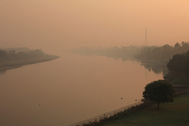
Sunrise in Serengeti National Park on October 13, 2017. After landing in Arusha, we took a small aircraft for a one-hour flight to the landing strip at Serengeti. We got on the ground just in time too as a huge downpour lasting 2 or more hours inundated the northern part of the park. While driving one hour to the Four Seasons Lodge, hail pelleted our safari jeep. The runoff was spectacular. This was the sunrise that followed the deluge.

I was up for sunrise at 4:30 AM so that we could go ballooning over the landscape!

Note the glow of the burner in this photo of one of our five aircraft.

Reflections in the hippo pool. Note the dozens of hippo's in this pool.

Since the temperatures were so cool from the previous days rain, some of the hippos felt comfortable enough to emerge from the pool and we were able to see them from the unusual vantage from above.

A small stream lined with Seronera palm trees as seen from above.

Ballooning is much more fun than it might appear at first and is a very interesting craft. The elevation of the balloon controls the speed and direction of movement. Here our balloons are almost touching the ground as they catch a desired wind direction. At other times we rose to 1,500 feet or more to move faster and farther. This was my second time ballooning in Africa and you can see a post here from my first balloon experience in Namibia in 2013).

Skimming the umbrella acacia trees on the Serengeti, which in the local Masai language means "Endless Plain."

These passenger baskets are large and hold 16 people plus the pilot.

A high traverse over the Serengeti.

Every balloon ride ends in a Champaign breakfast somewhere out on the vast plain.

Next, it was time for a ground safari. It was a spectacular day with puffy clouds, perfect temperatures, and well-watered grass. This was the short rainy season and the 2 inches of rain the night before would have the grass looking green after our three day visit.

We saw more giraffes this time than I have ever seen before. The rains freed the animals from congregating around shrinking watering holes (it hadn't rained since April). This dispersed them to a certain degree but also made them more active. The giraffe (genus Giraffa with three species) is an amazing animal that is considered vulnerable in its conservation status, due to shrinking habitat. Farms and corn fields are often found right on the boundaries of these national parks.

We got excellent views of a cheetah (Acinonyx jubatus) who had just finished a meal of impala. This is our planets fastest animal and in a sprint achieves 70 mph. It is one of the smaller large cats at an average weight of 100 to 125 lbs. I saw very few lions this time but other vehicles got better views.

This is the red-billed horn-bill (genus Tockus with five species who some consider only sub-species). The colorful and rich palette of birds in Africa are as varied and satisfying as the larger game.

Afternoon thunderstorm on the Serengeti.

We encountered a family of 11 elephants resting under a single tree on the plain.

If the young ones can still walk beneath their mother, then they are less than six months old. We saw three in this group with one only two months old.

Typical safari scene in Serengeti.

This one was eating the grass and would pluck at it with its trunk, then position the various strands while bringing it up higher. He would then place the loose bundle on the flattened underside of its trunk (using it like a table) to further arrange the grass with the end of its trunk. When everything was just right he picked up the bundle again and devoured it. It is said that there are 1,700 muscles in an elephants trunk. Read about their trunks in this link that also tells you anything you want to know about these amazing animals.

No trip to Serengeti is complete without a view of the leopard. Active at night, they usually can be found resting in the branches of an acacia tree during the day.

Next stop, Petra in the country of Jordan!

Saturday, October 28, 2017

Visiting the Taj Mahal, Agra India

I am sorry for the delay in posting. I have been in the States now for one week but attended my High School reunion in Southern California and was delayed in getting home.

The last time I visited the Taj Mahal, a pouring rain made the visit a sloppy mess and precluded any photography (although the huge crowds at that time were a really interesting part of the experience). This time, conditions could not have been more ideal and it was my first time in which I visited at sunrise - a huge difference with respect to the light and the lack of crowds. Agra does not have a commercial airport (we landed at a military airport) and many visitors make the 100 mile drive from Dehli and do not arrive until late morning. (During the peak tourist season, up to 45,000 people visit the Taj each day).The sunrise option was a great way to see this marvelous construction!

The Taj is merely the crown in a body of architectural jewels. Before seeing it, one must pass through a large gate that makes the building look more remote than it actually is. This is an actual design feature made purposely.

Once through the gate, its appearance changes as it is viewed along the long reflecting pools.

This is the view backwards to the entrance gate, composed a red sandstone blocks.

Sunrise east of the Taj Mahal on October 11, 2017.

Looking straight up along the front faรงade of the construction is beautiful Arabic calligraphy in black marble set within white marble. It mainly contains verses from the Koran. A short article on the calligraphy can be found here.

The faรงade has incredible inlaid stones that resemble flowers. The types of stones are varied from white and black marble, red jasper and coral, yellow onyx, blue lapis-lazuli, and others. It is incredibly well-rendered.

One of the realities of traveling in India is that the air-quality is usually very bad and this sunrise was n o exception. A combination of smoke from domestic and agricultural fires, exhaust and fog make for interesting skies. This is the Yamuna River which id the second longest and largest tributary of the Gangers River. It begins in the high Himalaya at an elevation of nearly 21,000 feet and flows for 850 miles to the Ganges, through the north-central part of India.

One of the minaret towers with the moon present above it. The Taj Mahal (literally, Crown of the Palace) is actually a mausoleum. It was commissioned by the Mughul emperor Shah Jahan in 1632 to house the tomb of his favorite wife. It was completed in 1653. Shah Jahan was imprisoned by his son (who assumed the throne) for "wasting" funds on its construction and his cell in the Agra Fort looked over the river toward his masterpiece. He looked at there Taj for the last five years of his life while in confinement.

The building is mostly made of Makrana marble, quarried in Rajasthan, India in the northwest part of the country. It is a Precambrian- age metamorphosed limestone that is part of the Dehli SuperGroup. Metamorphism commenced about 1,450 Ma during an event known as the Dehli Orogeny. This is very old marble. India holds a spectacular and robust geologic evolution!

A different view of the Taj from the west. The gardens surrounding the grounds (measuring nearly 1/3rd by 1/2 a kilometer)  are impressive.

Western pathway among the gardens.

Red sandstone carving with inlaid stone border on one of the side buildings, themselves very impressive.

The Taj receives 8 million visitors per year and it is a kind of pilgrimage site for Indians.

Next posting from the Serengeti National Park in Tanzania.