My last river trip of the year! And it was a good one. It was sponsored through the
Grand Canyon Association Field Institute. We run it once a year for the members and supporters of the Association. As usual, my post is not meant to be comprehensive of the entire trip. After 85 or so journeys down the river in Grand Canyon, I usually only shoot photos of stops not made in a long time. And there is a dearth of photos showing participants on hikes or in camp.
AzRA was the outfitter for our trip and Jed Koller was the trip leader. He was a great guide with lots of experience and great way of sharing information.
***NOTE: I'll be on an Adventure in Iceland with Smithsonian Journeys starting on September 11. So keep checking back here for updates and photos from there soon!***
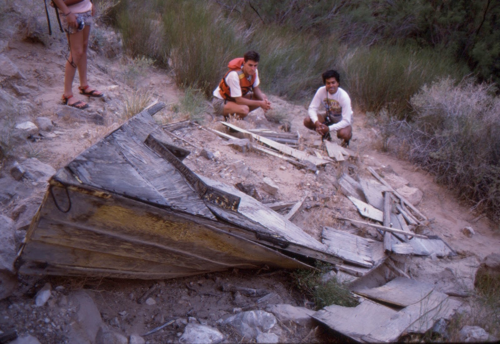
At river mile 41 are the remains of Bert Loper's boat from his 1949 expedition (the one in which he died at the oars in 24.5 Mile Rapid - his boat came to rest near here and others in the party brought it high above the high water mark). I had not stopped here since May, 1988 while rowing on another AzRA trip. Here is a photo of the boat on August 31, 2016.
August 31, 2016
Same view of the boat in May, 1988.
Close-up of the bow of Loper's boat, May, 1988.
Another view from 1988.
I never knew that this plaque was here placed above the rock next to a juniper tree.
A highlight on this trip was walking up Saddle Canyon for the first time since it had experienced a tremendous flash flood on August 1 earlier this year.
Word had come out that the old chock-stone boulder that guarded the entrance to the final waterfall had been flushed out and sure enough it had! The boulder used to sit adjacent to the left wall here where you can see the smooth foot beds left center. Amazing to think this huge boulder was washed out!
Jed is standing where the boulder used to sit and the smooth footbeds - worn by the sandals of thousands of hikers - can be seen just beneath him.
The waterfall with a new boulder at its base.
Note how the water in Saddle Creek had carved a path into the bedrock when the chock-stone was present.
The vegetation was still recovering.
We left Saddle Canyon about 1 PM after lunch when it began to rain again. This view is looking upstream toward Saddle Canyon. My friend, Walker Mackay was hiking up in Saddle Canyon when this storm hit and he said he made it out of the narrows by 35 minutes before another flash flood came through. His videos on Facebook were amazing and it is a good thing they made it out in time.
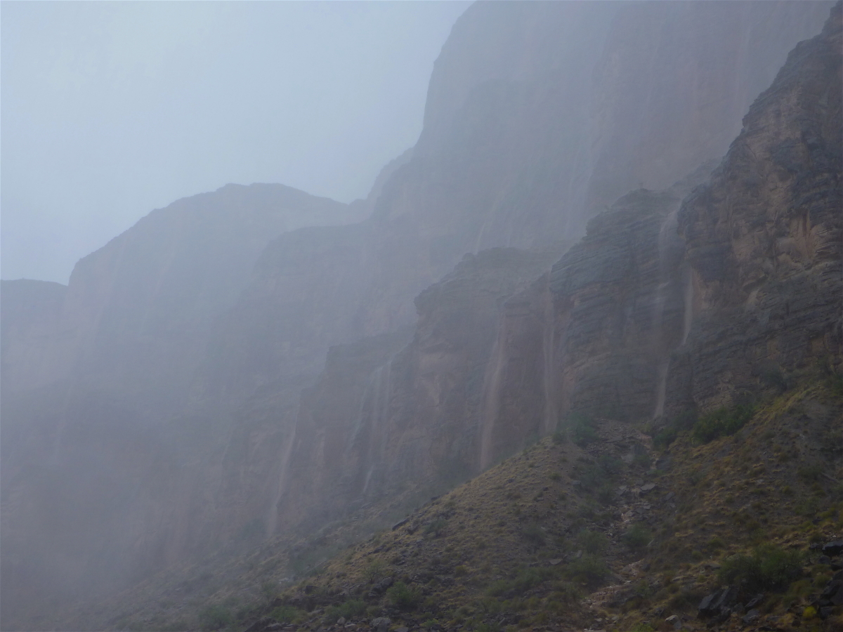
Rain coming down. We camped at Sixty-Mile Rapid and it rained from 4:30 PM to 1:30 AM.
Hiking at the Unkar delta with our group.
The Arizona monsoon this year has been tremendous and Flagstaff experienced its 7th wettest monsoon on record.
The final rainbow from Trinity Camp.
Slickensides in the Zoroaster Granite at Bedrock Canyon. I had never been ashore here before.
Possible iron-banded formation in the Vishnu Schist.
Up in Bedrock Canyon is a place to see the Bass Limestone in contact with the Vishnu rocks. This is an unconformity of "only" 500 million years (compared the The Great Unconformity of 1,200 million years where the Tapearts Sandstone sits on top of the Vishnu rocks).
I made it a point to touch this unconformity where the Vishnu rocks saw the light of day some 1,254 million years ago.
The schist and granite here has some fantastic folds in them.
More folds.
Two unconformities for the price of one! Note the dark cliff near there top of the photo. This is a remnant of the Bass Limestone, sitting on top of pinkish granitic rock. This is the first unconformity (technically a non-conformity). On top of the Bass Limestone in angular unconformity is the lighter colored Tapeats Sandstone. What an awesome contact!
We visited Matkatimiba Canyon, which for me was the first time in about 10 years. It was great.
A very scenic patio.
A small-ish camp in the Muav gorge, also known as the Icebox. Some of our camps are very large (Texas-style), and others are more intimate (Vermont-style). I like them both for different reasons.
The ocotillo's were full of leafy greenness.
They have received a lot of rain this summer.
This one is located at the entrance to Havasu Creek.
Prospect Spring at the foot of Lava Falls.
And another spring just downstream, bubbling up through the silty water of the Colorado.
Note the small raft in the river with a lava flow (dark cliff) looming above it at Whitmore Wash. The course deposit on top of the lava flow was mapped by Cassie Fenton as an outburst flood deposit when a lava dam upstream catastrophically failed.
Close-up of the outburst flood deposit.
At river mile 194 is another outburst flood deposit - this one filling an old channel of the Colorado River! Note the "smiley face" channel cut into the bedrock with the outburst flood deposit filling this.
Western Grand Canyon where Paleozoic Limestone is king!
Close-up of the stack from Precambrian Vishnu Schist (extreme bottom) through to Tapeats Sandstone, Bright Angel Shale (lower slopes with two, rusty-brown dolomite cliffs trending through the shale), Muav Limestone (a series of four prominent cliffs, each one its own Member), Temple Butte Limestone, and all capped by the massive Redwall Limestone cliff.
What a great group! All interested in geology, the Grand Canyon, and the Colorado River. Thank you one and all!