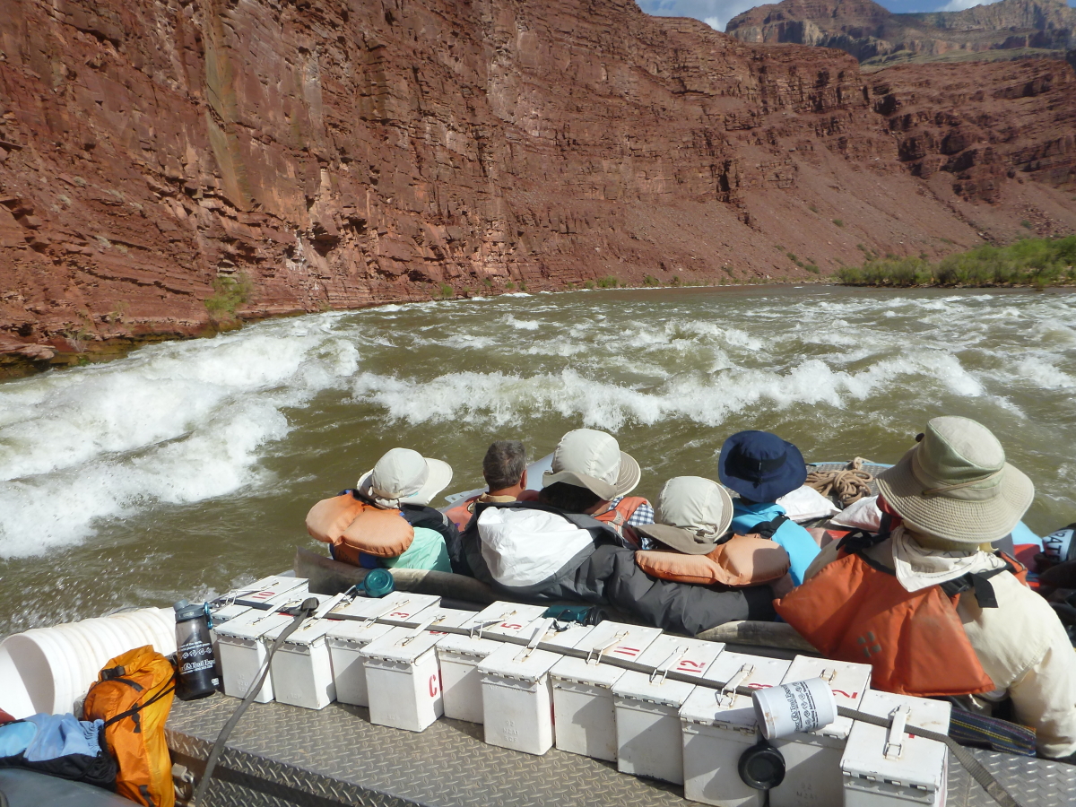
If it seems like I am doing a lot of Grand Canyon river trips this year, let me say that I will be doing five of them this year; one each in May, June, July, August and September. There is a nice symmetry to a schedule like that. I get to see the canyon emerge from winter into its flower-dappled spring and slowly roll into the dog days of summer, with just a hint of Indian Summer at the end. I like that. I recently finished my third trip and was worried from the start that this might be the hardest with the heat dome that has developed over North America this year. But we saw some monsoon clouds and moisture, and there was a wonderful group of 11 people. This was one of my geology-charter trips.
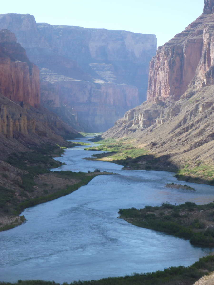
Bright, clear sunshine at the start as we float through the Supai Group of rocks. Note the haze in the far distance - that is smoke from the Fuller Canyon Fire on the North Rim.
Vasey's Paradise is normally a good size spring issuing from the Redwall Limestone but its discharge is much compromised this season with the relatively low snow pack on the North Rim this past winter. The large hole on the left is completely dry and just a trickle comes out at center.
Just past Redwall Cavern, we entered the smoke zone. It was eery and weird looking to see the canyon in an orange haze.
It reminded me of my high school days in southern California when we ran track and field in the height of the smog epidemic.
This was the day that the fire grew from about 3,000 to 14,000 acres due to a flare up in the wind. We were right below the fire up near Saddle Canyon.
It did make for some pretty interesting pictures.
I'm not sure what everyone made of the smoke although a few were bothered by it at night. We did do the Saddle Canyon hike in the smoke as it drifted in and out of the canyon above us.
We finally got beyond the smoke and could look back upstream as it billowed up over Saddle Mountain.
With the smoke gone, we decided to hike to the Nankoweap granaries. I never would have imagined doing this on a middle-of-July trip but we started early and hiked with wet clothing. It was a breeze!
And a great view!
These are the granaries, located in a niche cut into the Muav Limestone about 800 feet above the Colorado River. They likely were constructed about 1,000 years ago by farmers who lived near the delta of Nankoweap Creek.These granaries were used to keep critters from getting into food stores at night, just as on river trips today when food and trash is put in closed containers to prevent the same.
A final view of the Colorado River from the granaries.
We set up lunch in some rocky ledges etched into the Tapeats Sandstone just below Sixty-Mile Rapid. Many people wonder how the ledges form, if the whole deposit is sandstone? The question actually is:"If it is all sandstone, why does it erode in such nice neat layers?"
The answer can be found looking back under the ledges. The formation is not entirely sandstone but actually interfingers with stringers of Bright Angel Shale. Notice how the shale is more readily excavated by the river since it is softer. The sandstone becomes undercut and ultimately collapses downward.
This is the Sandra, an original 1940's-era cataract boat made by Norman Nevills, considered by most to be the first commercial outfitter in Grand Canyon. Rowing the boat is Greg Reiff, the grandson of Norm Nevills. He patched her up and has now made 33 trips in the Grand Canyon with her.
Travertine 'drapes' on top of the Bright Angel Shale. The travertine formed when spring water, saturated by the dissolution of calcium from the Redwall Limestone, degassed and precipitated limestone. To a geologist, travertine is spring deposited limestone, to counter-top makers travertine is everything from limestone to marble to who knows what. The dates on this travertine are around 330,000 years.
The same process continues nearby within the drainage of the Little Colorado River. About 13 miles upstream from the confluence of the two rivers, is Blue Springs, the largest spring in Arizona at about 220 cfs. Groundwater is dissolving calcium in the Redwall Limestone (where the spring issues from) and the dissolved calcium gives the water its blue color. As the water runs over boulders, the CO2 is driven off and travertine forms in the bed of the LCR.
Wow! The canyon would be spectacular enough but then this warm, colorful water frames it all.
At home in a rocky paradise.
Running Unkar Rapid with the Dox Sandstone above the rapid.
One of the more popular camps above the Inner Gorge is Upper Rattlesnake Camp. I've camped here a lot and have grown quite fond of this little outcrop in the Dox. It is a mudstone/shale that is bounded above and below by thin layers of sandstone. It's like an ice cream sandwich. But the mudstone appears as if it is two weeks old! You could find materials like this on any exposed river floodplain. That is how unchanged it is after over 1 billion years.
Our boatman, Mikenna, has "adopted" the Clear Creek beach. You can read about the Adopt a Beach Program of the Grand Canyon River Guides here. As we stopped, I noticed the fabric in the Vishnu Schist and took a few pictures.
Erosive patterns composed of gray schist rock (metamorphosed shale or sandstone) with light colored quartz dikes (once molten magma).
Interesting shape with quartz dike remnants still plastered on in two places.
I like to set up my bed near the beach where it is a bit cooler in the summer for sleeping.
On our way to Elves Chasm in the Tapeats Sandstone.
Two large boulders of travertine frame the beautiful waterfall.
The Desert Spiny lizard (Scleroperos magister). They can change their color to better absorb or reflect heat.
Spectacular setting on top of Deer Creek Falls after a good hike of about 300 feet uphill. That's the Powell Plateau in the far distance. Note also how the Tapeats Sandstone across the river pinches out gradually away from the photographer. This was the location of a substantial knob of granite that protruded above the Tapeats depositional plane.
Looking into the Deer Creek Narrows from the trail above.
Wild plant garden.
Here is everyone from the trip, except myself who took the picture. You all were great river companions!
Adventure and foreign travel, philosophical and scientific musings, geology and landscapes, photography and earthly explorations.
Sunday, July 24, 2016
Sunday, July 10, 2016
Reviews for "The Grand Canyon: Monument to an Ancient Earth"
I would be happy to send you a signed copy of my newest book (described in this post) for just $30 postpaid. Please order by sending me an e-mail with your contact information at wayneranney@earthlink.net
It has been 12 weeks since our book, "The Grand Canyon: Monument to an Ancient Earth" was released and I am happy to report that the response has been unbelievably positive. National news media is beginning to notice the value of it, which shows clearly but in a respectful manner how ideas associated with a "young earth" are misguided and just plain wrong. The book is the culmination of over five years of work from eleven co-authors, myself included. I wrote the Foreword to the book and am a co-author on Chapters 1 and 19.
I like to share with readers a few of the reviews our book has received so far. But before I do, just realize that many people including many open-minded Christians, already know that the preposterous idea that Noah's Flood could have created the Grand Canyon in just one year (and not just the hole in the ground but the rock layers too) is a sham and a falsehood for which there is absolutely no evidence. You can see a partial list of the endorsements our book has received here:
As for the reviews see all seventeen reviews we have received so far on our Amazon page here. All of these are 5 Stars!
In the July/August edition of "Church and State," we have this review here.
Locally, our book was reviewed in The Grand Canyon news here and the The Arizona Daily Sun (Flagstaff) here.
Lastly, I have had many friends and colleagues tell me that they cannot believe that a book like this is necessary. They are astounded that ideas put forth by Young Earth Creationists (YEC's) are given much credence. And yet, if you think of the giant recreation of "Noah's Ark" that opened this week in Kentucky, you can see that people like Ken Hamm are spending incredible amounts of money to further these misguided claims. (See articles in the New York Times and Washington Post here and here.) Rob Boston responds to the hoopla about the opening of the Ark in Kentucky with this missive and made a plug for our book as well here. As you look at this $102 million construction, and think of the financial and human resources it took to complete, we are supposed to believe that a family of eight built something like this to this scale 4,000 years ago?
Here are a few peeks into our book. The table of contents is shown here:
And I include the entire Foreword here:
I would be happy to send you a signed copy of my newest book for $30 postpaid. Please order by sending me an e-mail with your contact information at wayneranney@earthlink.net
It has been 12 weeks since our book, "The Grand Canyon: Monument to an Ancient Earth" was released and I am happy to report that the response has been unbelievably positive. National news media is beginning to notice the value of it, which shows clearly but in a respectful manner how ideas associated with a "young earth" are misguided and just plain wrong. The book is the culmination of over five years of work from eleven co-authors, myself included. I wrote the Foreword to the book and am a co-author on Chapters 1 and 19.
I like to share with readers a few of the reviews our book has received so far. But before I do, just realize that many people including many open-minded Christians, already know that the preposterous idea that Noah's Flood could have created the Grand Canyon in just one year (and not just the hole in the ground but the rock layers too) is a sham and a falsehood for which there is absolutely no evidence. You can see a partial list of the endorsements our book has received here:
![]() |
Some of the endorsements for the book from seminary professors, theologians, and geologists |
As for the reviews see all seventeen reviews we have received so far on our Amazon page here. All of these are 5 Stars!
In the July/August edition of "Church and State," we have this review here.
Locally, our book was reviewed in The Grand Canyon news here and the The Arizona Daily Sun (Flagstaff) here.
Lastly, I have had many friends and colleagues tell me that they cannot believe that a book like this is necessary. They are astounded that ideas put forth by Young Earth Creationists (YEC's) are given much credence. And yet, if you think of the giant recreation of "Noah's Ark" that opened this week in Kentucky, you can see that people like Ken Hamm are spending incredible amounts of money to further these misguided claims. (See articles in the New York Times and Washington Post here and here.) Rob Boston responds to the hoopla about the opening of the Ark in Kentucky with this missive and made a plug for our book as well here. As you look at this $102 million construction, and think of the financial and human resources it took to complete, we are supposed to believe that a family of eight built something like this to this scale 4,000 years ago?
Here are a few peeks into our book. The table of contents is shown here:
And I include the entire Foreword here:
I would be happy to send you a signed copy of my newest book for $30 postpaid. Please order by sending me an e-mail with your contact information at wayneranney@earthlink.net
Sunday, June 26, 2016
Flying To and From a Grand Canyon Rafting Trip
My latest river trip in the Grand Canyon included some choice perks! In advance of the trip, there were three nights at The Enchantment Resort located in Boynton Canyon near Sedona and on the back end was a night at the Vdara Hotel on the Strip in Las Vegas. That might sound cheesy I agree, but sandwiched between these two luxurious bookends was a six-day rafting trip in Grand Canyon. It was a perfect ying and yang of a trip. Additionally, there were some fantastic flights to and from the river. This posting highlights only those flights - see some of my other postings for pictures of a river trip in Grand Canyon.
This is a view to the southwest of the Sedona Airport on Table Mesa where our flight to Marble Canyon began. Note the "21" on the bottom of the runway. These numbers tell pilots what orientation they are heading on take-off or landing and 21 is short for 210 degrees, or 30 degrees west of south, which is 180 degrees. In the far background is the House Mountain volcano, a 15 to 13 Ma shield volcano that erupted upon pre-existing topography. You can barely make out some of that preserved topography as the colorful sedimentary rocks beneath the volcano summit. Note the course of Oak Creek as the winding green line between Table Mesa and House Mountain. In fact, Table Mesa is capped by debris from a former alignment of Oak Creek and these deposits are now perched 700 feet above the modern stream. What a wonderland for the geologist.
Famous Cathedral Rock from above. Note the obvious joint pattern in the rocks which align parallel to local faults.
Oak Creek flowing southwest toward Mingus Mountain.
Heading north we cross the Mogollon Rim. These are essentially the same rocks as the upper one-third of the Grand Canyon with one notable exception. The Sedona area contains a 700 foot thick sequence of sandstones and limestone not found in the Grand Canyon called the Schnebly Hill Formation. This unit is seem as the red lower cliffs in this view.
Compare the view above with this one located in the south wall of the Grand Canyon. Between the two is about 100 miles where all of these rocks lay in the subsurface. These are in a sense opposing view of the same rock column, 100 miles removed. Some southern Arizona geologists do not ascribe to the Schnebly Hill nomenclature in the Mogollon Rim. But stratigraphers here know that both the Coconino and Schnebly Hill formations thin to the north and thicken to the south, showing a consistent pattern of deposition that cannot be negated by a few borehole data points.
Looking west into the Grand Canyon of the Colorado River. It is about 10 miles across here and one mile deep with the South Rim on the left side and the North Rim barely visible on the right.
A view north along strike on the Butte fault (where the strata are upturned in photo center). Rocks on the far left are uplifted some 2,500 feet relative to this on the right and place gray Precambrian Chuar Group sediments against red Pennsylvanian sandstones and shale. This is a mighty fault!
Looking down to the confluence of the Big and Little Colorado rivers. We had a great stop here on the following day, swimming in the turquoise blue and warm water. The color comes from dissolved calcium that originates in springs from the Redwall Limestone (seen as the sheer cliff standing 1,500 feet above the confluence).
From directly over the confluence this view is to the south toward Chuar Butte. Red-colored Temple Butte beyond Chuar Butte. Note how the top of Chuar Butte is tilted up to the west (right). This is a section of the flank of the East Kaibab monocline that has been isolated by deep erosion in the Grand Canyon. Note also the drainage and small canyon on top of the butte, trending away from the uplifted edge to the east. Amazingly, this drainage must predate the deep dissection of the Grand Canyon and it is safe to say that the small canyon located on top of Chuar Butte is older than the Grand Canyon!
Now turning 180 degrees and looking northwest along strike of the East Kaibab monocline. Marble Canyon to right and the top of the Kaibab Plateau in the extreme upper left. This is where the Grand Canyon intersects the trend of the monocline.
A wider view of the same area. The Colorado River comes in from the right in Marble Canyon and Nankoweap Canyon can be seen on the far left with Saddle Mountain located right on the crest of the monocline between the two. Here one can understand how the Grand Canyon becomes so deep after it crosses the uplifted portion of the monocline.
Drainage pattern atop the Marble Platform, related to the same drainage seen on top of Chuar Butte above. The dissection of the Grand Canyon in some cases interrupted this drainage.
The giant gooseneck of the Colorado River as it rounds Point Hansborough, visible in the upper right and sticking out toward the photographer. Here the Colorado takes three miles to travel downstream but has advanced only 1/2 mile south. Upper Saddle Canyon near the left bend at the top.
I think this is South Canyon coming into the river.
Marble Canyon.
Upper Marble Canyon.
The slope outside Marble Canyon dips to the north toward the photographer but the river is opposed to this. Curious.
Near the beginning of the Grand Canyon.
Ha! After landing here we completed a six day river trip. I have photos of the river elsewhere on this blog but for now, let's head west and a flight to Las Vegas after the trip.
We left the river at mile 188 from Lees Ferry. Catching a Twin Otter aircraft, we fly out over lava cascades int the Grand Canyon. Look at the "frozen" lava cascades filling an old canyon.
A cinder cone perched on top of the canyon walls is now being cut by Whitmore Wash.
More cascades. Imagine the fury here when this lava was red hot and flowing down into the canyon!
A tributary of Parashant Canyon, seen in the distance.
Twin Point and Kelly Point project out into western Grand Canyon.
This is the mouth of the Grand Canyon. Sedimentary rocks fill most of the frame but on the far right is the Grand Wash fault with 18,000 feet of displacement that has lower these same sedimentary rocks on the west (right). The Colorado River exits the canyon at this location after being "trapped" in the earth for 277 miles. The Hualapai Plateau is visible in the upper part of the photo.
The dark gray vegetation marks the former reservoir bed of Lake Mead when it was at full pool for the last time in 1999. From the upper right corner, a new road comes to the new Pearce Ferry take-out and landing (river boats only). In the center of the photograph is the new Pearce Ferry Rapid, formed when the river insides down into a formed ledge in the Muddy Creek Formation. The original river channel before the reservoir was located farther to the left.
The delta of the Colorado River into the Lake Mead reservoir. Will it ever fill again?
Looking down to The Temple near Temple Bar on Lake Mead reservoir.
Close-up of The Temple, carved into the Muddy Creek Formation.
Looking down into the channel of the Colorado River in the Black Canyon below Hoover Dam. As always, thank you for reading!
Subscribe to:
Posts (Atom)