Saturday, March 02, 2013

Update on US Highway 89 Slump and Road Closure

The Arizona Department of Transportation (ADOT) has established a web site to keep the public up to date on the progress in repairing the rupture to US Highway 89 south of Page, AZ. You can access and bookmark the web site here. It really is a great way to keep abreast of the progress as engineers assess what to do to repair  the scenic road.

Also, my colleague Chuck Larue forwarded some photographs taken a few days after the rupture. I'm not quite sure how he obtained these photo's so I cannot give any more credit than that. But whomever took them, thank you.

You can see the south side of the slump scarp at bottom center. It angles down beneath the road bed and is a wiggly dark line. Then look to the far left of the photograph and you can see automobiles on the road. Between these two is the length of the slump. The cliff above the failed section of road (creating a shadow in the center of the picture) is the massive prehistoric slump block that was shown in my previous posting here (fifth and sixth photographs there). This is the block that slipped down from the whitish cliff near the top of this photograph. That surely was one massive slump but just one of many that have occurred on this section of the Echo and Vermilion Cliffs. Slumps do not have to happen catastrophically - they can form by gradual creep. Of course, gradual to the geologist is relative. This massive block could have slipped in one event within a few minutes or it might have taken a few years to decades to get here. In fact, it could still be moving slightly as evidenced by this event. Or.......

Here is a closer view of the south side of the rupture. I am wondering if the break didn't occur on back fill material placed here when the road was under construction? I find it interesting that the road failed no further back into the cliffside (east) than the double yellow line on the road. In road construction, engineers will often cut into the bedrock on the cliff side, and use the "spoil" or removed material as fill on the outside of the road. I'm wondering if only human-made fill is what failed or slipped here? Certainly that is a possibility and I am sure the engineers on site are considering this as well.

This is likely just a digital zoom from the photo above showing a close-up of the rupture area. Look in the scarp created by this recent break. I do not see any evidence for blueish-grey Chinle Formation here, rather just sandy rubble typical of slope wash, talus, or road fill. Of course, the failure occurred well below this view of the rupture, and could have slipped within beds of the Chinle. But don't rule out failure within road construction backfill for this event. In that case, this would make it kind of a non-geologic event.

Helen and I are headed to Lake Powell today and of course, we will not be able to drive this section  of the highway. We will be taking the Coppermine Road and will report back on its condition. Watch the ADOT web site for updates and check back here for pictures of the Coppermine Road..

Friday, March 01, 2013

Final Reflections on Flying Around the World

This trip has come to an end and I am now at home with Helen reflecting on the adventure. In a word, it was AMAZING. Perhaps faster than I would have preferred but what a way to make a living. First a few closing photo's.

I gave my final lecture on the jet while flying from Egypt to Fes, Morocco. It was called "A Natural History of Oil in the Middle East". Here is a picture of the lecture set-up on the jet. We have a flight engineer who helps us with the equipment. I attach my iPad to a port at the lecture station, which feeds my images to the overhead TV monitors. In addition, my lectures and slides, previously downloaded to every passengers' own iPad (provided by TCS as a trip amenity) are viewable on each  individual iPad. It works really well but there are some limitaions - I cannot show slides taken just prior from our previous stops - the lectures are "canned" so to speak well in adbvance of the trip.

Each passenger listens to the lectures on their provided set of Bose headphones (this they must return at the end of the trip). Sometimes it only looks as if everyone is asleep while we lecture. Actually, most people were awake and I took this photograph before I started lecturing. This trip was very fast-paced and getting some sleep in the seats is a must on some flights.

Final runway shot in Fes, Morocco. It rained hard the day before - sorry no pictures of the medieval medina from this trip - but the sun was shinning on this the final day of the trip.

A run-off swollen river in northwest Morocco

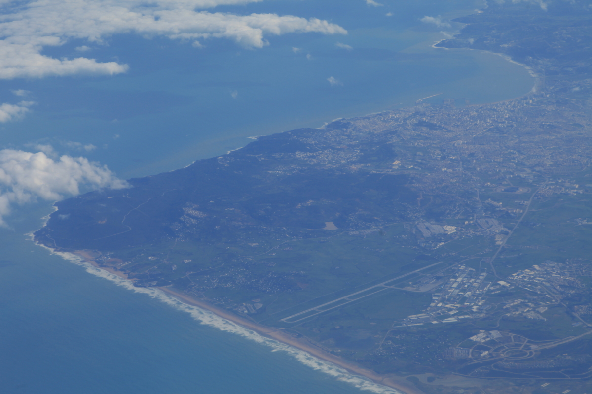
The port city of Tangier with the Strait of Gibraltar located inconspicuously in the background

A wider view of Tangier and Cape Spartel to the left. In 1989, I visited Tangier and took a road trip to Cape Spartel, the very northwest corner of the continent of Africa.

We were required to make a technical stop in the Azores Islands, three hours from Morocco. This is because Fes is not deemed to have international security to the standards that our own TSA requires. So we touched down for 90 minutes, had all of our luggage removed, picked out individually then walked 90 feet to another counter where it was reloaded on the jet. For all of that I got a quick look at the coast of the island group.

The pattern of settlement in a place called Florida. After a seven hour flight from the Azores we touched down in the place where we had started some 21 days before.

Were we changed by such an experience? I know I was, but I also observed people who traveled with me and for whatever reason could not escape the worldview that had created around them. Some people saw India and their first inclination was, "How can we get 1.2 billion people to be consumers like we are". It is not in my nature to see something different and want to change it, even if I might be able to make it just a little bit better.

Some statistics on the trip:

We traveled 27,476 nautical miles by private jet. This comes out to be 31,540 statute (or regular) miles. If you add the 3,834 statute miles I flew from Flagstaff to Orlando and back, I completed a total of over 35,000 miles on this journey.

There was 67 hours of flying on the private jet in 21 days

We crossed the equator four times and each tropic line (Capricorn and Cancer) twice

We visited ten counties: Peru, Chile, Samoa, Australia, Cambodia, India, Tanzania, Egypt, Morocco, and the USA. I went to Cambodia and Jaipur India for the first time.

We flew over the Caribbean Sea, the South Pacific Ocean, the Coral Sea, the Gulf of Carpentaria, the Arafura Sea, the Timor Sea, the Banda Sea, the Celebes Sea, the South China Sea, the Andaman Sea, the Bay of Bengal, the Arabian Sea, the Indian Ocean, the Mediterranean Sea, and the Atlantic Ocean.
We used 82,094 gallons of jet fuel. This comes out to a little less than 1,000 gallons per passenger in 21 days. Our carbon footprint was huge, only slightly offset by the wads of cash we infused into the economies of the ten different countries.

Our crew aboard Flight TOM 989 made a video of their experience on the trip and you can view it here. Spectacular.

I gave five lectures on this trip, each well received. Some people learned for the first time that the continents drift about the surface of the planet through time.

I learned that the earth really is round - each morning we put the pointy end of the jet towards the west and ate up miles at the average rate of about 450 per hour. At sunset, our jet was flying into the sunlight. I started in Orlando and ended up in Orlando. The world is round.

I learned that clouds have shapes, colors and textures beyond imagination. My favorite thing on whole trip was watching clouds from 36,000 feet! 

I learned patience, flexibility, and tolerance - thanks to our expedition leader Micheline Place who schooled us of this on the first night. I never forgot her words of wisdom.

I listened to fellow lecturer Barry Lopez who told us that the reason we travel was to share our experiences with others - spouses, children, grandchildren, great grand-children, friends, lovers, acquaintances, strangers - anyone who wants to hear about this beautiful home called earth

I cannot wait for the next trip on the jet - Cape to Cape, January, 2014. Stay tuned.

Monday, February 25, 2013

The Valley of the Kings and the Pyramids and Sphinx

Here are the images from my iPhone of some of the tombs in the Valley of the Kings, across the Nile River from Luxor, Egypt. During the 18th, through 20th Dynasty's, rulers in ancient Egypt dug elaborate tombs for their afterlife. Sixty-three tombs have been discovered so far and they were created over a nearly 500 year period from the 16th to 11th centuries BC. This means that some tombs are over 3,500 years old!

The Valley of the Kings is really a box canyon or a dry wash into the Nile. The ancient Egyptians constructed a diversion canal above the canyon to divert flood water from entering the wash. They anticipated a long history of burials here.

The sign located at the entrance of King Tut's tomb (it was essentially closed on this day for cleaning of the walls and repairs). The tomb was discovered in 1922 by Howard Carter and was completely intact having never been looted.

Here are some images from King Ramses 9 tomb. This is a detail of the ceiling near the burial chamber.

The paintings on the walls are well preserved due to the dry climate and their long history of secrecy. Most tombs were not plundered by thieves until the 17th or 18th centuries AD.

Where the burial chamber had been carved out of solid limestone, I saw unmistakable slickensides on a wall - this can be seen in the central part of the photo. Here a small fault had moved down to the left. The orientation of the fault plane suggested to me that this fault became activated when the canyon was cut. The block on the left simply slid down into the open hole of the canyon. I wonder if the ancient Egyptians recognized this as well?

This is the tomb of Seti II and is located at the head of the box canyon. (Note the solid wall of limestone that marks the stream pour-off to the left).

At the entrance to Seti II tomb

At the foot of the final chamber. The ancient Egyptians would often times build pseudo-burial chambers a short way into the tomb entrance. This was done in the hope of tricking future grave robbers into thinking they had reached the treasure. Keeping a tomb secret was very difficult to do since later people usually feel little to no connection to the spiritual  aspects of a persons burial (see Anasazi burial looting in the American Southwest).

A look back down at the sarcophagus

There is a scale model of the valley in the visitor center and one can see the complete layour of the various tombs here.

After leaving Luxor, we took a one-hour flight down to Cairo for a one-day touch-down to see the Pyramids and Sphinx at Giza. There was much anticipation for this stop since Cairo has been in the news so much lately. But all was calm. Friday is the hold day of the week in Islam and so the streets were quite empty as we drove through from the airport to the site. As usual, our pilot wanted to give us the best view he could from our seats in the 757.

Approaching Cairo looking southeast. The air quality was pretty good until we passed a huge power plant that was belching out tremendous amounts of pollution. Notice the agricultural patterns along the Nile River.

Our first view of the Pyramids of Giza from the southwest

We came in quite low in the jet...

...and then were virtually on top of them!
A strong wind whipped up this day and the visibility went opaque

Wind-whipped visitors at the Sphinx, carved from solid limestone in front of the Pyramids

Another view. I will have one more posting from this trip Around the World. There was drenching rain in Fes, Morocco and I did not get any photographs. But I will summarize my experiences in the last posting. Check back in a day or so.

Saturday, February 23, 2013

Pharoeic Treasures of Luxor, Egypt

At last the big day arrived when we left Tanzania for the country of Egypt. Most everyone was curious if we would be able to visit this recently troubled country but as usual, the reality was so much different from the hype. We found the people in Luxor to be calm, gentle and friendly. Our local guides said the revolution is contained within one and half square kilometers in Cairo. I am so glad we were able to make this stop.

I've been to Cairo and Giza many times but only once before to Luxor. Its archaeological treasures are from a later period in Pharoeic history and thus are more developed and ornate. I was blown away by the temples and frescoes here. I had to take pictures of the Valley of the Kings on my iPhone and I don't yet know how to transfer pictures from the phone to the computer. But the tombs there were marvelous and as soon as I can figure out how to get photos from there, I will share them here.

Heading north we eventually picked up the NIle River flowing through the Nubian Desert

Near the Sudan/Egypt border we saw the Nasser reservoir. This is a huge body of water and is reminiscent of our own Lake Powell. I would love to be down there checking out the shoreline.

Dropping into Luxor Airport it became obvious that this would be a desert scenery treat. These are sedimentary rocks that were greatly utilized by the ancient Egyptians for building materials

The next day, water taxi's came to the dock on the river right in front of out hotel. In ancient Egypt, people lived on the east bank where the sun rises. And they kept their tombs on the west bank where the sun sets. We were going to the west bank and the Valley of the Kings.

The boat I got on was named "Titanic Hmm??

Peaceful cruise up the Nile River near Luxor

Virtually no foreigners are visiting Egypt these days. Here is the parking lot for the renown Valley of the Kings and it is empty. When I was here last time (about 2002) it was filled with Spaniards, French, German, Italian, Russian and Australian tourists. We basically had it all to ourselves. (Note: I will figure out how to transfer images from my phone and when I do this posting will be updated with photos of the tombs).

The tomb of Queen Hatshepsut

The entrance to stunning Hebu Temple

An interior room with massive sandstone columns

Detail of a wall engraving. The number of these features in Habu Temple produced a sense of awe as we kept going into it.

Originally colored frescoes are abundant and here is a vulture depicted on a door jam. The image is about eight feet wide and stands about 15 feet above the viewer.

One happy traveler!

On the way back to the river bank, we made a quick stop at the Colossi of Memnon, built between 1391 and 1353 BC. They are being restored and we saw archaeologists using sonar to locate buried portions of the site.

Time for lunch so we set sail on a series of felucca's on the river. These are fantastic sailing vessels that maneuver the river easily.

We enjoyed lunch while under sail

Afterwards we paid a visit to the Temple of Karnak, easily the most impressive of all of Luxor's treasures (with the possible exception  of the Valley of the Kings).

Two rows of carved sphinx's lead to the inner part of the temple, built as a monument to a triad of Egyptian gods

Impressive columns are seen in the heart of the temple, which was covered while in use with huge sandstone slabs

A granite obelisk standing in Karnak. One was removed by the French in the 19th century and stands in the Place de la Concorde in Paris. Egyptians hope one day it will return. Ancient Egyptians used multiple types of rock to build their civilization. This granite was quarried near Aswan to the south, then transported by boats during the Nile flood to Karnak.

Afternoon crowd at Karnak - likely from a river boat moving through town. This is still just a fraction of the visitation that Egypt normally receives.

Karnak is truly impressive

Our group was treated to an evening dinner in the Temople of Luxor at night after it was closed to the public